| Previous :: Next Topic |
| Author |
Message |
Matt
Tea, Earl Grey, Hot


Joined: 30 Jan 2007
Posts: 4307 | TRs | Pics
Location: Shoreline |
|
Matt
Tea, Earl Grey, Hot
|
 Wed Jan 01, 2014 1:35 pm |
|
|
Date: 12/29/2013
Destination: "Anthracite" (5002ft, 402P) & "Beaver" (5113ft, 593P), USGS Silverton
Party: Matt, Dicey, Lindsay, Gabrielx, GeoTom, Martin S, Dave Creeden, fwb, Michelle
These are two Mountain Loop Highway peaks on opposite sides of a col, south of Coal Lake (thus the "Anthracite" name) and north of Beaver Creek (thus the "Beaver" name).
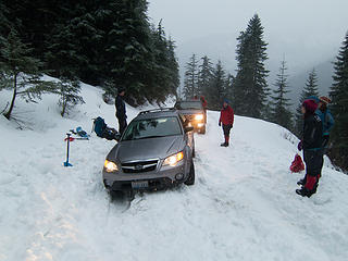
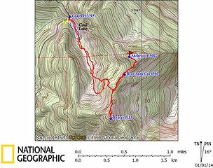 Anthracite & Beaver GPS Track 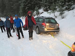 Trying to pull the car out didn't work 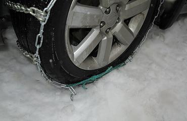 Wrong-size chains attached with a hero loop 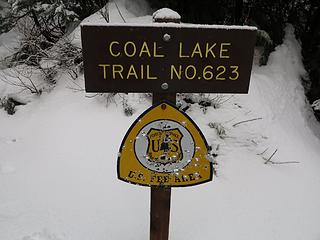 Coal Lake Trailhead target sign 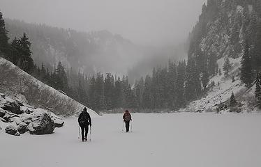 Walking across Coal Lake 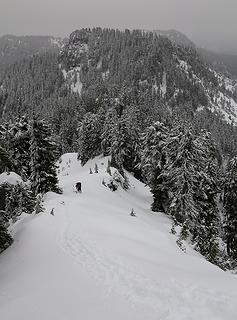 Anthracite viewed later from near Beaver 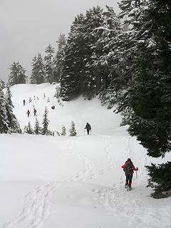 Walking across the easy part 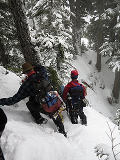 Turning a corner on the brief steep part 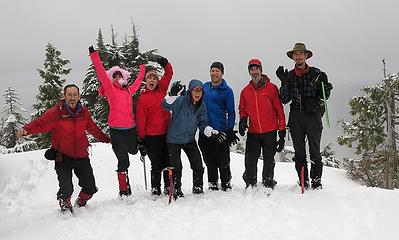 Matt, Michelle, Lindsay, Dicey, GeoTom, Franklin & Gabriel (Martin & Dave had already departed) 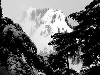 Beaver Summit, from the ridge near Anthracite 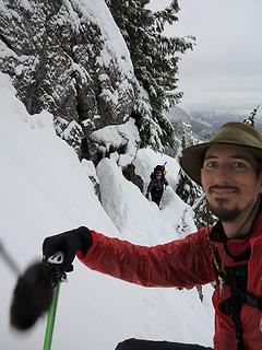 Gabriel (with his new ice axe) while Lindsay approaches the steep corner 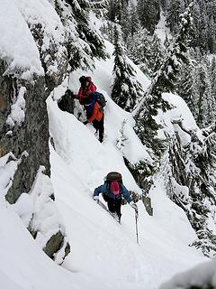 Dicey, GeoTom & Michele rounding the steep corner 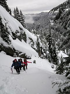 Coming up easier snow on the summit side of the gully 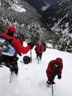 Franklin jumping off Beaver summit 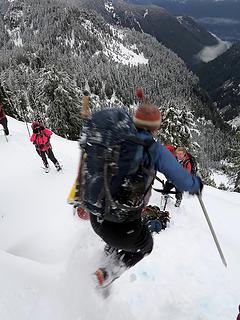 Lindsay jumping off Beaver summit 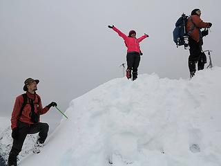 Beaver summit block 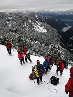 Six red coats & two red hats. The unseen photographer (me) also has a red coat. 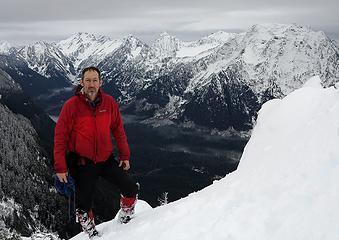 Red coat for me also. 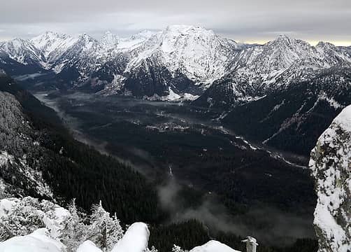 The southern Mountain Loop peaks: Lewis, Del Campo, Gothic, Morning Star, Sperry, Vesper, Big Four, Hall (click for full size) 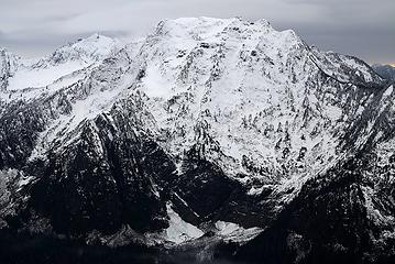 Big Four, the monster of the Mountain Loop 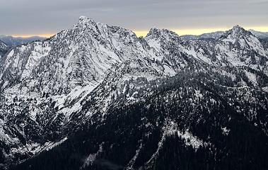 Hall & Marble 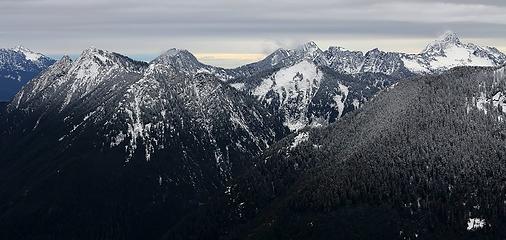 Looking west to Anaconda, Long, Bald, Fletcher, & Liberty 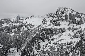 Forgotten & Stillaguamish 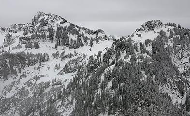 Future traverse between Stillaguamish & Pemmican 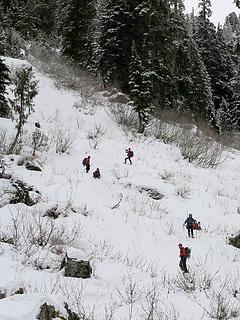 A bit of glissading on the barely covered slopes 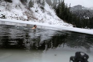 A brief swim at the end
As beacons mountains burned at evening. J.R.R. Tolkien
As beacons mountains burned at evening. J.R.R. Tolkien
|
| Back to top |
  
|
|
GeoTom
Member

Joined: 19 May 2005
Posts: 3215 | TRs | Pics
Location: Earth |
|
GeoTom
Member
|
Wed Jan 01, 2014 3:00 pm |
|
|
My non-blue layer was actually orange instead of red. That's progress for me though as I normally dress in very drab attire.
Fun trip, even with the lack of views.
A few of my photos:
 Stuck 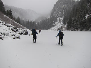 Ice skates would have been useful 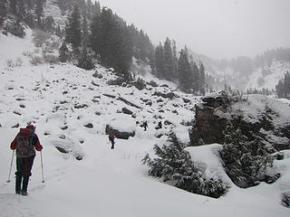 Into the boulder field 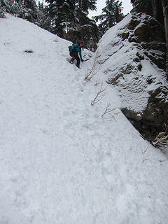 Michelle descends 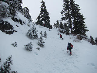 Almost to the ridge 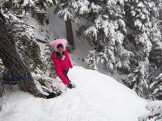 The pink yeti makes an appearance 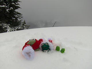 Christmas frogs on Anthracite 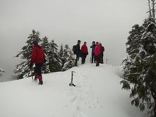 Anthracite summit gathering 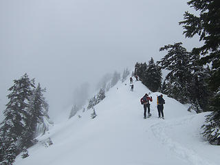 Final ridgeline 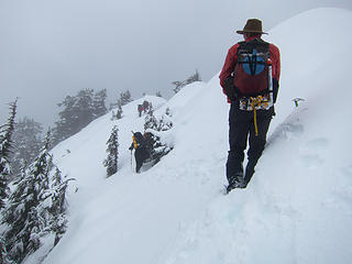 Gabriel watches the others 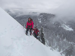 Matt photobombs Michelle 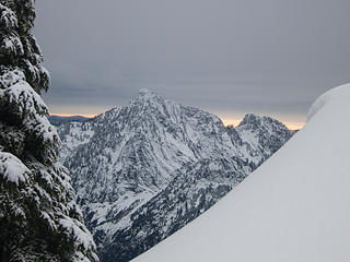 Hall Peak 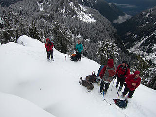 Looking down on the others 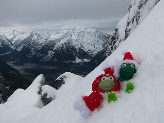 Frogs on Beaver
|
| Back to top |
|
|
Jim Dockery
Member

Joined: 12 Sep 2007
Posts: 3092 | TRs | Pics
Location: Lake Stevens |
Another cool Mt. Loop adventure. Franklin is braver than I driving up that road in a Subaru! Nice pics of the peaks 
|
| Back to top |
|
|
raising3hikers
Member

Joined: 21 Sep 2007
Posts: 2344 | TRs | Pics
Location: Edmonds, Wa |
nice trip that swim looks like a cold one
|
| Back to top |
|
|
iron
Member

Joined: 10 Aug 2008
Posts: 6392 | TRs | Pics
Location: southeast kootenays |
|
iron
Member
|
Wed Jan 01, 2014 6:42 pm |
|
|
| Jim Dockery wrote: | | Franklin is braver than I driving up that road in a Subaru! |
braver is one way to describe franklin's snow driving "tactics". i have other words that could be substituted for it...
|
| Back to top |
|
|
Type E
Member

Joined: 19 Aug 2006
Posts: 1381 | TRs | Pics
|
|
Type E
Member
|
Thu Jan 02, 2014 11:55 pm |
|
|
Looks like a fun trip full of interesting terrain.
E
|
| Back to top |
|
|
like2thruhike
Member
Joined: 28 May 2009
Posts: 1288 | TRs | Pics
Location: Seattle |
After being stuck I now pack a '1x'1 piece of 3/4 inch plywood for jacking the car up to put chains or digging out and plenty of bunji cords to keep the chains tight. You don't want chains coming off and destroying your fender or severing a brake line.
I just googled "sand ladders". They're big with the 4 wheelers but they're be useful to any vehicle in any season as well. They give you a firm space for momentum to get up and out. Kinda like a tow strap, you might not need it but when you do you're glad you had it when you do.
Nice pics.
No group photo in the water? I thought you were hardcore. 
|
| Back to top |
|
|
|
|
You cannot post new topics in this forum
You cannot reply to topics in this forum
You cannot edit your posts in this forum
You cannot delete your posts in this forum
You cannot vote in polls in this forum
|
Disclosure: As an Amazon Associate NWHikers.net earns from qualifying purchases when you use our link(s). |


