| Previous :: Next Topic |
| Author |
Message |
Sculpin
Member


Joined: 23 Apr 2015
Posts: 1383 | TRs | Pics
|
|
Sculpin
Member
|
 Sat Jun 05, 2021 8:52 am |
|
|
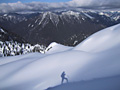
Noodling around in Rock Island Coulee:
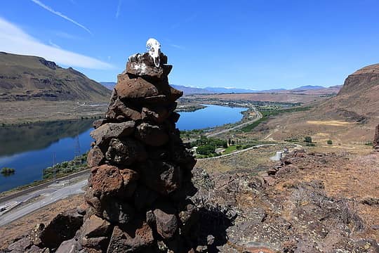 Rock Island Cthulhu 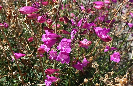 Mystery Penstemon 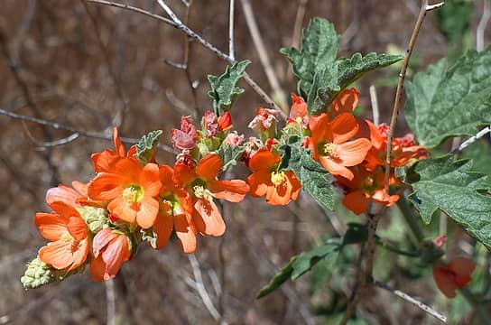 Sphaeralcea munroana 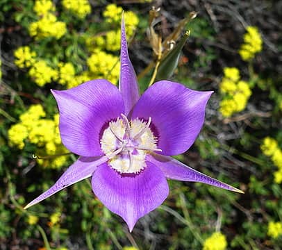 Calochortus macrocarpus
Between every two pines is a doorway to the new world. - John Muir
 reststep, Tom reststep, Tom
Between every two pines is a doorway to the new world. - John Muir
reststep, Tom
|
| Back to top |
  
|
|
awilsondc
Member

Joined: 03 Apr 2016
Posts: 1324 | TRs | Pics
|
Mt. Baker - Easton Glacier 6/4/21. This was supposed to be a 2 day trip with a group of 8 guys, but weather had other plans and had us move the trip up a day. Half of us were able to head up and camp Thursday night, but myself and 3 others had to work Thursday so we met up after work on Thursday and headed up to the trailhead for an all night no sleep mission. We started hiking at 10:30pm and hiked up and found the other four guys camping getting there around 1am. We laid down to rest for about an hour (not sure if I really got any "sleep") before everyone got up and ready for the summit. We started hiking a little after 3, geared up at the edge of the Easton Glacier around sunrise and hiked up. Going was slower than I'm used to. My group made the summit around 10am, despite relentless 30mph winds from 9000 ft until the summit. The second group reached the top of the Roman Wall 45 minutes later, but didn't head over to the true summit. Our two groups leapfrogged for a bit on descent before my team got quite a bit ahead of the other team. Once off the glacier, my friend and I headed for the car while the other two waited for the other team. We got back around 4:30 for an 18 hour day. The other 6 made it back around 8. I'm glad to have this one in the bag, and the experience of climbing on a rope team. Looking forward to more glacier travel in the years to come!
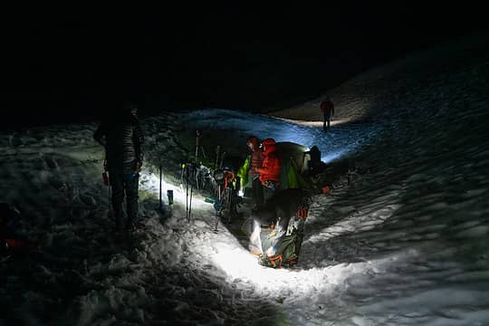 getting ready 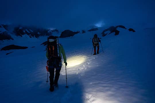 starting out 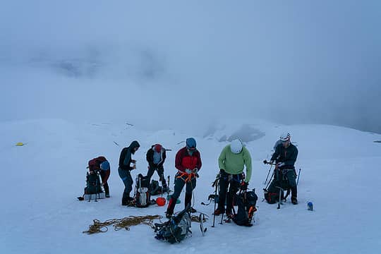 roping up 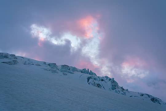 sunrise 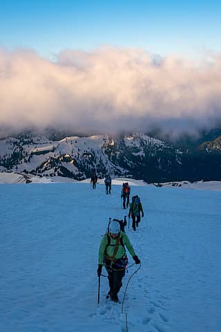 golden hour 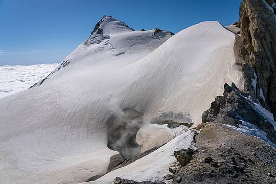 sherman 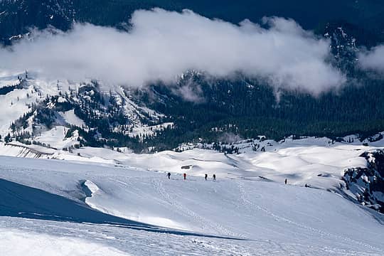 team J 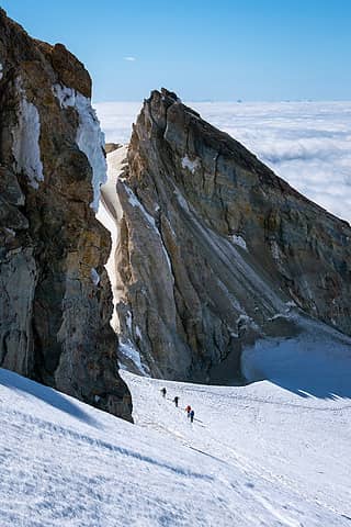 team J ascending past the crater 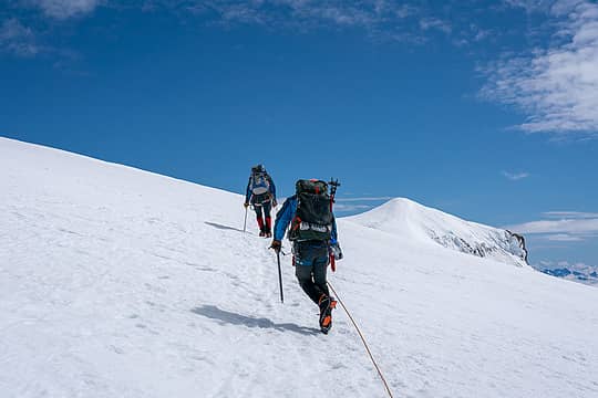 nearing the top of the Roman Wall 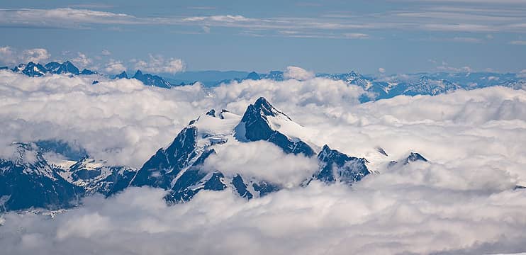 Shuksan 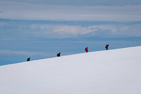 team J on their summit 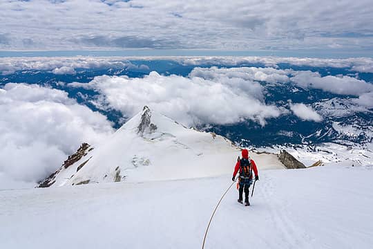 descending 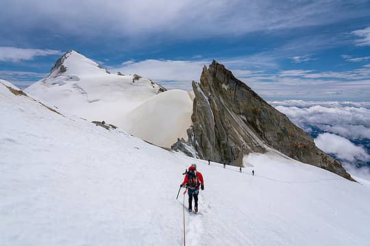 passing Sherman 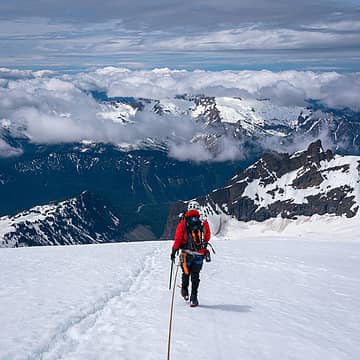 slogging 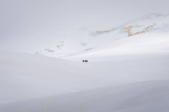 lost 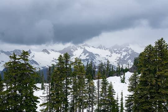 weather
Cyclopath, Tom, reststep, RichP, mosey  Walkin' Fool, Navy salad, KascadeFlat Walkin' Fool, Navy salad, KascadeFlat
Cyclopath, Tom, reststep, RichP, mosey Walkin' Fool, Navy salad, KascadeFlat |
| Back to top |
|
|
Tom
Admin
Joined: 15 Dec 2001
Posts: 17854 | TRs | Pics
|
|
Tom
Admin
|
Fri Jun 11, 2021 8:36 pm |
|
|
Gorgeous shots. I'd say this one is calendar worthy if not for being vertical.
Walkin' Fool, awilsondc, Gabep, Chief Joseph
Walkin' Fool, awilsondc, Gabep, Chief Joseph |
| Back to top |
|
|
Nancyann
Member

Joined: 28 Jul 2013
Posts: 2319 | TRs | Pics
Location: Sultan Basin |
|
Nancyann
Member
|
Mon Jun 14, 2021 3:05 pm |
|
|
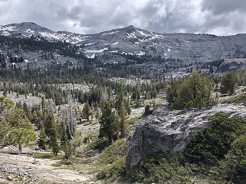
Spent last week in the Tahoe area with my son who is stationed near Sacramento. We dayhiked in the Desolation Wilderness and also the Mokelumne Wilderness at Kit Carson Pass, both gorgeous areas! This was a real treat for me because I have only done a small amount of hiking in the Sierras, and it was quite a few years ago.
The first hike was on the Tahoe Rim Trail from Echo Lake to Tamarack Lake. We wanted to go much further, but Washingtons bad weather apparently followed me to California. Temps were in the 30s and gusty winds created a wind chill reminiscent of the dead of winter. We knew it was time to turn around when we arrived at Tamarack Lake and the dark gray skies began spitting snow. Welcome to the Sierras!
A beautiful start to our hike at Echo Lake.
 Tahoe Rim Trail, Desolation Wilderness 6/9/21 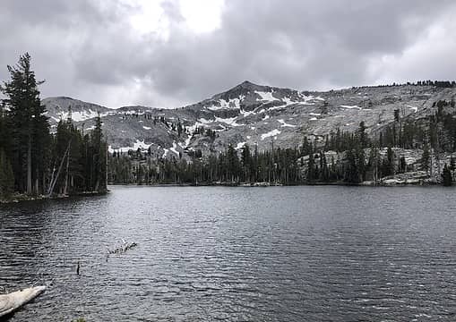 Tamarack Lake, Desolation Wilderness 6/9/21 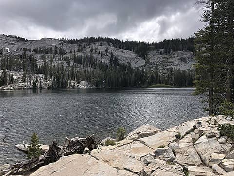 Tamarack Lake, Desolation Wilderness 6/9/21 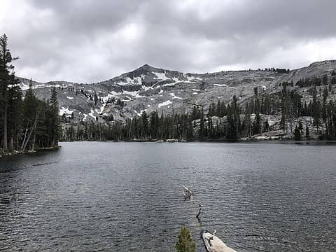 Tamarack Lake, Desolation Wilderness 6/9/21  Skier on the PCT, Echo Lake, Desolation Wilderness 6/9/21 
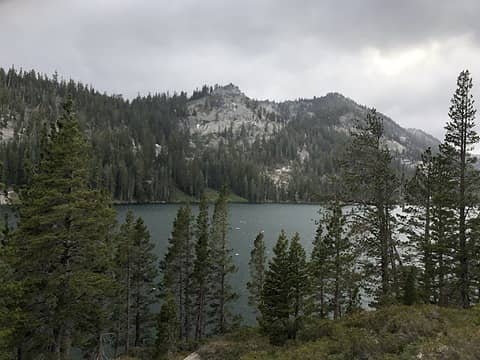 Echo Lake, Desolation Wilderness 6/9/21 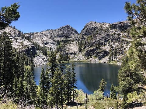 Eagle Lake, Desolation Wilderness 6/10/21 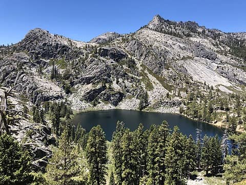 Eagle Lake, Desolation Wilderness 6/10/21 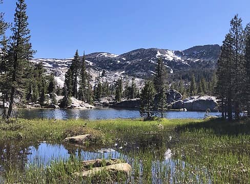 Upper Velma Lake, Desolation Wilderness 6/10/21 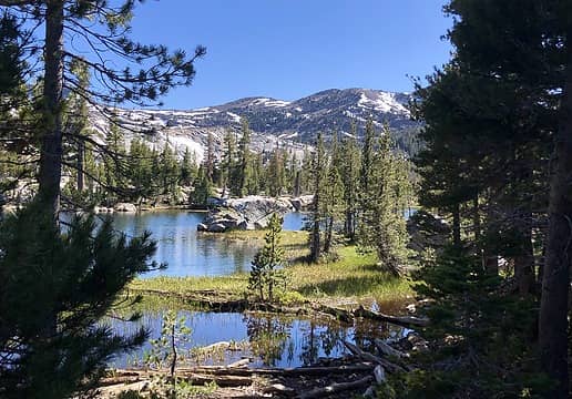 Upper Velma Lake, Desolation Wilderness 6/10/21 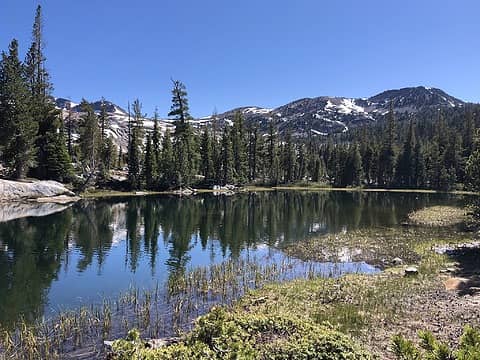 Upper Velma Lake, Desolation Wilderness 6/10/21 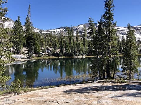 Upper Velma Lake, Desolation Wilderness 6/10/21 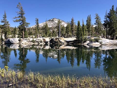 Upper Velma Lake, Desolation Wilderness 6/10/21 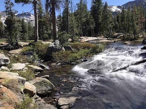 Upper Velma Lake, Desolation Wilderness 6/10/21 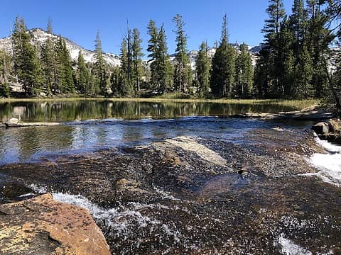 Upper Velma Lake, Desolation Wilderness 6/10/21 
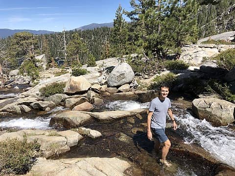 Cascade Falls, South Lake Tahoe 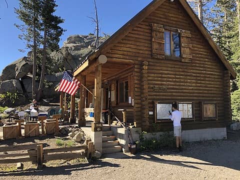 Kit Carson Pass 6/12/21 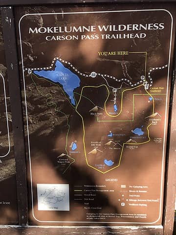 Kit Carson Pass 6/12/21 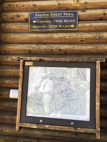 Kit Carson Pass 6/12/21 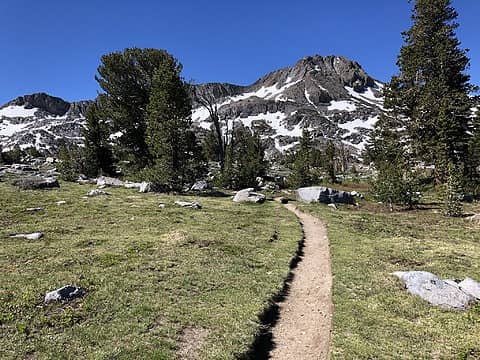 Winemucca Lake 6/12/21 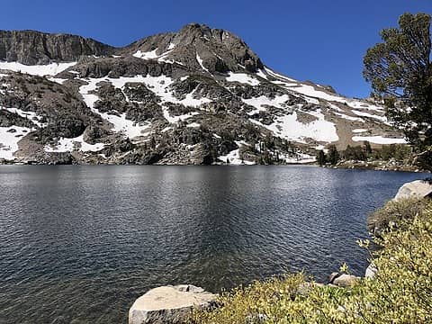 Winemucca Lake 6/12/21 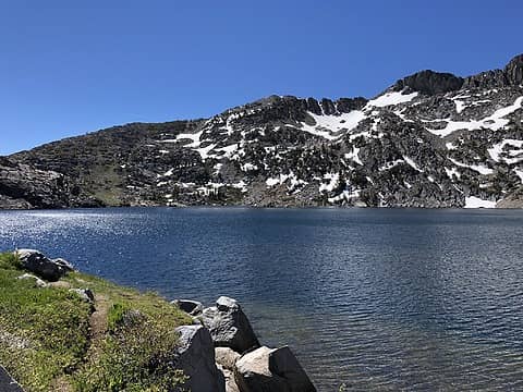 Winemucca Lake 6/12/21 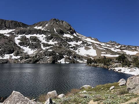 Winemucca Lake 6/12/21 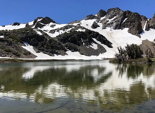 Winemucca Lake 6/12/21 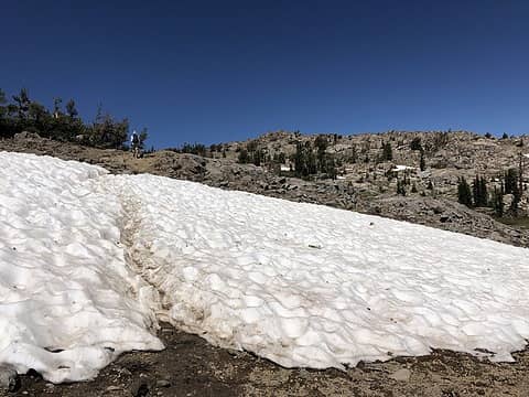 Round Top Mountain 6/12/21 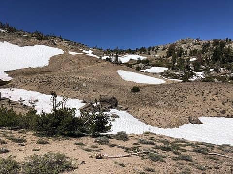 Round Top Mountain 6/12/21 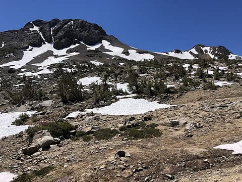 Round Top Mountain 6/12/21 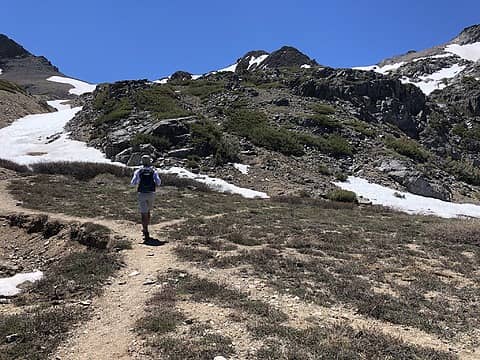 Round Top Mountain 6/12/21 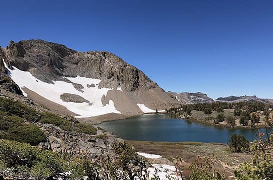 Round Top Lake 6/12/21 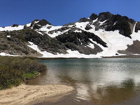 Round Top Lake 6/12/21 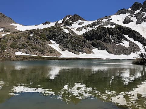 Round Top Lake 6/12/21 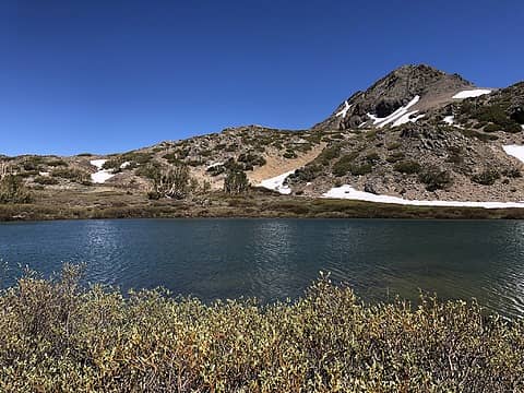 Round Top Lake 6/12/21 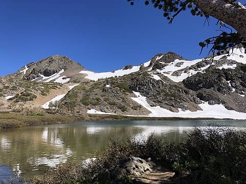 Round Top Lake 6/12/21 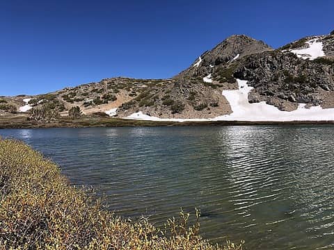 Round Top Lake 6/12/21 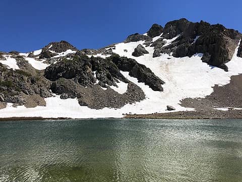 Round Top Lake 6/12/21 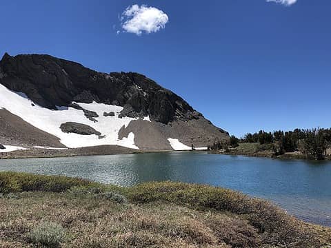 Round Top Lake 6/12/21 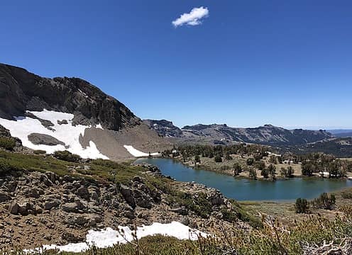 Round Top Lake 6/12/21 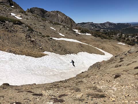 Round Top Mountain 6/12/21 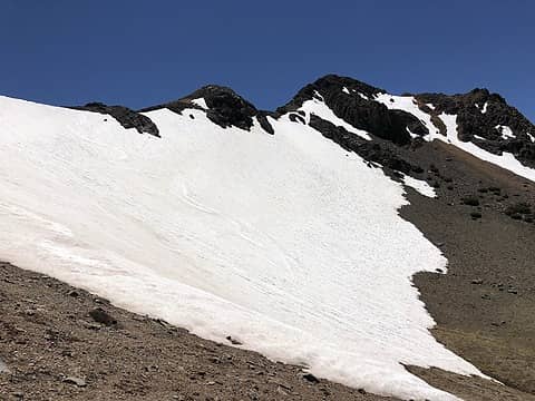 Round Top Mountain 6/12/21 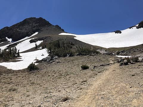 Round Top Mountain 6/12/21 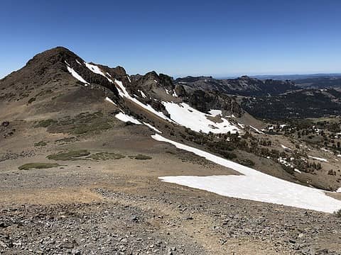 Round Top Mountain 6/12/21 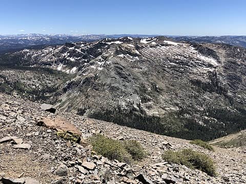 Round Top Mountain 6/12/21 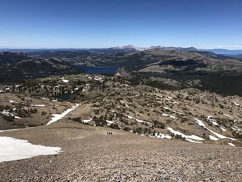 Round Top Mountain 6/12/21 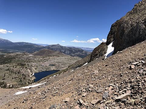 Round Top Mountain 6/12/21 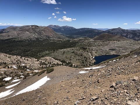 Round Top Mountain 6/12/21 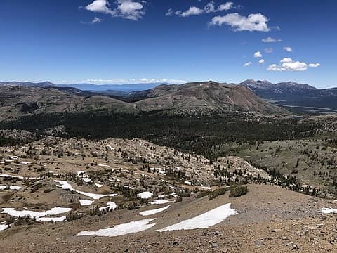 Round Top Mountain 6/12/21 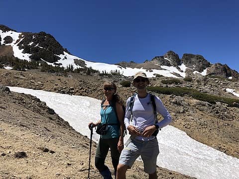 Round Top Mountain 6/12/21 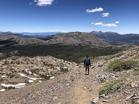 Round Top Mountain 6/12/21 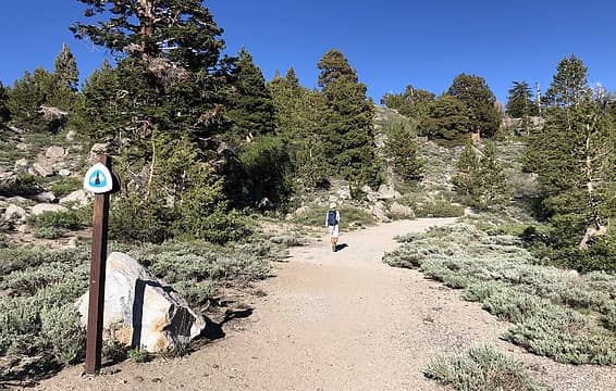 Kit Carson Pass 6/12/21
Cyclopath, Slugman, Walkin' Fool, reststep, RichP, rubywrangler  awilsondc, KascadeFlat awilsondc, KascadeFlat
Cyclopath, Slugman, Walkin' Fool, reststep, RichP, rubywrangler awilsondc, KascadeFlat |
| Back to top |
|
|
zephyr
aka friendly hiker

Joined: 21 Jun 2009
Posts: 3370 | TRs | Pics
Location: West Seattle |
|
zephyr
aka friendly hiker
|
Mon Jun 14, 2021 9:28 pm |
|
|
Living the dream. ^
This beautiful trip deserves its own trip report. Very nice. ~z
Tom, awilsondc
Tom, awilsondc |
| Back to top |
|
|
Route Loser
Member
Joined: 24 Jul 2012
Posts: 199 | TRs | Pics
Location: Whidbey Island |
| zephyr wrote: | | This beautiful trip deserves its own trip report. Very nice. ~z |
Agree. Not lazy at all. Great shots of some of Tahoe's finest. The Round Top area is superb. If you go down next spring, the drive down to Sonora Pass is equally beautiful.
|
| Back to top |
|
|
Nancyann
Member
Joined: 28 Jul 2013
Posts: 2319 | TRs | Pics
Location: Sultan Basin |
|
Nancyann
Member
|
Tue Jun 15, 2021 12:19 am |
|
|
Thanks Zephyr and Route Loser and everyone who liked my TR. It seemed like a lazy trip, thanks to cushy accommodations at a cute cabin instead of hauling around my backpack for a week. My son takes good care of his mom!
|
| Back to top |
|
|
reststep
Member
Joined: 17 Dec 2001
Posts: 4757 | TRs | Pics
|
|
reststep
Member
|
Tue Jun 15, 2021 12:39 pm |
|
|
Thanks for sharing Nancyann. Beautiful pictures.
My daughter will be hiking through that area later this month and your pictures gave me a chance to see what a beautiful area that is.
"The mountains are calling and I must go." - John Muir
Nancyann
"The mountains are calling and I must go." - John Muir
Nancyann
|
| Back to top |
|
|
timberghost
Member
Joined: 06 Dec 2011
Posts: 1332 | TRs | Pics
|
Thanks for letting us tag along Nancy Ann
Nancyann
Nancyann |
| Back to top |
|
|
Roly Poly
Member
Joined: 02 Jan 2013
Posts: 713 | TRs | Pics
|
Now you know why I love the Sierras!
Nancyann
Nancyann |
| Back to top |
|
|
HikingBex
Member
Joined: 17 Aug 2020
Posts: 110 | TRs | Pics
|
Hiked Mount Baldy near Easton today - great selection of wildflowers blooming. The ones I recognized were glacier lily, balsam root, and paintbrush, but there were many more along the way. Great views over Cle Elum Lake, and a nice look at Rainier. Not really a wilderness experience as we could hear/see 90 much of the time & some of the trail was pretty slick with little ball bearing-like pebbles, but also it was a reasonable drive from Seattle, we only saw around 25 people on the trail (on a sunny Saturday!) and the only snow was some flat patches on the ridgel near the top. I hadn't heard of this one before but was very happy to have checked it out!
Cyclopath, reststep, awilsondc, RichP
Cyclopath, reststep, awilsondc, RichP |
| Back to top |
|
|
timberghost
Member
Joined: 06 Dec 2011
Posts: 1332 | TRs | Pics
|
Only 25?
|
| Back to top |
|
|
rossb
Member

Joined: 23 Sep 2002
Posts: 1679 | TRs | Pics
|
|
rossb
Member
|
Sun Jun 20, 2021 10:12 am |
|
|
Went up Frog Mountain yesterday. The trail isn't done. There is a gap, although the gap isn't as big as last year. I would estimate around 200 feet of elevation gain off trail. I think it is best to try and follow the path as they've sketched it out, but we lost it. Going up you can just go straight up and eventually regain the trail. Going down you'll need to work your way over. GPS would help -- we brought one, but I ran out of battery power (oops).
All the snow was towards the top (no snow on the bushwhacking part). Easy to follow the path through the snow.
|
| Back to top |
|
|
timberghost
Member
Joined: 06 Dec 2011
Posts: 1332 | TRs | Pics
|
There was a white car parked at Jack's Pass when I went by yesterday luckily I didn't see any vandalism done to it.
|
| Back to top |
|
|
rossb
Member
Joined: 23 Sep 2002
Posts: 1679 | TRs | Pics
|
|
rossb
Member
|
Mon Jun 21, 2021 7:25 pm |
|
|
| timberghost wrote: | | There was a white car parked at Jack's Pass when I went by yesterday |
Yep, that was mine.
|
| Back to top |
|
|
|
|
You cannot post new topics in this forum
You cannot reply to topics in this forum
You cannot edit your posts in this forum
You cannot delete your posts in this forum
You cannot vote in polls in this forum
|
Disclosure: As an Amazon Associate NWHikers.net earns from qualifying purchases when you use our link(s). |


