| Previous :: Next Topic |
| Author |
Message |
Treehugger5
Member

Joined: 23 Sep 2012
Posts: 407 | TRs | Pics
Location: Spokane, WA |
How about 'forgotten to post' trip reports?
Last year I was too busy backpacking and working to post but I did have some fantastic trips. I think about 9 total, but here are some highlights:
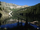
In early July did a 40 loop in the Lemhi range that was about half off trail. Really spectacular and one of the 5 passes kicked my arse a little:
If you look really close in this next one, you can see my friend silhouetted on the ridge. We went over the pass just to the left of him there.
This storm system chased us the entire three days but we managed to stay ahead of it.
Backside of the last pass. I admit I was glad to get down, ha. The next 6 miles were all x-country, through this tight tight forest of freaking lodgepole that was hideous, and lots of talus slopes, one of which I rolled 360, head over heels down after spotting a bobcat streak in front of us and not watching where I was going. My friend laughed his arse off after making sure I was only injured in pride.  Fun trip, but I'd been sick with um...digestive issues the day before, and all I'd done was drink Hammer Heed at work the day before. I got up at 5am to drive with my friend to the range from Spokane, we hit the trail at 1:30 and did 11 miles, and camped at around 8500' I wouldn't suggest it as a m.o.
Next a few trips to the Cabinets in Montana, and Beehive Lake.
Fun trip, but I'd been sick with um...digestive issues the day before, and all I'd done was drink Hammer Heed at work the day before. I got up at 5am to drive with my friend to the range from Spokane, we hit the trail at 1:30 and did 11 miles, and camped at around 8500' I wouldn't suggest it as a m.o.
Next a few trips to the Cabinets in Montana, and Beehive Lake.
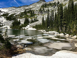 Beehive lake reconn 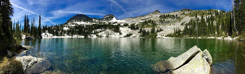 Beehive lake reconn  We didn't get to do my cross country route because his feet got ripped up on the first day into bloody, blistered messes. Long story but he gutted out 15 miles the first day to Valentine Lake, and when I saw his feet, and how raw and bloody they were all over, and thought about the 5 big stream crossings and passes we had to do, I decided to turn around and just go back out. We cross county-ed 1 1/2 miles the next day to Little Valentine lake, to give his feet a rest, spent the day just relaxing and hanging out, then hiked out the next day and drove leisurely home. Next time.
Sunset at campground first night:
Then I came home and went to do Mt Daniel and surround. Weather didn't cooperate that much but it was ok. Spent the first night at Peggy's Pond, then climbed to old summit of Mt Daniel next day, came down, x-county-ed around to Circle lake via a sketchy and massively brushy route but made it fine.
Looking back on our xcountry route. How deceiving looks are!
Drove home to Spokane, then turned around because the forecast for our planned Selkirk traverse was snow, and next day drove back to do a loop in Goat Rocks.
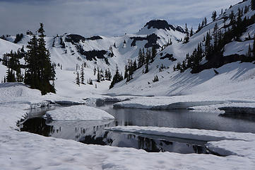
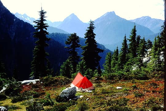
Then after a couple days rest, went to Eagle Cap to do a x-country loop for a few days there. Spectacular colors.
View from dinner, we decided we'd go over to that the next morning and check it out. Oof. We didn't get to do my cross country route because his feet got ripped up on the first day into bloody, blistered messes. Long story but he gutted out 15 miles the first day to Valentine Lake, and when I saw his feet, and how raw and bloody they were all over, and thought about the 5 big stream crossings and passes we had to do, I decided to turn around and just go back out. We cross county-ed 1 1/2 miles the next day to Little Valentine lake, to give his feet a rest, spent the day just relaxing and hanging out, then hiked out the next day and drove leisurely home. Next time.
Sunset at campground first night:
Then I came home and went to do Mt Daniel and surround. Weather didn't cooperate that much but it was ok. Spent the first night at Peggy's Pond, then climbed to old summit of Mt Daniel next day, came down, x-county-ed around to Circle lake via a sketchy and massively brushy route but made it fine.
Looking back on our xcountry route. How deceiving looks are!
Drove home to Spokane, then turned around because the forecast for our planned Selkirk traverse was snow, and next day drove back to do a loop in Goat Rocks.
Then after a couple days rest, went to Eagle Cap to do a x-country loop for a few days there. Spectacular colors.
View from dinner, we decided we'd go over to that the next morning and check it out. Oof.  Looking back on the valley we came up after we checked out that ridge. We went back down, packed up and then headed over west to do our day loop and circle back to camp. I think that day was about 16 miles in all, with our added morning trek.
Started snowing at breakfast.
Found an old cabin, super cool.
Took a few weeks off and went down to the Wenaha river, out of the TH at Troy, OR. Joseph is a great town, too.
Recent burn in there obliterated any trail and the fireweed was 6 ft tall, but the thistle was 5. Can you say falling down and scratches everywhere?
LOTS of sheep on the way out.
Pretty good summer. I hope this one shapes up too.
Looking back on the valley we came up after we checked out that ridge. We went back down, packed up and then headed over west to do our day loop and circle back to camp. I think that day was about 16 miles in all, with our added morning trek.
Started snowing at breakfast.
Found an old cabin, super cool.
Took a few weeks off and went down to the Wenaha river, out of the TH at Troy, OR. Joseph is a great town, too.
Recent burn in there obliterated any trail and the fireweed was 6 ft tall, but the thistle was 5. Can you say falling down and scratches everywhere?
LOTS of sheep on the way out.
Pretty good summer. I hope this one shapes up too.
Elrond's Rocket of Rivendell~ hiker and runner extraordinaire
Elrond's Rocket of Rivendell~ hiker and runner extraordinaire
|
| Back to top |
  
|
|
olderthanIusedtobe
Member

Joined: 05 Sep 2011
Posts: 7709 | TRs | Pics
Location: Shoreline |
Wow, that looks like a great summer (and part of fall too?).  Plenty of variety and some areas that see few if any TRs on this site. Plenty of variety and some areas that see few if any TRs on this site.
|
| Back to top |
|
|
Treehugger5
Member

Joined: 23 Sep 2012
Posts: 407 | TRs | Pics
Location: Spokane, WA |
| olderthanIusedtobe wrote: | | Wow, that looks like a great summer (and part of fall too?). Plenty of variety and some areas that see few if any TRs on this site. |
Thanks. I do like to do the atypical.
Elrond's Rocket of Rivendell~ hiker and runner extraordinaire
Elrond's Rocket of Rivendell~ hiker and runner extraordinaire
|
| Back to top |
|
|
MyFootHurts
Huge Member

Joined: 22 Nov 2011
Posts: 912 | TRs | Pics
Location: Kekistan |
Went up to Granite Lakes (Middle fork) on Thursday. Last half mile was brushy with some snow.
Took the new connector trail on the way down and walked the road back to the car.
I don't know what DNR is thinking but the new parking lot they are building is freaking HUGE for a trail nobody really uses.
|
| Back to top |
|
|
bobbi
stillaGUAMish

Joined: 13 Jul 2006
Posts: 8012 | TRs | Pics
Location: olympics! |
|
bobbi
stillaGUAMish
|
 Sun May 28, 2017 7:29 pm |
|
|
Deer Ridge, ONF, to Deer Park, ONP via Slab Camp, May 27, 2017
trail is snow free (except a very small snow patch) until the parking lot.
Rhodies are still a ways away from blooming. some fawn lilies, Indian paintbrush, etc.
BUT this is why our own nwhikers lurkers, my hubby and I hiked this steep trail, 10 miles RT
with the warm weather, these satin flowers are fading fast!
that's it!
bobbi ૐ
"Today is your day! Your mountain is waiting. So
get on your way!" - Oh, the Places Youll Go! By Dr. Seuss
bobbi ૐ
"Today is your day! Your mountain is waiting. So
get on your way!" - Oh, the Places Youll Go! By Dr. Seuss
|
| Back to top |
|
|
meck
Member
Joined: 31 Dec 2010
Posts: 920 | TRs | Pics
|
|
meck
Member
|
Thu Jun 01, 2017 7:58 pm |
|
|
Tyler Peak & Baldy, Memorial Day 2017:
Hiked a loop w/ "ears" on a warm sunny Monday to Tyler Peak, then over to Baldy. There's still a lot of snow in the upper Dungy.
 this guy was eating a raccoon. 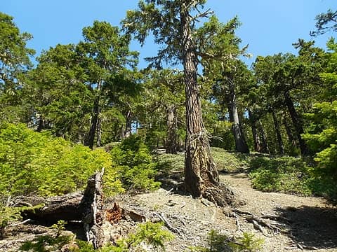 up, up , and away I go through the open'ish forest. 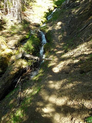 snow melt stream 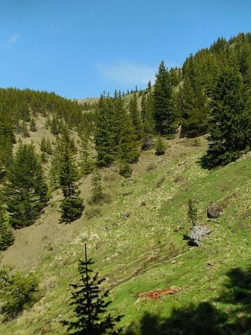 open view up to the ridgeline 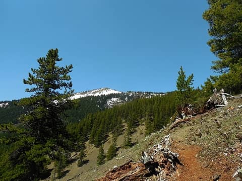 Baldy false summit in the distance 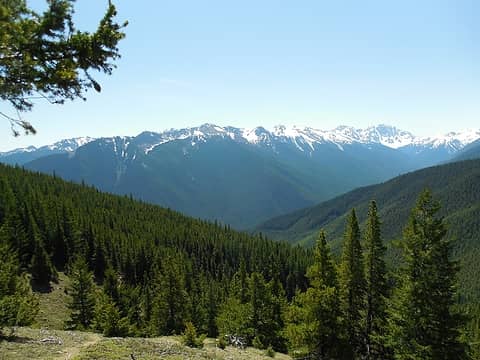 the upper dungy drainage 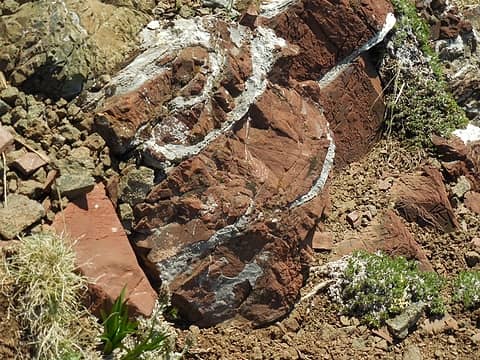 red brick rock 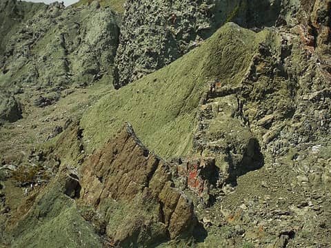 mint-chocalate chip ice cream rock (or at least that's what I was thinking of on this warm spring day...) 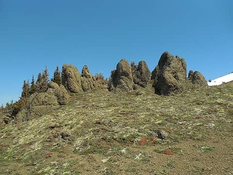 rock people villagers next to Tyler Peak 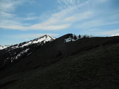 cloud rolled over between the sun and ridge! 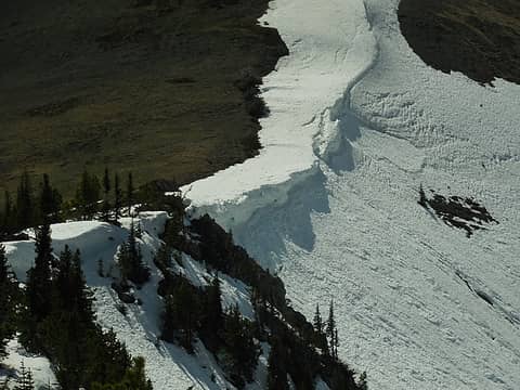 cornices on the north edge of the ridge to Baldy 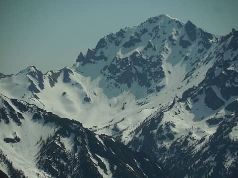 Zoom in on Deception in the distance
*Just say NO to Rent-Seeking, don't give up the concept of "ownership"*
*Just say NO to Rent-Seeking, don't give up the concept of "ownership"*
|
| Back to top |
|
|
bobbi
stillaGUAMish
Joined: 13 Jul 2006
Posts: 8012 | TRs | Pics
Location: olympics! |
|
bobbi
stillaGUAMish
|
Thu Jun 01, 2017 8:36 pm |
|
|
snow free?
how was the traverse from Tyler to little Baldy?
what a great day!
bobbi ૐ
"Today is your day! Your mountain is waiting. So
get on your way!" - Oh, the Places Youll Go! By Dr. Seuss
bobbi ૐ
"Today is your day! Your mountain is waiting. So
get on your way!" - Oh, the Places Youll Go! By Dr. Seuss
|
| Back to top |
|
|
meck
Member
Joined: 31 Dec 2010
Posts: 920 | TRs | Pics
|
|
meck
Member
|
Mon Jun 05, 2017 6:53 pm |
|
|
Hi bobbi,
Yeah it was essentially snow free except for the short ridge up from where the upper maynard-burn trail crosses that west facing meadow and reaches the ridgeline, up to the small peaklet west of Baldy. The snow on that slope was pretty good for booting up, I hardly post holed at all.
*Just say NO to Rent-Seeking, don't give up the concept of "ownership"*
*Just say NO to Rent-Seeking, don't give up the concept of "ownership"*
|
| Back to top |
|
|
mbravenboer
Member
Joined: 20 Oct 2013
Posts: 1422 | TRs | Pics
Location: Seattle |
Just a quick note on Artist Point: the crew is clearing the road now. Bagley Lakes is looking wonderful!
 Bagley Lakes 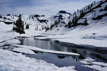 Bagley Lakes 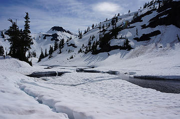 Bagley lakes 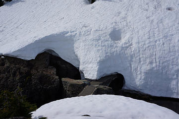 Bridge for the summer trail at Bagley Lakes
|
| Back to top |
|
|
Snuffy
Member

Joined: 28 Dec 2012
Posts: 315 | TRs | Pics
Location: Everett, WA |
|
Snuffy
Member
|
Sun Jun 11, 2017 8:40 am |
|
|
Just a quick report for anyone thinking of heading up to Bedal Peak. We had a great but challenging time summiting yesterday, make sure you go prepared for adventure. The climber's path has plenty of blowdown (some pretty good sized trees) but there is also a plethora of flagging. Snow started at about 4500ft and made getting over the cliff band at 4900ft quite a scramble where the snow shelf hits the rock. The good ramps were either blocked with snow or had a sketchy snow bridge to maneuver. As other folks of said before, don't be tempted to go up the gully, you'll end up cliffing out. We all had ice axes that helped on the steep snow field to the summit (we went around to approach from the east. We didn't have amazing views but it was still a fantastic day out on the Mountain Loop! I will hopefully get around to a longer trip report this week.
You don't find yourself standing at the top of a mountain without having started out in the valley.
You don't find yourself standing at the top of a mountain without having started out in the valley.
|
| Back to top |
|
|
olderthanIusedtobe
Member
Joined: 05 Sep 2011
Posts: 7709 | TRs | Pics
Location: Shoreline |
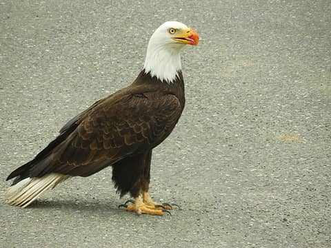
Monte Cristo townsite and Glacier Basin yesterday. The falls above the townsite is ripping right now! Encountered snow just beyond the steep rock slab part of the trail. Fairly consolidated, but with lots of holes so punching thru is a constant possibility. Encountered several parties heading out, but based on boot track it looks like they all gave up before getting to the basin proper. My buddy and I got to the lower edge of it, below the Wilmon's Spires. Had lunch on one of the big boulders. Cloud deck was low, couldn't see the tops of any of the peaks ringing the basin. Rain off and on, cool temperature. Still had a nice day. Plenty of flowers off and on--columbine, bleeding heart, trillium, salmonberry and plenty more I couldn't identify.
And then of course it was sunny and gorgeous by the time we got back to the Seattle area.
|
| Back to top |
|
|
bobbi
stillaGUAMish
Joined: 13 Jul 2006
Posts: 8012 | TRs | Pics
Location: olympics! |
|
bobbi
stillaGUAMish
|
Tue Jun 13, 2017 7:17 pm |
|
|
lakebed of the former Lake Mills, Glines Canyon Dam (gone!), Elwha River, Olympic National Park
lupine galore!
bobbi ૐ
"Today is your day! Your mountain is waiting. So
get on your way!" - Oh, the Places Youll Go! By Dr. Seuss
bobbi ૐ
"Today is your day! Your mountain is waiting. So
get on your way!" - Oh, the Places Youll Go! By Dr. Seuss
|
| Back to top |
|
|
Nancyann
Member
Joined: 28 Jul 2013
Posts: 2319 | TRs | Pics
Location: Sultan Basin |
|
Nancyann
Member
|
Tue Jun 13, 2017 7:51 pm |
|
|
Wow, bobbi, those lupine are almost as tall as you! Absolutely breathtaking!
|
| Back to top |
|
|
glenoid
Member
Joined: 30 Oct 2012
Posts: 307 | TRs | Pics
|
|
glenoid
Member
|
Wed Jun 14, 2017 7:21 am |
|
|
Some snake beta for the Wenaha River: hiked in from Troy Oregon June 5-6. At this time of year the trail is very brushy. In lush areas the trail is obscured to the point there is only high grass draping over or brush growing in the "trail". In these cooler areas the rattlesnakes lay in the shade of the brush. They must be asleep as my wife stepped on one before it rattled. Others rattled at us from a foot or so away, but refused to slither off the trail. You could not see them, just hear the brush at the toe of your boot rattle. I stepped on a bull snake that was beneath long grass hanging over the trail. Next year will hike in May when there is way less brush. (All the rattlesnakes were at least an inch and a half in diameter. Not the usual "babies" we see there.) The streambank globemallow was about five feet tall.
|
| Back to top |
|
|
Treehugger5
Member

Joined: 23 Sep 2012
Posts: 407 | TRs | Pics
Location: Spokane, WA |
^ I was there from that TH last Nov. Did you go up through the burn area?
Bobbi, WOW on the lupine!
Elrond's Rocket of Rivendell~ hiker and runner extraordinaire
Elrond's Rocket of Rivendell~ hiker and runner extraordinaire
|
| Back to top |
|
|
|
|
You cannot post new topics in this forum
You cannot reply to topics in this forum
You cannot edit your posts in this forum
You cannot delete your posts in this forum
You cannot vote in polls in this forum
|
Disclosure: As an Amazon Associate NWHikers.net earns from qualifying purchases when you use our link(s). |


