Forum Index > Trip Reports > round+alpine lookout+round mt 4-6-2014
 Reply to topic
Previous :: Next Topic
Author Message
b00
Member
Member


Joined: 29 Sep 2003
Posts: 1144 | TRs | Pics
b00
Member
PostWed Apr 09, 2014 1:08 pm 
round+alpine lookout+round mt 4-6-2014 aka round and a round again :>)
alpine look-ouuuuuuuuuuuut!
big group, big fun. of course there was the big email discussions going on before the trip as folks thrashed about for the choices of destinations. iron and i both were both a little worried about alpine lookout as the trail approached from the south and we did not want to ascend the obviously dangerous avy terrain. fortunately with regards to avy danger, we were able to avoid it by finding a nice ridge route to the summit.
getting around to it on round mt
we parked the cars two miles before the trailhead.
the obligatory discussions about routing ensued as we moved along. a memorable moment for me was when we were early in the trip and i looked over at gabriel as the others were expressing their opinions about which way to go, and i just knew that he had come to the same realization as me - just about any way would work, so just let the others how had stronger opinions decide.
we smiled. once we got moving, it was great chatting with one person then moving on and chatting with another. so many fun conversations, so little time :>)
the route was obvious - follow the road or bisect the road to the trailhead, follow trail to round mt, do the large group, long break on round mt, follow trail and then take alpine lookout east ridge to finish at the lookout.
on the way down, eric and i both commented how happy we were with this choice of peaks and how it was so cool that they were not ones we would have thought of ourselves for this weekend.
if was so fun to get out with so many nice people. 12.82mi 5265' gain 2:58 car to round mt summit 0:28 summit stay 2:15 round mt summit to alpine lookout 0:25 summit stay 1:54 alpine lookout to round mt summit 0:08 summit stay 1:30 round mt summit to car 9:38 car to car equipment: snowshoes, ice axe, (brought but did not use: crampons)
ps to lindsay - thanks for the great cookies:>)

Back to top Reply to topic Reply with quote Send private message
Roly Poly
Member
Member


Joined: 02 Jan 2013
Posts: 713 | TRs | Pics
Roly Poly
Member
PostWed Apr 09, 2014 1:13 pm 
Nice. up.gif up.gif

Back to top Reply to topic Reply with quote Send private message
Magellan
Brutally Handsome


Joined: 26 Jul 2006
Posts: 13116 | TRs | Pics
Location: Inexorable descent
Magellan
Brutally Handsome
PostWed Apr 09, 2014 1:37 pm 
Sounds great! up.gif

Back to top Reply to topic Reply with quote Send private message
iron
Member
Member


Joined: 10 Aug 2008
Posts: 6392 | TRs | Pics
Location: southeast kootenays
iron
Member
PostWed Apr 09, 2014 10:27 pm 
great report wood. i'm glad you captured my most flattering pose...

Back to top Reply to topic Reply with quote Send private message
n16ht5
Member
Member


Joined: 21 Jun 2010
Posts: 592 | TRs | Pics
n16ht5
Member
PostThu Apr 10, 2014 9:09 am 
nice report, looks like a party up there

Back to top Reply to topic Reply with quote Send private message
raising3hikers
Member
Member


Joined: 21 Sep 2007
Posts: 2344 | TRs | Pics
Location: Edmonds, Wa
raising3hikers
Member
PostThu Apr 10, 2014 4:48 pm 
thanks everyone for the fun trip and company. awesome cookies lindsay!

Eric Eames
Back to top Reply to topic Reply with quote Send private message
Matt
Tea, Earl Grey, Hot


Joined: 30 Jan 2007
Posts: 4307 | TRs | Pics
Location: Shoreline
Matt
Tea, Earl Grey, Hot
PostSat Apr 12, 2014 9:30 am 
Date: April 6, 2014 Party: GeoTom, Dicey, Iron, r3h, Lindsay, Gabriel, Suzanne R, mtnmike, Matt Destination: Round Mtn 5800 & Alpine Lookout 6235 (USGS Lake Wenatchee) We went east to escape the clouds and rain. The drive was rainy almost to the last mile. Then just before the Nason rest stop, the skies cleared. Round Mountain We were able to drive only 0.9 miles up Road 6910, where it had been plowed for private landowners. For the rest of the way to the Round Mtn trailhead, we cut most of switchbacks, since it's easy open terrain for hiking. That reduced what would have been about 4 miles of road walk to only 2 miles of mostly off-road walking. Then we followed trail, snow and ridge up to Round Mtn. Weather was mostly sunny on the way up, but clouds hung on the higher ridge crest.
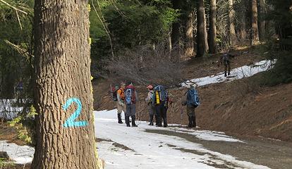
One of the places we left the road
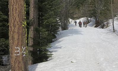
Back on the road, having walked only about half the marked distance
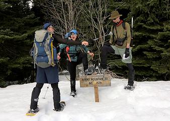
Silliness at trailhead
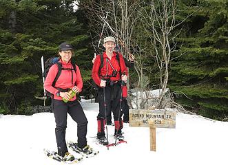
Colorful at trailhead
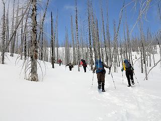
Going up the silver forest
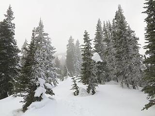
Foggy/snowy on the ridge crest
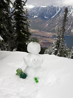
Questionable summit decoration
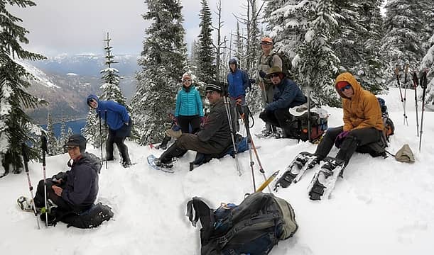
Group near Round Mtn summit
Alpine Lookout Six of us decided to continue two Alpine Lookout, 2.5 miles further along the ridge. Clouds covered the crest most of the way, but then it was sunny at the end. The undulating crest looked like it would be a fine view hike in clear weather. The final col before the lookout had some steep cliffs and cornices. Up on to was mostly sunny. Distant clouds lifted enough to give views of Buck Mountain and the Maude group.
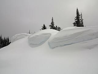
Some grounded cornices along the way
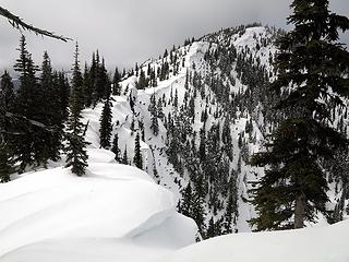
The last col before Alpine Lookout
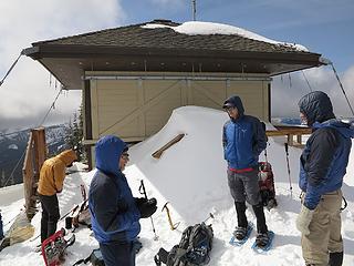
Alpine Lookout
Alpine Lookout
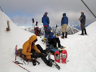
Group at the lookout
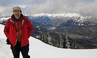
Me at the lookout
Me at the lookout
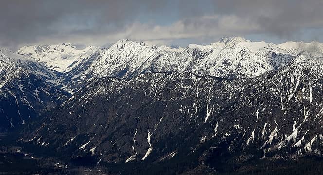
Looking across Lake Wenatchee to Buck & Maude
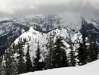
View further west toward Howard & Mastiff
Exit Along our way out, the weather became clear and sunny. Snow on the ridge packed down firmly, but the top foot was getting very soft on the open slopes in the silver forest.
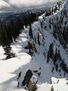
Sunlit cornices at the col
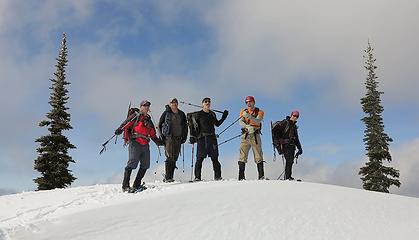
Mis-use of trekking poles
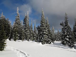
Sunshine on the crest
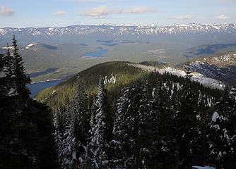
Looking off the east end of Nason Ridge
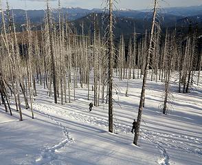
Descending the silver forest
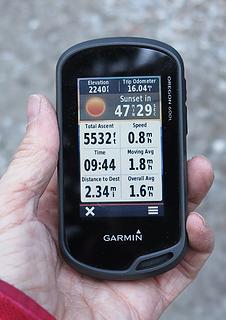
GPS seems to overstate the odometer
Stats: 14 miles, 5450 gain, 9:45 hours

“As beacons mountains burned at evening.” J.R.R. Tolkien
Back to top Reply to topic Reply with quote Send private message
GeoTom
Member
Member


Joined: 19 May 2005
Posts: 3215 | TRs | Pics
Location: Earth
GeoTom
Member
PostSun Apr 20, 2014 7:12 am 
More of the same, but different:
Carla disappears behind a snag
Silver forest
Silver forest
The frogs made a new friend
Small trees and snag
Hikers
Hikers
Full set: Round Mountain & Alpine Lookout; April 6, 2014

Knows literally nothing
Back to top Reply to topic Reply with quote Send private message
iron
Member
Member


Joined: 10 Aug 2008
Posts: 6392 | TRs | Pics
Location: southeast kootenays
iron
Member
PostSat Jun 28, 2014 12:05 am 
more of the different, but the same...
in the middle of the forest, on the ridge, we came across a hole that was at least 10ft deep, if not more. never seen anything like that before, though snowking, i'm told, is similar.

Back to top Reply to topic Reply with quote Send private message
   All times are GMT - 8 Hours
 Reply to topic
Forum Index > Trip Reports > round+alpine lookout+round mt 4-6-2014
Jump to:   
Search this topic:

You cannot post new topics in this forum
You cannot reply to topics in this forum
You cannot edit your posts in this forum
You cannot delete your posts in this forum
You cannot vote in polls in this forum