| Previous :: Next Topic |
| Author |
Message |
John Morrow
Member


Joined: 03 Apr 2007
Posts: 1526 | TRs | Pics
Location: Roslyn |
Island in the Sky District
Part 1 of my 2014 Canyon Country travels.
I have some firm dates later in the month but I had no specific plan as I drove through Salt lake on what to do first. I-15 through Provo means decision time at the forks. I heard that Canyonlands National Park got snow last week which could open up some longer hiking opportunities in its' driest district: The Island in the Sky.
Now, the Island gets an undeserving cold shoulder by the backpacking crowd, so I was even more determined to find some special stuff both, off the beaten path, and that I haven't tried. My thought was; do a loop hike around the tip of Grandview Point and Junction Butte, beginning at the Gooseberry Traihhead and ending at Murphy Trailhead. If you know it at all you are probably saying, "Who wants to walk the White Rim road??? Hoping that the White Rim sandstone potholes indeed held recent snowmelt for water, my idea was to find descents through the vertical White Rim and explore its hidden riches below.
Day 1, April 5, Government Trail:
OK, day one actually started with a day hike. Why? Well I didn't fully trust water availability so I figured I'd supplement. An unpublished trail... downclimb actually, called Gov't Trail or Murphy Basin Route would drop me down to the White Rim at about the 1/2 way point of the loop. With a special cache permit from the rangers I set out to cache 2.5 gallons of milk jugs and bottles of water down onto the rim for pickup a couple days later.
Yes, Government Trail... well, it is no trail! I put it at exposed Class 3 or even Class 4, with 20 pounds of sloshing water weight centered against my shoulder blades inside the daypack. Exciting it was. After carefully picking my way down, occasionally lowering the awfully weird weighing pack to ledges below, I managed to safely reach the scree below. it was done.
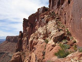 Murphy basin Route: good start 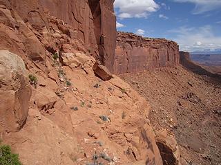 Whoa, this is gritty 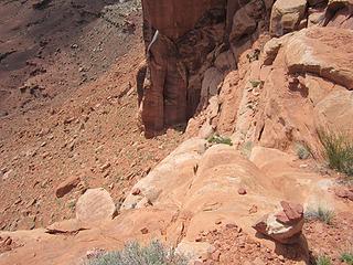 Call this a trail? 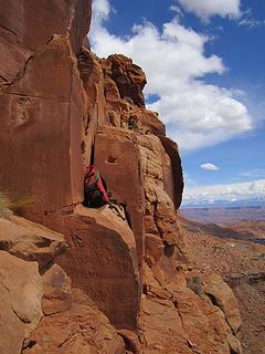 Com' on man! 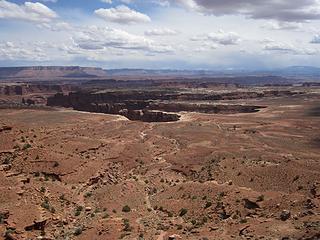 Finally through 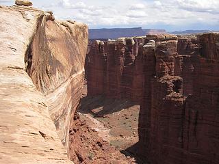 At the Monument rim 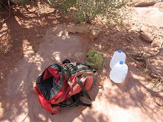 Drop off the 2 gal cache 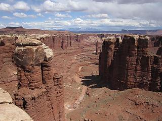 Cool tower 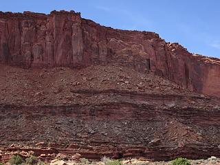 That's the route 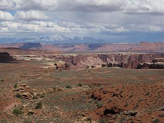 Last look 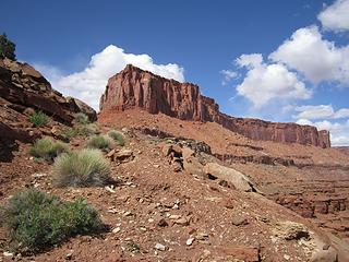 Grandview Point 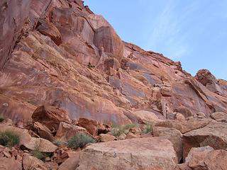 Time to go again 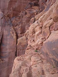 The trail is not a trail..Gary Snyder 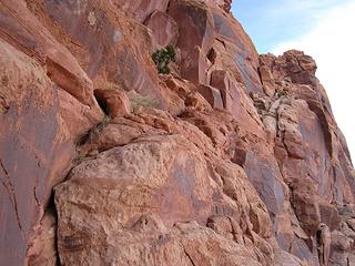 Slight exposure I'd say 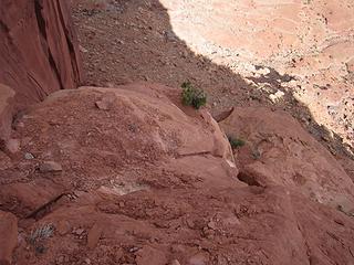 Yeah, right..made it, whew 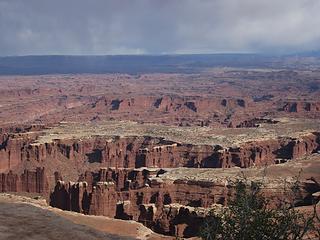 Back on top 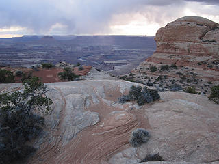 IMG_6486 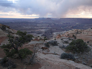 IMG_6488 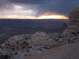 Incoming weather 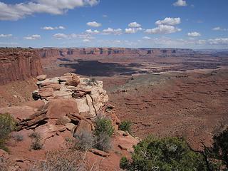 Time to drop Gooseberry 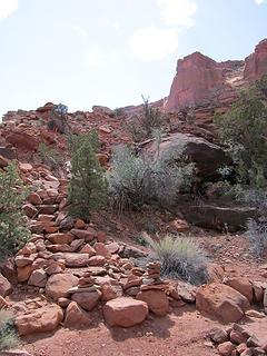 Gooseberry switchbacks bottom 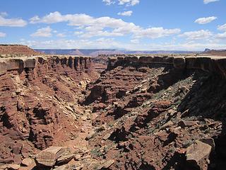 Gosseberry canyon proper  Esay walking on the white rim 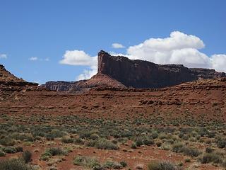 Started up at the overlook 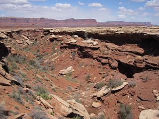 Water! In little Dogleg Cyn 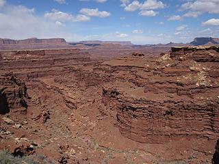 Water in main Dogleg! 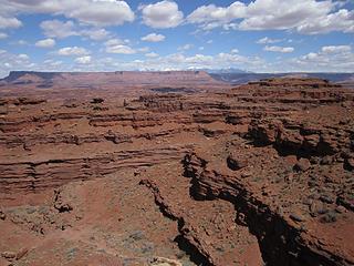 Crazy Organ Rock formation 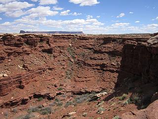 Dogleg entrance...goes 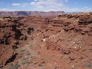 More Dogleg water, too 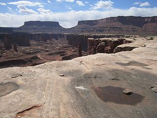 onto east rim Monument Basin 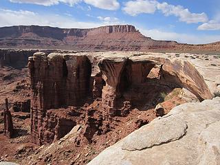 Island in the Sky District, Canyonlands National Park, UT 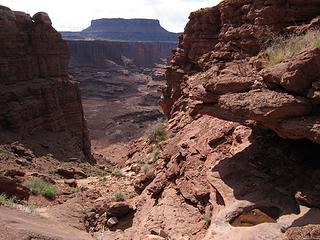 Cool...Monument Basin goes! 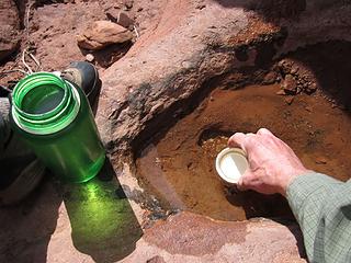 one capful at a time! 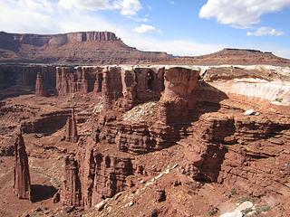 Evening among Monuments 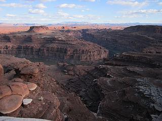 Colorado River view dusk 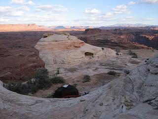 Fantastic camp over river! 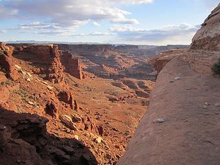 From the tent! 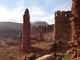 eve. stroll down Monument route 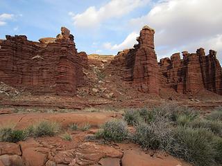 The way in 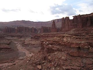 Far enough...it goes easy 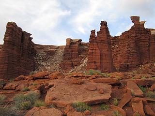 Colorful Monuments 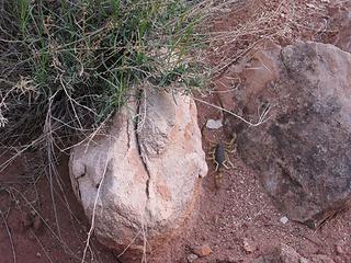 I don't like these... 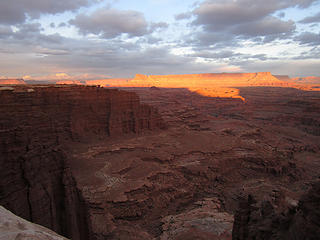 IMG_6563 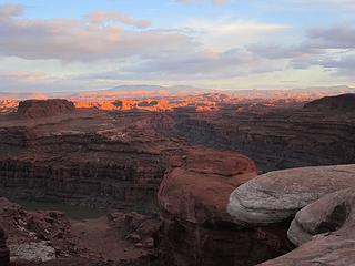 Needles area sunset over river 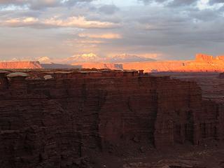 fading light 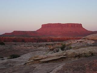 First light on Junction Butte 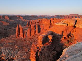 Sunrise color, Monument Basin 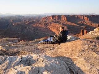 White Rim above Colorado River. Island in the Sky District, Canyonlands National Park, UT 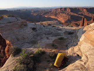 Best camp ever 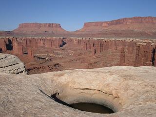 Yet more water! 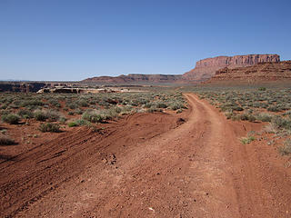 IMG_6598 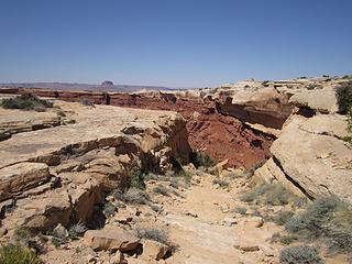 The "White Crack" to descend 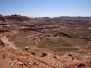 Into the lovely Cedar Mesa sandstone 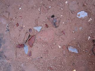 Lithics 800+ yrs old 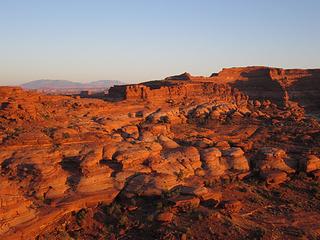 Sunset on the Cedar Mesa forms 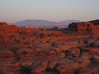 The Needles through there 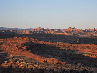 Total confusion country 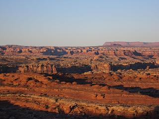 Maze crazed 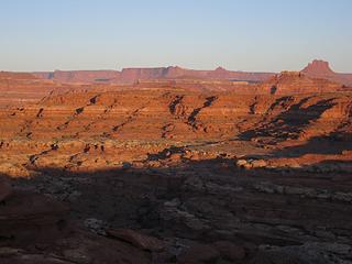 Ekker Butte 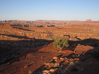 Wait...best camp ever?
Island in the Sky District. 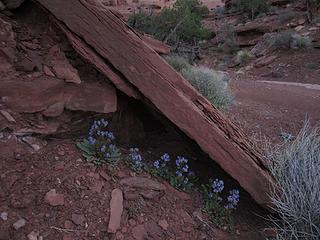 forget-me-not 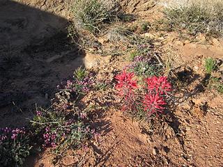 florals 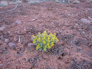 some yellow thing 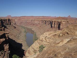 The Green River! 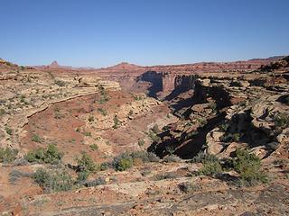 Stove Canyon...goes? 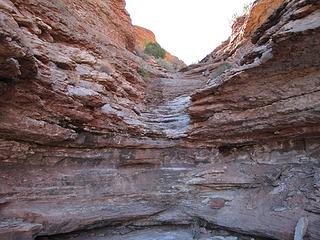 fun stuff!  it goes! 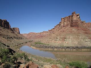 At the river 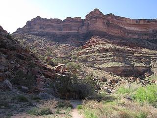 Stove route above nice camp 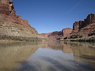 Soak and splash! 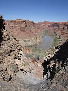 Back out 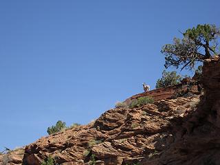 Met this one 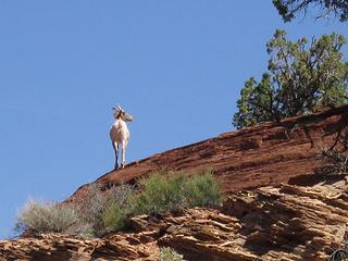 stately  Sheep love views too 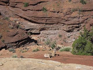 Very friendly 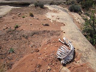 maybe, too friendly 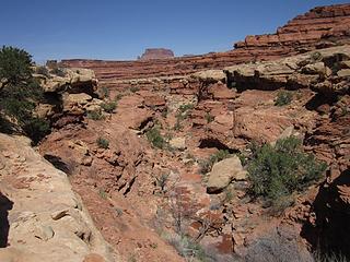 Cedar Mesa canyons water! 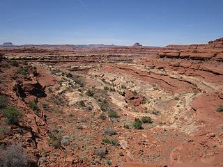 Love these forms 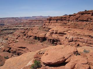 Tent along tree upper right 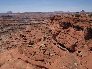 Tent view 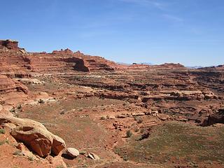 Leaving for White Crack 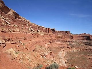 Up the crack 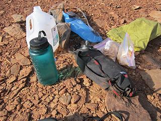 reunited with bumped up cache 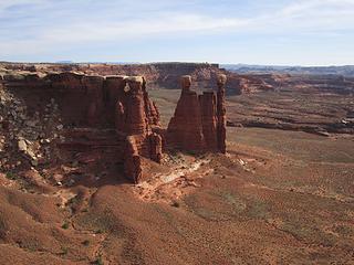 The twins 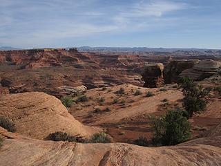 Twins Basin to Needles and Grabens 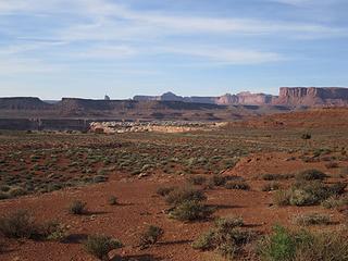 Heading north, endless road 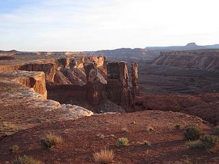 Last White Rim view  15 endless miles done! 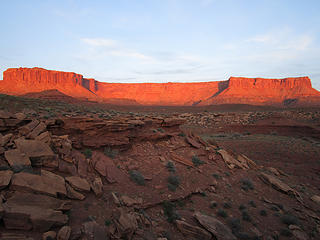 IMG_6710 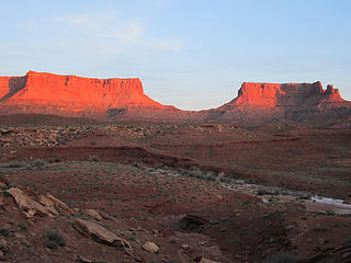 IMG_6711 Canyonlands National Park, Island in the Sky District 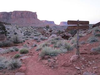 Canyonlands National Park, Island in the Sky District 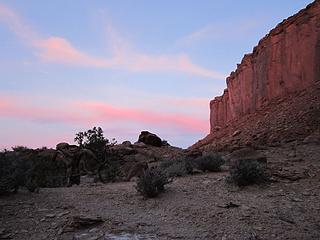 Sun coming up 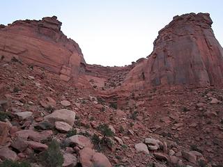 Murphy Trail climb 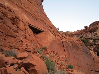 NPS trailwork 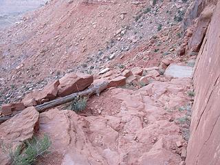 Nice bridge 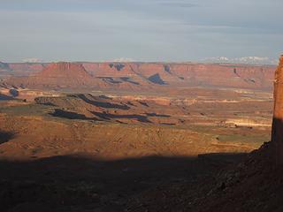 Sun shines 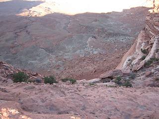 Finally! 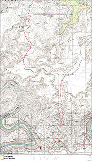 April 8 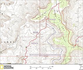 April 9
Tell me, what is it you plan to do with your one wild and precious life?-Mary Oliver
A nation that continues year after year to spend more money on military defense than on programs of social uplift is approaching spiritual doom.
― MLK Jr.
Tell me, what is it you plan to do with your one wild and precious life?-Mary Oliver
A nation that continues year after year to spend more money on military defense than on programs of social uplift is approaching spiritual doom.
― MLK Jr.
|
| Back to top |
  
|
|
bobbi
stillaGUAMish

Joined: 13 Jul 2006
Posts: 8012 | TRs | Pics
Location: olympics! |
|
bobbi
stillaGUAMish
|
 Wed Apr 09, 2014 4:15 pm |
|
|
oh my
..what great hiking with awesome weather!
water may have been from some recent rains? very timely!
scorpion, nope  thanks for sharing your trip and fabulous photos!
bobbi ૐ
"Today is your day! Your mountain is waiting. So
get on your way!" - Oh, the Places Youll Go! By Dr. Seuss
bobbi ૐ
"Today is your day! Your mountain is waiting. So
get on your way!" - Oh, the Places Youll Go! By Dr. Seuss
|
| Back to top |
|
|
MyFootHurts
Huge Member

Joined: 22 Nov 2011
Posts: 912 | TRs | Pics
Location: Kekistan |
The Colorado Plateau makes the NW look like Detroit.
|
| Back to top |
|
|
GaliWalker
Have camera will use

Joined: 10 Dec 2007
Posts: 4930 | TRs | Pics
Location: Pittsburgh |
|
GaliWalker
Have camera will use
|
Wed Apr 09, 2014 5:48 pm |
|
|
And so it begins...John Morrow's annual spring series of superb, envy-inducing trip reports from the southwest.
Bravo to the first installment!
|
| Back to top |
|
|
ragman and rodman
Member

Joined: 28 Apr 2005
Posts: 1219 | TRs | Pics
Location: http://rgervin.com/ |
Simply incredible!!
|
| Back to top |
|
|
Rainie Too!
Member

Joined: 12 Dec 2008
Posts: 377 | TRs | Pics
|
|
| Back to top |
|
|
John Morrow
Member
Joined: 03 Apr 2007
Posts: 1526 | TRs | Pics
Location: Roslyn |
Thanks everyone! Happy and hopeful that it will inspire adventures for others to come.
I added maps to the original post, at bottom, for anyone interested.
John
Tell me, what is it you plan to do with your one wild and precious life?-Mary Oliver
A nation that continues year after year to spend more money on military defense than on programs of social uplift is approaching spiritual doom.
― MLK Jr.
Tell me, what is it you plan to do with your one wild and precious life?-Mary Oliver
A nation that continues year after year to spend more money on military defense than on programs of social uplift is approaching spiritual doom.
― MLK Jr.
|
| Back to top |
|
|
olderthanIusedtobe
Member

Joined: 05 Sep 2011
Posts: 7709 | TRs | Pics
Location: Shoreline |
| MyFootHurts wrote: | | The Colorado Plateau makes the NW look like Detroit. |
Really? The desert southwest is cool no doubt, TOTALLY different than the northwest, but the NW rocks. I'll keep it, you can have Detroit. I'd say the NW makes the SW look like Mars.
|
| Back to top |
|
|
olderthanIusedtobe
Member
Joined: 05 Sep 2011
Posts: 7709 | TRs | Pics
Location: Shoreline |
Great pictures by the OP, sounds like quite an adventure. Nice when it all works out according to plan.
|
| Back to top |
|
|
Jim Dockery
Member

Joined: 12 Sep 2007
Posts: 3092 | TRs | Pics
Location: Lake Stevens |
|
| Back to top |
|
|
Gwen
LO Girl-of-the-Month
Joined: 14 Feb 2010
Posts: 1673 | TRs | Pics
|
|
Gwen
LO Girl-of-the-Month
|
Tue Apr 15, 2014 1:17 am |
|
|
| GaliWalker wrote: | | And so it begins...John Morrow's annual spring series of superb, envy-inducing trip reports from the southwest.
Bravo to the first installment! |
Yeah, what he said!
Tomorrow's not promised to anyone, so be bold, scare yourself, attempt something with no guarantee of success. You'll be amazed at what you can achieve. -Olive McGloin
Tomorrow's not promised to anyone, so be bold, scare yourself, attempt something with no guarantee of success. You'll be amazed at what you can achieve. -Olive McGloin
|
| Back to top |
|
|
D. Inscho
Not bored yet...

Joined: 28 Feb 2010
Posts: 973 | TRs | Pics
Location: Bellingham,WA |
|
D. Inscho
Not bored yet...
|
Tue Apr 15, 2014 6:57 am |
|
|
I'm not surprised you were bonking John; manic coverage of the area! You really know how to sling a camera too. Very nice photo work. (I love seeing red BTW) 
eve. stroll down Monument route
http://david-inscho.smugmug.com/
The key to a successful trip is to do the planning during work hours. -- John Muir
My most memorable hikes can be classified as 'Shortcuts that Backfired'. --Ed Abbey
http://david-inscho.smugmug.com/
The key to a successful trip is to do the planning during work hours. -- John Muir
My most memorable hikes can be classified as 'Shortcuts that Backfired'. --Ed Abbey
|
| Back to top |
|
|
Gabigabs
Trail Breaker

Joined: 07 Nov 2007
Posts: 841 | TRs | Pics
Location: Seattle |
|
Gabigabs
Trail Breaker
|
Tue Apr 15, 2014 9:32 am |
|
|
Great adventure
Life is simple... Eat, Sleep, Hike!
Life is simple... Eat, Sleep, Hike!
|
| Back to top |
|
|
nuclear_eggset
Member

Joined: 02 Jul 2006
Posts: 2206 | TRs | Pics
Location: Eastside |
Very pretty! Thanks for sharing such a different landscape!
|
| Back to top |
|
|
|
|
You cannot post new topics in this forum
You cannot reply to topics in this forum
You cannot edit your posts in this forum
You cannot delete your posts in this forum
You cannot vote in polls in this forum
|
Disclosure: As an Amazon Associate NWHikers.net earns from qualifying purchases when you use our link(s). |


