| Previous :: Next Topic |
| Author |
Message |
ree
Member


Joined: 29 Jun 2004
Posts: 4399 | TRs | Pics
|
|
ree
Member
|
 Mon May 26, 2014 9:03 pm |
|
|
Cashmere Mountain 5/24/2014
Our intention was a prominent peak on the west side of the Cascade Crest, but THAT wasn't going to happen with the forecast of rain and clouds. What's the point of the effort if you're socked in? Well, better not ask that question with this crowd.  Nevermind. The forecast was decent for the east side of the crest, so we decided on our alternative, Cashmere Mountain.
At 8,501',Cashmere Mountain makes the list of top 100 highest peaks of Washington. Admittedly, my view of Icicle Creek peaks is rather tame, but I was fooled by ignorance. Cashmere is a nice hulking peak, with lots of gain, and pucker-factor scrambling on top.
Wow, Memorial Day weekend crowds were out, tour de force. It was CROWDED. Trailheads, parking lots, trails... I'm really blown away by how many people go out with not enough water, clothing, etc. And of course, there was more than one dog owner contemplating ignoring the ban on bringing dogs on the trail. Both dog owners said they consulted the WTA website looking to see if bringing their dogs were okay, but said there was no mention of it on the Eightmile Trail. So they brought dogs, only to be disappointed.
Throngs of people were on the Eightmile Lake Trail, but at Little Eightmile Lake, we turned north and headed towards Lake Caroline, where crowds thinned considerably. The trail switchbacked steeply up to a bench, and as it leveled out, snow became consistent (approx. 6,100'). Continuing to climb, we reached the hilltop above Lake Caroline.
We came upon Opus and Lindsey, some mountaineer acquaintances, at the high point above Lake Caroline. It blows my mind you can be in the middle of nowhere and come across people you know... but I guess it is a small world, especially in the hiking community up here.
We scrambled down around Lake Caroline's outlet, and meandered to a flat spot in the snow near Little Caroline Lake. We dropped our packs and headed north east to Cashmere Mountain's southern shoulder. It was a loonnnnng trip upwards, over tundra, rocks, and snowfields, leaving trees and brush behind. The southern reaching shoulder of Cashmere Mountain is wide and grand, giving spectacular views of Mt. Stuart, Assguard Pass, Colchuck Lake, etc. It was pretty easy travel, considering the elevation.
We crossed a saddle between Cashmere Mountain and Point 8,219' and headed up a bootpath on Cashmere's west ridge.
We saw boot prints in a northern-aspected snowfield with a frightening run out, and thinking we could avoid that and scramble to the summit from the west ridge, we headed up. It turned out that getting to the actual summit was impossible from there, given our equipment shortages and day light running out. So we all were content to enjoy the view on the western ridge of the summit, and have snacks. We called it "good enough" and headed back down, arriving at our camp around dusk. Nevermind. The forecast was decent for the east side of the crest, so we decided on our alternative, Cashmere Mountain.
At 8,501',Cashmere Mountain makes the list of top 100 highest peaks of Washington. Admittedly, my view of Icicle Creek peaks is rather tame, but I was fooled by ignorance. Cashmere is a nice hulking peak, with lots of gain, and pucker-factor scrambling on top.
Wow, Memorial Day weekend crowds were out, tour de force. It was CROWDED. Trailheads, parking lots, trails... I'm really blown away by how many people go out with not enough water, clothing, etc. And of course, there was more than one dog owner contemplating ignoring the ban on bringing dogs on the trail. Both dog owners said they consulted the WTA website looking to see if bringing their dogs were okay, but said there was no mention of it on the Eightmile Trail. So they brought dogs, only to be disappointed.
Throngs of people were on the Eightmile Lake Trail, but at Little Eightmile Lake, we turned north and headed towards Lake Caroline, where crowds thinned considerably. The trail switchbacked steeply up to a bench, and as it leveled out, snow became consistent (approx. 6,100'). Continuing to climb, we reached the hilltop above Lake Caroline.
We came upon Opus and Lindsey, some mountaineer acquaintances, at the high point above Lake Caroline. It blows my mind you can be in the middle of nowhere and come across people you know... but I guess it is a small world, especially in the hiking community up here.
We scrambled down around Lake Caroline's outlet, and meandered to a flat spot in the snow near Little Caroline Lake. We dropped our packs and headed north east to Cashmere Mountain's southern shoulder. It was a loonnnnng trip upwards, over tundra, rocks, and snowfields, leaving trees and brush behind. The southern reaching shoulder of Cashmere Mountain is wide and grand, giving spectacular views of Mt. Stuart, Assguard Pass, Colchuck Lake, etc. It was pretty easy travel, considering the elevation.
We crossed a saddle between Cashmere Mountain and Point 8,219' and headed up a bootpath on Cashmere's west ridge.
We saw boot prints in a northern-aspected snowfield with a frightening run out, and thinking we could avoid that and scramble to the summit from the west ridge, we headed up. It turned out that getting to the actual summit was impossible from there, given our equipment shortages and day light running out. So we all were content to enjoy the view on the western ridge of the summit, and have snacks. We called it "good enough" and headed back down, arriving at our camp around dusk.
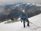
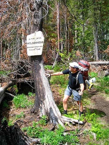 Steve inspects brand new sign 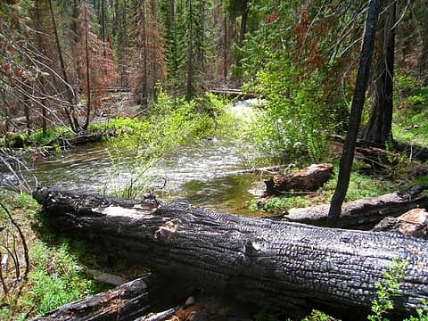 burnt log and Eight Mile Creek 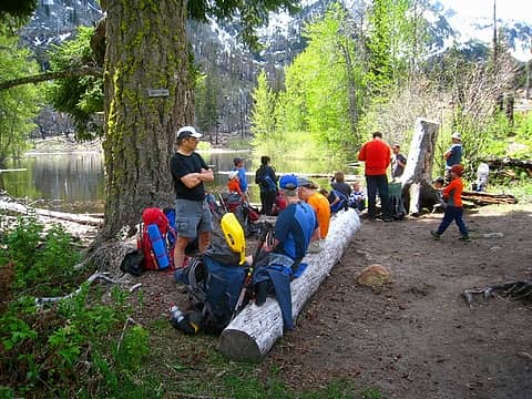 Rest stop at Little Eight Mile Lake 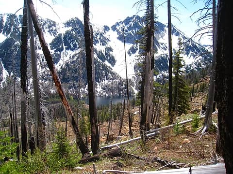 Eight Mile Lake 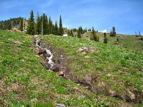 glacier lilies galore 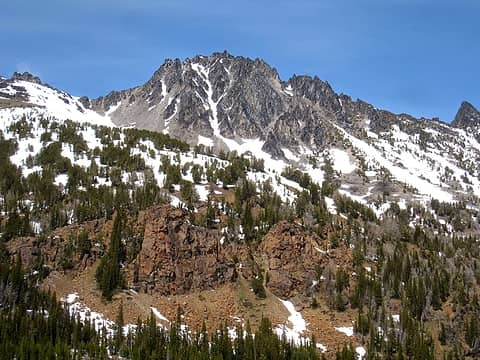 Our objective: Â Cashmere Mountain 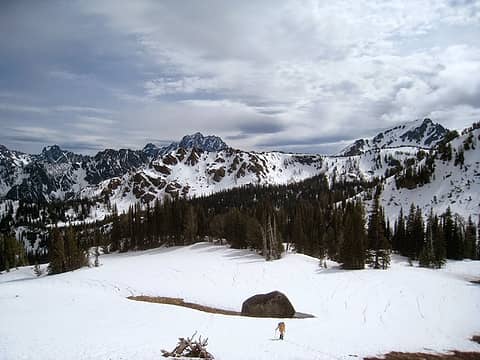 making our way up to Cashmere Mountain with Mt. Stuart peeking in bg 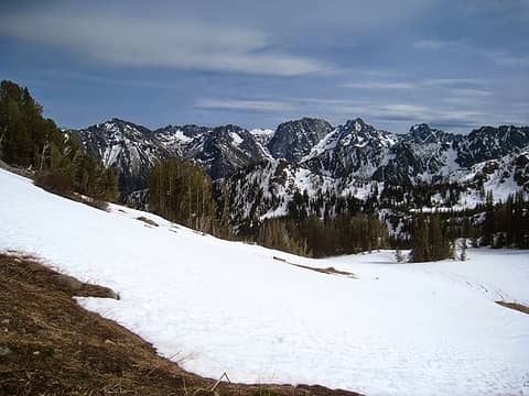 Little Annapurna, with Ass Guard Pass 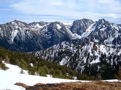 3 labels Snow-bound Annapurna; ColdChuck Lake 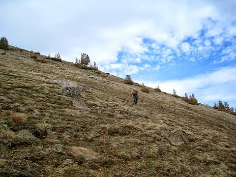 tundra heaven 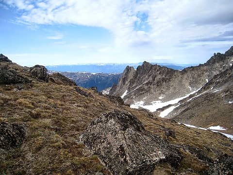 the east side mountains 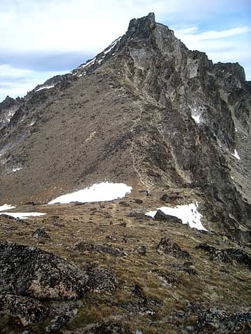 boot path up west ridge 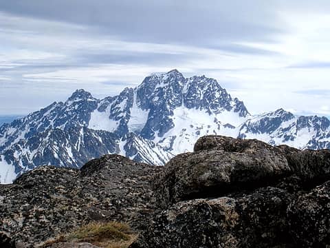 Mt. Stuart 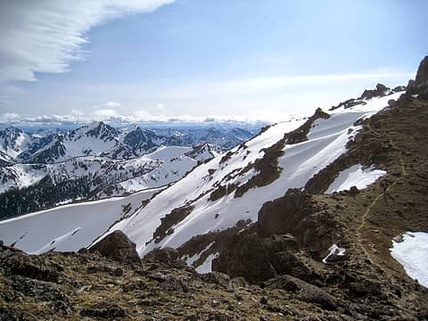 Mt. Axis 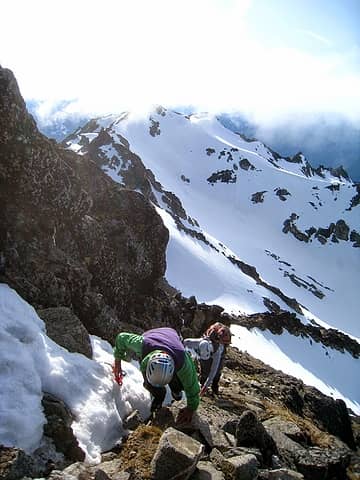 scrambling up the west ridge 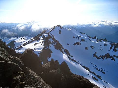 you can see the "trail" on the left 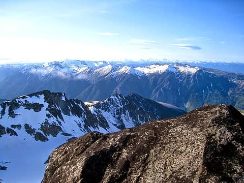 Icicle Ridge 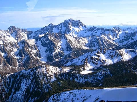 Mt. Stuart, with Rainier on right 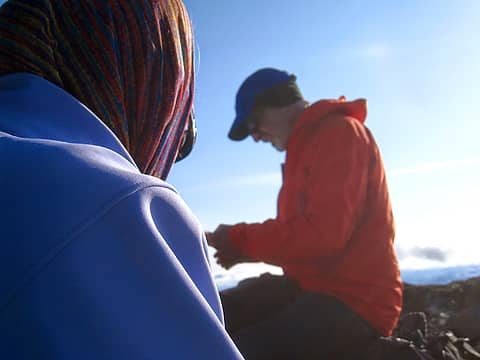 mountain couple 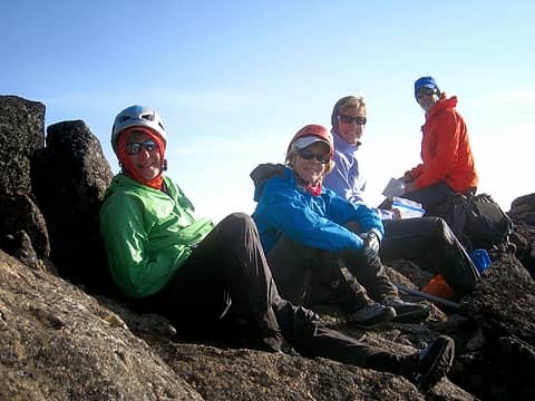 glad to be sitting down... for once. 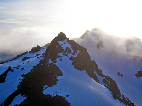 weather coming in from the west 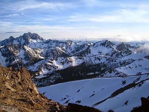 Mt. Stuart on left, Mt. Rainier on right 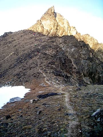 color-speckled climbers come down 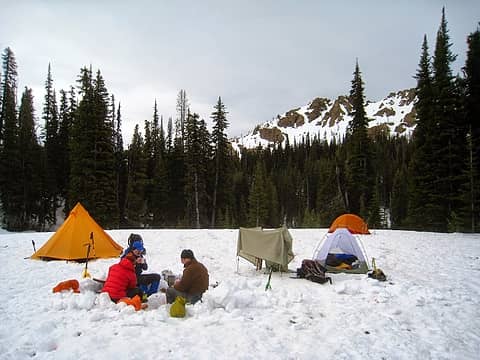 snowy camp 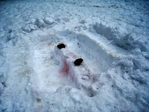 kitchen kamp 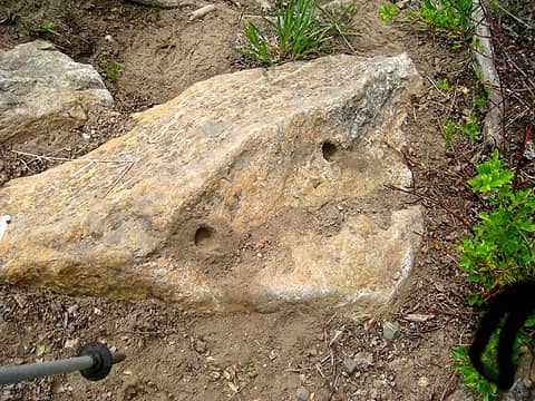 Holes in the rocks 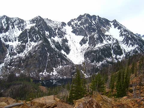 Axis and Eightmile Lake 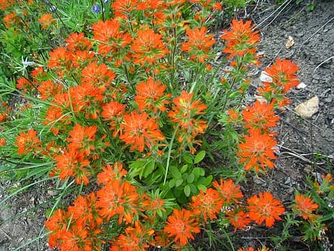 paintbrush bliss 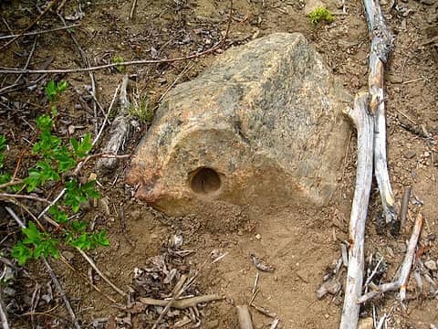 hole in the rock
|
| Back to top |
  
|
|
SergioNapelo
Member
Joined: 05 Mar 2011
Posts: 666 | TRs | Pics
Location: Edmonds, WA |
| ree wrote: | Rest stop at Little Eight Mile Lake |
That is me in orange shirt in the middle of the picture...  I thought that some people looked familiar... I am the one that asked men in the picture where are they heading!
We were out with the children on the hike!
Nice pictures!
I thought that some people looked familiar... I am the one that asked men in the picture where are they heading!
We were out with the children on the hike!
Nice pictures!

"I will lift up my eyes to the mountains. From where shall my help come. My help comes from the LORD, who made heaven and earth!" - David, King of Israel 1,000 BC
"I will lift up my eyes to the mountains. From where shall my help come. My help comes from the LORD, who made heaven and earth!" - David, King of Israel 1,000 BC
|
| Back to top |
|
|
ree
Member
Joined: 29 Jun 2004
Posts: 4399 | TRs | Pics
|
|
ree
Member
|
Mon May 26, 2014 11:02 pm |
|
|
|
| Back to top |
|
|
SergioNapelo
Member
Joined: 05 Mar 2011
Posts: 666 | TRs | Pics
Location: Edmonds, WA |
"I will lift up my eyes to the mountains. From where shall my help come. My help comes from the LORD, who made heaven and earth!" - David, King of Israel 1,000 BC
|
| Back to top |
|
|
Fletcher
Member

Joined: 29 Jul 2009
Posts: 1870 | TRs | Pics
Location: kirkland |
|
Fletcher
Member
|
Tue May 27, 2014 12:27 am |
|
|
Cashmere is a fun one. When I did it, that snow traverse on the west side was like bullet ice. No axe penetration. And bad, bad runout. Scared the sh## out of me.
|
| Back to top |
|
|
loper
Member

Joined: 11 Aug 2007
Posts: 453 | TRs | Pics
Location: seeking the sun |
|
loper
Member
|
Tue May 27, 2014 7:39 am |
|
|
Thanks for bringing the camera Ree! Can't believe I left mine in the car. Such stunning light and scenery!
|
| Back to top |
|
|
ree
Member
Joined: 29 Jun 2004
Posts: 4399 | TRs | Pics
|
|
ree
Member
|
Tue May 27, 2014 8:44 am |
|
|
Sergio, I remember meeting you at the calendar social? No?
Good choice, to choose to go out with family instead of the challenging-mountain-notch-on-belt. I wonder if you will scare up any photos...
Fletcher, Cashmere is a really fun and challenging one. I'd like to do it again late season.
Hey Loper, thanks for the great time. Yeah, I forgot my camera more than once. 
|
| Back to top |
|
|
Blowdown
Sawin' Logs ...

Joined: 24 Aug 2011
Posts: 376 | TRs | Pics
Location: On the Summit |
|
Blowdown
Sawin' Logs ...
|
Tue May 27, 2014 11:27 am |
|
|
| Quote: | | We called it "good enough" and headed back down |
That's always a tough call when you're so close to the summit, but without enough gear and/or daylight. Good on you to turn around. We'd rather read your cool trip report in this forum than read about your rescue in the headlines!
|
| Back to top |
|
|
Jetlag
Member
Joined: 17 Aug 2010
Posts: 1410 | TRs | Pics
|
|
Jetlag
Member
|
Tue May 27, 2014 11:59 am |
|
|
I really like the "color-speckled climbers coming down" photo. Neat to see at least three separate groups of NWHikers cross paths at one spot . . . and not know it immediately.
|
| Back to top |
|
|
|
|
You cannot post new topics in this forum
You cannot reply to topics in this forum
You cannot edit your posts in this forum
You cannot delete your posts in this forum
You cannot vote in polls in this forum
|
Disclosure: As an Amazon Associate NWHikers.net earns from qualifying purchases when you use our link(s). |


 You are the Elvis of nwhikers or something...
  A tamer trip for sure for you. I know what you are capable of...
 )
)