| Previous :: Next Topic |
| Author |
Message |
daffish
Member


Joined: 16 Sep 2009
Posts: 282 | TRs | Pics
Location: Dreamtime |
|
daffish
Member
|
 Sun Jul 13, 2014 12:53 pm |
|
|
I left the White Pine Trailhead in the mid-afternoon on this scorcher of a day. The trail contoured a steep hillside in dry forest for 2.5 miles to the junction with the Wild Horse Trail.
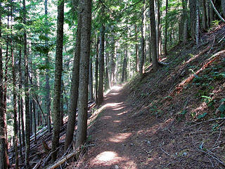 forest hike on a hillside high above the creek 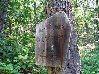 always a good sign 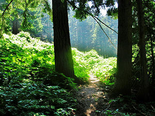 from shade to sun 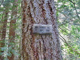 trail junction sign 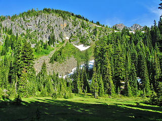 basin with meadow at 5600ft 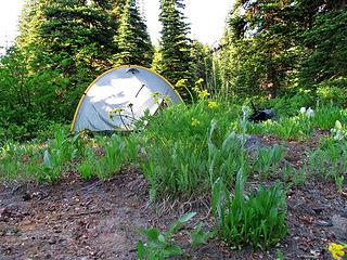 camp just above the basin 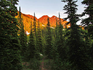 alpineglow on the Chiwaukums 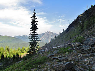 scrambling upward in the morning 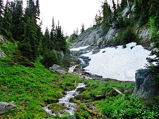 following the stream upward 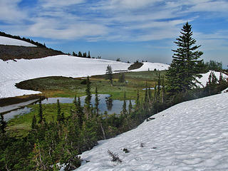 first view of the 'soccer field' 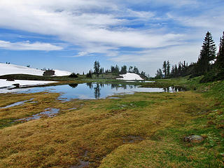 lake is mostly a flooded meadow 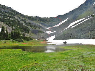 Deadhorse Pass route 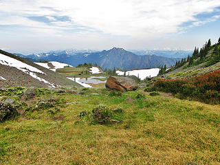 looking northwesterly to Jim Hill Mtn 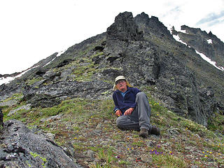 dead tired at Deadhorse Pass 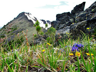 a tiny Pine struggles to survive at Deadhorse Pass  west views from Deadhorse Pass area 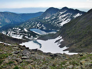 Cup Lake still snow covered; Larch Lake mostly snow free 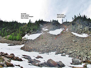 'soccer field' up and down gullies 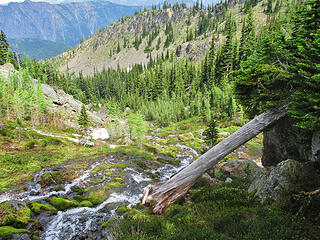 descending alongside the stream 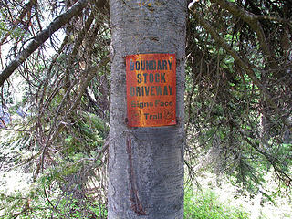 old sign in the forest above the hunters camp
"Be moderate in everything, including moderation" Horace Porter
"Be moderate in everything, including moderation" Horace Porter
|
| Back to top |
  
|
|
Backpacker Joe
Blind Hiker

Joined: 16 Dec 2001
Posts: 23956 | TRs | Pics
Location: Cle Elum |
Did you find the dead horse? Im pretty sure there werent any fish up there!
Nice work.
"If destruction be our lot we must ourselves be its author and finisher. As a nation of freemen we must live through all time or die by suicide."
Abraham Lincoln
"If destruction be our lot we must ourselves be its author and finisher. As a nation of freemen we must live through all time or die by suicide."
Abraham Lincoln
|
| Back to top |
|
|
Marmot Salad
Member

Joined: 05 Jul 2014
Posts: 23 | TRs | Pics
Location: Tacoma |
Nice. Looks like you had the place to yourself.
|
| Back to top |
|
|
HitTheTrail
Member

Joined: 30 Oct 2007
Posts: 5458 | TRs | Pics
Location: 509 |
Good trail beta for me.  (I like hiking on trails actually). Grace Lakes via Wildhorse is high on my list for a quick backup "get off the couch" hike when all else fails. It will probably execute when my wife wants me out of the house next. BTW, places like the "Soccer field" appeal to me. (I like hiking on trails actually). Grace Lakes via Wildhorse is high on my list for a quick backup "get off the couch" hike when all else fails. It will probably execute when my wife wants me out of the house next. BTW, places like the "Soccer field" appeal to me.
|
| Back to top |
|
|
D. Inscho
Not bored yet...

Joined: 28 Feb 2010
Posts: 973 | TRs | Pics
Location: Bellingham,WA |
|
D. Inscho
Not bored yet...
|
Mon Jul 14, 2014 6:48 am |
|
|
Deadhorse is a great alternative to the long Larch lake route. A stay in Deadhorse meadows is nice enough destination itself. Thanks for the reminder 
| Quote: | | the lake was more of a flooded meadow than an actual pond. I suspected the water may be seasonal. |
It is seasonal. There was no water in the basin during my stay there in the fall.
http://david-inscho.smugmug.com/
The key to a successful trip is to do the planning during work hours. -- John Muir
My most memorable hikes can be classified as 'Shortcuts that Backfired'. --Ed Abbey
http://david-inscho.smugmug.com/
The key to a successful trip is to do the planning during work hours. -- John Muir
My most memorable hikes can be classified as 'Shortcuts that Backfired'. --Ed Abbey
|
| Back to top |
|
|
MLHSN
What goes here?????

Joined: 09 Sep 2007
Posts: 1069 | TRs | Pics
Location: Wenatchee |
|
MLHSN
What goes here?????
|
Mon Jul 14, 2014 7:50 am |
|
|
Good stuff
|
| Back to top |
|
|
|
|
You cannot post new topics in this forum
You cannot reply to topics in this forum
You cannot edit your posts in this forum
You cannot delete your posts in this forum
You cannot vote in polls in this forum
|
Disclosure: As an Amazon Associate NWHikers.net earns from qualifying purchases when you use our link(s). |


