| Previous :: Next Topic |
| Author |
Message |
Bloated Chipmunk
Cock Rock Searcher


Joined: 29 Jan 2007
Posts: 2993 | TRs | Pics
Location: Margaritaville |
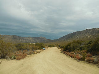
Cliff BM is the dark, pyramid-shaped mtn. viewed from southbound S-1 just north of the 8. It also looms high above the Buckman Springs area border checkpoint, giving a bird's eye view down to all those patiently waiting in line on the freeway. MM had pointed out this pk. some time ago & was intrigued. So, after some mapsturbating I figured out which one it was & how to approach it.  From the Buckman Springs rest area, continue east up a dirt rd. that angles up the hill....how far you can make it depends on what type of car you have. I drove up a little ways but then it got too humpy so I backtracked to a good pullout & parked.
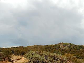
 Where I parked 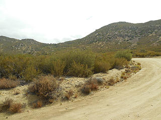 Rd. goes up through that gap  I looked back & saw one of their SUVs slowly creeping up the rd. I expected them to catch up w/me & ask some questions, but it appeared they turned around shortly after passing my car. Later one of their sedans appeared & parked itself closer to the beginning of the dirt rd., perhaps laying in wait for my return. I looked back & saw one of their SUVs slowly creeping up the rd. I expected them to catch up w/me & ask some questions, but it appeared they turned around shortly after passing my car. Later one of their sedans appeared & parked itself closer to the beginning of the dirt rd., perhaps laying in wait for my return.
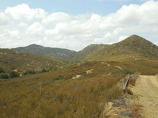 Horse Canyon 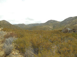 View eastish 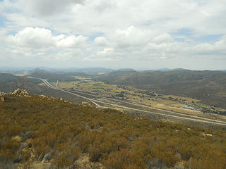 Looking back down @ Buckman Springs area 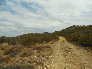 1st sight of Cliff BM 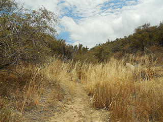 Where the trail leaves the rd. 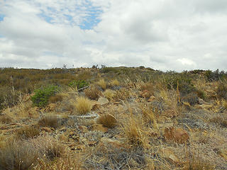 Some parts of the bushwhack were easy 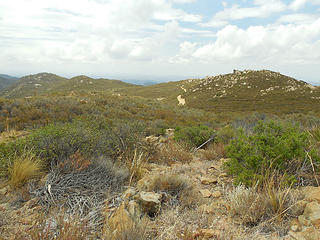 Looking back @ the rd. 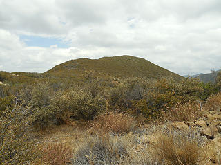 Gettin' close now 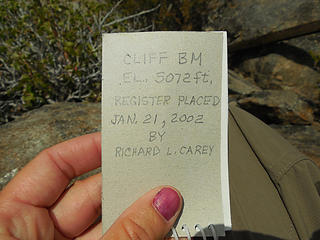 Summit register 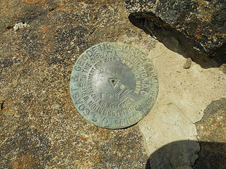 Cliff BM 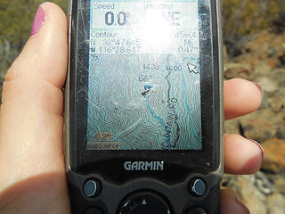 The latter part of my route 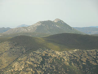 Long Valley Pk. across the freeway 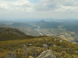 View south 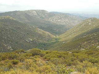 View SE 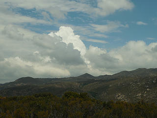 Storm cloud 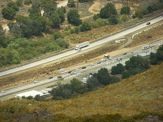 Zoom of border check point below 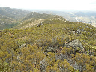 The ridge I came up 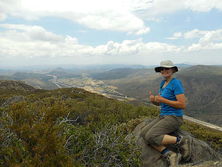 BC atop Cliff BM  When I finally did crouch down to pull it from my pack & put it on, my wet arms just made it all wet inside. D'oh! But thankfully I wore my usual quick-dry pants, & I figured the storm would soon pass & the sun would come back out & dry things out. This was true, but until then I had some lightening bolts & thunder a little too close for comfort. I chided myself for not getting an earlier start, but also remembered that (supposedly) the chances of getting struck by lightening are pretty slim. But then again, I always wonder if they're slim only b/c most people are not outdoors hiking on exposed ridgelines with lightening close by. When I finally did crouch down to pull it from my pack & put it on, my wet arms just made it all wet inside. D'oh! But thankfully I wore my usual quick-dry pants, & I figured the storm would soon pass & the sun would come back out & dry things out. This was true, but until then I had some lightening bolts & thunder a little too close for comfort. I chided myself for not getting an earlier start, but also remembered that (supposedly) the chances of getting struck by lightening are pretty slim. But then again, I always wonder if they're slim only b/c most people are not outdoors hiking on exposed ridgelines with lightening close by. 
 Looking back @ the thundercloud 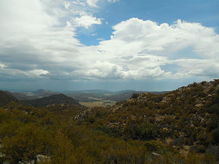 Buckman Springs area 
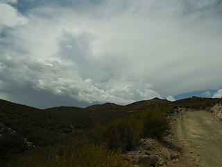 Last look @ thunderclouds to the N/NW
Home is where the hiking is.
"Peaks that have come and gone four times should halt a man in his steps." -- William O. Douglas
A balanced diet is a margarita in each hand.
Home is where the hiking is.
"Peaks that have come and gone four times should halt a man in his steps." -- William O. Douglas
A balanced diet is a margarita in each hand.
|
| Back to top |
  
|
|
Ski
><((((°>

Joined: 28 May 2005
Posts: 12832 | TRs | Pics
Location: tacoma |
|
Ski
><((((°>
|
 Sun Aug 03, 2014 10:23 pm |
|
|
nobody else up there in twelve years?!? or maybe they just didn't find the register? or border patrol spooked 'em off?
"I shall wear white flannel trousers, and walk upon the beach.
I have heard the mermaids singing, each to each."
"I shall wear white flannel trousers, and walk upon the beach.
I have heard the mermaids singing, each to each."
|
| Back to top |
|
|
Bloated Chipmunk
Cock Rock Searcher
Joined: 29 Jan 2007
Posts: 2993 | TRs | Pics
Location: Margaritaville |
Oh, that was just when it was placed. I usually don't take a pic of the last entry, but from what I remember it wasn't too long ago (w/in the last yr. or 2).
As a side note, a funny thing about the border patrol I've noticed is that when the weather turns bad (or just semi-bad) w/rain or very cold temperatures (like, 30s), the checkpoint closes up shop & you can just whiz right through. So, when I drove out it was closed even though by that point the storm had passed...  I wonder if the border crossers have figured this out yet, & if stealth activity picks up during bad weather.
Home is where the hiking is.
"Peaks that have come and gone four times should halt a man in his steps." -- William O. Douglas
A balanced diet is a margarita in each hand.
Home is where the hiking is.
"Peaks that have come and gone four times should halt a man in his steps." -- William O. Douglas
A balanced diet is a margarita in each hand.
|
| Back to top |
|
|
|
|
You cannot post new topics in this forum
You cannot reply to topics in this forum
You cannot edit your posts in this forum
You cannot delete your posts in this forum
You cannot vote in polls in this forum
|
Disclosure: As an Amazon Associate NWHikers.net earns from qualifying purchases when you use our link(s). |


