| Previous :: Next Topic |
| Author |
Message |
cartman
Member


Joined: 20 Feb 2007
Posts: 2800 | TRs | Pics
Location: Fremont |
|
cartman
Member
|
 Wed Aug 13, 2014 4:05 pm |
|
|
The Pasayten Wilderness, with its high, rambling terrain, long-ranging vistas, good trails and numerous peaks is one of my favorite areas of the Cascades. However, I've spent very little time in its western reaches and have for several years wanted to backpack the Devils Dome trail from Ross Lake to Canyon Creek, especially after seeing the photos from Barb E's trip a few summers ago.
Ed and I had the benefit on this trip of four days of stellar weather, great trails and flowers at their peak. This area is a flower mecca, and they got better the further we went, culminating in the fantastic traverse below Jackita Ridge. And the easy terrain allowed me to wear sneakers and Ed trail shoes the entire trip.
Water availability is a real issue on the W>E portion of the trip. KarlK's trip report was very helpful and is quite accurate for water sources, save for the basin between Devils Dome and Devils Pass, where we saw none. Bugs also were an issue, no surprise given the extensive flower fields all along the trails.
Day 1: Ross Lake to Devils Dome
Ed was game for a four day trip so we caught the boat Sunday morning for the Devils Junction TH on the east side of the lake, elevation 1600'.
(Photos marked with an * taken by Ed)
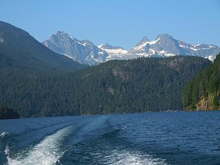 Boat ride 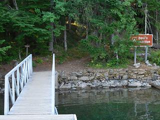 Devils Junction 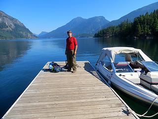 At the dock*  Into the Pasayten 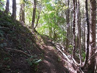 Good trail 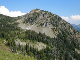 Devils Dome 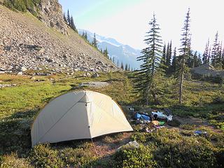 Devils Dome camp 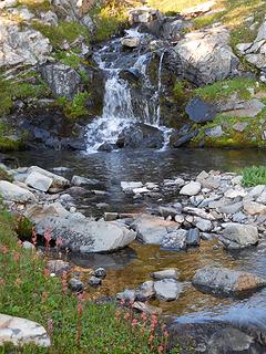 Waterfall pool 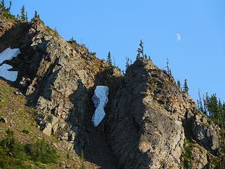 Devils Dome moon 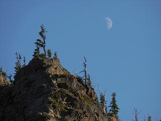 Dome moon 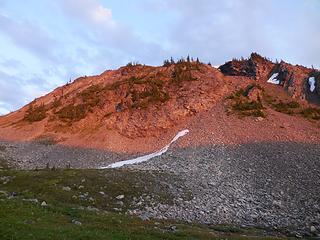 Domeglow 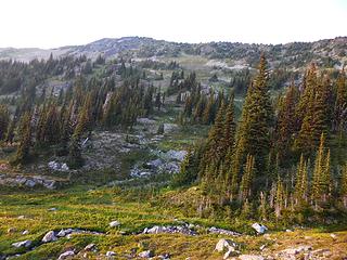 Route up Bear Skull 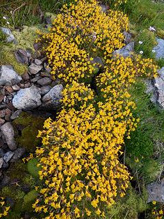 Yellow Monkeyflowers 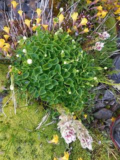 Cool leaves 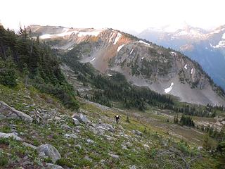 Ed and Devils Dome 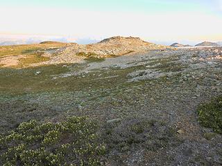 Approaching Bear Skull summit 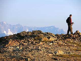 Bear Skull summit* 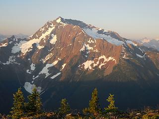 Jack morning 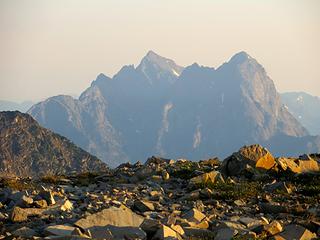 Hozomeen from Bear Skull* 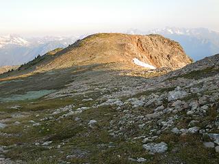 Bear Skull ridge walk 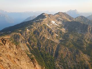 Spratt and Hozomeen 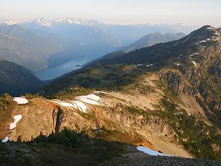 Spratt meadows 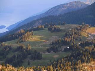 Spratt meadow closeup 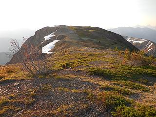 Bear Skull 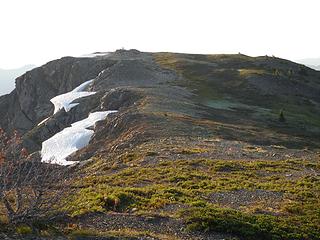 Bear Skull 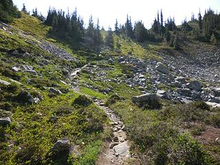 Up to pass 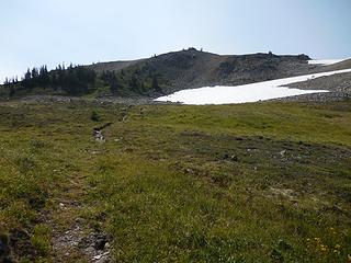 Up to Devils Dome 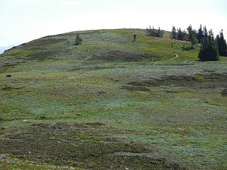 Ed nears the top 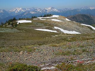 Dome plateau 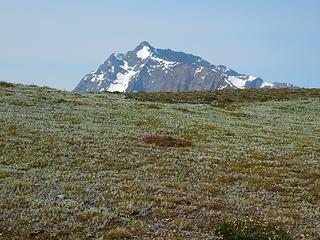 Jack rise 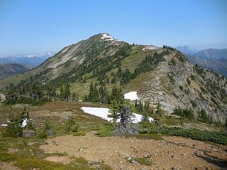 Bear Skull 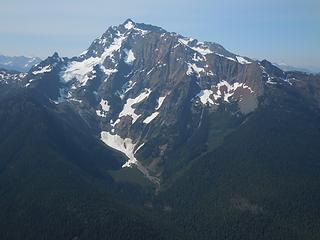 Jack 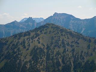 Cassia, Silhouette, Daemon 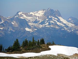 Prophet 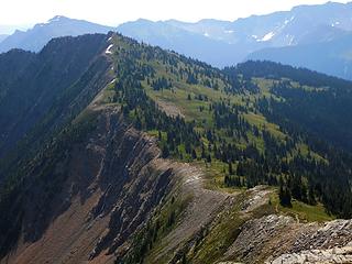 Ridge to Cinnamon 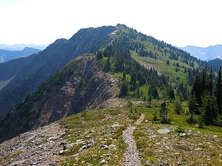 Trail to Cinnamon 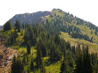 Cinnamon 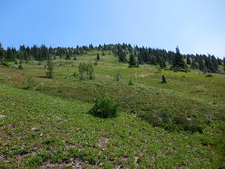 Slopes up Cinnamon 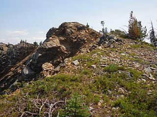 Cinnamon summit 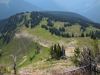 Cinnamon south slope 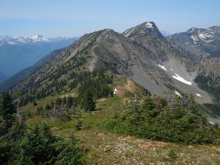 Devils Dome and Bear Skull 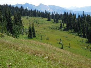 Meadows 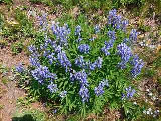 Lupine 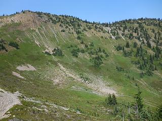 Basin traverse 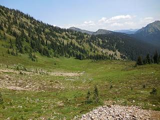 Basin 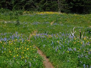 Flower trail 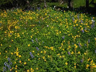 Flower meadow 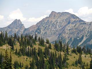 Silhouette and Daemon 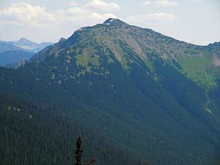 San Juan 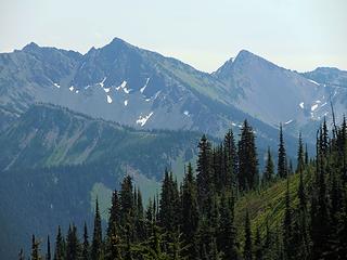 Jackita Ridge 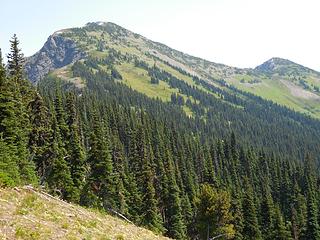 San Juan 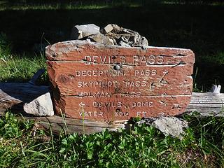 Devils Pass 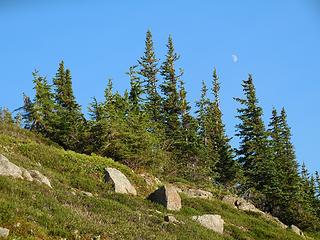 San Juan moon 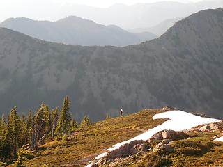 Ed on San Juan 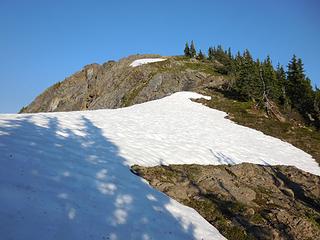 High on San Juan 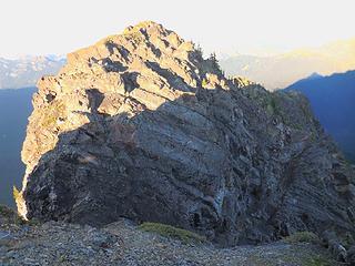 San Juan summit block 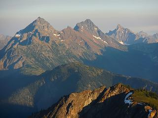 Ballard, Azurite, Golden Horn, Tower 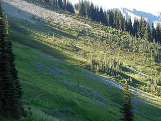 Lupine slopes 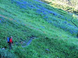 Lupine* 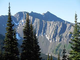 On to Jackita 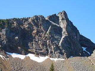 Pointy Jackita 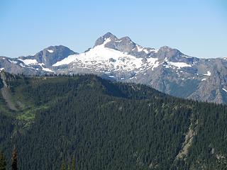 Crater  Jack 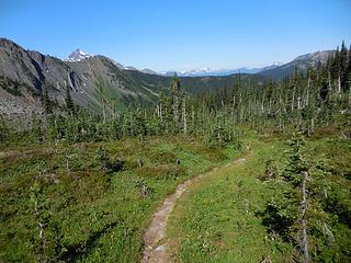 Jackita Basin trail 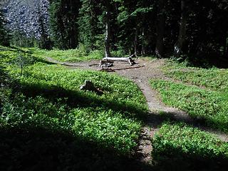 Campsite 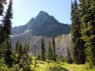 With a view 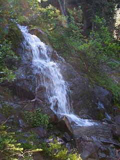 Waterfall 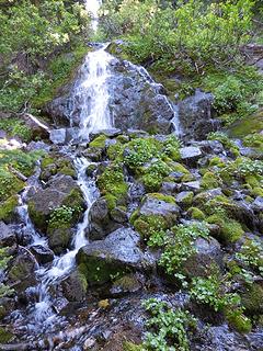 Waterfall 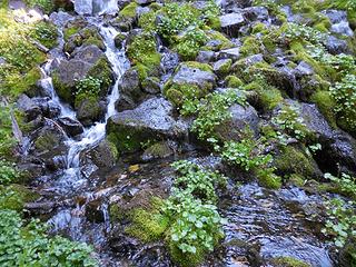 Mossy rocks 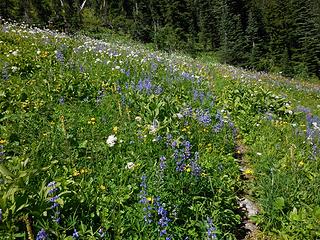 Time to head up 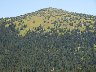 North Jackita 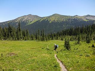 Ed in the meadow 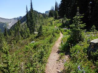 Ridge trail 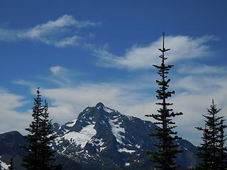 Jack 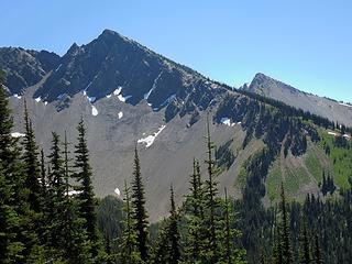 Jackita ahead 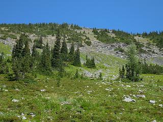 Jackita slopes 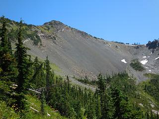 Scree traverse below South Jackita 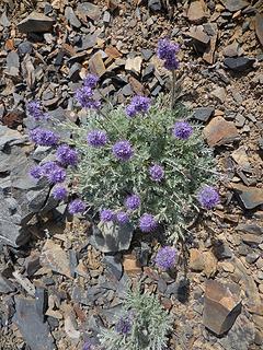 We love scree 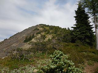 Up South Jackita 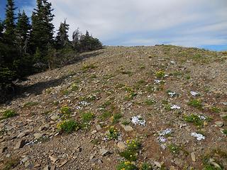 Almost there 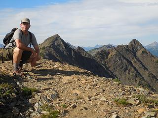 South Jackita summit 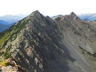 Jackita Ridge 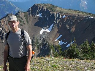 South Jackita summit 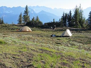 Tent shot 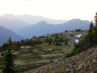 Evening camp* 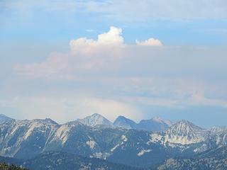 Falls Creek Fire 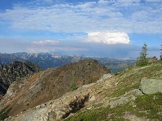 Falls Creek Fire 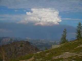 Falls Creek Fire 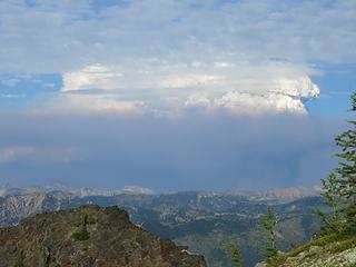 Falls Creek Fire 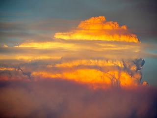 Falls Creek Fire* 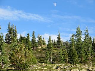 Moonrise 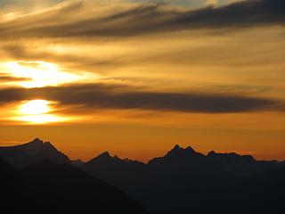 Setting Sun* 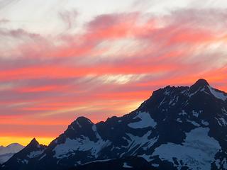 Sunset over Jack* 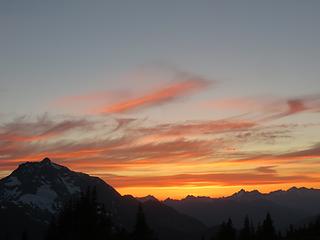 Sunset over Jack* 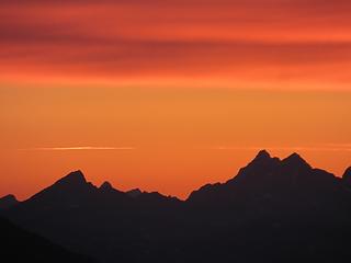 Sunset* 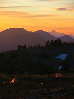 Sunset camp* 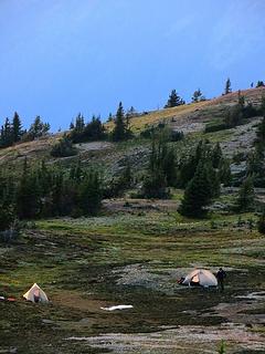 Morning camp* 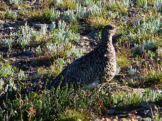 Queen of the Mountain* 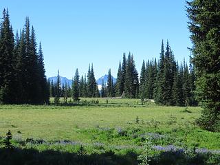 Devils Park* 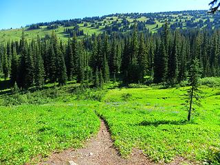 Slopes from Devils Shelter*
|
| Back to top |
  
|
|
Opus
Wannabe

Joined: 04 Mar 2006
Posts: 3700 | TRs | Pics
Location: The big rock candy mountain |
|
Opus
Wannabe
|
Wed Aug 13, 2014 4:20 pm |
|
|
Nice! I just did the loop from the 8th - 12th going counter clockwise. Very similar trip overall right down to the water issues. My trip was also much more smokey from that fire plume and calm winds. Great area, can't wait to head back!
|
| Back to top |
|
|
Jetlag
Member
Joined: 17 Aug 2010
Posts: 1410 | TRs | Pics
|
|
Jetlag
Member
|
Wed Aug 13, 2014 7:36 pm |
|
|
Enjoying your trip report as thunderstorms rise over the Denver airport. Your careful description and photos give me a satisfying feeling as I relive the best parts of the four days.
Hiking and climbing through Tahoe's Desolation Wilderness, the Jackita/Dome loop and along the Continental Divide this summer, I noticed a few things.
First, water management is a key consideration. I have been so spoiled spending most of my hiking time on the west slopes of the North Cascades! Rarely do I carry more than a liter of water and a few doses of Aquamira. On trips this summer in the three drier ranges, however, I've been averaging 3-4 liters and two water treatment options!
Secondly, the flowers that light up the scree, like the Purple Fringes you photographed, are so much the same in all three ranges. Butterfly species, however, are wildly dissimilar.
Lastly, it's much easier to stay under 30 pounds on and off-trail for four days than I thought. Merrill Foot Gloves are as light as Vibram Five Fingers but the soles are just a bit thicker, making off-trail travel effortless. I didn't long for my mountaineering boots once. I know that agreeing not to pack a rope, protection and harnesses cost you the summit of San Juan, but now we know there is an easier alternate route. Thanks so much for inviting me on this trip and for researching the details!
|
| Back to top |
|
|
PorcupinePhobia
Murse
Joined: 04 Mar 2012
Posts: 1002 | TRs | Pics
Location: Hwy20 |
Leaving Sunday for the same trip, thanks for the info 
|
| Back to top |
|
|
cartman
Member
Joined: 20 Feb 2007
Posts: 2800 | TRs | Pics
Location: Fremont |
|
cartman
Member
|
Wed Aug 13, 2014 7:50 pm |
|
|
| Jetlag wrote: | | I know that agreeing not to pack a rope, protection and harnesses cost you the summit of San Juan |
Naw, not bringing boots and/or doing it at the end of the day made me a bit conservative. I wouldn't need a rope for that.
|
| Back to top |
|
|
Jetlag
Member
Joined: 17 Aug 2010
Posts: 1410 | TRs | Pics
|
|
Jetlag
Member
|
Wed Aug 13, 2014 7:59 pm |
|
|
Good point - you wouldn't need a rope, but I would!!
|
| Back to top |
|
|
Eric Hansen
Member
Joined: 23 Mar 2015
Posts: 866 | TRs | Pics
Location: Wisconsin |
+ 1 on Pt. 7111, plateau at s. end of Jackita Ridge. I slept there a few years back and would gladly return.
|
| Back to top |
|
|
Sculpin
Member

Joined: 23 Apr 2015
Posts: 1383 | TRs | Pics
|
|
Sculpin
Member
|
Fri Sep 16, 2016 7:37 am |
|
|
Between every two pines is a doorway to the new world. - John Muir
|
| Back to top |
|
|
|
|
You cannot post new topics in this forum
You cannot reply to topics in this forum
You cannot edit your posts in this forum
You cannot delete your posts in this forum
You cannot vote in polls in this forum
|
Disclosure: As an Amazon Associate NWHikers.net earns from qualifying purchases when you use our link(s). |


 And of course, after not seeing a soul for two days, a hiker strolled up just as we were finishing.
  That was the best memory. The worst was meeting two hunters on horseback in Devil's Meadow, one with an open, half-drained whiskey bottle in one hand and a rifle in the other.