| Previous :: Next Topic |
| Author |
Message |
williswall
poser


Joined: 30 Sep 2007
Posts: 1967 | TRs | Pics
Location: Redmond |
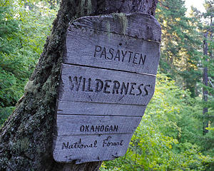 Entering Pasayten 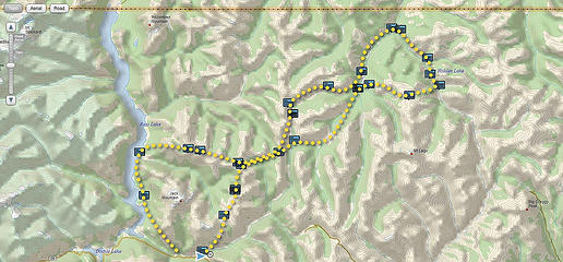 Taken from the DeLorme map, this shows positions reports I sent on our 8 day trip, starting at Canyon Creek Trail head 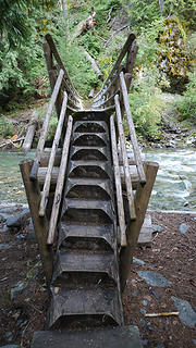 D1.1 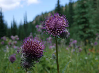 Thistle 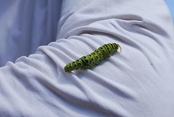 Green friend 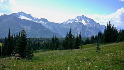 Crater and Jack Mountain 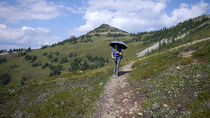 The Protector 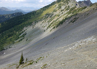 Hard for Stock and Outward Bound 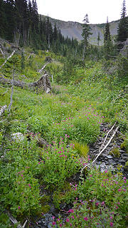 Elixer of Life 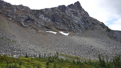 along Jakita Ridge 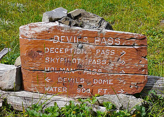 Devils Pass 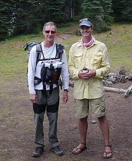 with Porcupine Phobia 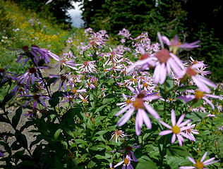 trail flowers 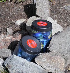 left behind 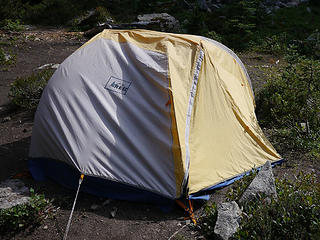 Broken Arm shelter 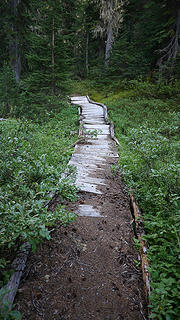 twisted path 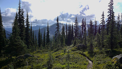 the trail east, looking west 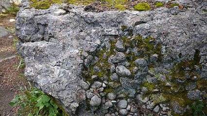 rocks within rocks 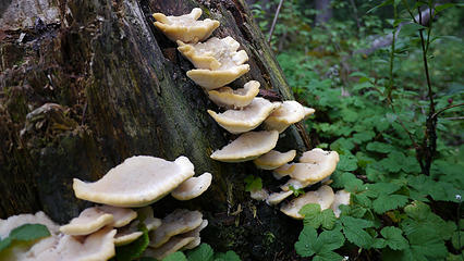 clams with no shells 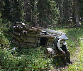 sagging house, sagging Dad 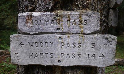 Holman Pass 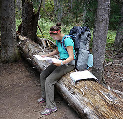 switching maps 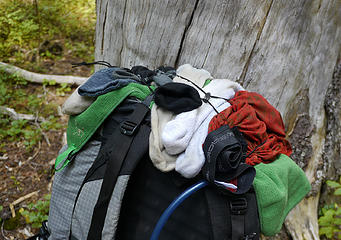 drying rack 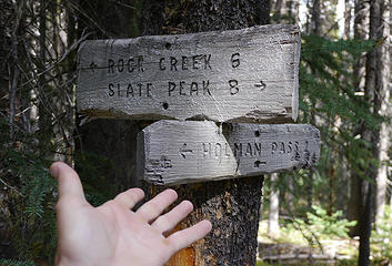 How can you miss this? 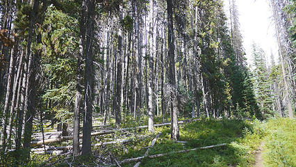 a stressed forest 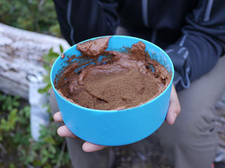 Chocolate Moose 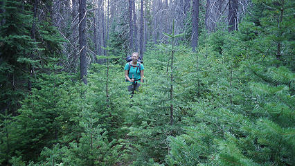 rejuvenation 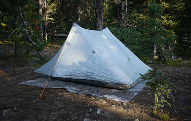 Duplex at Rock Creek 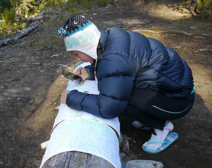 figuring ahead 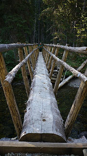 Soda Creek bridge 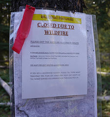 Fire closure sign 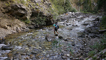 crossing Middle Fork Pasayten 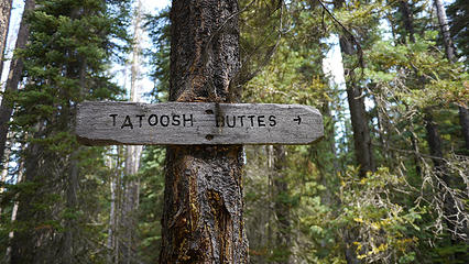 Tatoosh Buttes 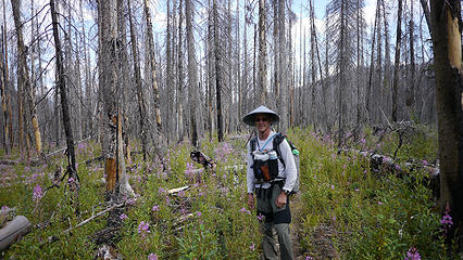 entering the fire zone 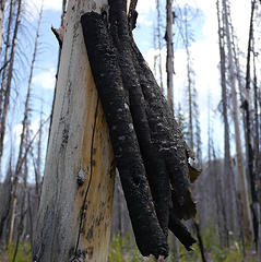 hanging by a thread 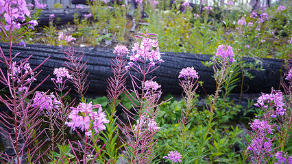 land of contrasts 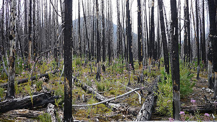 deep in the zone 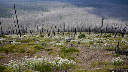 stark beauty 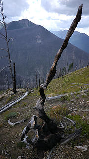 off angle 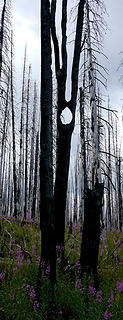 running man 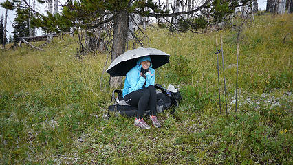 refuge from the storm 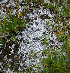 Ouch! 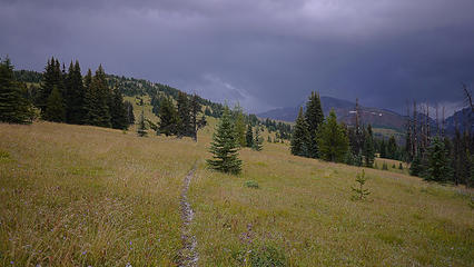 Storm clouds and Tatoosh Buttes 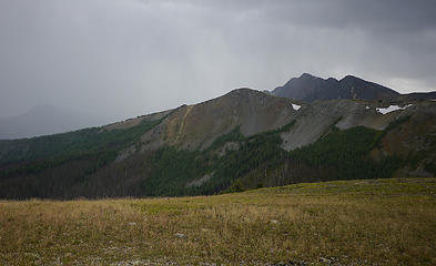 Beauts 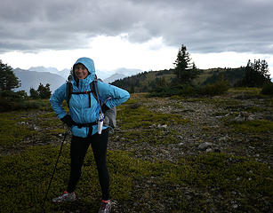 atop the Buttes 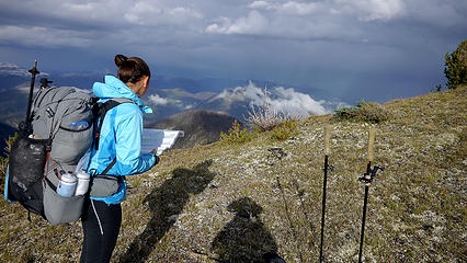 sun and storm 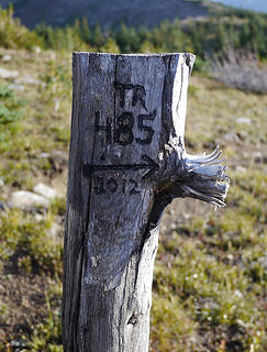 D3.20 Don't take the trail ahead, go right! 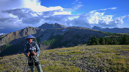 the storm passes 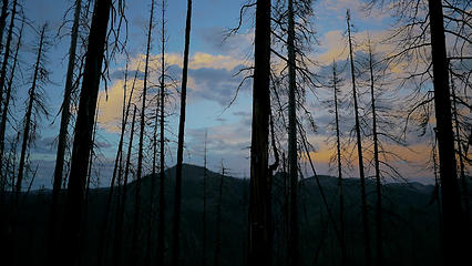 Night approaches 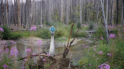 crossing East Fork Pasayten 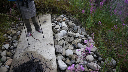 end of the road 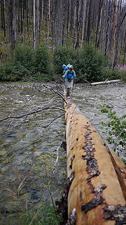 crossing Pasayten River 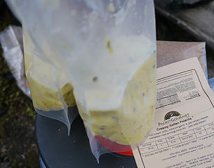 PIG Creamy Italian Polenta dinner 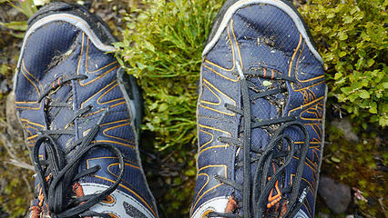 typical state of footwear 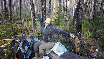 The Sun! 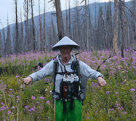 Charred trees and fireweed opinion-day3 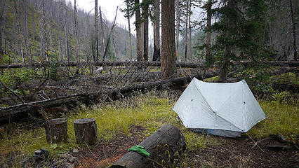 campsite found in the dark 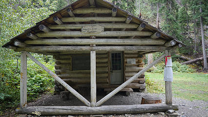 horse camp at Middle Hidden Lake 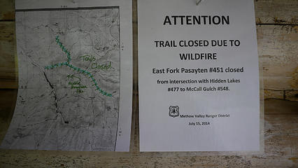 as far east as we go 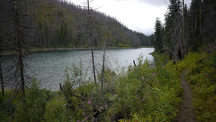 Middle Hidden emerges 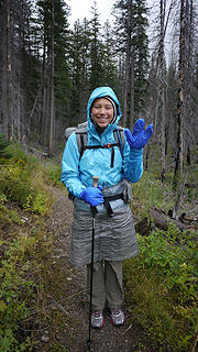 Live long and prosper! 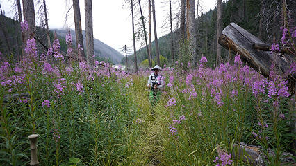 soaking head high flora 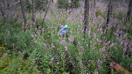 schwacking around blowdown 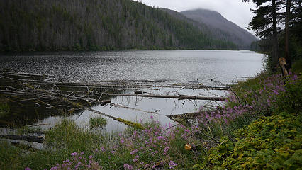 Big Hidden Lake 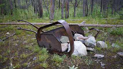 rock mover near Canadian border 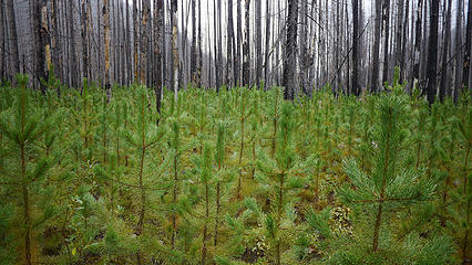 the young forest grows 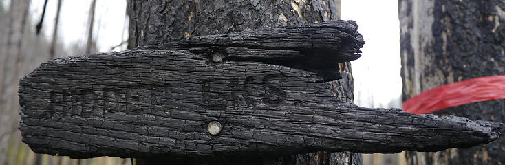 'nuff said 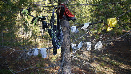 if we could only dry some clothes! 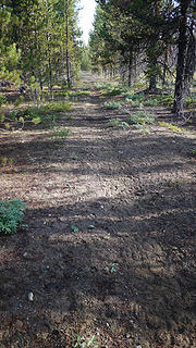 trail leading to Pasayten airstrip 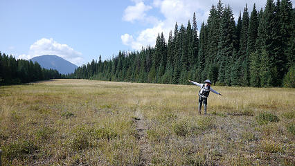 Willis Wall takes off from Pasayten airstrip 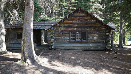 Pasayten Guard Station 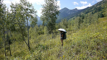 trail of spiky balls 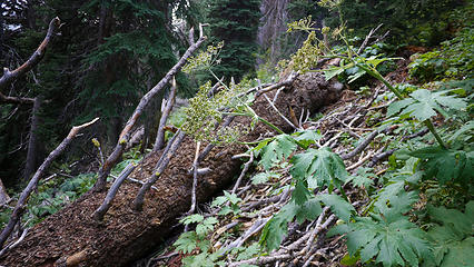 one of hundreds 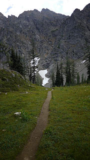 PCT Autobahn 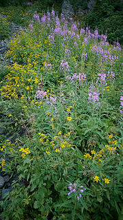 flowers on the PCT 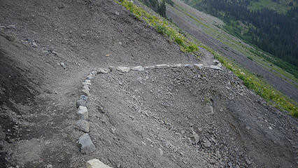 PCT- manicured to a T 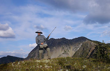 Willis Wall rocks at Rock Pass 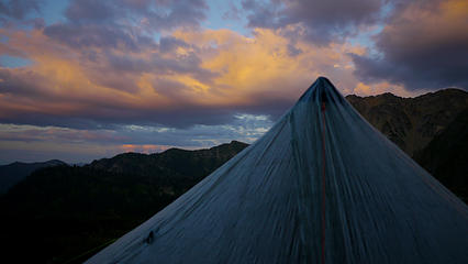 camp site at 6500 feet 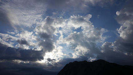 Daybreak at Rock Pass 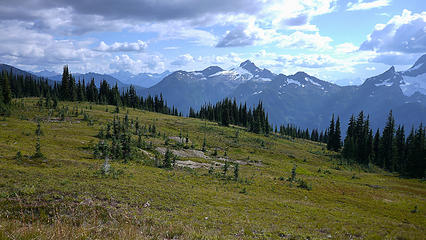 approaching Devils Pass 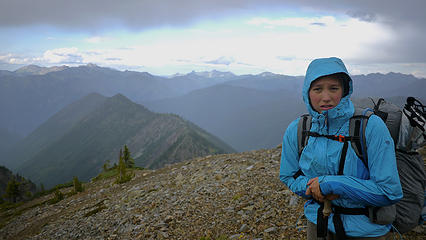 Devils Dome-cold and hungry 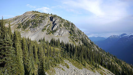 Sunshine after Devils Dome 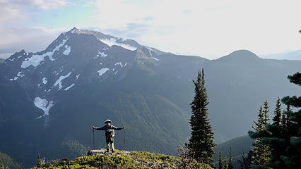 tomorrow we drop! 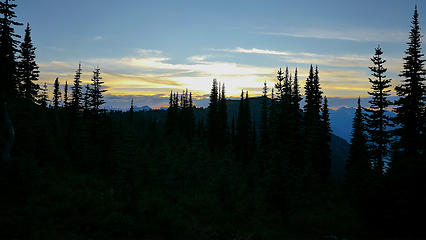 sunset at Dry Creek Pass 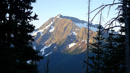 Jack Mountain in the morning 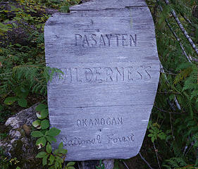 leaving the Pasayten Wilderness 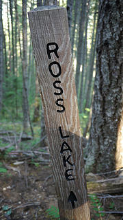 getting closer 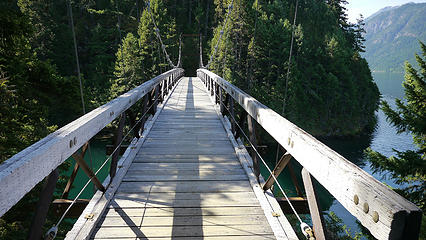 bridge over Devils Creek 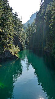 Devils Creek 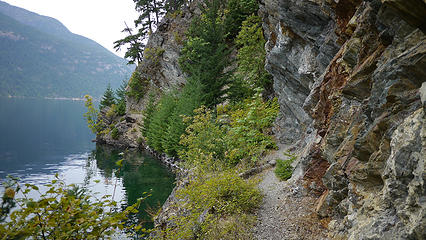 East Bank Trail 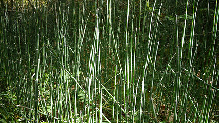 bamboo wannabe 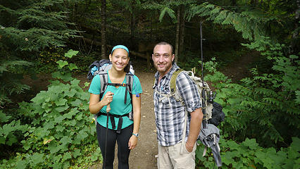 benefactor Paul from DC 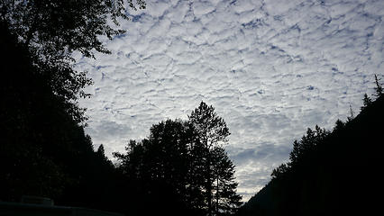 as we leave the parking lot 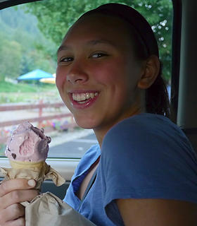 Ice Cream!
|
| Back to top |
  
|
|
Magellan
Brutally Handsome

Joined: 26 Jul 2006
Posts: 13116 | TRs | Pics
Location: Inexorable descent |
|
Magellan
Brutally Handsome
|
 Tue Aug 26, 2014 9:45 pm |
|
|
Great story, and a lot of great beta for hikers and climbers heading that way.  Cassie is a rock star! Cassie is a rock star!
|
| Back to top |
|
|
KarlK
Member

Joined: 18 Jun 2009
Posts: 584 | TRs | Pics
|
|
KarlK
Member
|
Tue Aug 26, 2014 9:48 pm |
|
|
Outstanding trip report and my hat's off to the both of you!
Yes, the Pasayten ain't for the weak. That's what TV and McDonalds are for.
|
| Back to top |
|
|
Nietzsche's Horse
Equine Philosopher

Joined: 16 Aug 2010
Posts: 92 | TRs | Pics
Location: Seattle |
An exceptional report from an exceptional trip, Willis Wall. This, in particular, was just lovely:
| williswall wrote: | | After the routine of setting up camp and hunkering down, my daughter was still feeling chilled so I draped some of my quilt over her sleeping bag and put my arm around her until she fell asleep. No matter how much we advance in age, she is still my baby. |
You are lucky and she is lucky. I hope you can both look back upon this trip with great fondness in the years to come, even as you continue to make new memories together.
"Trails are like that: you're floating along in a Shakespearean Arden paradise and expect to see nymphs and fluteboys, then suddenly you're struggling in a hot broiling sun of hell in dust and nettles and poison oak... just like life." - Kerouac
"Trails are like that: you're floating along in a Shakespearean Arden paradise and expect to see nymphs and fluteboys, then suddenly you're struggling in a hot broiling sun of hell in dust and nettles and poison oak... just like life." - Kerouac
|
| Back to top |
|
|
Ski
><((((°>

Joined: 28 May 2005
Posts: 12830 | TRs | Pics
Location: tacoma |
|
Ski
><((((°>
|
Tue Aug 26, 2014 11:29 pm |
|
|
so.. if a trail sign burns in the forest and nobody is around....
very nice. were you making "vroom! vroom!" sounds when she took that shot of you at the airstrip? 
"I shall wear white flannel trousers, and walk upon the beach.
I have heard the mermaids singing, each to each."
"I shall wear white flannel trousers, and walk upon the beach.
I have heard the mermaids singing, each to each."
|
| Back to top |
|
|
PorcupinePhobia
Murse
Joined: 04 Mar 2012
Posts: 1002 | TRs | Pics
Location: Hwy20 |
It was great to meet you guys Glad to hear her hips and your shoulders held up! You put that mariposa to the test!
When are you doing the Wonderland in Sept? I'm planning on somewhere between the 9th and 17th.
|
| Back to top |
|
|
tmatlack
Member
Joined: 21 Aug 2007
Posts: 2854 | TRs | Pics
|
|
tmatlack
Member
|
Wed Aug 27, 2014 3:22 am |
|
|
Great photos of a wonderful trip. It's really important that we aging Baby Boomers get the next generation or younger into the woods, up in the mountains, on the rivers, and in the ocean. Those folks are the next generation of stewards and trip leaders!
Tom
|
| Back to top |
|
|
wamtngal
Member

Joined: 13 Jun 2004
Posts: 2382 | TRs | Pics
Location: somewhere |
|
wamtngal
Member
|
Wed Aug 27, 2014 8:33 am |
|
|
Great report. I did a 10 day loop trip in that general area a few years ago, but we started at Slate Pass. Wrapped up another Wonderland tour last week and I can safely say that the Pasayten ain't no Wonderland. But in all it's ruggedness, solitude and lesser traveled trails, I love it as much and even more.
Opinions expressed here are my own.
Opinions expressed here are my own.
|
| Back to top |
|
|
suziq999
Member
Joined: 25 Sep 2013
Posts: 164 | TRs | Pics
Location: United States |
|
suziq999
Member
|
Wed Aug 27, 2014 8:53 am |
|
|
What a wonderful daddy-daughter trip! She will remember these for a lifetime. 
|
| Back to top |
|
|
iron
Member

Joined: 10 Aug 2008
Posts: 6392 | TRs | Pics
Location: southeast kootenays |
|
iron
Member
|
Wed Aug 27, 2014 10:46 am |
|
|
really nice, WW. i hope your daughter is still talking to you after this one... though she seems pretty tough and resilient.
what's up with her hip injury?
|
| Back to top |
|
|
mbtigger
Sherpa Da
Joined: 14 Apr 2011
Posts: 697 | TRs | Pics
Location: Sucking the dry air |
|
mbtigger
Sherpa Da
|
Wed Aug 27, 2014 11:42 am |
|
|
Sounds like a tough one! Glad you both held up and got out OK. I have yet to hike in the Passayten, Maybe I will stick with Horseshoe basin when I do....
|
| Back to top |
|
|
williswall
poser
Joined: 30 Sep 2007
Posts: 1967 | TRs | Pics
Location: Redmond |
| iron wrote: | | really nice, WW. i hope your daughter is still talking to you after this one... though she seems pretty tough and resilient.
what's up with her hip injury? |
She's tougher than I am. She has had problems with the stabilizing muscles in her hip and has been doing PT. It prevented her from running or hiking earlier this summer so no training. Occasional aching and a few temporary sharp pains on the trip but nothing serious. Hopefully identifying the problem will help her train next year so we can plan a trip without undue physical limitations.
|
| Back to top |
|
|
Conrad
Meadow bagger

Joined: 25 Aug 2006
Posts: 2298 | TRs | Pics
Location: Moscow, ID |
|
Conrad
Meadow bagger
|
Wed Aug 27, 2014 12:00 pm |
|
|
| mbtigger wrote: | | Maybe I will stick with Horseshoe basin when I do.... |
The eastern couple-dozen miles (at least, that's as far as I went) of the Boundary Trail (to Cathedral Pass) are broad, smooth, gentle, easy.
|
| Back to top |
|
|
Jim Dockery
Member

Joined: 12 Sep 2007
Posts: 3092 | TRs | Pics
Location: Lake Stevens |
Great trip and write up, nice to read these ongoing parent/child trips.
|
| Back to top |
|
|
raising3hikers
Member
Joined: 21 Sep 2007
Posts: 2344 | TRs | Pics
Location: Edmonds, Wa |
very cool that your daughter joined you on that trip! thanks for sharing
|
| Back to top |
|
|
|
|
You cannot post new topics in this forum
You cannot reply to topics in this forum
You cannot edit your posts in this forum
You cannot delete your posts in this forum
You cannot vote in polls in this forum
|
Disclosure: As an Amazon Associate NWHikers.net earns from qualifying purchases when you use our link(s). |


