| Previous :: Next Topic |
| Author |
Message |
meck
Member


Joined: 31 Dec 2010
Posts: 920 | TRs | Pics
|
|
meck
Member
|
 Tue Dec 09, 2014 10:10 pm |
|
|
Happy Lake Ridge Loop via Olympic Hot Springs Road/TH
7 December 2014, Solo
Elevation Gain: ~1800' to highpoint of ~5650' = 3850' (lots of small up-down on the ridge)
Round trip distance: ~16.2 miles (all on trail)
Continuing progress on trail-bagging the entire ONP/ONF, I left the Boulder Creek TH around 0945 in the morning and headed east back down the road to the currently unmarked Happy Lake Ridge TH (~a little over a mile back).
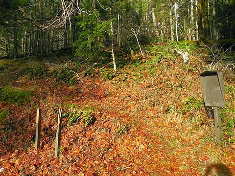 Happy Lake Ridge TH 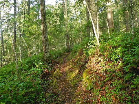 brush work 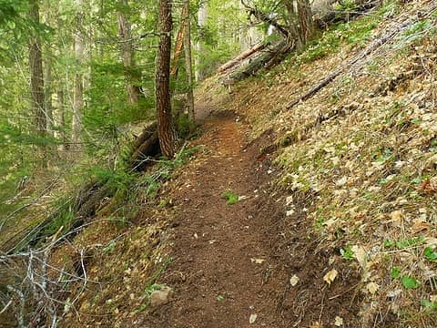 tread work 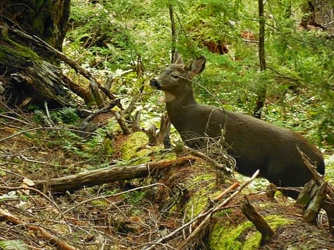 healthy looking hoofed quadruped 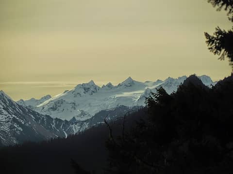 first glimpse of Olympus 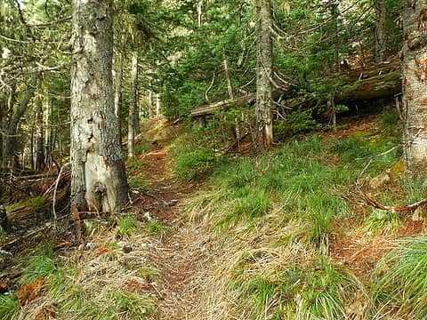 nearing the ridge line, a wonderful pine smell in the air 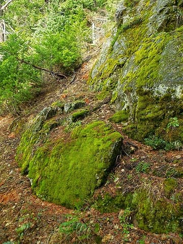 bright green moss 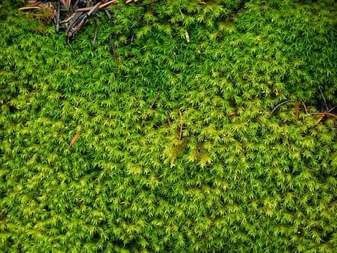 intricate pattern close-up 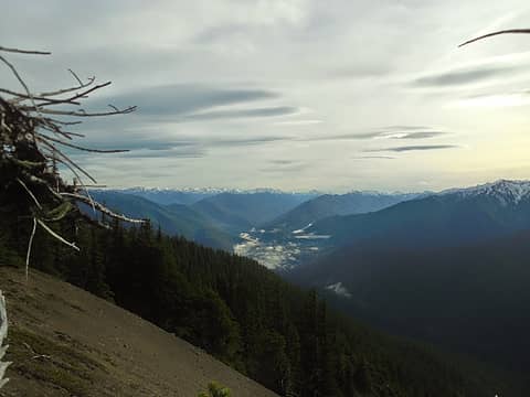 view to the southeast 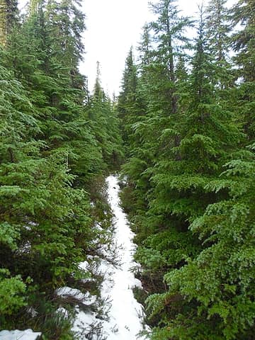 some light snow along the encroached path 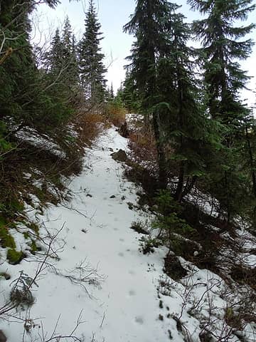 more snowy travel 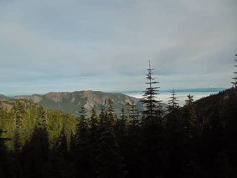 Mt Baldy Ridge to the north (not to be confused with "Baldy" next to Tyler peak in NE Olys) 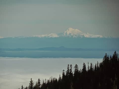 Mt. ? across the sound to the north east 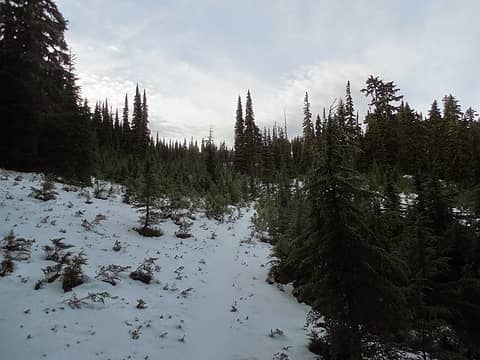 final snowy meadow before the Happy Lake junction 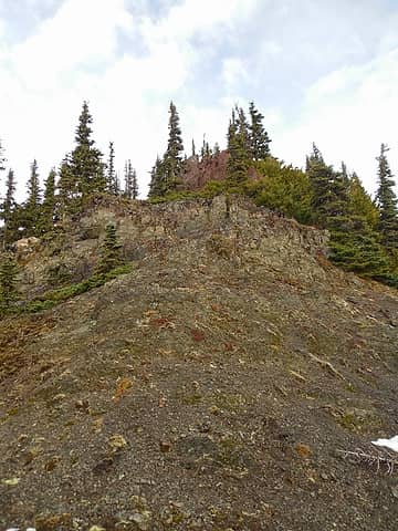 up this rocky point (actually went to the right around the east side to avoid the crappy rock near the top) 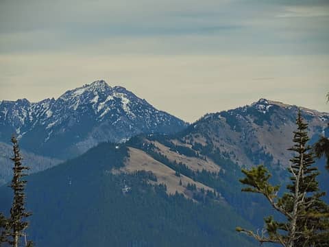 Mt Angeles and Hurricane Hill to the east 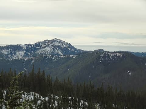 1 label Boulder Peak with a sugar coat 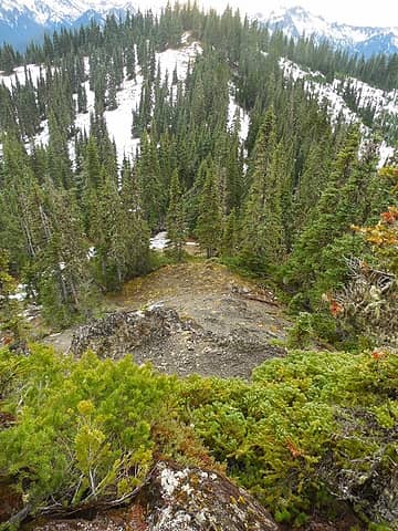 looking south down from the point 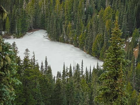 Happy Lake, frozen below 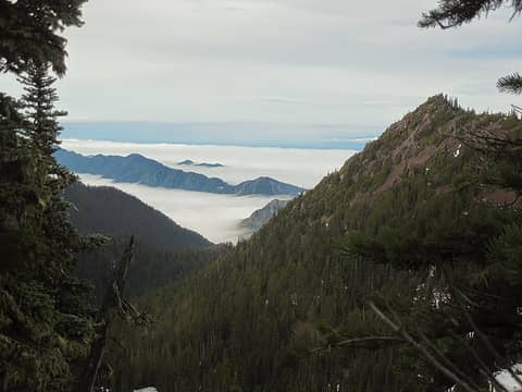 view northwest, Aurora ridge on the left towards the Straight 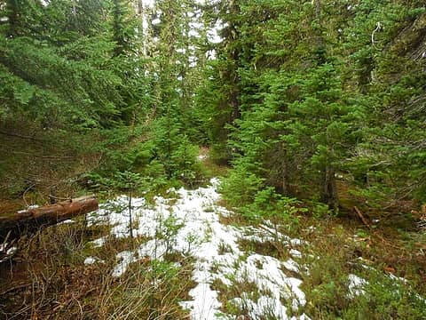 brushy portion of trail 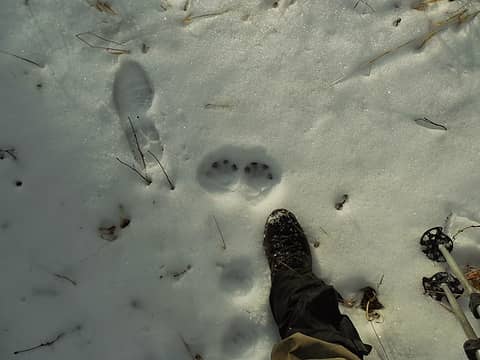 jumping/pouncing tracks? 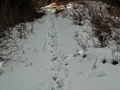 busy trail! 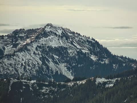 zoom in on Boulder Peak 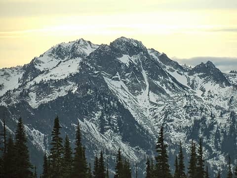 Pt 6100 and Mt Appleton 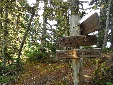 three way trail junction 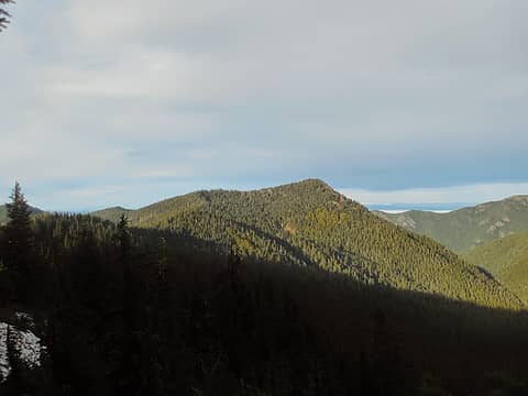 1 label Lizard Head Peak, visited in Nov 2013 (even ran into Ms Pullen that day...) 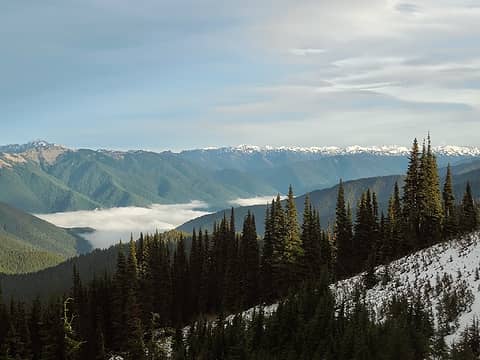 Looking east again, the clouds looked brooding 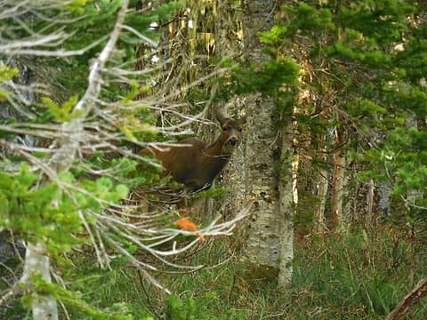 more deer! 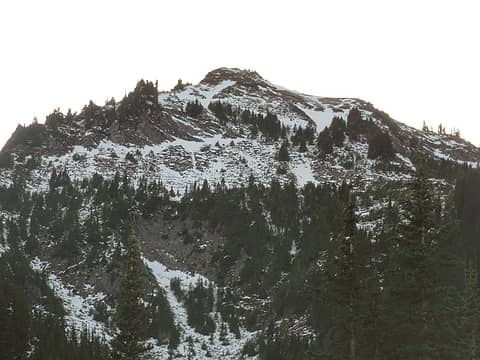 Boulder Peak from the lake 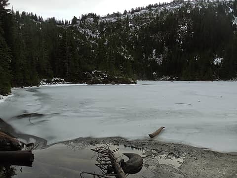 Boulder Lake looking wintry
*Just say NO to Rent-Seeking, don't give up the concept of "ownership"*
*Just say NO to Rent-Seeking, don't give up the concept of "ownership"*
|
| Back to top |
  
|
|
meck
Member
Joined: 31 Dec 2010
Posts: 920 | TRs | Pics
|
|
meck
Member
|
Wed Dec 10, 2014 11:05 am |
|
|
@ Hesman: Trail-miles, I'd estimate that I'm between a third and one-half completed. On the east/north side of the Olys I've still got to travel over: upper portion of the Duckabush (west of 10 mile camp), Lacrosse Pass, and the sections up to First Divide and ONeil pass/Marmot Lake (been to both from the south sides); Gray Wolf River/Pass; Lost Pass Way trail; Little River and Wolf Creek trails up to Hurricane Ridge; Heart O'the Hills; Lillian River tr; Dodger Pt way trail (maybe never on this one...); Appleton Pass via Oly Hot Springs; North Fork Sol Duc trail; about 2/3 of Aurora Ridge that I have not yet visited piecemeal; Spruce Railroad tr (saving this for a wintry day); Mink Lk/Deer Lk loop; plus maybe 5-6 of the really short ONP/ONF trails.
On the west and south sides I still have a lot to visit: Bogachiel, N&S forks of the Hoh, Calawah and Queets trails; N fork Quinault and Skyline Ridge; mid and northern coast trails; Wynoochee/Sundown/Six Ridge passes; S fork Skokomish; and the Colonel Bob & Wonder Mtn Wildernesses; and of course Mt. Olympus itself.
I figure that'll take me another good 3-6 years as I'm not a huge fan of backpacking (I prefer, sometimes ultra-long, day hiking).
*Just say NO to Rent-Seeking, don't give up the concept of "ownership"*
*Just say NO to Rent-Seeking, don't give up the concept of "ownership"*
|
| Back to top |
|
|
Jeb
Summit Driven
Joined: 21 Jul 2012
Posts: 251 | TRs | Pics
Location: Seattle |
|
Jeb
Summit Driven
|
Wed Dec 10, 2014 5:33 pm |
|
|
Nice TR and great photos!
Olympus looks especially gorgeous.
The big snowy one across the sound to the NE must be Baker.
|
| Back to top |
|
|
ranger rock
One of the boys

Joined: 14 Dec 2011
Posts: 2550 | TRs | Pics
|
Wow, all those tracks are really neat. I'm glad I made it up there this summer as the area is sure to be more visited with the road open. We had the hot springs all to ourselves.
|
| Back to top |
|
|
RodF
Member

Joined: 01 Sep 2007
Posts: 2593 | TRs | Pics
Location: Sequim WA |
|
RodF
Member
|
Fri Dec 12, 2014 3:25 pm |
|
|
Delightful report, Meck!
| meck wrote: | | The trail crew has done a fantastic job of clearing the trail up to ~4500' where the trail meets the ridge line. |
Backcountry Horsemen of Washington, Peninsula Chapter, did all this work. Two workparties to brush the trail, one to recut tread, earlier this year in anticipation of the recent reopening of Olympic Hot Springs Road to the trailheads. More to do to Aurora trail junction. It'd been 3 years since it'd last been cleared.
BCHW has maintained Happy Lake trail for years. It was built for stock, with excellent even climbing grade and no stream crossings. It makes a huge difference to have stock pack gear up there for trail maintenance!
It was amazing that the draft Wilderness Stewardship Plan alternatives B and C proposed to block stock access to this trail. That would end BCHW volunteer maintenance of it, and double the effort required to maintain it on foot. No benefit to hikers that I can imagine.
"of all the paths you take in life, make sure a few of them are dirt" - John Muir
"the wild is not the opposite of cultivated. It is the opposite of the captivated - Vandana Shiva
"of all the paths you take in life, make sure a few of them are dirt" - John Muir
"the wild is not the opposite of cultivated. It is the opposite of the captivated - Vandana Shiva
|
| Back to top |
|
|
meck
Member
Joined: 31 Dec 2010
Posts: 920 | TRs | Pics
|
|
meck
Member
|
Fri Dec 12, 2014 4:35 pm |
|
|
@ Jeb: Thank you! (and thanks for naming the peak, I'm woefully ignorant of the mtn names on that side of the water).
@ RangerRock: Yeah, you visited it at the right time. Both times I've visited since the reopening, the parking lot has had no less than 12 cars there. I'd had no idea that hot, smelly water was such an attraction  ... (of course I never really cared for hot-tubs either...)
@ RodF: please pass my thanks to the BCHW! The section they'd worked was in great shape (especially when compared to some of the less recently maintained sections along the ridge, many section would be hard to follow in snow as they blend right in with the surrounding brush). Given the distances, I can see how having stock available for hauling equipment would make the trail maintenance an order of magnitude easier, it would be a shame to lose that as an option.
@ Hesman: I'd be game for trying out an "over-the-ridge" hike (one car at Little River, the other at Whiskey Bend or Elwha RS). I half-thought about doing the Dodger Point loop this last August (up the trail, down the way trail, cross the river then back via the Elwha trail) with low-river depths, but went for the Bailey Range Traverse instead. I read your TR of that crossing and trip with great interest. I'm gonna have to give it a go next year (maybe after having visited Ferry Basin via Dodger Point and stopping by Ludden and Scott on the way back out too). ... (of course I never really cared for hot-tubs either...)
@ RodF: please pass my thanks to the BCHW! The section they'd worked was in great shape (especially when compared to some of the less recently maintained sections along the ridge, many section would be hard to follow in snow as they blend right in with the surrounding brush). Given the distances, I can see how having stock available for hauling equipment would make the trail maintenance an order of magnitude easier, it would be a shame to lose that as an option.
@ Hesman: I'd be game for trying out an "over-the-ridge" hike (one car at Little River, the other at Whiskey Bend or Elwha RS). I half-thought about doing the Dodger Point loop this last August (up the trail, down the way trail, cross the river then back via the Elwha trail) with low-river depths, but went for the Bailey Range Traverse instead. I read your TR of that crossing and trip with great interest. I'm gonna have to give it a go next year (maybe after having visited Ferry Basin via Dodger Point and stopping by Ludden and Scott on the way back out too).
*Just say NO to Rent-Seeking, don't give up the concept of "ownership"*
*Just say NO to Rent-Seeking, don't give up the concept of "ownership"*
|
| Back to top |
|
|
|
|
You cannot post new topics in this forum
You cannot reply to topics in this forum
You cannot edit your posts in this forum
You cannot delete your posts in this forum
You cannot vote in polls in this forum
|
Disclosure: As an Amazon Associate NWHikers.net earns from qualifying purchases when you use our link(s). |


