| Previous :: Next Topic |
| Author |
Message |
mbravenboer
Member


Joined: 20 Oct 2013
Posts: 1422 | TRs | Pics
Location: Seattle |
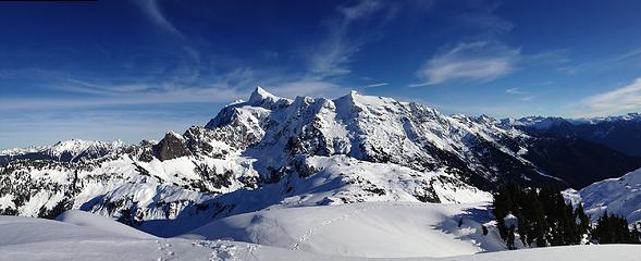 Mount Shuksan from summit of Mt. Ann 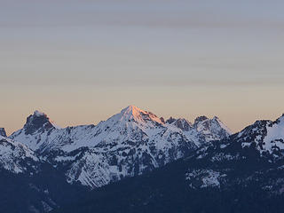 First morning sun on Mt. Larrabee while ascending to the Austin Pass 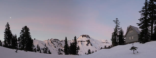 Table Mountain and Cabins 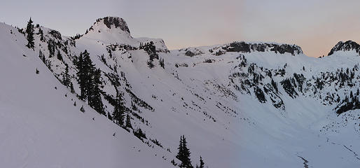 Early morning view of Table Mountain 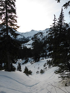 View when starting to descend into the Swift Creek valley from Austin Pass, with Annette in the middle, and Mount Ann (the objective) barely visible on the right 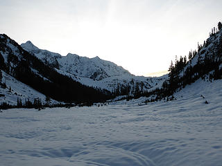 Swift Creek valley with view on Mt. Shuksan, with in the foreground the ridge of Pt. 5112, Annette, and Mount Ann (not visible). The lowest point on that ridge is the trail to Lake Ann. 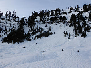 Previous avalanches coming down from Huntoon Point 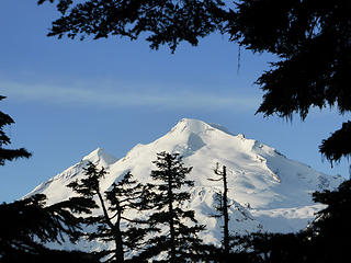 First view on Mt. Baker while traversing through the forest at about 4100ft 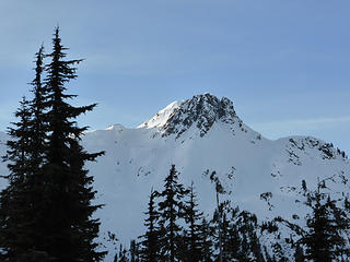 Mount Ann - The rocky peak in front is not actually the highest point. The snow dome in the back is. 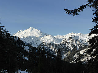 Mt. Baker and the Ptarmigan Ridge 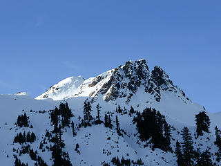 Closer view of Mount Ann during the ascend 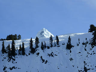 Mt. Shuksan peaking over the ridge 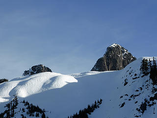 Shuksan Arm peaks becoming visible 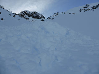 Avalanches below Annette (Pt 5681) 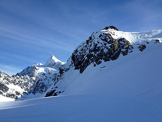 Mt. Shuksan and Annette from ~5300ft 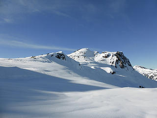 Broad ridge between Annette and Mount Ann 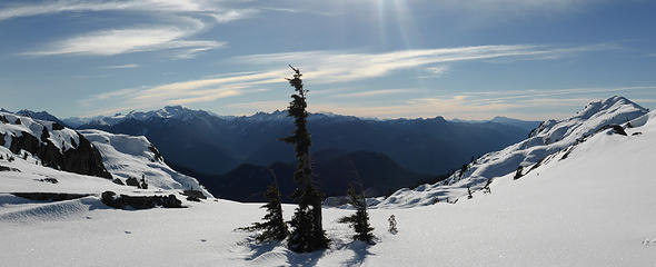 View on the North Cascades from the ridge 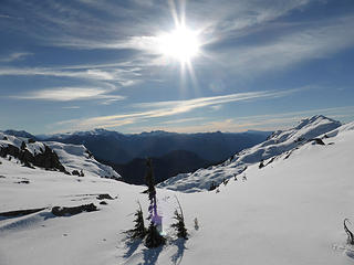 View on the North Cascades from the ridge 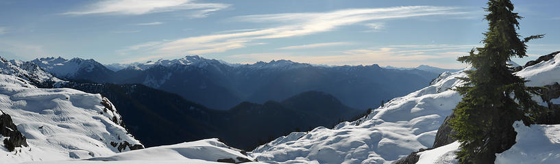 View on the North Cascades from the ridge 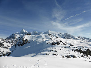 Panorama of Mt. Shuksan and Annette in the foreground  Wide panorama of Mt. Shuksan and Baker Lake from summit of Mount Ann Mount Shuksan from summit of Mt. Ann 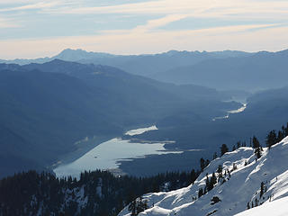 Baker Lake 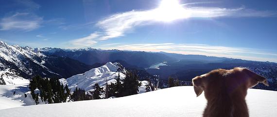 Liesl enjoys the view as well 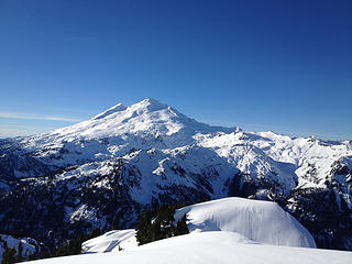 Mt. Baker 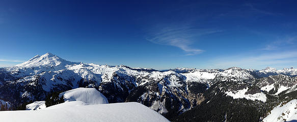 Mt. Baker, Ptarmigan ridge, Artist Point, and the border peaks 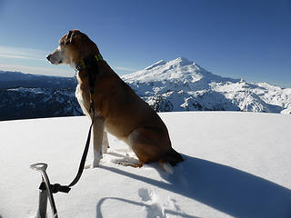 Liesl admiring the view at the summit of Mt. Ann with Mt. Baker in the background 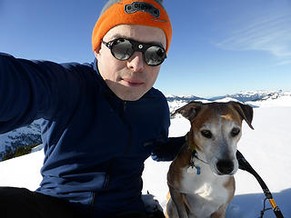 Martin and Liesl at Mt. Ann 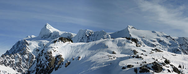 Panorama of Mt. Shuksan and Annette in the foreground 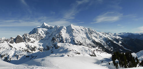 Panorama of Mt. Shuksan and Annette in the foreground 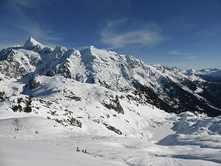 Unnamed lake on the east slope of Mount Ann 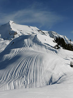 Human (left) and unknown animal tracks (right) on the ridge 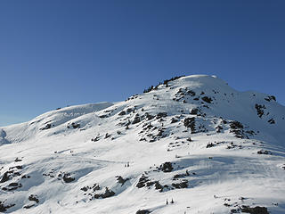 Looking back at Mount Ann. Up we pretty much went straight up. Back we descended more gradually to the left. 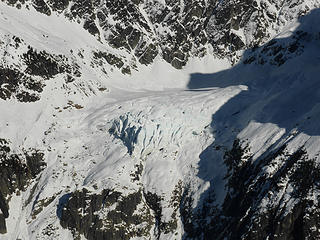 Lower Curtis Glacier 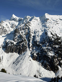 Impressive runout from avalanches  Mt. Baker, Ptarmigan ridge, Artist Point, and the border peaks 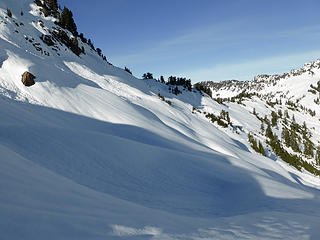 The eastern slope of Pt. 5681 (Annette). We traversed this slope at about 5100ft 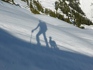 Hiker and dog 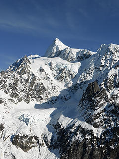 Lower and Upper Curtis Glacier 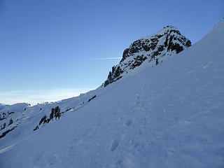 Looking back at Annette from the slope above Lake Ann 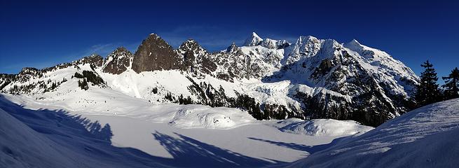 Panorama of Lake Ann with Mt. Shuksan 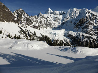 Lake Ann, Lower Curtis Glacier, and Upper Curtis Glacier 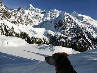 Liesl again enjoying the view 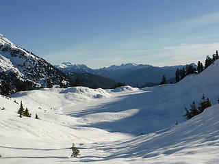 Lake Ann and North Cascades in the background 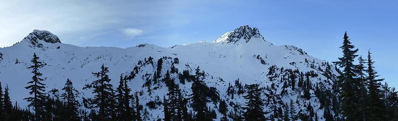 Annette and Mount Ann - Earlier today this is the ridge we traversed 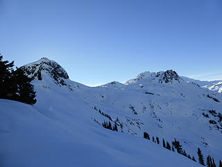 Annette and Mount Ann 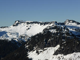 Table Mountain, Artist Point, and Huntoon Point 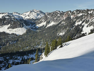 View on Swift creek valley and the Austin Pass while descending from the pass, returning from Lake Ann 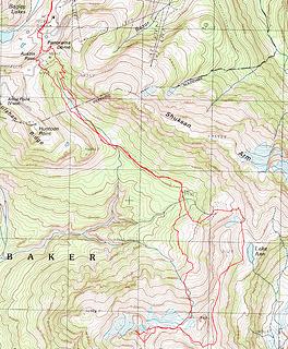 GPS Track of Mount Ann / Lake Ann loop
|
| Back to top |
  
|
|
Roly Poly
Member
Joined: 02 Jan 2013
Posts: 713 | TRs | Pics
|
|
| Back to top |
|
|
Chico
Member

Joined: 30 Nov 2012
Posts: 2500 | TRs | Pics
Location: Lacey |
|
Chico
Member
|
 Thu Jan 15, 2015 4:21 pm |
|
|
| mbravenboer wrote: | Martin and Liesl at Mt. Ann |
Nice photos.
This one makes me wonder, are dogs susceptible to snow-blindness?
|
| Back to top |
|
|
mbravenboer
Member
Joined: 20 Oct 2013
Posts: 1422 | TRs | Pics
Location: Seattle |
| Chico wrote: | | This one makes me wonder, are dogs susceptible to snow-blindness? |
Yeah, apparently they are, but at least my dog will certainly not allow me to protect her  .
My criteria is mostly to observe that she has fun and does not seem bothered, but I don't know if that actually works. .
My criteria is mostly to observe that she has fun and does not seem bothered, but I don't know if that actually works.
|
| Back to top |
|
|
Sadie's Driver
Sadie's Driver

Joined: 24 Apr 2006
Posts: 1763 | TRs | Pics
Location: Welcome Pass |
Four-paw buddy lets me tag along!
|
| Back to top |
|
|
silence
Member

Joined: 25 Apr 2005
Posts: 4420 | TRs | Pics
|
|
silence
Member
|
Sat Jan 17, 2015 9:57 am |
|
|
Stunning pix .... awesome hike ... thx for posting!
PHOTOS
FILMS
Keep a good head and always carry a light bulb. Bob Dylan
PHOTOS
FILMS
Keep a good head and always carry a light bulb. Bob Dylan
|
| Back to top |
|
|
mbravenboer
Member
Joined: 20 Oct 2013
Posts: 1422 | TRs | Pics
Location: Seattle |
| Sadie's Driver wrote: | | Love it! Looks like you two had a wonderful day to be up there. That was a favorite trip of Gus'. |
Yeah, it was definitely a wonderful day. Liesl particularly likes going out in the snow when she can run around on the snow pack, rather than just in my tracks. That was certainly not an issue this week  . Hope the memories are good for you!
silence, thanks, glad you liked the report. . Hope the memories are good for you!
silence, thanks, glad you liked the report.
|
| Back to top |
|
|
Gimpilator
infinity/21M

Joined: 12 Oct 2006
Posts: 1684 | TRs | Pics
Location: Edmonds, WA |
Nice trip. That's one of the most fun and scenic WA winter trips I've ever done.
|
| Back to top |
|
|
yukon222
Member

Joined: 12 Mar 2007
Posts: 1893 | TRs | Pics
|
|
yukon222
Member
|
Thu Jan 22, 2015 5:25 pm |
|
|
Really nice pics - captured some amazing scenery. Love seeing your dog out there enjoying it with you!!
|
| Back to top |
|
|
|
|
You cannot post new topics in this forum
You cannot reply to topics in this forum
You cannot edit your posts in this forum
You cannot delete your posts in this forum
You cannot vote in polls in this forum
|
Disclosure: As an Amazon Associate NWHikers.net earns from qualifying purchases when you use our link(s). |


 Gorgeous
  Love it! Looks like you two had a wonderful day to be up there. That was a favorite trip of Gus'.