| Previous :: Next Topic |
| Author |
Message |
Matt
Tea, Earl Grey, Hot


Joined: 30 Jan 2007
Posts: 4307 | TRs | Pics
Location: Shoreline |
|
Matt
Tea, Earl Grey, Hot
|
 Fri Feb 27, 2015 2:03 am |
|
|
Dates: February 22-23, 2015
Destination: Lasiocarpa Ridge 6521 (541P), West Portal 6920 (420P), Coleman Pinnacle 6403 (243P) (USGS Mt. Baker)
Party: Matt, cartman
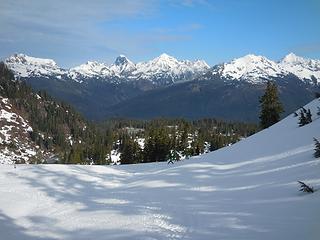
Credit cartman for proposing this trip. It was his idea to camp near Coleman Pinnacle and run side trips from there out to the high points of Lasiocarpa Ridge and The Portals. It made a beautiful opportunity to roam across miles of snowy terrain on the east side of Baker. In striking contrast to the crowds around Artist Point, we had this entire expanse of mountain all to ourselves once we went past Coleman Pinnacle. All of the travel was on firm crampon-crusty snow.
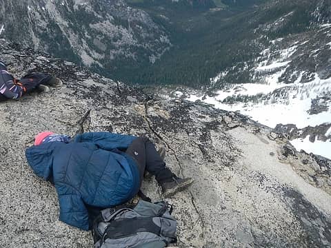
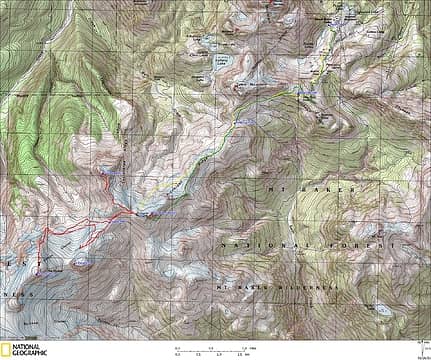 GPS Track (yellow line is approach, green line is exit, red lines are summit trips) 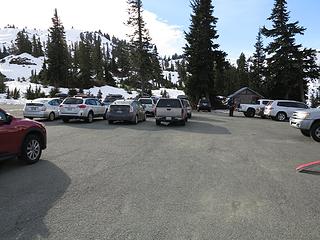 The appallingly bare parking lot at Heather Meadows 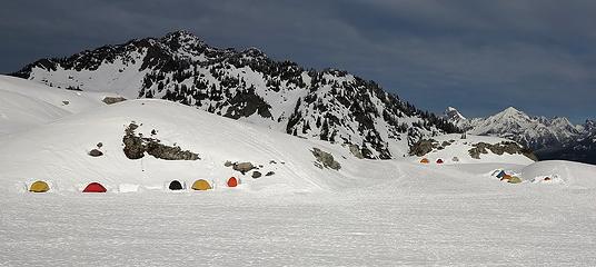 Battalion encamped below Artist Point (WAC alpine course) 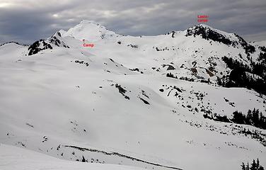 Looking up the valley to our camp and Lasiocarpa Point 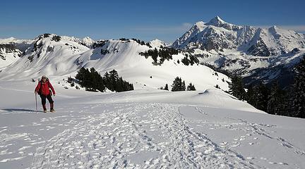 Hordes of tracks on the early part of our trip 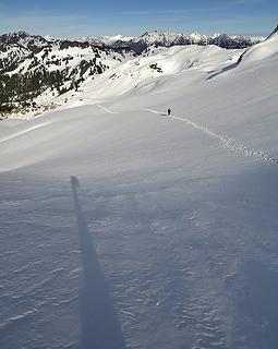 All by ourselves now 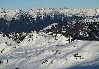 3 labels View of our track below Ptarmigan Ridge, taken later from Lasiocarpa 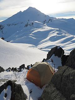 Campsite on The Balcony at Coleman Col 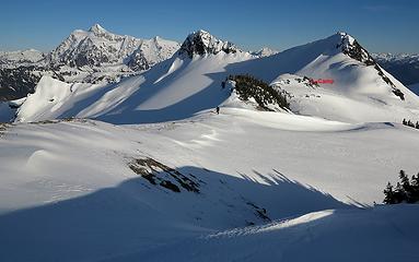 Crossing the very windblown col 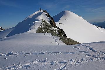 Crossing a snowy point and a rocky point 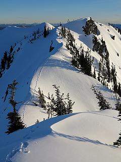 More tracks along the crest 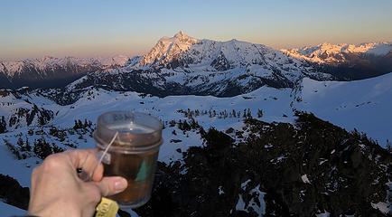 Sunset summit tea (with much of our approach route running along Ptarmigan Ridge below Shuksan) 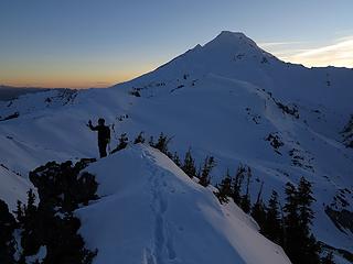 Eric on the summit at sunset 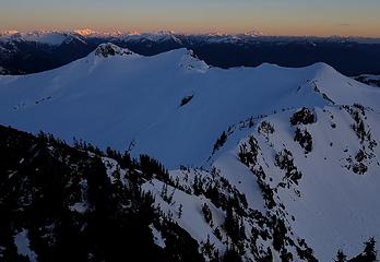 Looking back along the ridge at our route from camp in the distant col 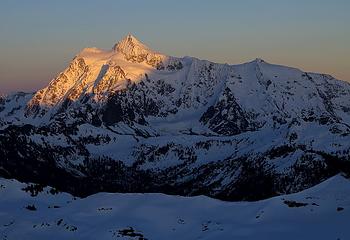 Shuksan, 5:26pm 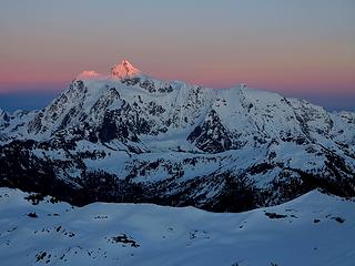 Shuksan, 5:40pm 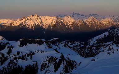 Sefrit & Nooksack Ridge sunlit, Chilliwack peaks in shadow, 5:23pm 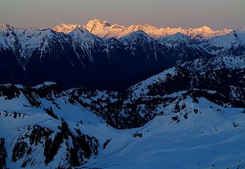 Nooksack Ridge shadowed, Redoubt & Chilliwack peaks sunlit, 5:27pm 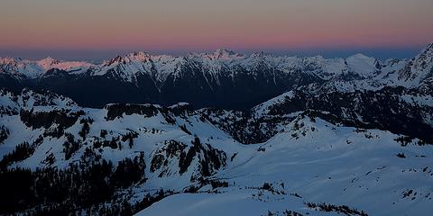 Light lifting above all of them, 5:37pm 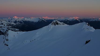 Summit light on Blum, Hagan, and Bacon (with Coleman Pinnacle unlit in the center, and our camp at far right) 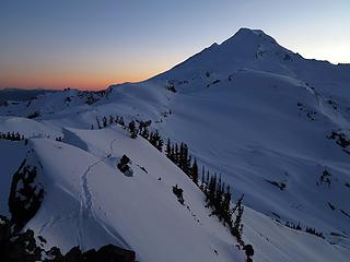 Twilight tracks on Lasiocarpa 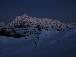 Last faint afterglow on Shuksan  Hiking home in the twilight 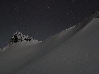 Sparkling stars and snow around Coleman Pinnacle 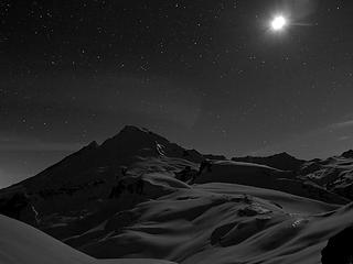 Partial moon over the snowfields of Baker 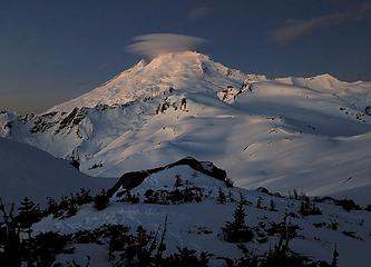 First hint of light on Baker summit, 6:30am 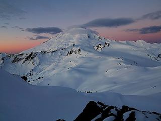 Sunrise clouds above Baker, 6:50am 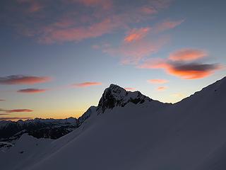 Sunrise clouds above Coleman Pinnacle 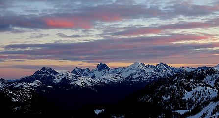 Sunrise clouds above the border peaks (Tomyhoi, Canadian Border, American Border, Larrabee, Slesse) 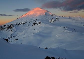 Baker, 6:59am 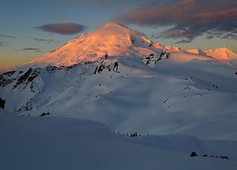 Baker, 7:03am 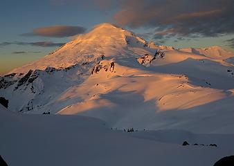 Baker, 7:06am 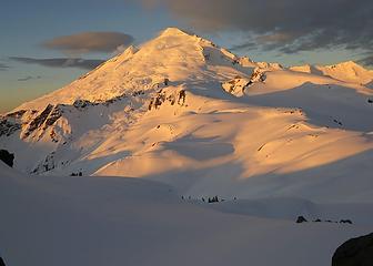 Baker, 7:10am 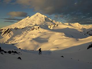 Departing camp 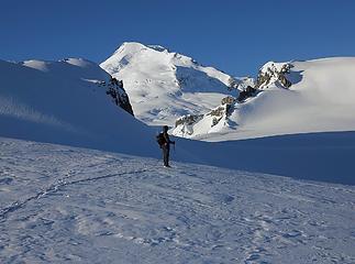 You can see why they're called The Portals 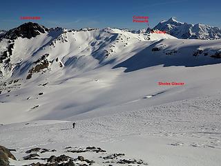 Ascending the north ridge of West Portal after crossing the foot of the Sholes Glacier 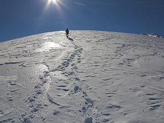 Endless retreating horizon on the slightly convex ridge crest 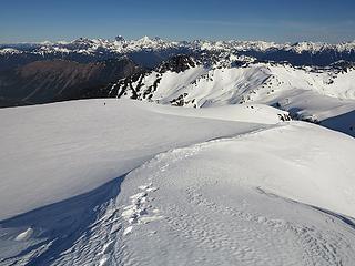 Eric crossing the wide plateau below the summit 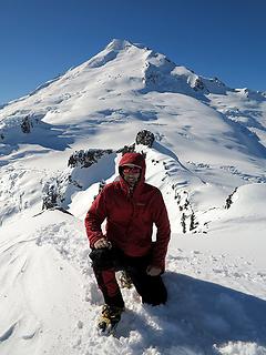 Me on West Portal summit 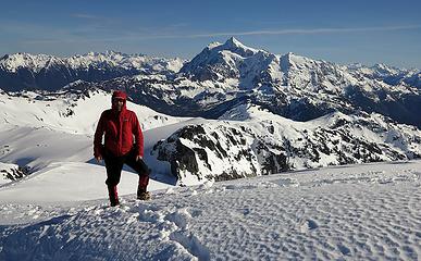 The view back from West Portal 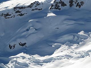 Some seracs on the Rainbow Glacier (I thought the one just above and left of center looked like a dinosaur holding a large egg, but it's actually a snow bridge) 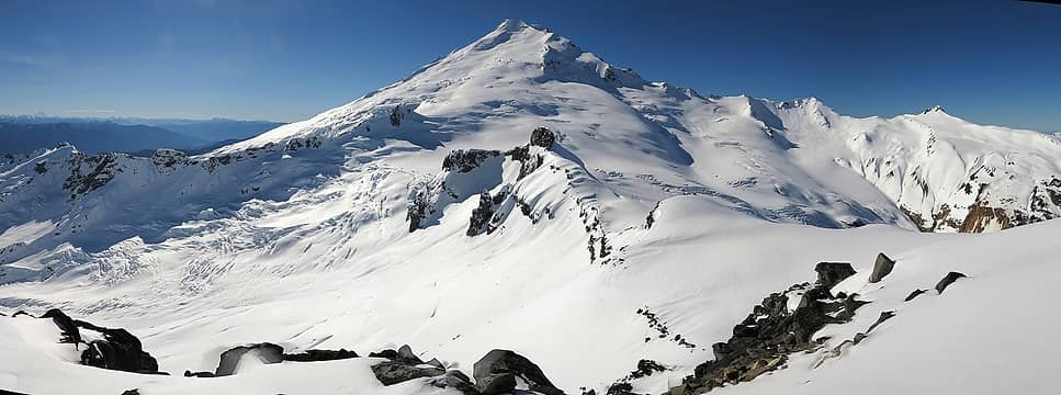 Baker (Rainbow Glacier at left, Park Glacier above, Mazama Glacier & Hadley Peak at right) 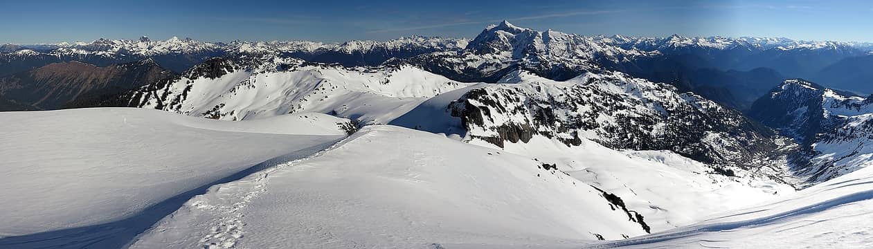 Countless peaks north and east of us (look at the totally bare slopes on Barometer at far left!) 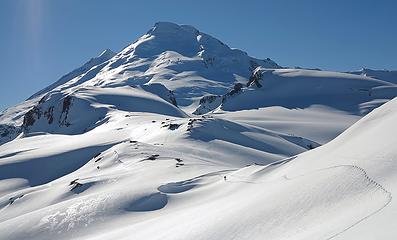 Hiking back to camp 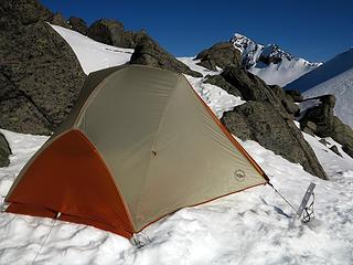 Peek-a-boo view of Coleman Pinnacle from our camp 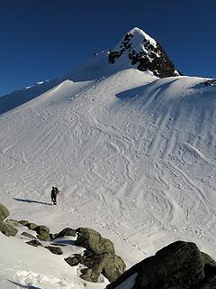 Eric departing 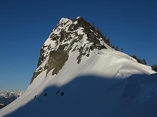 Looking up at Coleman Pinnacle from the col at its base 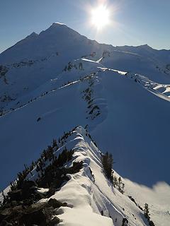 Looking back down the crest of the Pinnacle, and out to the Portals & Baker 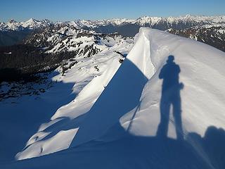 My shadow on the summit cornice 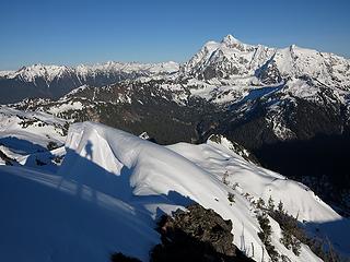 More of my shadow on the summit cornice 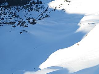 Eric crossing the snowfields 800 feet below 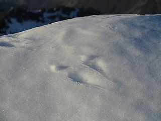 Tracks left by a little animal on the very top of the cornice 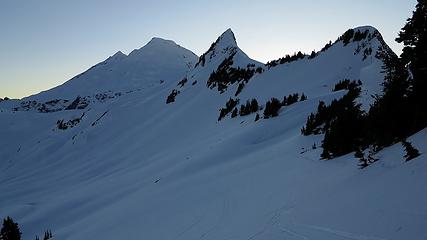 Rejoining the tracks on Ptarmigan Ridge, looking back at the traverse from Coleman Pinnacle 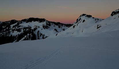 Approaching the Table-Ptarmigan Col, 5:45pm 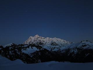 Star coming out above Shuksan 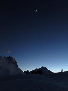 Looking back from the traverse below Table, 6:20pm 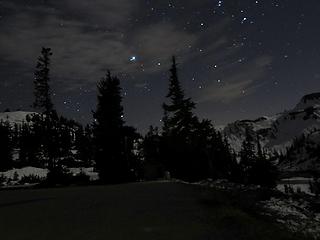 Stars above the Heather Meadows parking lot, 8:40pm
As beacons mountains burned at evening. J.R.R. Tolkien
As beacons mountains burned at evening. J.R.R. Tolkien
|
| Back to top |
  
|
|
Justus S.
Member

Joined: 17 Nov 2004
Posts: 1298 | TRs | Pics
Location: WA |
Lovely pics Matt! I've often thought about walking that ridge out to the Portals.
|
| Back to top |
|
|
RichP
Member

Joined: 13 Jul 2006
Posts: 5634 | TRs | Pics
Location: here |
|
RichP
Member
|
Fri Feb 27, 2015 6:49 am |
|
|
Beautuful! That cartman always has some good ideas.
|
| Back to top |
|
|
cartman
Member
Joined: 20 Feb 2007
Posts: 2800 | TRs | Pics
Location: Fremont |
|
cartman
Member
|
Fri Feb 27, 2015 10:44 am |
|
|
I've been wanting to get out here for years in winter or spring, but the timing was never quite right. This terrain has miles of serious avalanche potential in normal snow conditions, and by the time it would normally firm up we'd be climbing other objectives in the North Cascades.
But this most unusual winter provided ideal conditions for a winter ascent of this rarely traveled inner gateway to Baker. Credit where credit is due: I got the idea from the amazing Fay Pullen--as I have so many others--who soloed the area twice in winter several years ago.
We traveled up via the normal route past Artist Point,
 Vista 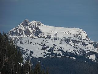 Tomyhoi 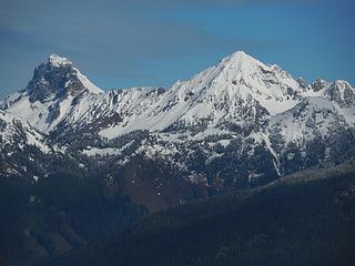 American Border, Larrabee 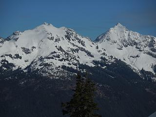 Goat Mtn 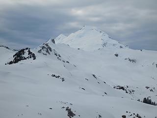 Cloudy Baker 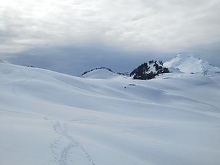 Approach 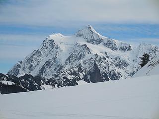 Shuksan 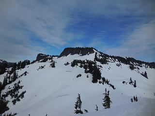 Table Mtn 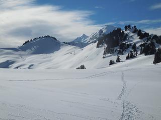 Clearing up 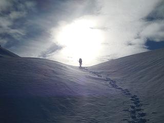 The Heavens Await 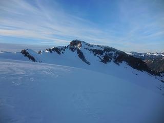 Lasiocarpa Ridge 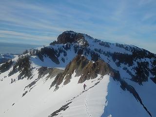 Running the ridge 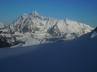 Shuksan afternoon 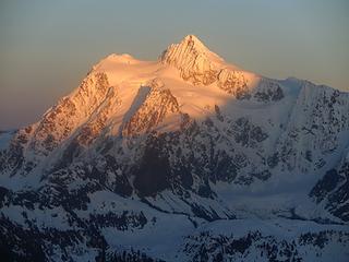 Shuksan evening 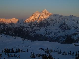 Shuksan alpenglow 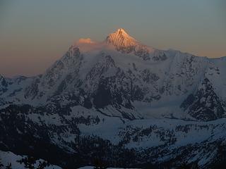 Last light on Shuksan 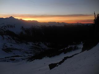 Sunset 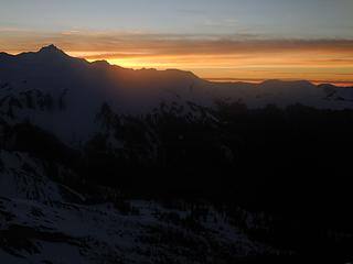 Evening glow 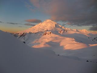 Morning light on Baker 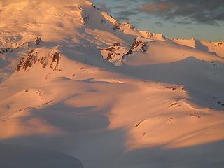 Portals 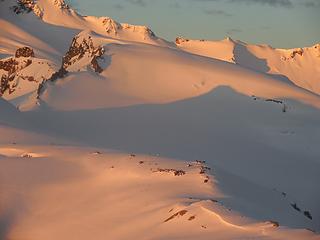 West Portal 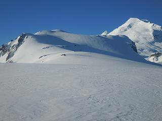 East Portal 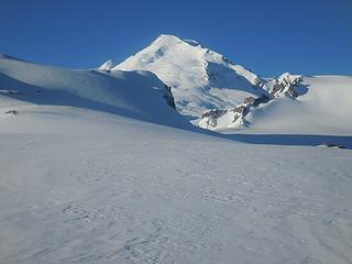 Portal to Baker 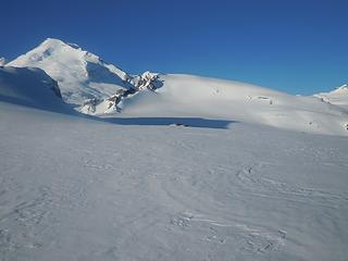 Sholes Glacier 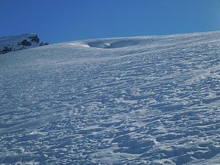 Big crevasse on the Sholes 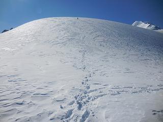 Up Portal 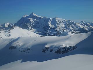 Shuksan 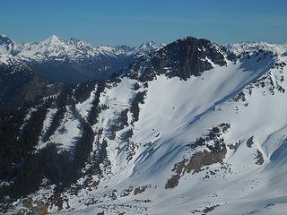 Lasiocarpa 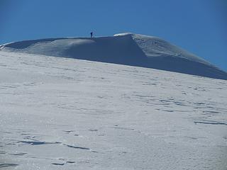 Matt approaches the top 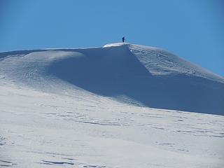 Matt at the summit 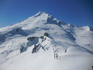 Baker 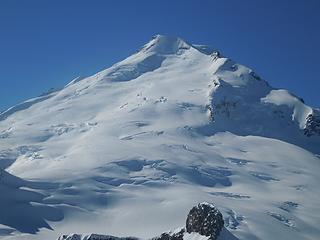 Baker closeup 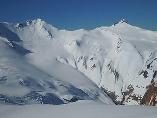 Bastile and Hadley 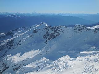 Lava Divide 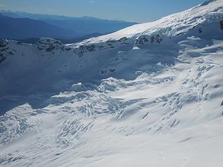 The Rainbow Glacier 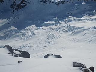 Rainbow Glacier 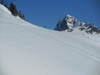 Matt approaches camp
|
| Back to top |
|
|
joker
seeker

Joined: 12 Aug 2006
Posts: 7953 | TRs | Pics
Location: state of confusion |
|
joker
seeker
|
Fri Feb 27, 2015 11:02 am |
|
|
Nice. I haven't been out that way in many years, and then only as long day tours on skis, which always made me ponder pushing camp out that way in moderate avalanche hazard conditions. But in any case, my memories are of it getting very quiet and special once getting out past Table Mountain and onto Ptarmigan ridge. Your photos rekindle great memories - thanks for that!
|
| Back to top |
|
|
olderthanIusedtobe
Member
Joined: 05 Sep 2011
Posts: 7708 | TRs | Pics
Location: Shoreline |
Great pictures. I love that area by the Portals. Shuksan is stunning, hard to beat that for a mountain profile. Looks like a great trip.
|
| Back to top |
|
|
Stefan
Member

Joined: 17 Dec 2001
Posts: 5091 | TRs | Pics
|
|
Stefan
Member
|
Fri Feb 27, 2015 12:55 pm |
|
|
|
| Back to top |
|
|
Magellan
Brutally Handsome

Joined: 26 Jul 2006
Posts: 13116 | TRs | Pics
Location: Inexorable descent |
|
Magellan
Brutally Handsome
|
Fri Feb 27, 2015 4:37 pm |
|
|
The full meal deal. Nice work fellas. 
|
| Back to top |
|
|
raising3hikers
Member
Joined: 21 Sep 2007
Posts: 2344 | TRs | Pics
Location: Edmonds, Wa |
your first light on baker picture is awesome! nice that you guys went over to lasiocarpa, i've wanted to go there for some time
|
| Back to top |
|
|
BlameTheDogz
Member

Joined: 03 Jan 2013
Posts: 293 | TRs | Pics
Location: Ballard |
Awesome! Seems like every time Matt posts a report, I add a new destination to my list- and ponder getting a new camera. Cheers!
striving to stand like mountain yet flow like water, and make the dogs happy
striving to stand like mountain yet flow like water, and make the dogs happy
|
| Back to top |
|
|
Michael Lewis
Taking a nap
Joined: 27 Apr 2009
Posts: 629 | TRs | Pics
Location: Lynnwood, WA (for now) |
|
| Back to top |
|
|
Tom_Sjolseth
Born Yesterday

Joined: 30 May 2007
Posts: 2652 | TRs | Pics
Location: Right here. |
Nice-looking trip Matt (and cartman).
|
| Back to top |
|
|
trumpetsailor
Member
Joined: 27 Mar 2007
Posts: 22 | TRs | Pics
|
Neat to see you guys out there! Such beautiful weather, and a great position. Sorry we were in such a hurry  . Susan gets all the credit for running the class; I just help out sometimes...
-- Charlie . Susan gets all the credit for running the class; I just help out sometimes...
-- Charlie
|
| Back to top |
|
|
puzzlr
Mid Fork Rocks

Joined: 13 Feb 2007
Posts: 7220 | TRs | Pics
Location: Stuck in the middle |
|
puzzlr
Mid Fork Rocks
|
Sun Mar 01, 2015 2:15 am |
|
|
Great report, made me feel like I was along. Way to take advantage of the snow conditions.
|
| Back to top |
|
|
|
|
You cannot post new topics in this forum
You cannot reply to topics in this forum
You cannot edit your posts in this forum
You cannot delete your posts in this forum
You cannot vote in polls in this forum
|
Disclosure: As an Amazon Associate NWHikers.net earns from qualifying purchases when you use our link(s). |


