| Previous :: Next Topic |
| Author |
Message |
puzzlr
Mid Fork Rocks


Joined: 13 Feb 2007
Posts: 7220 | TRs | Pics
Location: Stuck in the middle |
|
puzzlr
Mid Fork Rocks
|
 Mon Mar 16, 2015 9:32 pm |
|
|
Mile High is located at the head of the Taylor River valley above Dream Lake. It's #78 on the Home Court list but more importantly to me it's one of the many peaks that drain into the Middle Fork on at least one side (14 to go now). Gabriel organized a capable (culpable?) group including Yana, Carla and me.
My warning description to invitees was "scrambling up through slabby brush, over the top of a meaningless peak, traversing a mile of talus, then fighting rocks and krumholz to the summit of a peak no one can see or has heard about. What could be more fun :-)". That turned out to be pretty accurate. It took us 11 hours RT from the Dorothy Lake trailhead with only the first 1 1/2 miles on trail and only short breaks along the way and on the summit (we wanted to get down in daylight and we did). Much of the route required real effort to stay upright and make forward progress. There was just enough snow high up to help with the long traverse and provide a way around some of the rocky sections on the ridge.
Besides the Toto route (lots of brush), Mile High is also climbed from Dream Lake (lots of brush) and from Smith Creek (lots of brush). Not hard to find the common thread there. The benefits of the Toto route is great views at all stages of the the climb -- first of Dorothy Lake and Big Snow, then wide open panoramas of Cascade Mountain across the Smith Creek valley.
Pictures tell the rest of the story ...
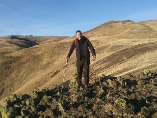
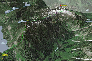 Mile High route 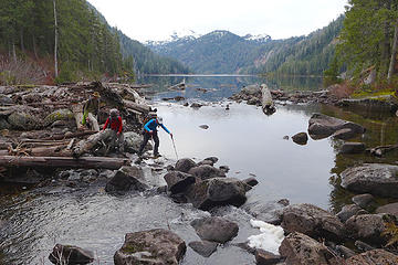 Very low flow at Lake Dorothy outlet. We could easily rock hop across with dry feet. 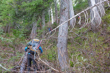 Pushing through tall but leafless brush just above the lake 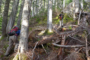 A half an hour above the lake the brush started to thin out 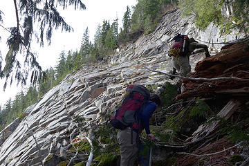 Ascending next to the huge slabs facing Lake Dorothy 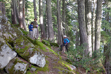 Checking our location next to the first big talus field 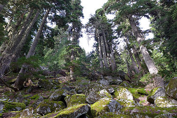 Big trees and talus 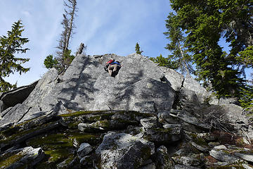 Yana tackles a rock problem 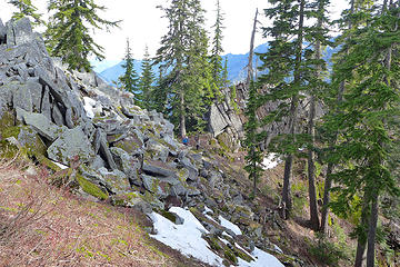 The first set of large rock outcrops on the ridge. On the way down we knew we could pass the lower set on the north. 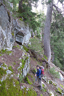 Instead of continuing up the rock crest we dropped off to the north side to catch snow fields we could see 100' below 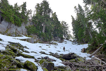 Much easier than the rocky ridge above, but still 20 minutes to the top of Toto 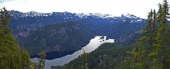 Dorothy Lake view 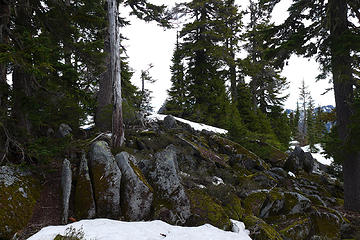 Toto summit 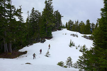 Continuing on the relatively flat ridge beyond Toto summit 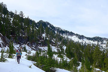 Traversing on benches west of Pugsley Pass, north of Mile High 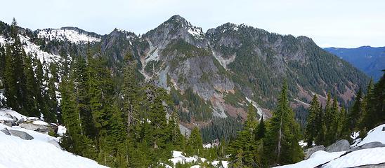 Cascade Mountain panorama 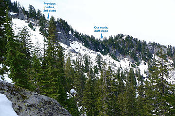 Where to gain the ridge? It doesn't matter too much as the farther, easier one only adds a few minutes. 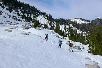 Traversing below the cliffs 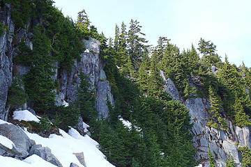 We got on the ridge going up steep duff through this treed break in the cliffs 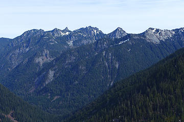 View down Smith Creek. Malachite in center, Turquoise to it's right. The spire to the left is Malachite North Peak. 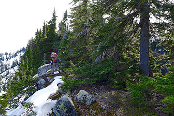 Proceeding up the NW ridge 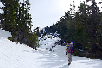 Lower ridge tarn, covered in snow 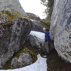 Gap in the rocks 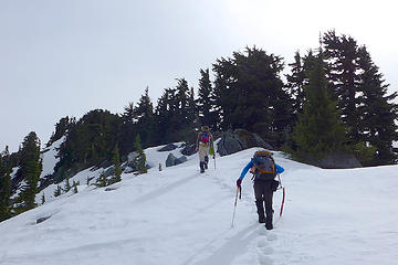 Broad ridge above upper ridge tarn, still wondering where the hard part is 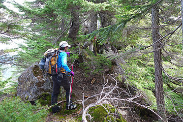 Oh, here it is. The tangled tree section begins 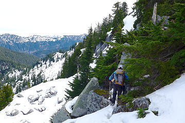 Diverting left to use snow for a bit 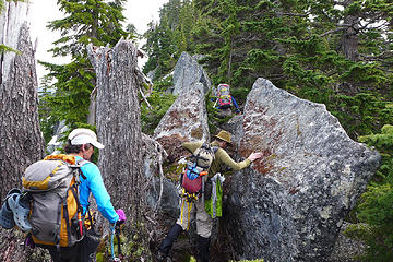 Trees and rocks 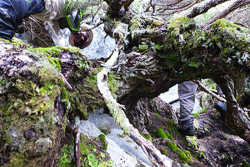 Head over heels, which way is up? Yana made it through that little hole, but can i? 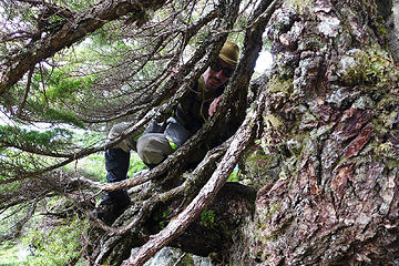 You shall not pass 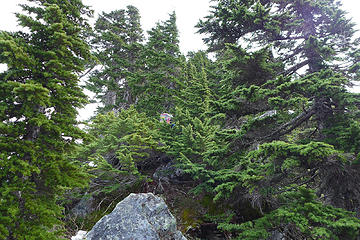 Standing on leafy ground 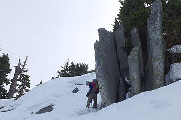 Yana wisely chooses snow for the final slopes to the summit 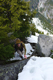 Don't slip 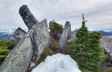 Mile High summit 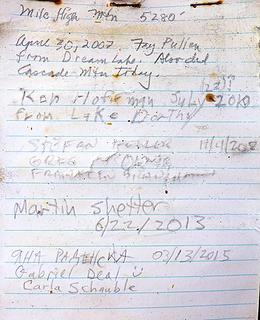 Mile High summit register. First ascent was by a Bulger group on 10/15/1995 (not on this register). It's climbed roughly once every other year. 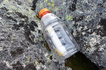 Mile High summit register. Placed by Fay Pullen in 2007. Later it got wet and a hiker-that-will-not-be-named dried it out but lost the cap, hence the capless PVC tube inside a gatorade bottle. So far it's working well. 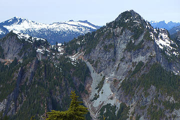 Cascade Mountain summit area 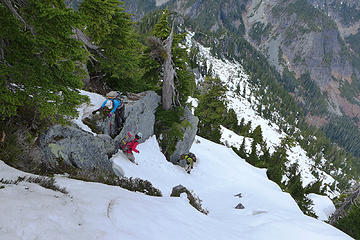 Descending Mile High ridge 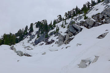 Mile High 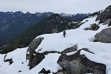 Traversing back across the talus field 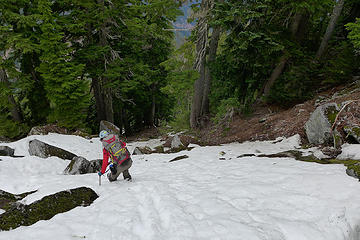 Descending snow on Toto ridge above Lake Dorothy 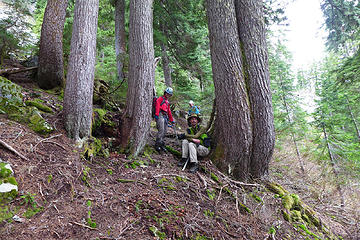 Taking a breather while descending to Lake Dorothy
|
| Back to top |
  
|
|
Magellan
Brutally Handsome

Joined: 26 Jul 2006
Posts: 13116 | TRs | Pics
Location: Inexorable descent |
|
Magellan
Brutally Handsome
|
Mon Mar 16, 2015 9:38 pm |
|
|
Ya'll are crazy! In a good way!  Congrats on a tough summit. Congrats on a tough summit.
|
| Back to top |
|
|
mbravenboer
Member

Joined: 20 Oct 2013
Posts: 1422 | TRs | Pics
Location: Seattle |
 That looks like lovely terrain. Great trip! That looks like lovely terrain. Great trip!
|
| Back to top |
|
|
RichP
Member

Joined: 13 Jul 2006
Posts: 5634 | TRs | Pics
Location: here |
|
RichP
Member
|
Tue Mar 17, 2015 5:06 am |
|
|
My favorite kind of peak; obscure, lonesome and brushy.  Looking forward to a trip to Cascade Mtn with you, Monty.
|
| Back to top |
|
|
Stefan
Member

Joined: 17 Dec 2001
Posts: 5093 | TRs | Pics
|
|
Stefan
Member
|
Tue Mar 17, 2015 9:17 am |
|
|
wonderful!!! weather is on your side!
|
| Back to top |
|
|
Jim Dockery
Member

Joined: 12 Sep 2007
Posts: 3092 | TRs | Pics
Location: Lake Stevens |
Funky fun
|
| Back to top |
|
|
Backpacker Joe
Blind Hiker

Joined: 16 Dec 2001
Posts: 23956 | TRs | Pics
Location: Cle Elum |
Strong work. Nice job Krazie Klimbers. 
"If destruction be our lot we must ourselves be its author and finisher. As a nation of freemen we must live through all time or die by suicide."
Abraham Lincoln
"If destruction be our lot we must ourselves be its author and finisher. As a nation of freemen we must live through all time or die by suicide."
Abraham Lincoln
|
| Back to top |
|
|
wildernessed
viewbagger

Joined: 31 Oct 2004
Posts: 9275 | TRs | Pics
Location: Wenatchee |
I know that you know it could be worse.You could be on a trail. You love that stuff your Rea
ly in the woods. 
Living in the Anthropocene
Living in the Anthropocene
|
| Back to top |
|
|
MLHSN
What goes here?????

Joined: 09 Sep 2007
Posts: 1069 | TRs | Pics
Location: Wenatchee |
|
MLHSN
What goes here?????
|
Tue Mar 17, 2015 9:11 pm |
|
|
| puzzlr wrote: | Dorothy Lake view |
Thanks for the snow report! I think for once I might leave my comfortable box and head west of the crest come May for some melted high lakes.
|
| Back to top |
|
|
ofuros
Member

Joined: 04 Feb 2015
Posts: 45 | TRs | Pics
Location: Gondwana....Australia. |
|
ofuros
Member
|
Tue Mar 17, 2015 11:00 pm |
|
|
Looks like a challenging hike...my kind of adventure.
|
| Back to top |
|
|
iron
Member

Joined: 10 Aug 2008
Posts: 6392 | TRs | Pics
Location: southeast kootenays |
|
iron
Member
|
Wed Mar 18, 2015 9:15 am |
|
|
|
| Back to top |
|
|
Brucester
Member
Joined: 02 Jun 2013
Posts: 1102 | TRs | Pics
Location: Greenwood |
The kind of inspiration I look for this time of year.
Looks interesting.
|
| Back to top |
|
|
|
|


