| Previous :: Next Topic |
| Author |
Message |
Hesman
Member


Joined: 24 Oct 2005
Posts: 396 | TRs | Pics
|
|
Hesman
Member
|
 Sat Apr 25, 2015 8:18 pm |
|
|
I have been wanting to make the walk up the short trail to the top of Ned Hill to see the old fire lookout platform before it falls over for the last couple of years. I have always procrastinated in going, but after reading Redwic's endeavor of visiting all the fire lookouts in Washington that still exist this last winter and deciding that perhaps visiting some fire lookouts this year will rekindle my interest in hiking, I made the trip to Ned Hill.
After spending some time locating the trail since I had driven past it the first time, I started off up the trail at about 8:30 this morning and discovered that I am woefully out of shape. I guess I was a bit too lazy this last winter and didn't get enough exercise. Anyway, I spent an hour puffing my way up the trail and arrived at the lookout with it snowing very very lightly. When I returned to my car it began to hail.
Since it was a short hike, I took some pictures of the Graywolf and Dungeness Rivers on my drive out to Highway 101. Once I had returned to Highway 101 I stopped at Panorama Vista County Park. It is a small Clallam County park that provides beach access to the beach on the north end of Miller Peninsula. When I arrived at the beach, I made the walk to Travis Spit which is at the north end of Sequim Bay. When I made it to Sequim Bay I saw several Private Property/No Trespassing signs prominently displayed, so I did not stay for long. When I got home I did some searching on the internet and discovered that beach on Travis Spit is public land, but land on the spit that is not covered by salt water is private land. Next time I'll have to stay longer.
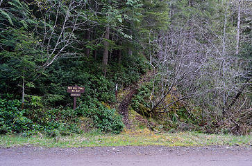 Ned Hill Trailhead 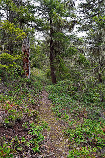 Ned Hill Trail 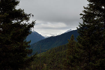 Ned Hill View 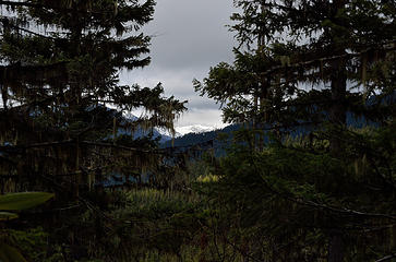 On the Way Up 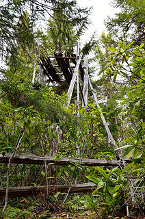 Ned Hill Fire Lookout 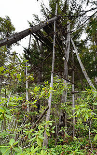 Ned Hill Fire Lookout 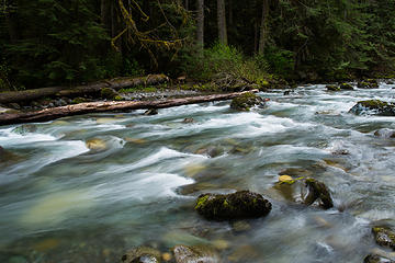 Dungeness River 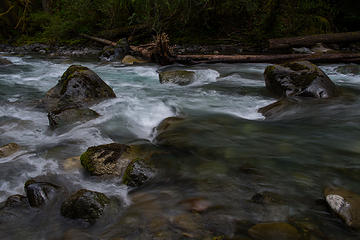 Dungeness River 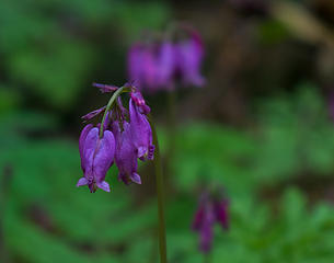 Bleeding Heart 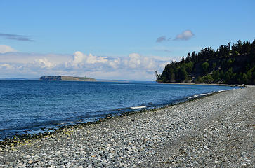 Protection Island 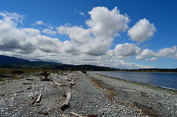 Sequim Bay Spit
|
| Back to top |
  
|
|
Magellan
Brutally Handsome

Joined: 26 Jul 2006
Posts: 13117 | TRs | Pics
Location: Inexorable descent |
|
Magellan
Brutally Handsome
|
Sun Apr 26, 2015 9:08 pm |
|
|
Nice tour. 
|
| Back to top |
|
|
tigermn
Member

Joined: 10 Jul 2007
Posts: 9242 | TRs | Pics
Location: There... |
|
tigermn
Member
|
Mon Apr 27, 2015 8:42 am |
|
|
| Hesman wrote: | Ned Hill Trailhead |
About 4 years ago after doing Deer Ridge, I went in search of this trailhead. I never found it.
That sign sure looks obvious. Not sure how I missed it unless maybe that is a new sign. I even had what I thought was a GPS coordinate. Maybe I was just brain dead that day.
|
| Back to top |
|
|
tigermn
Member
Joined: 10 Jul 2007
Posts: 9242 | TRs | Pics
Location: There... |
|
tigermn
Member
|
Tue Apr 28, 2015 8:57 am |
|
|
Thanks for the info. I guess if I can't find it next time I should just drive home and watch TV...  Trying to decide now whether to do it on the front or back end of Deer Ridge/Blue Mountain....
|
| Back to top |
|
|
tigermn
Member
Joined: 10 Jul 2007
Posts: 9242 | TRs | Pics
Location: There... |
|
tigermn
Member
|
Tue Apr 28, 2015 7:03 pm |
|
|
I think that makes the most sense. If I save it till the end I usually end up bagging it. If I do it first, well it's done and I'm not likely to bag getting to Deer Park/Blue Mountain since the payoff is so much better, especially the views from Blue (weather permitting of course).
|
| Back to top |
|
|
|
|


