| Previous :: Next Topic |
| Author |
Message |
John Morrow
Member


Joined: 03 Apr 2007
Posts: 1526 | TRs | Pics
Location: Roslyn |
After some rest at Capitol Reef with short musings while stretching legs in varied terrain:
Sulphur Creek with the gang:
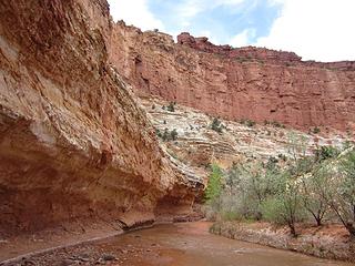 Sulphur Creek, Capitol Reef National Park, UT 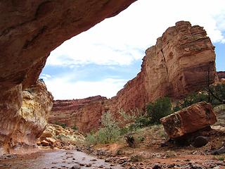 Capitol Reef National Park 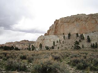 The cove 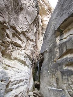 Fish Cr waterfall 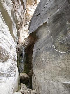 waterfall closeup 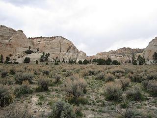 Navaho sandstone buttes 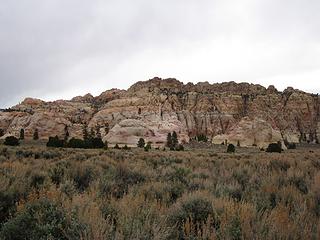 The Cockscomb 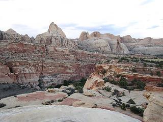 Reef sunset 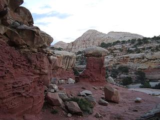 Cohab Trail 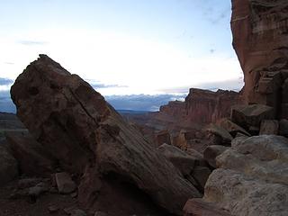 Profile the Wingate 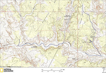 Escalante River/Deer Canyon 2 separate dayhikes 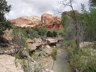 Escalante River 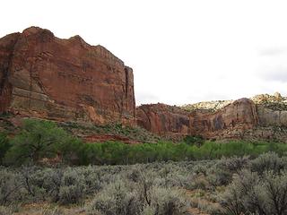 Escalante River wall 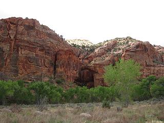 Escalante Natural Bridge 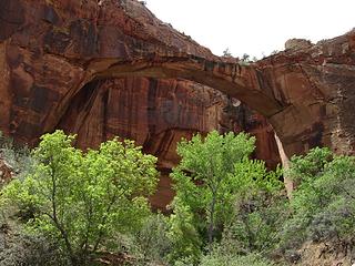 bridge up close 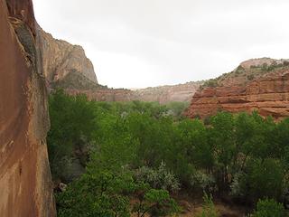 storm coming 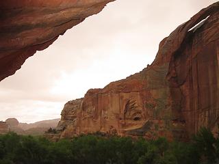 alcove shelter 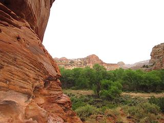 time to walk 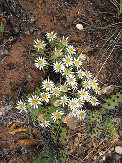 aster 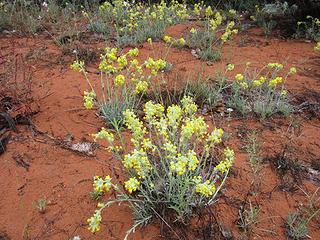 can't remember 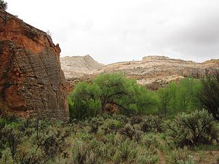 Navajo sandstone appears 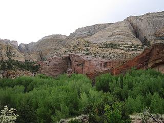 Big Navajo walls 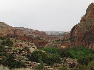 Downcanyon on Bowington Route 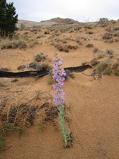 beautiful 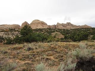 domeland over Death Hollow 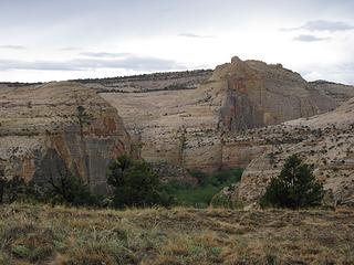 Escalante cuts 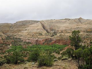 Bowington Route views 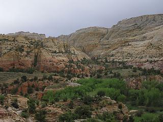 valley floor, Escalante River 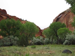 Upper Escalante Canyon 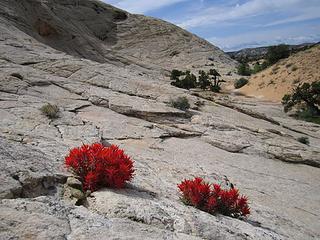 Descending from Haymaker Bench 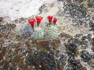 Claret Cup 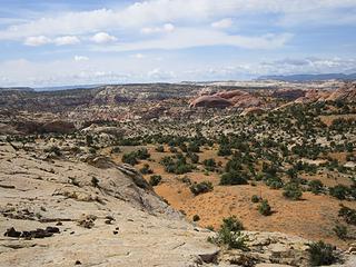 Deer canyon ahead 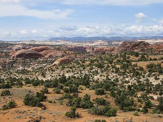 Escalante domes 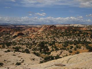 Layers of distant rock 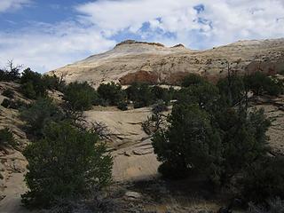 Leaving the Panel 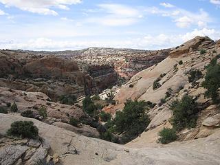 Could it go? 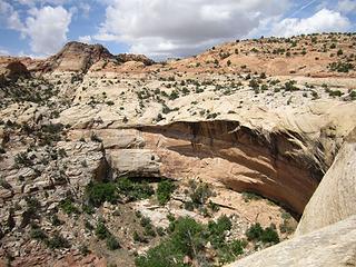 No entry! 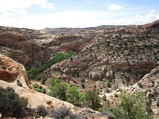 That rib will go 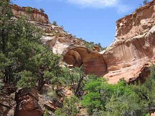 Bowington Arch 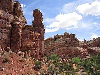 Hoodoos are a surprise 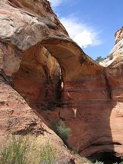 vertical look at arch 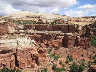 Arch view 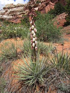 yucca flower 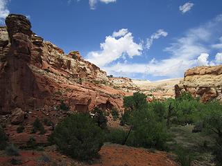 Idyllic Canyon 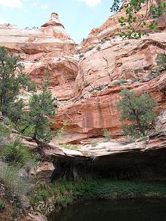 Oasis 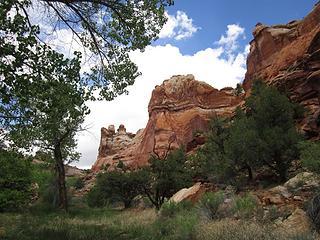 Buttress walls 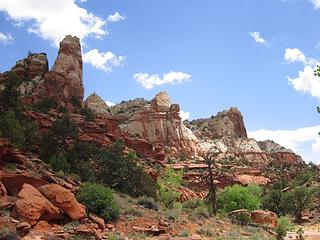 Fine surprise of a canyon 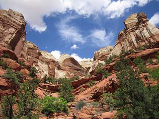 side draw 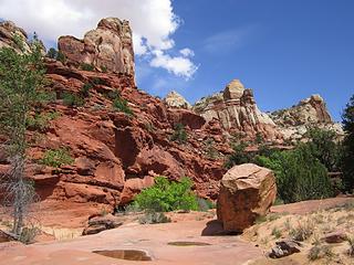 slickrock and water 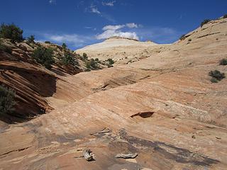 Time to head out 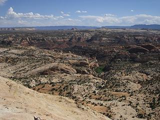 Looking back 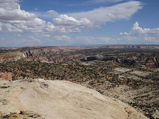 South view from Pt 6160'; The Escalante 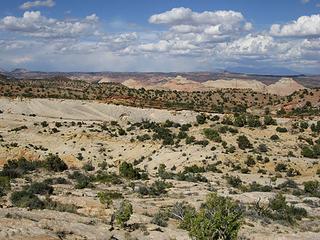 Boulder Creek area buttes 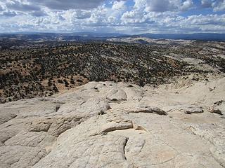 NW ridge slickrock walk 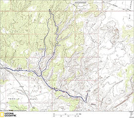 Big Horn Canyon W. Fk upstream, Main Fork downstream 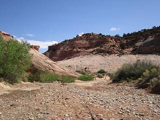 Down Harris to cattle fence 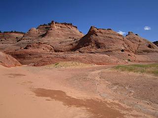 Big Horn Forks junction 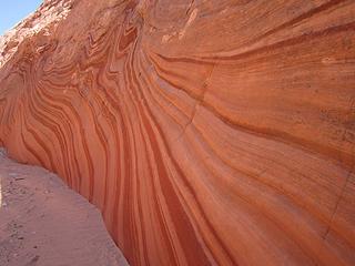 wavvy 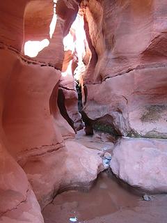 W. Fk first 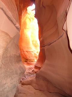 Into slot going up W. Fk. 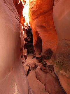 W. Fk. Bighorn Slot 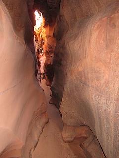 tight 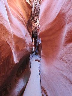 Big Horn West Fork 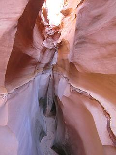 dryfall to climb 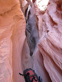 fun step up 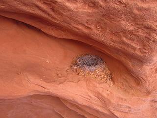 secure place 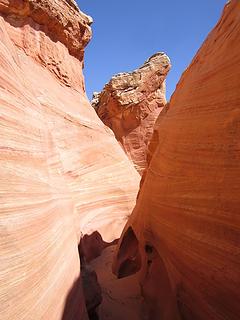 Dryfall ahead, Grand Staircase-Escalante NM 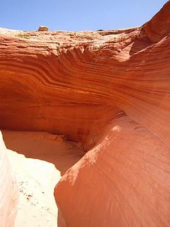 Class 5 bypass 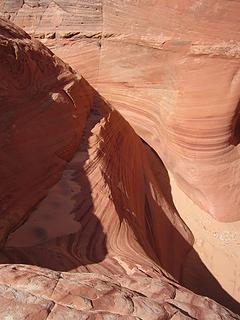 Class 5 friction 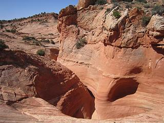 W. Fk. Bighorn Canyon 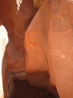 stem the water 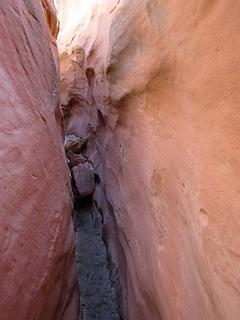 W. Fork Bighorn Canyon 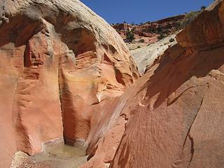 bypass this, too 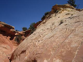 bypass a third with steep friction 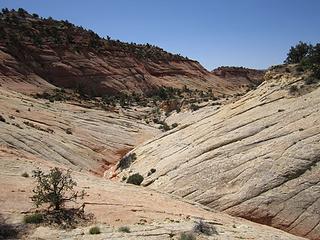 looking at easy bypass options 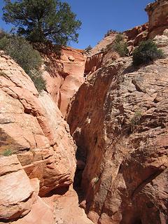 a fourth! 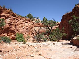 a fifth dryfall! 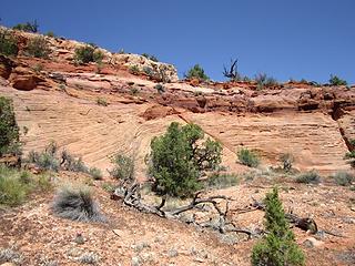 bypass No. 5 with class 4 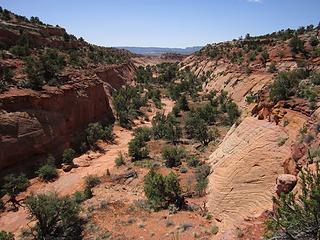 Looking down (easier ramp further right) 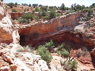 Sixth and final bypass 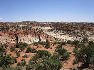 There's Main Fork Big Horn 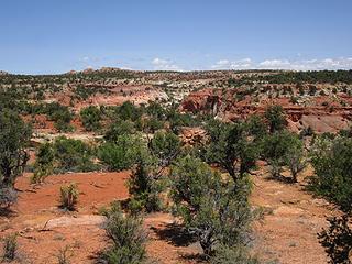 Find an enrty 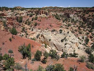 This goes! 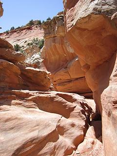 Sculpted rock 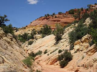 Very colorful Main Fork 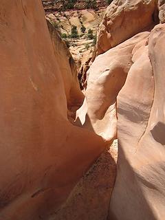 Doesn't go unfortunately 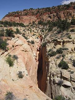 But easy bypassing 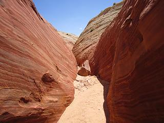 great lines 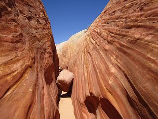 shallow Big Horn Canyon slot 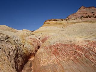 big view 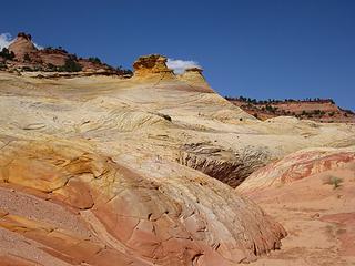 what a landscape 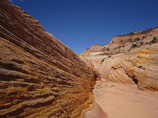 Big Horn Canyon 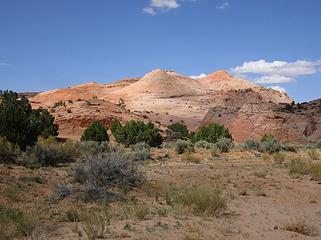 Into Harris Wash 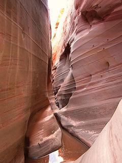 Into Zebra slot 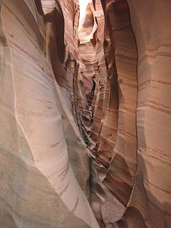 Classic Zebra 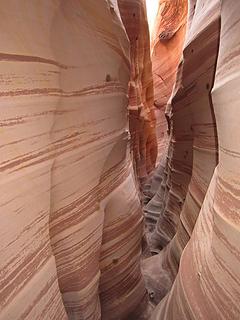 The stripes 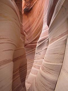 Zebra Canyon 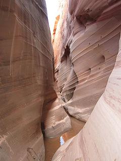 Wet on this day (crotch high) 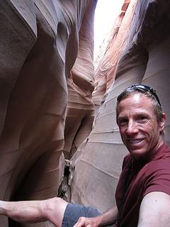 Stem with barefeet 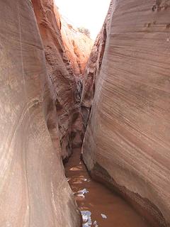 the water waves 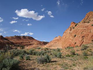 Long Harris wash slog 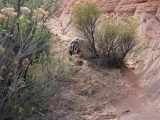 Not happy with me! 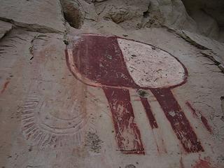 petro-picto 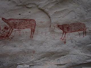 headless 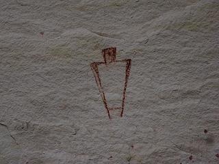 outline 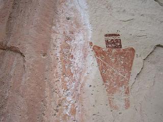 Faded and clear 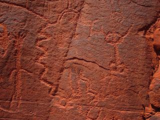 much going on 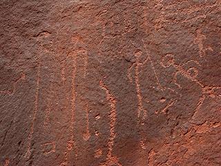 long torso, spear? 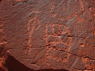 Interesting design 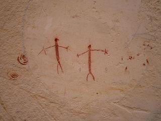 peculiar figures 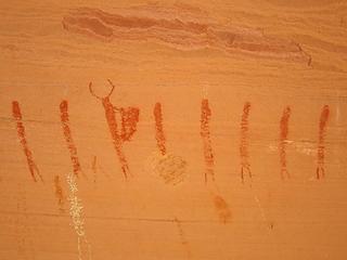 horns and shield 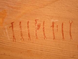 Not sure if these are actually archaic or much younger. They are 6" tall and have that elongated BCS form. 47 I think I counted in all. Lesser visited canyon but obvious as one walks upstream has me doubting they are archaic. 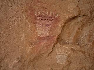 bearpaws 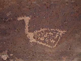 strange 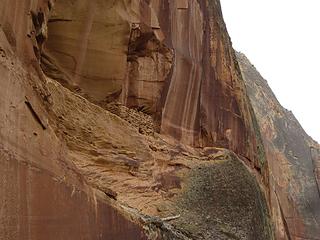 must have had ladder pole 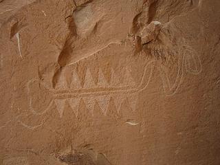 awesome centipede? 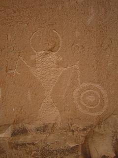 Fremont warrior 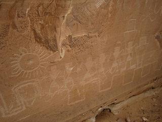 sun and morphs 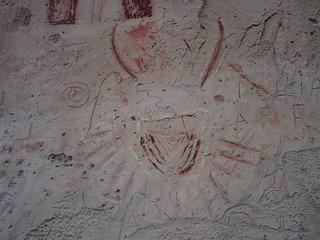 elaborate necklace 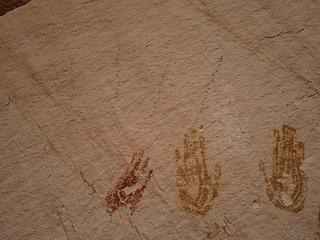 strange black rays eminate 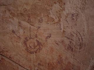 fine hands 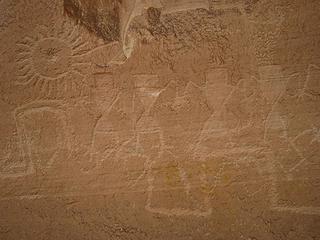 holding hands
Tell me, what is it you plan to do with your one wild and precious life?-Mary Oliver
A nation that continues year after year to spend more money on military defense than on programs of social uplift is approaching spiritual doom.
― MLK Jr.
Tell me, what is it you plan to do with your one wild and precious life?-Mary Oliver
A nation that continues year after year to spend more money on military defense than on programs of social uplift is approaching spiritual doom.
― MLK Jr.
|
| Back to top |
  
|
|
Rainie Too!
Member

Joined: 12 Dec 2008
Posts: 377 | TRs | Pics
|
Wow! I think I like the Escalante up there better! More slots, great views....
Think I missed a lot. It is prettier than the loop we did! Hope you enjoyed your peaceful saunterings John.
|
| Back to top |
|
|
John Morrow
Member
Joined: 03 Apr 2007
Posts: 1526 | TRs | Pics
Location: Roslyn |
| Rainie Too! wrote: | | Wow! I think I like the Escalante up there better! More slots, great views....
Think I missed a lot. It is prettier than the loop we did! Hope you enjoyed your peaceful saunterings John. |
Goody! I didn't really skip Red Breaks, I was saving it for us to finish. Let's do it as part of a big loop in this middle Escalante country as part of next years trip!
Tell me, what is it you plan to do with your one wild and precious life?-Mary Oliver
A nation that continues year after year to spend more money on military defense than on programs of social uplift is approaching spiritual doom.
― MLK Jr.
Tell me, what is it you plan to do with your one wild and precious life?-Mary Oliver
A nation that continues year after year to spend more money on military defense than on programs of social uplift is approaching spiritual doom.
― MLK Jr.
|
| Back to top |
|
|
Rainie Too!
Member
Joined: 12 Dec 2008
Posts: 377 | TRs | Pics
|
|
| Back to top |
|
|
Abert
Member

Joined: 02 Sep 2010
Posts: 588 | TRs | Pics
Location: Sequim |
|
Abert
Member
|
 Mon May 11, 2015 1:06 pm |
|
|
You've gotten some great slot canyon photos this year, John. Funny that I had my first badger in the wild sighting (crossing the Burr Trail Road) just a couple days before you saw yours.
|
| Back to top |
|
|
John Morrow
Member
Joined: 03 Apr 2007
Posts: 1526 | TRs | Pics
Location: Roslyn |
Escalante River/Deer Canyon 2 separate dayhikes Big Horn Canyon W. Fk upstream, Main Fork downstream
Tell me, what is it you plan to do with your one wild and precious life?-Mary Oliver
A nation that continues year after year to spend more money on military defense than on programs of social uplift is approaching spiritual doom.
― MLK Jr.
Tell me, what is it you plan to do with your one wild and precious life?-Mary Oliver
A nation that continues year after year to spend more money on military defense than on programs of social uplift is approaching spiritual doom.
― MLK Jr.
|
| Back to top |
|
|
|
|


