| Previous :: Next Topic |
| Author |
Message |
Fletcher
Member


Joined: 29 Jul 2009
Posts: 1870 | TRs | Pics
Location: kirkland |
|
Fletcher
Member
|
 Fri Jul 03, 2015 12:51 pm |
|
|
As soon as access to the Suiattle Valley was restored last fall, I decided I was going to make Dome a priority this summer. This week, Rob, Micheal, and I made it happen.
On Tuesday morning I picked Rob and Mike up from their homes and we drove out to the Downey Creek TH. We started hiking shortly before 9:30. Only a few minutes up the trail, I was drenched in sweat and knew it was going to be a long day. We cruised the 6ish miles to Bachelor Creek in 2 hours.
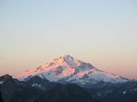
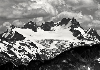
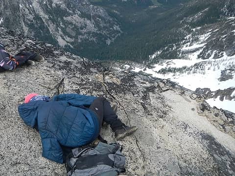
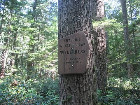 probably my favorite wilderness 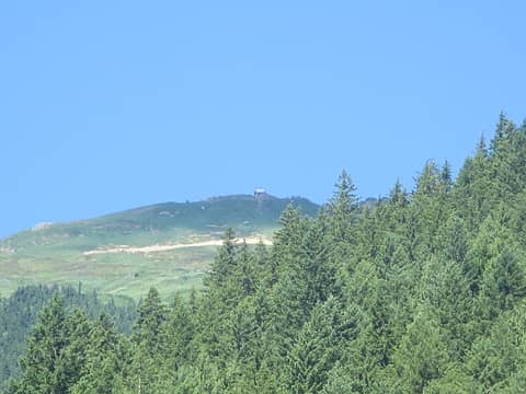 Green Mountain Lookout from Downey Creek 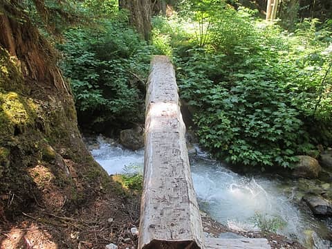 Bachelor Creek foot log 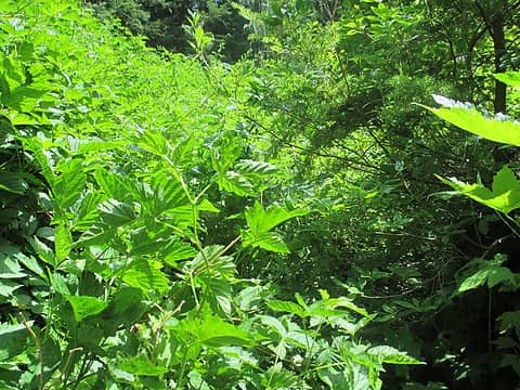 Bachelor Creek Trail 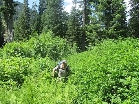 Rob in one of the nicer sections of Bachelor brush 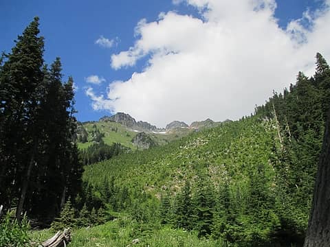 up the old avy path 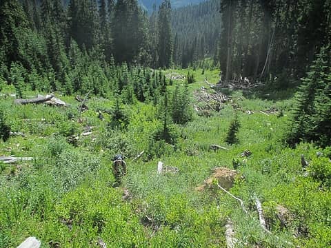 this section of the route was heinously hot and muggy 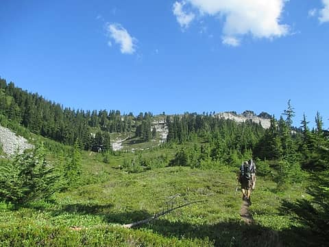 ahhhh finally pleasant travel 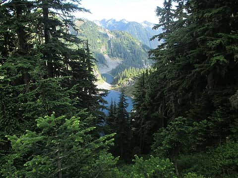 cub lake below 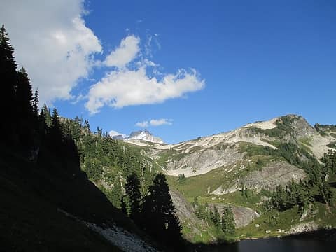 first look at Dome 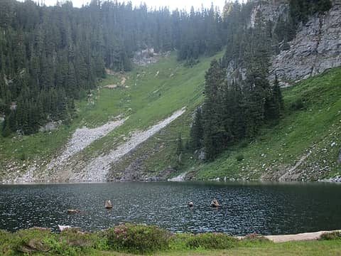 Cub Lake with route up to Bachelor Creek 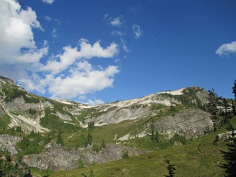 Itswoot Ridge 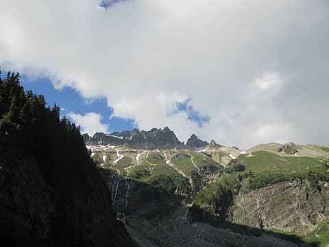 Spire Point 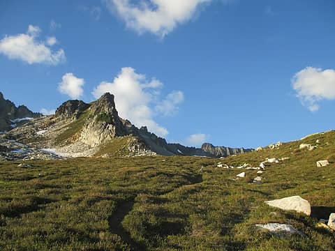 nearing camp 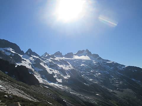 traverse to Dome 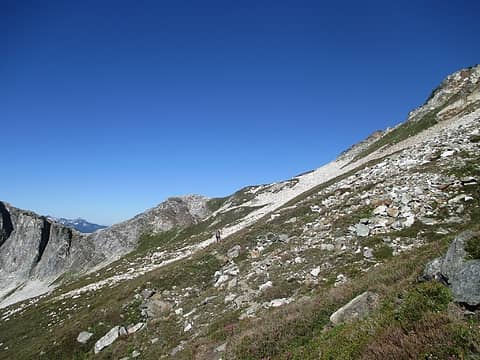 descending from camp 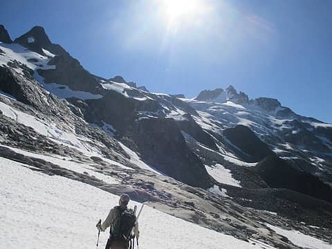 our route went down around the buttress that is just over Rob's head, then up and climbers right 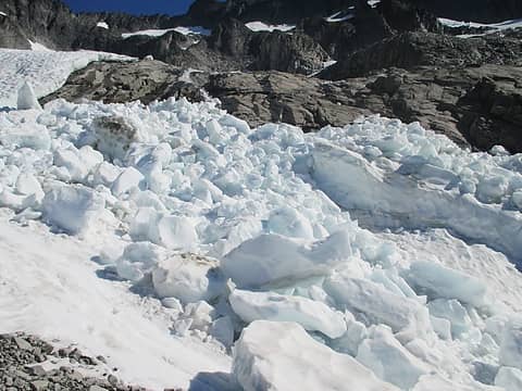 ice blocks 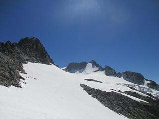 nearing the Dome Glacier 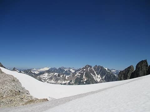 Eldorado and the Ptarmigan Traverse 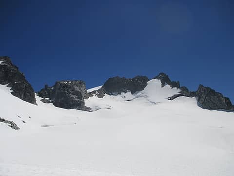 Dome Col is just right of the blocky sub summit and just left of the true summit 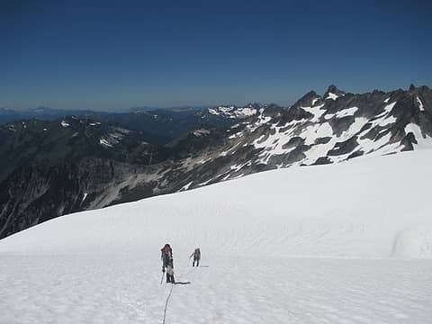 Mike and Rob with Spire Point and our Iltswoot Ridge camp far below 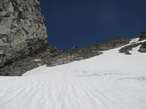 nearing Dome Col 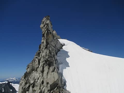 gnarly 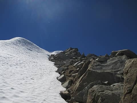 summit ridge 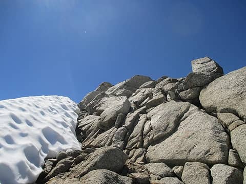 easy scrambling approaching the summit block 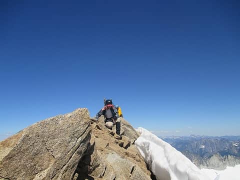 Mike and Rob on the ridge 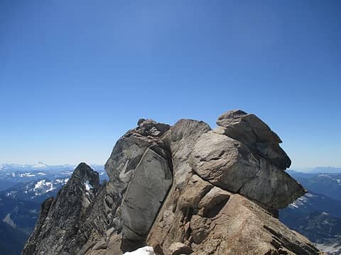 Dome summit 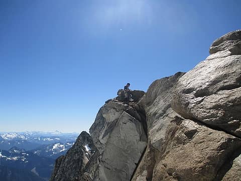 Mike on the summit 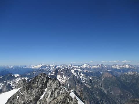 view north 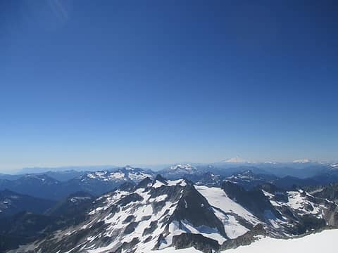 view NW 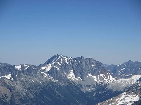 Bonanza 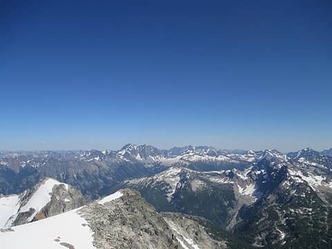 view east 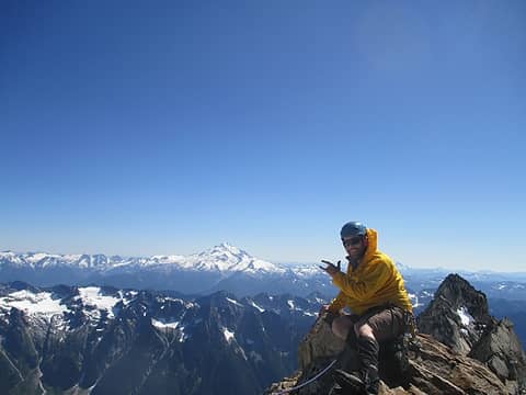 Rob and Glacier 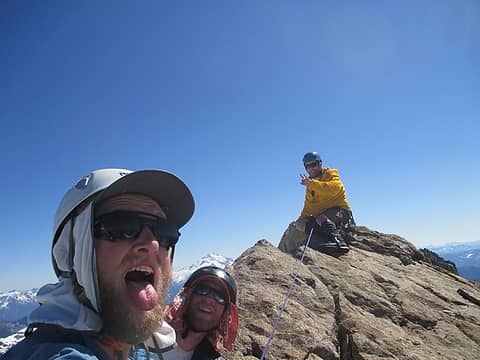 three idiots made the summit of Dome Peak! 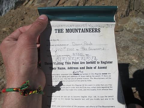 Register 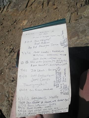 some names I recognized 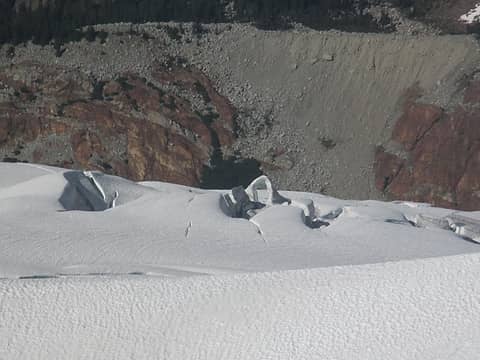 snow arch below us on the Chickamin Glacier 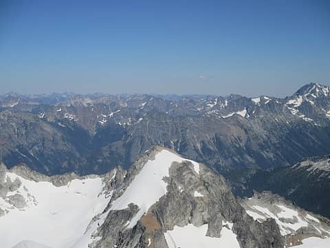 Sinister 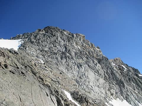 looking back up at the summit 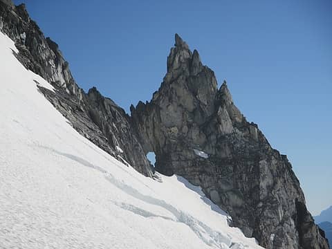 obligatory cannon hole shot 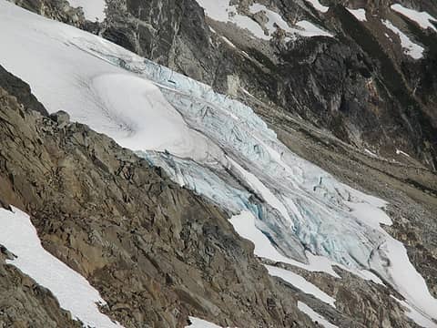 Dome Glacier terminus 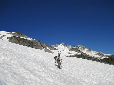 looking back  We grabbed a 6 pack and found a nice spot to relax on the Sauk rather than get stuck in traffic for rush hour. What a great trip!
~30ish miles
~lots of gain We grabbed a 6 pack and found a nice spot to relax on the Sauk rather than get stuck in traffic for rush hour. What a great trip!
~30ish miles
~lots of gain
 Glacier sunrise 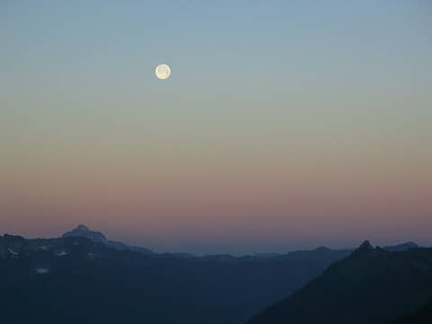 moon setting 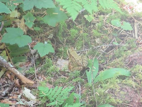 frog on Downey Creek Trail 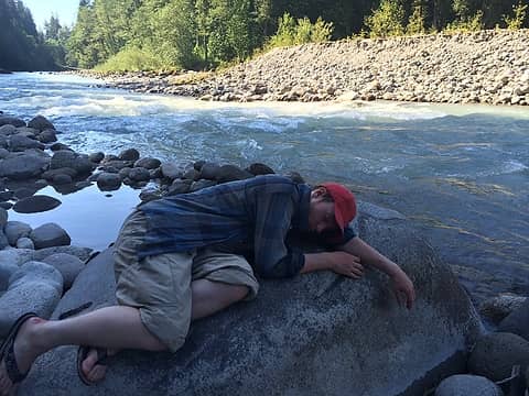 Mike passed out
|
| Back to top |
  
|
|
Schenk
Off Leash Man

Joined: 16 Apr 2012
Posts: 2372 | TRs | Pics
Location: Traveling, with the bear, to the other side of the Mountain |
|
Schenk
Off Leash Man
|
Fri Jul 03, 2015 1:18 pm |
|
|
Nice report!
Nice trip!
Be glad you did not try to shortcut up Sulfur Creek...traveling through it could push one over the edge of sanity.
Nature exists with a stark indifference to humans' situation.
Nature exists with a stark indifference to humans' situation.
|
| Back to top |
|
|
silence
Member

Joined: 25 Apr 2005
Posts: 4420 | TRs | Pics
|
|
silence
Member
|
Fri Jul 03, 2015 1:36 pm |
|
|
I looked longingly at Dome on the 30th from Green Mountain ... and while I've always had my eye on it, we're just not skilled enough to climb the peak by ourselves, esp now at our age. However, getting up to Itswoot Ridge is still possible ... so thx for the great beta. And, congrats on the summit!
 Shot with the tele from the top of Green Mountain.
PHOTOS
FILMS
Keep a good head and always carry a light bulb. Bob Dylan
PHOTOS
FILMS
Keep a good head and always carry a light bulb. Bob Dylan
|
| Back to top |
|
|
Distel32
Member
Joined: 03 Jun 2014
Posts: 961 | TRs | Pics
Location: Edmonds, WA |
|
Distel32
Member
|
Fri Jul 03, 2015 2:22 pm |
|
|
Sweet 
|
| Back to top |
|
|
contour5
Member

Joined: 16 Jul 2003
Posts: 2963 | TRs | Pics
|
|
contour5
Member
|
Fri Jul 03, 2015 3:12 pm |
|
|
Stellar reportage. Perfect angle for shooting Glacier Pk...
|
| Back to top |
|
|
cefire
Member

Joined: 03 Feb 2010
Posts: 523 | TRs | Pics
|
|
cefire
Member
|
Fri Jul 03, 2015 3:28 pm |
|
|
Very cool!
Also, "Ptarmigangstas"!!!
|
| Back to top |
|
|
raising3hikers
Member
Joined: 21 Sep 2007
Posts: 2344 | TRs | Pics
Location: Edmonds, Wa |
great place to go! to avoid the brush and alder, don't cross the creek. as soon as the trail peters out, go N through 5'-10' of alder and on the other side, is nice open pockets of easy travel to weave in and out of to avoid the bushwhacking. Then at the top of the meadows near boulders, hike back into the forest (East) to find the old trail again near the creek
|
| Back to top |
|
|
EastKing
Surfing and Hiking

Joined: 28 Mar 2007
Posts: 2082 | TRs | Pics
Location: 77 miles from Seattle! |
|
EastKing
Surfing and Hiking
|
Sat Jul 04, 2015 1:24 am |
|
|
YouTube | SummitPost
Saw the depths of despair. Now I am salvaging what time I have left on Earth.
|
| Back to top |
|
|
cartman
Member
Joined: 20 Feb 2007
Posts: 2800 | TRs | Pics
Location: Fremont |
|
cartman
Member
|
Sun Jul 05, 2015 1:12 am |
|
|
Outstanding, and thanks for all the great pics and beta. That's a tough one to do in the heat.
|
| Back to top |
|
|
gb
Member
Joined: 01 Jul 2010
Posts: 6308 | TRs | Pics
|
|
gb
Member
|
Sun Jul 05, 2015 9:05 am |
|
|
| Fletcher wrote: | | We saved considerable time by crossing back over Bachelor Creek at 4500 instead of 4100. There is a noticeable campsite there, with a large boulder with a fire pit next to it. This way you avoid much of the brush. It sounds like quite a few parties have done the same thing we have done in figuring out the easier route on the way out. On the way in, it felt like we had to cross the creek sooner than later to stay in easier terrain but dont! Stay on the north side and the brush will give way to open forest and save you time. The "trail" through between 4100 and 4500 is complete sh## and was the crux of the approach. |
Thanks for the beta, Fletcher. Amazingly, Bachelor Meadows (with the option to go to Cub Lake) was in 101 Hikes in the 1970 version. We actually did a day hike when I was about your age. At that time the description was to cross Bachelor Creek 2 miles in (which would have been around 4100'). Although overgrown and chest high, there was a relatively easy to follow trail on the south side. By 1989 (coming out of the Ptarmigan on my last trip there) we were still able to follow the trail but lost it near where it crosses Bachelor Creek. That brush would be horrible without a trail. I am glad you found a better route coming out.
|
| Back to top |
|
|
Gregor
Gregor
Joined: 15 May 2007
Posts: 117 | TRs | Pics
|
|
Gregor
Gregor
|
Sun Jul 05, 2015 11:30 am |
|
|
Nice report
Amazing how different it looks. We did this peak almost the same day but in 2013 and cub lake was frozen, it was all snow to the summit from there. The summit was a crazy snow fin.
|
| Back to top |
|
|
Foist
Sultan of Sweat

Joined: 08 May 2006
Posts: 3974 | TRs | Pics
Location: Back! |
|
Foist
Sultan of Sweat
|
Sun Jul 05, 2015 7:01 pm |
|
|
Bachelor Meadows was still in the "100 classic hikes in washington" book when we bought a copy in the late '90s. I was always drawn to the photo of Itswoot Lake (but scared off by the description). Isn't that one a cool turquoise color? Did you get any photos of it on your trip?
|
| Back to top |
|
|
wildernessed
viewbagger

Joined: 31 Oct 2004
Posts: 9275 | TRs | Pics
Location: Wenatchee |
Living in the Anthropocene
Living in the Anthropocene
|
| Back to top |
|
|
Michael Lewis
Taking a nap
Joined: 27 Apr 2009
Posts: 629 | TRs | Pics
Location: Lynnwood, WA (for now) |
Video's up. Thanks Fletcher for having me on this very memorable climb!
|
| Back to top |
|
|
rbuzby
Attention Surplus
Joined: 24 Feb 2009
Posts: 1008 | TRs | Pics
|
|
rbuzby
Attention Surplus
|
Mon Jul 06, 2015 8:38 am |
|
|
Great pics! Dome is a very important mountain.
|
| Back to top |
|
|
|
|


