| Previous :: Next Topic |
| Author |
Message |
Redwic
Unlisted Free Agent


Joined: 23 Feb 2009
Posts: 3292 | TRs | Pics
Location: Going to the Prom(inence) |
|
Redwic
Unlisted Free Agent
|
 Sun Aug 23, 2015 6:49 pm |
|
|
Or this could be called "Chikamin The Hard Way" or "Chikamin: A Trip Of Perseverance and Triumph"...
Paul Michelson had one peak remaining on the "Snoqualmie Peak Pin-All" list of 20 peaks in the Snoqualmie Pass area. The remaining mountain for him to visit was Chikamin Peak, which also happens to be the highest elevation peak on that list. There are two main directions from which people approach Chikamin Peak, from Mineral Creek and a longer route from Snoqualmie Pass. Joining Paul on this trip were Mike C., Chuck M., and me. Mike had located a route on the west side of Chikamin Ridge many years ago, and that idea coupled with a desire to see as many of the Snoqualmie peaks as possible led to the decision to go a longer approach from Snoqualmie Pass.
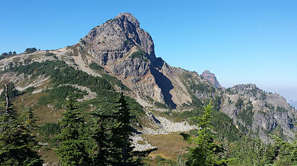
I had visited relatively few peaks in the Snoqualmie Pass area, so I was looking forward to hiking the PCT and passing by many peaks. We left the car at 4:30 AM and took the Commonwealth Basin shortcut trail to the PCT. We stopped for water at Ridge Lake before continuing to Chikamin Pass for a short break. From there, we continued on the PCT, passing by Chikamin Peak and the apparent standard western approach leading up the peak from that side. As we passed the peak, imposing cliffs loomed above us as Paul and Mike looked for a place to leave the trail. I commented that we were already below Four Brothers and might have gone too far but we soon found an open slope for which to ascend up high.
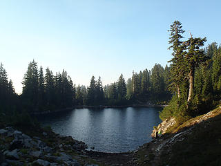 Ridge Lake 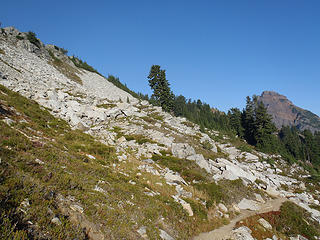 Nice terrain 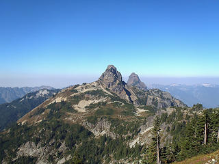 Huckleberry & Thomson 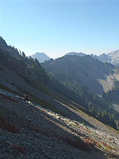 Ascending steep talus above PCT 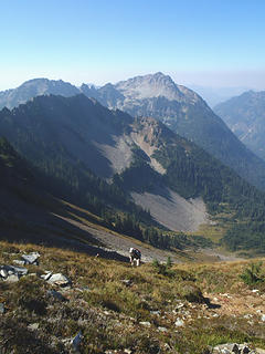 Ascending steep slopes 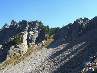 Mostly impassable here 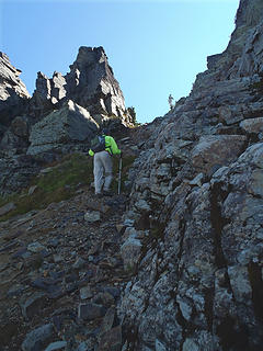 A fortuitous notch 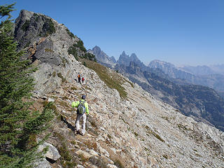 Along Four Brothers ridgetop 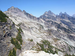 Chikamin & Lemah 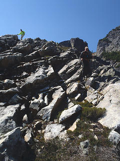 Descending one of terraces 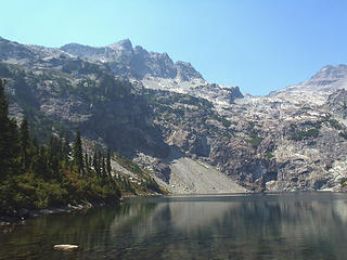 Glacier Lake 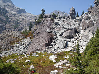 Looking at "Monolith Rock" 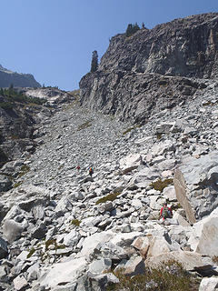 Ascending around cliff... 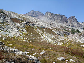 Nice open slopes... 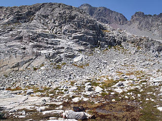 Mike takes a power nap 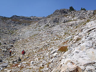 The ridge becomes a talus pile 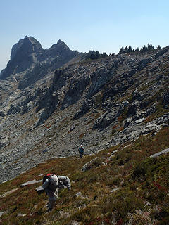 Ascending the ridge... 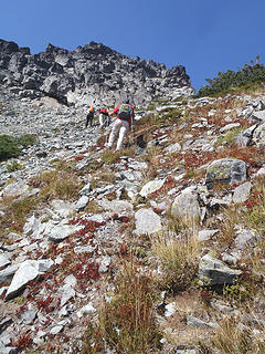 Nearing the peak... 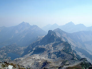 Four Brothers from Chikamin 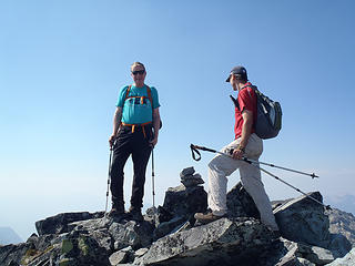 Paul & Chuck atop Chikamin 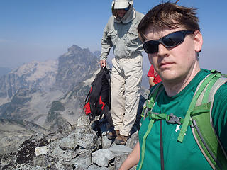 Mike & me atop Chikamin 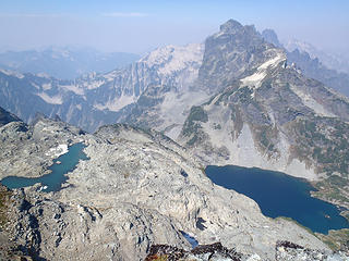 Chikamin Lake (right) 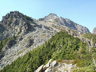 Paul & Chuck along ridgetop 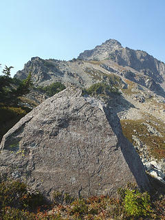 "Denny Rock" 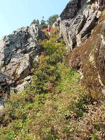 Near-vertical veggie slope 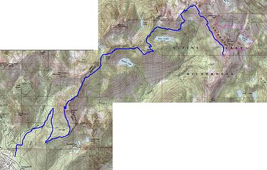 Chikamin-Estimated Route
60 pounds lighter but not 60 points brighter.
60 pounds lighter but not 60 points brighter.
|
| Back to top |
  
|
|
Paul M
Member

Joined: 15 Jul 2008
Posts: 371 | TRs | Pics
|
|
Paul M
Member
|
Sun Aug 23, 2015 6:59 pm |
|
|
Thanks guys for joining me on this "interesting" day trip. I must say that we covered some ground and it brought back some old memories of the area despite the round about way we ended up climbing the peak. Heck I always wanted to go in via Glacier Lake but really like the PCT between Snoqualmie and Chikamin also..... who would have figured we would see both approaches on the same day trip!
Too bad we had hazy views all day from all of the smoke in the air.
 Huckleberry from PCT 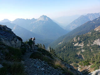 Craig, Mike, Paul along PCT (photo by Chuck M) 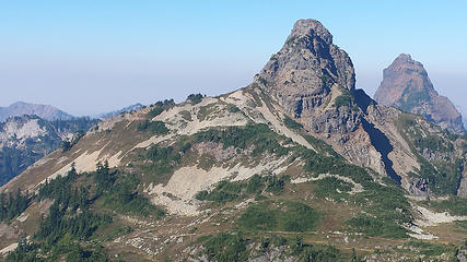 Huckleberry and Thompson above PCT 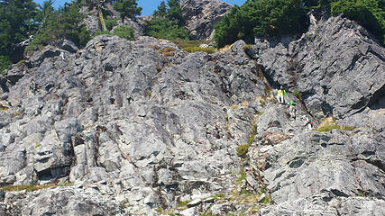 Off route 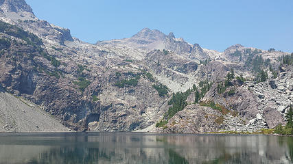 Glacier Lake 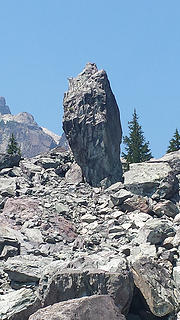 The monolith 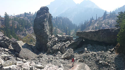 Chuck below the Monolith 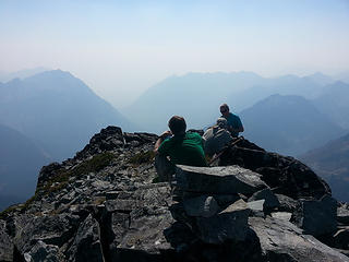 Craig, Mike, Paul on Chikamin summit photo by Chuck M 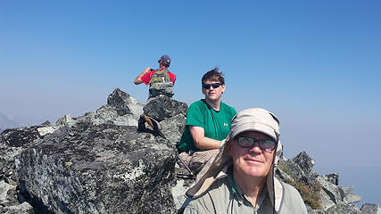 Mike, Craig, Chuck on Chikamin summit 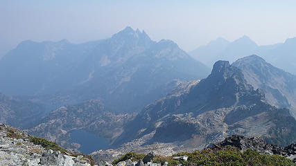 Smokey summit views 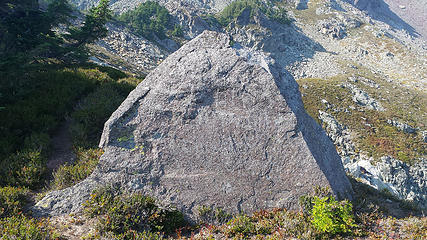 Faded writing on Denny Rock
|
| Back to top |
|
|
Bernardo
Member

Joined: 08 Feb 2010
Posts: 2174 | TRs | Pics
Location: out and about in the world |
|
Bernardo
Member
|
Sun Aug 23, 2015 7:07 pm |
|
|
Wow, that was quite a trek!!! Did you drop off the ridge at the low point not far from Denny Rock? I explored a bit down that side recently, passing a large marmot den. Sound familiar? It looked like it might go, but I stopped at the first point where I could see the PCT far below. Did you find a summit register?
|
| Back to top |
|
|
RichP
Member

Joined: 13 Jul 2006
Posts: 5632 | TRs | Pics
Location: here |
|
RichP
Member
|
Sun Aug 23, 2015 7:11 pm |
|
|
I'm headed up there tomorrow and plan on taking the "easy" route via Mineral Ck with a camp at Glacier Lake.
I'm hoping for the promised clearing of the air for a Tuesday summit trek.
|
| Back to top |
|
|
Bernardo
Member
Joined: 08 Feb 2010
Posts: 2174 | TRs | Pics
Location: out and about in the world |
|
Bernardo
Member
|
Sun Aug 23, 2015 7:13 pm |
|
|
Lucky you RichP! Have fun and travel safe.
|
| Back to top |
|
|
Mike Collins
Member

Joined: 18 Dec 2001
Posts: 3092 | TRs | Pics
|
| Bernardo wrote: | | I explored a bit down that side recently, passing a large marmot den. Sound familiar? It looked like it might go, but I stopped at the first point where I could see the PCT far below. Did you find a summit register? |
We did pass a large marmot den near the saddle shortly after starting the descent. In fact I made a comment about it being a nice condominium. There was no register so I left one.
|
| Back to top |
|
|
Bernardo
Member
Joined: 08 Feb 2010
Posts: 2174 | TRs | Pics
Location: out and about in the world |
|
Bernardo
Member
|
Sun Aug 23, 2015 7:46 pm |
|
|
No wonder you all survived that route and kept going; it was a very strong party! Mike Collins, I have to laugh a bit at the thought of this because you are one of the most professional posters on this site and I read your previous postings with lots of warnings on the difficulty and danger of routes up to Chikamin from the PCT prior to my own trip. After approaching from Glacier Lake, I was thinking about dropping down to the PCT from the low point on the ridge and circling back to my camp at Glacier Lake just so I could test that side and see some different terrain. I figured this was the route you had suggested that would traverse below the Brothers. But as I discovered the distance down to the the PCT was far and steep with no clear path, I decided to go back and enjoy the very beautiful and less stressful rocks of the other side.
Anyway, sounds like the route was even harder than you were warning. Would you recommend your route down as a way up if you were to do it again?
And believe it or not here is a picture of the marmot condo that I saw.
|
| Back to top |
|
|
cartman
Member
Joined: 20 Feb 2007
Posts: 2800 | TRs | Pics
Location: Fremont |
|
cartman
Member
|
Mon Aug 24, 2015 8:29 am |
|
|
Good report. We had a similar, yet different experience on Chikamin two years ago coming from Mineral Creek.
We came up from the PCT, climbing up to exposed low Class 5 to reach the summit. Not wanting to return that way, we downclimbed a SW-trending gully to within 30' of easy terrain.
But we just could not safely solve that last 30'--the PCT was a two minute walk away! So we upclimbed back to the upper ridge and returned via the Glacier Lake route. Very frustrating and one of my longest days in the mtns ever.
Take home message: Chikamin can be a complex route-finding challenge. Be on your game when going for this one. Kudos to you guys for finding those routes.
|
| Back to top |
|
|
Gimpilator
infinity/21M

Joined: 12 Oct 2006
Posts: 1684 | TRs | Pics
Location: Edmonds, WA |
Nice job getting the peak guys. A great display of determination.
I can't speak with real authority, because I have not done both routes, but I will say that the Glacier Lake route via Mineral Creek is one of the nicest routes I have experienced in this general area. I would suggest that future trip planners consider going that way.
|
| Back to top |
|
|
wolffie
Member

Joined: 14 Jul 2008
Posts: 2693 | TRs | Pics
Location: Seattle |
|
wolffie
Member
|
Tue Sep 01, 2015 2:52 pm |
|
|
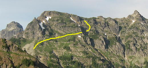 Chikamin standard route from PCT
Some people have better things to do with their lives than walking the dog. Some don't.
Some people have better things to do with their lives than walking the dog. Some don't.
|
| Back to top |
|
|
PeakJunkie
Member
Joined: 14 Feb 2009
Posts: 22 | TRs | Pics
|
Thanks for the report. Brings back memories of when I did that same trip years ago with Mitch Blanton and Steve Rankin... A long but good day indeed.
|
| Back to top |
|
|
|
|
You cannot post new topics in this forum
You cannot reply to topics in this forum
You cannot edit your posts in this forum
You cannot delete your posts in this forum
You cannot vote in polls in this forum
|
Disclosure: As an Amazon Associate NWHikers.net earns from qualifying purchases when you use our link(s). |


