| Previous :: Next Topic |
| Author |
Message |
RichP
Member


Joined: 13 Jul 2006
Posts: 5634 | TRs | Pics
Location: here |
|
RichP
Member
|
 Wed Apr 27, 2016 10:58 am |
|
|
Ten days ago I visited the same area with my hiking partner Don and vowed to come back for another try at the high point of the ridge when we could drive a bit further up the road.
Here is the report on that hike which I posted in the "lazy trip reports" section:
Manastash Ridge April 15, 2016
The road is drivable for any vehicle up to milepost 5 on FR 31 (continuation of Manastash Rd) at 3400' due to lingering snow in shady areas. There is some rock fall on the road above this point as well. We did see a couple of high clearance vehicles go another 1/2 mile before being stopped.
We walked about 1.5 miles up the road to 3900' and bushwhacked up the south side of the ridge for 1400' vert through dense second growth forest with occasional stands of old growth until reaching the top. Snow is still present in places but not much. We used snowshoes above 5500' for a short while and made it up to about 5700' before calling it a day. The 6335' high point of the ridge was still about 2 miles away from our turnaround.
The area is a favorite of the ORV crowd but has nice hiking options too, especially in early and late season. I wished we had brought overnight gear when I saw several potential scenic camp spots under the pines atop basalt cliffs. With snow banks for water, now is the perfect time.
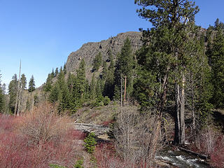 The South Fork of Manastash Creek. 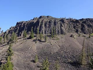 Impressive columnar basalt in Manastash Canyon. This feature is called The Island. 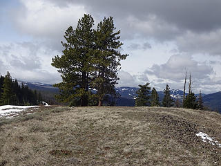 Manastash Ridge scene at 5400.' 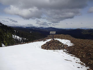 A memorial sign on Manastash Ridge. 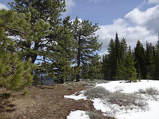 Pines, clouds, snow and sage brush. 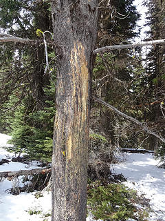 Claw marks reach about 9 ft. 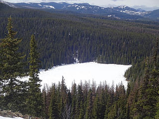 The largest body of water in the area, Manastash Lake 5063.' 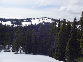 Point 5897 on Manastash Ridge. 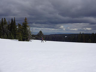 A large snow covered meadow at about 5700' on Manastash Ridge. 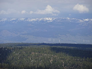 Lion Rock/Table Mtn area across the Kittitas Valley. 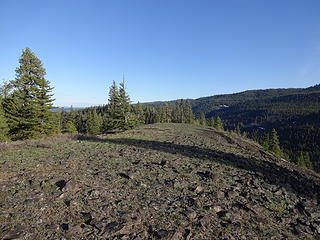 Walking out to "the Island" atop basalt cliffs. 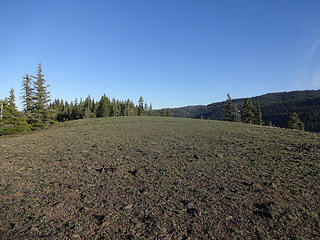 On the way to "The Island." 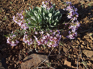 Flower on The Island. 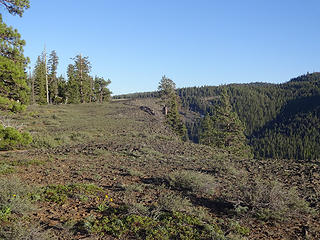 Nearing the top of The Island. 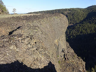 Columnar basalt on The Island. 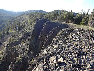 Looking back down the ridge. 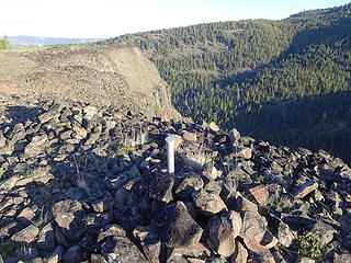 A marker on the high point of The Island 4251.' 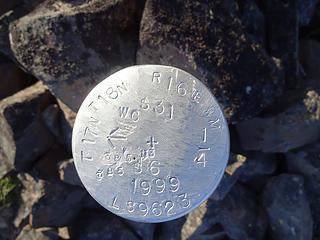 Marker on the Island. 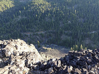 Looking down to the bottom of Manastash Canyon and forest road 31. The South Fork of Manastash Ck also in view. 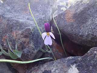 Sagebrush Violet on The Island. 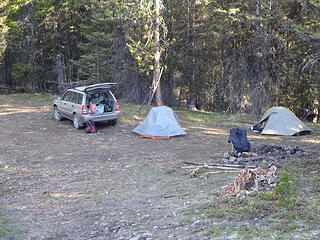 Our car camp at milepost 8 along forest road 31. 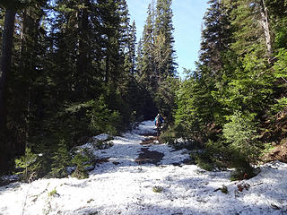 After parking the car at just past milepost 9 on forest road 31, we took this spur road (112) that follows the outlet of Manastash and Lost Lake. 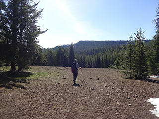 A clearing on the way to Manastash Lake. 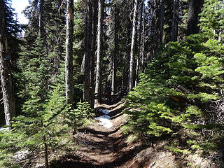 We soon found the trail to the lake. 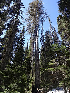 An enormous Western Larch along the trail just before Manastash Lake. 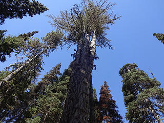 The Larch splits into 3. 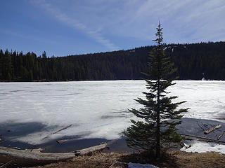 Manastash Lake 5063.' 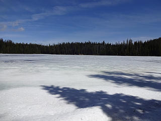 Manastash Lake. 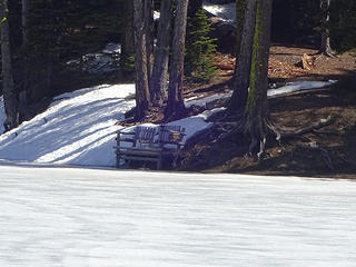 Bench at south end of Manastash Lake. 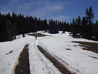 We followed the trail up to the top of the ridge at about 5600' where ORV'ers have already started their season. 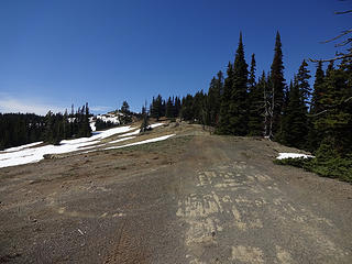 On Manastash Ridge. 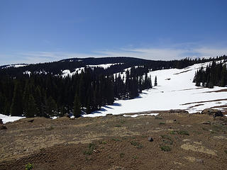 The area where we were mistakenly lured toward Point 6115 instead of the high point of Manastash Ridge. We should have gone right here instead of left. 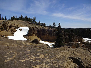 Rocks near Point 5897. this is an ORV "play area." 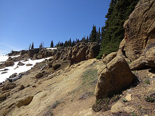 Walking near Point 5897. 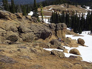 Near Point 5897. 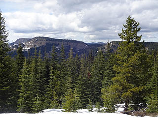 Near Point 6115 when we saw the true high point of Manastash Ridge 6335.' The low point right of center is called Rocky Saddle. 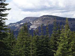 1 label A closer view of the high point of Manastash Ridge. 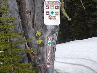 The trail we used up and down from Manastash Lake. 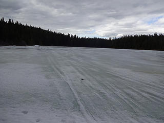 Snowmobile tracks on Manastash Lake. 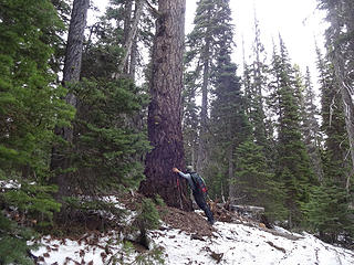 Farewell old Larch.
|
| Back to top |
  
|
|
Mountainfisherman
Member

Joined: 26 May 2010
Posts: 123 | TRs | Pics
|
Wow. Great TR and timely info for me. Thanks.
|
| Back to top |
|
|
Mountainfisherman
Member
Joined: 26 May 2010
Posts: 123 | TRs | Pics
|
Wow. Great TR and timely info for me. Thanks.
|
| Back to top |
|
|
wildernessed
viewbagger

Joined: 31 Oct 2004
Posts: 9275 | TRs | Pics
Location: Wenatchee |
It changes so fast, at least this year, we are heading back to thr 80's over here.
Living in the Anthropocene
Living in the Anthropocene
|
| Back to top |
|
|
Mountainfisherman
Member
Joined: 26 May 2010
Posts: 123 | TRs | Pics
|
I like to come into Manastash Lake from 410-a couple of different routes, but usually on the 1701, then walk on the ridge on the 694 and then down the trail to the lake. Generally around Memorial Day weekend or the weekend after it's doable. But with another round of 80 degree temps and from looking at the pictures, I'll bet my mid-May it'll be close. Of course, last year, you could get in there now if not sooner.
|
| Back to top |
|
|
Naches Hiker
Member
Joined: 01 Jun 2014
Posts: 239 | TRs | Pics
Location: Living among the Liberals |
That's some fun area to explore up there, but you need good tires and a small rig. The jeep trails can be nasty without lockers, especially on the 410 side of the ridge. Done some of them in my Toyota that I wish I wouldn't have gone on.. I'd be cautious of driving any road or trail that is marked a 4wd trail as they are seasonally closed until mid June.
Btw, that jeeping area is called funny rocks. Look it up on youtube. I often see the Yak county sheriff and other members of SAR playing up there.
Have I offended you today?
Have I offended you today?
|
| Back to top |
|
|
RichP
Member
Joined: 13 Jul 2006
Posts: 5634 | TRs | Pics
Location: here |
|
RichP
Member
|
Fri Apr 29, 2016 8:01 am |
|
|
| Naches Hiker wrote: | | Btw, that jeeping area is called funny rocks. Look it up on youtube. |
I did. I didn't realize "rock crawling" was a sub genre of off roading. Some impressive rigs used in that area with the occasional roll over and other fun.
I saw that the area is also called "the sandstones" due to the nature of the rock. It's apparently nice and grippy to make this kind of action possible.
|
| Back to top |
|
|
puzzlr
Mid Fork Rocks

Joined: 13 Feb 2007
Posts: 7220 | TRs | Pics
Location: Stuck in the middle |
|
puzzlr
Mid Fork Rocks
|
Fri Apr 29, 2016 10:07 am |
|
|
That area looks a lot more interesting in photos than on the flattened view in Google Earth. You're sure getting around this spring!
|
| Back to top |
|
|
|
|


