| Previous :: Next Topic |
| Author |
Message |
sticky buns
Member


Joined: 29 Aug 2010
Posts: 175 | TRs | Pics
Location: Seattle |
The Story
For seven years, Ive been planning a long-distance hike, since my employer requires its employees to take three months off every seven years, with pay(!). The PCT was a big contender, but ultimately, I decided to include some traveling, and spent my first two months hiking in the French and Swiss Alps, to see what long-distance hiking was like in a different country. (Spoiler alert: beautiful, with chocolate. Stay tuned; I hope to post trip reports for the GR5, Tour du Mont Blanc, and Walkers Haute Route.) My third month was backpacking the John Muir Trail solo from Yosemite Valley to Mt. Whitney.
"Wander here a whole summer, if you can. If you are business-tangled, and so burdened by duty that only weeks can be got out of the heavy-laden year ... give a month at least to this precious reserve. The time will not be taken from the sum of your life. Instead of shortening, it will indefinitely lengthen it and make you truly immortal." John Muir, Our National Parks (1901) Chapter 1.
That Muir guy gives good advice. Twenty-five days in the Sierras was precious. Ill keep you posted on the immortal stuff.
I dont know how I landed a permit from Yosemite; like so many places, the JMT has seen a huge increase in hikers over the past few years. I like to think that the permit-issuing gods wanted to help me celebrate my birthday since that was the start date for my permit. It was a pretty great gift. But because of the permit date and my already-booked return ticket from France, I had a two-day turnaround between returning from France and going to California. (My hiking poles, delayed by the airlines, had a few hours.) Between laundry, repacking, and last-minute chores, I read stories of fire, drought, and flood in Washington and plague in Yosemite. I had no idea what my trip would bring, but off I went!
I stopped for a night at a friends in Oakland before taking a train and bus to Yosemite Valley. By the time I picked up my permit and went to sleep at the backpackers camp, I felt like I had already talked with more people in California than I did in two months in France. It was pretty fabulous after the isolation I felt in the Alps where I couldnt converse much with others. It set the tone for the trip.
I had a permit to climb Half Dome, but a low water supply at the trail junction, reports of an overly-friendly bear at the nearby camp, and a desire to do the higher Clouds Rest, made me walk by. I pulled 14 miles and 6000+ feet of elevation gain on day 1, with 5 ½ days of food in my pack. I was beat but happy, and it made me greatly appreciate being in good shape and being acclimatized from the Alps. I washed up in a warm lake (Who knew there were warm lakes in the mountains?! What a joy to jump in without wanting to jump out immediately.), ate dinner on a hillside of granite slab, watched the sunset, and went to bed at peace with my world. Ahh, it was good to be backpacking!
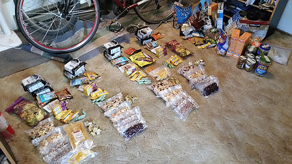 pre-trip. Food! 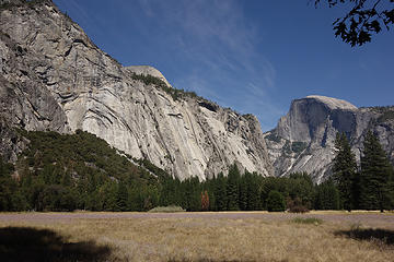 Day 0. Yosemite Valley and Half Dome 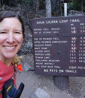 Day 1. Classic trailhead photo 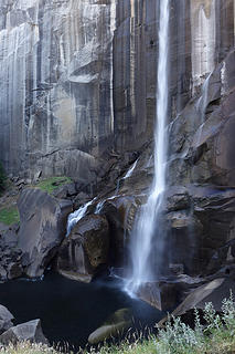 Day 1. Vernal Falls 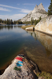 Day 2. Cathedral Lakes swimming pool 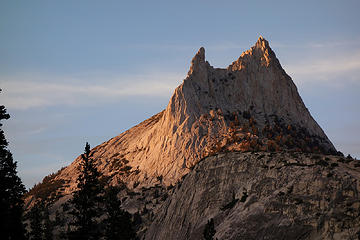 Day 2. Cathedral Peak 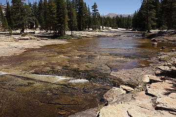 Day 3. Lyell Fork 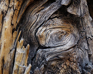 Day 4 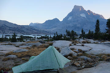 Day 4. Camp at Thousand Island Lakes 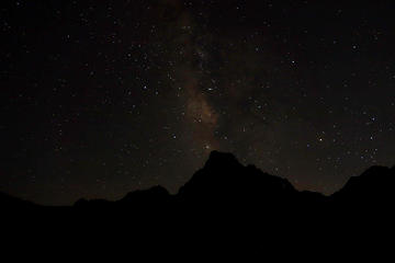 Day 4. Banner Peak starscape 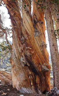 Day 5. The tree triplets 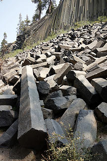 Day 6. Devils Postpile National Monument 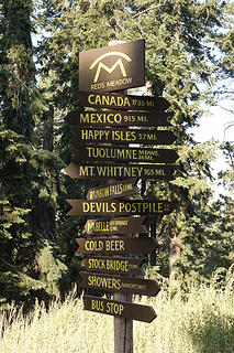 Day 6. Trail sign 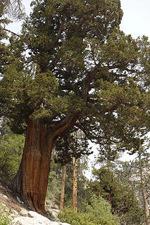 Day 7. I fell in love with juniper trees. 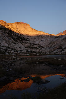 Day 8. Squaw Lake 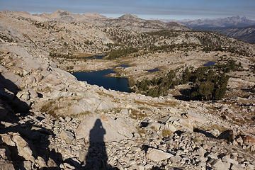 Day 9. Climbing Silver Pass 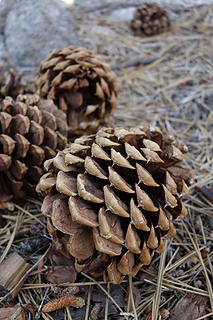 Day 9. Jeffrey Pine cones 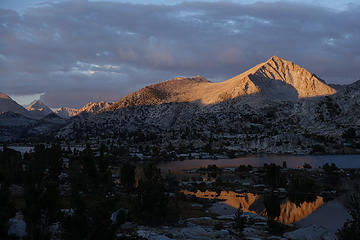 Day 10. Marie Lakes 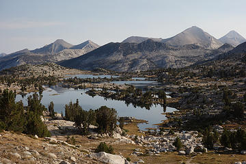 Day 11. Marie Lakes 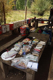 Day 11. Resupply at Muir Trail Ranch, with buckets full of free food 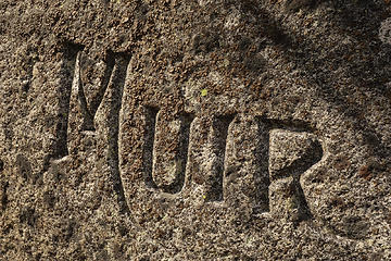 Day 12. graffiti or commemoration? 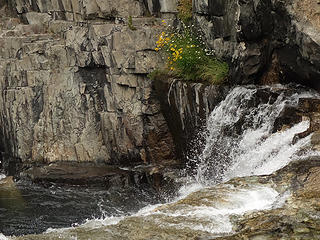 Day 12. Evolution Creek 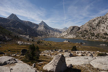 Day 13. Evolution Lake 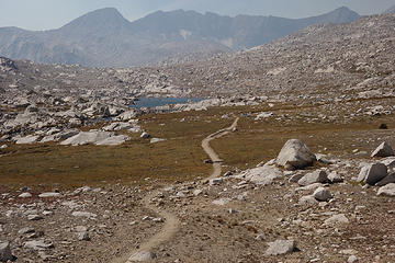 Day 13. On the way to Muir Pass 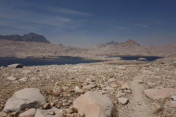 Day 13. Wanda Lake 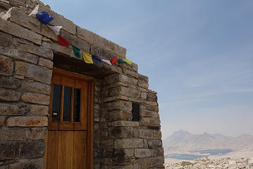 Day 13. 1931 shelter at Muir Pass 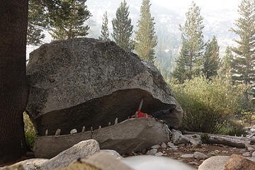 Day 14. Almost swallowed by the whale 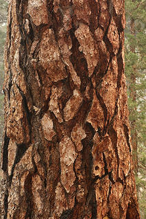 Day 14. Jeffrey Pine or molasses crinkle cookie? 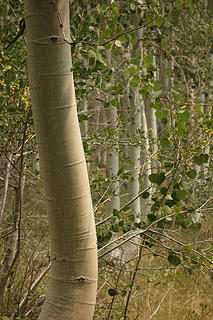 Day 14. Palisade Creek aspens 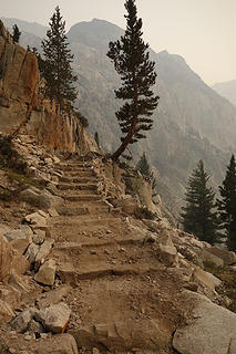 Day 14. The Golden Staircase to Palisade Lakes 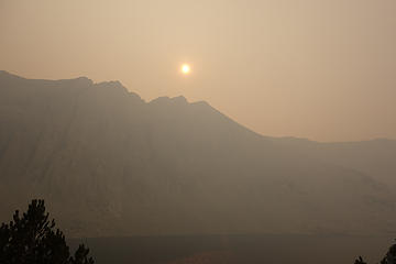 Day 15. Smoky skies near Lake Marjorie 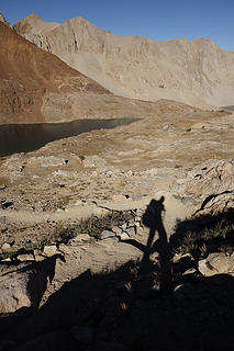 Day 16. Clear skies near Lake Marjorie, climbing to Pinchot Pass 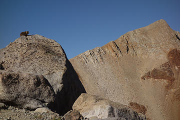 Day 16. Marmot near Pinchot Pass  Day 17. Fresh bear prints near South Baxter Creek 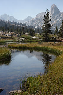 Day 17. Fin Dome 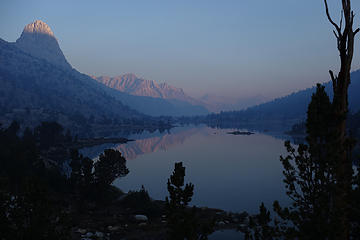 Day 18. Smoky morning at Rae Lakes 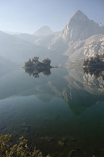 Day 18. Upper Rae Lake 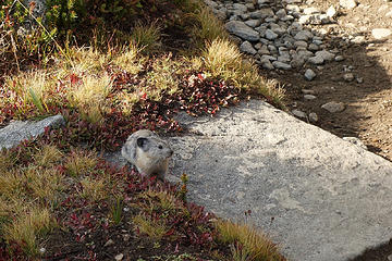 Day 18. Pika below Glen Pass 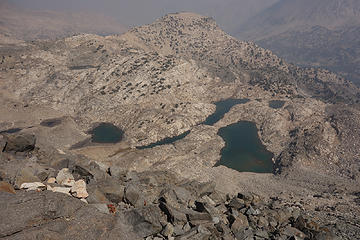 Day 18. View from climb to Glen Pass 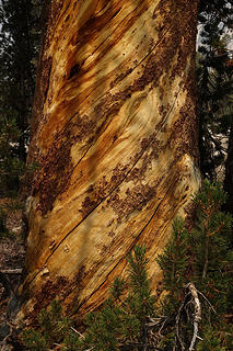 Day 18. I was enchanted by the beauty of the trees. 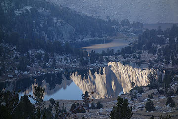 Day 19. Kearsarge Lakes 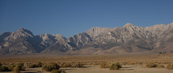 Day 20. View from Independence during resupply 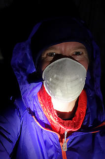 Day 20. My smokiest night, at Vidette Meadow 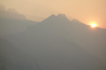 Day 21. I know it looks smoky, but this was exciting. The sun was still yellow at 5. 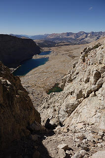 Day 22. View south from Forester Pass 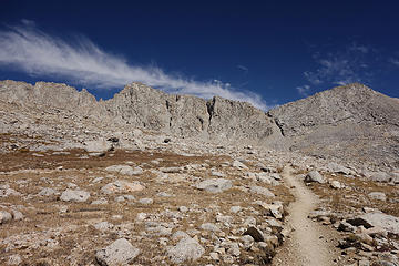 Day 22. Looking back up to Forester Pass  Day 23. Another beautiful tree 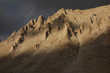 Day 23. Evening light near Guitar Lake 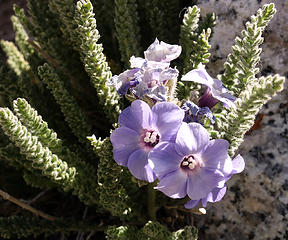 Day 24. 14,000 ft flowers 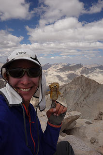 Day 24. Group summit shot 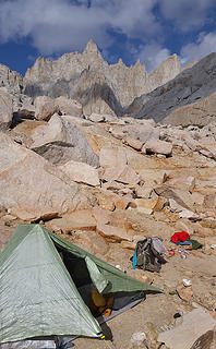 Day 25. Final camp
|
| Back to top |
  
|
|
bobbi
stillaGUAMish

Joined: 13 Jul 2006
Posts: 8012 | TRs | Pics
Location: olympics! |
|
bobbi
stillaGUAMish
|
 Sun Dec 20, 2015 9:49 am |
|
|
congratulations ... absolutely fabulous!  i really enjoyed reading your TR and your lovely photos! glad you got your solo, long distance trek checked off your list.
i especially liked that you were at Thousand Island Lake and Rae Lakes area.
you and i had a similar situation. i was in europe for about 3 weeks, returned back to the US, and promptly got back on a flight to California for the Rae Lakes Loop trek. jet lag was a pain the first day on the trail.
congratulations again!
i really enjoyed reading your TR and your lovely photos! glad you got your solo, long distance trek checked off your list.
i especially liked that you were at Thousand Island Lake and Rae Lakes area.
you and i had a similar situation. i was in europe for about 3 weeks, returned back to the US, and promptly got back on a flight to California for the Rae Lakes Loop trek. jet lag was a pain the first day on the trail.
congratulations again!
bobbi ૐ
"Today is your day! Your mountain is waiting. So
get on your way!" - Oh, the Places Youll Go! By Dr. Seuss
bobbi ૐ
"Today is your day! Your mountain is waiting. So
get on your way!" - Oh, the Places Youll Go! By Dr. Seuss
|
| Back to top |
|
|
RichP
Member

Joined: 13 Jul 2006
Posts: 5634 | TRs | Pics
Location: here |
|
RichP
Member
|
Sun Dec 20, 2015 11:46 am |
|
|
Some great details in your report for those planning to do this hike. It's been somewhere on my list for more than a decade but may have to wait a few years more now that I have a young daughter at home.
|
| Back to top |
|
|
RumiDude
Marmota olympus

Joined: 26 Jul 2009
Posts: 3590 | TRs | Pics
Location: Port Angeles |
|
RumiDude
Marmota olympus
|
Sun Dec 20, 2015 3:23 pm |
|
|
Thank you, thank you, thank you!!!
I may do this next summer but I am planning to go from south to north. I really appreciated the info.
Rumi
"This is my Indian summer ... I'm far more dangerous now, because I don't care at all."
"This is my Indian summer ... I'm far more dangerous now, because I don't care at all."
|
| Back to top |
|
|
Snowdog
Member

Joined: 21 Jul 2006
Posts: 1028 | TRs | Pics
Location: on (& off) the beaten path |
|
Snowdog
Member
|
Mon Dec 21, 2015 10:15 am |
|
|
What a terrific TR!!! Truly excellent.
Thank you for taking the considerable time to write it up so well!  You rock Pam!
'we don't have time for a shortcut'
'we don't have time for a shortcut'
|
| Back to top |
|
|
marydave
Musical Hikers
Joined: 11 Aug 2010
Posts: 182 | TRs | Pics
Location: Seattle |
|
marydave
Musical Hikers
|
Mon Dec 21, 2015 10:35 am |
|
|
Thanks for posting your trail report, and kudos for pushing through the smoky conditions! The JMT is on my must-do-sometime list.
|
| Back to top |
|
|
Malachai Constant
Member

Joined: 13 Jan 2002
Posts: 16092 | TRs | Pics
Location: Back Again Like A Bad Penny |
Nice report, we did the JMT just a bit earlier this summer. Saw the Rough Fire smoke heading our way as we topped Whitney. Probably the second best trip we ever did except for Nepal.
"You do not laugh when you look at the mountains, or when you look at the sea." Lafcadio Hearn
"You do not laugh when you look at the mountains, or when you look at the sea." Lafcadio Hearn
|
| Back to top |
|
|
coldrain108
Thundering Herd

Joined: 05 Aug 2010
Posts: 1858 | TRs | Pics
Location: somewhere over the rainbow |
| sticky buns wrote: | Day 22. View south from Forester Pass |
August 1990
25 years later and not much has changed... 
Since I have no expectations of forgiveness, I don't do it in the first place. That loop hole needs to be closed to everyone.
Since I have no expectations of forgiveness, I don't do it in the first place. That loop hole needs to be closed to everyone.
|
| Back to top |
|
|
John Morrow
Member

Joined: 03 Apr 2007
Posts: 1526 | TRs | Pics
Location: Roslyn |
Been anxiously awaiting this one!!!! Thanks sticky buns. Good reading from the far reaches of Southern New England.
Tell me, what is it you plan to do with your one wild and precious life?-Mary Oliver
A nation that continues year after year to spend more money on military defense than on programs of social uplift is approaching spiritual doom.
― MLK Jr.
Tell me, what is it you plan to do with your one wild and precious life?-Mary Oliver
A nation that continues year after year to spend more money on military defense than on programs of social uplift is approaching spiritual doom.
― MLK Jr.
|
| Back to top |
|
|
olderthanIusedtobe
Member

Joined: 05 Sep 2011
Posts: 7709 | TRs | Pics
Location: Shoreline |
Wonderful TR, thank you for sharing!
|
| Back to top |
|
|
Gabigabs
Trail Breaker

Joined: 07 Nov 2007
Posts: 841 | TRs | Pics
Location: Seattle |
|
Gabigabs
Trail Breaker
|
Wed Dec 30, 2015 9:33 am |
|
|
Nice photography. It's a great trail for intro to long distance backpacking.
Life is simple... Eat, Sleep, Hike!
Life is simple... Eat, Sleep, Hike!
|
| Back to top |
|
|
Brushbuffalo
Member

Joined: 17 Sep 2015
Posts: 1887 | TRs | Pics
Location: there earlier, here now, somewhere later... Bellingham in between |
| sticky buns wrote: | Day 18. Upper Rae Lake |
Congratulations on accomplishing a worthy goal! Exceptionally informative and well-written TR, too.
Of all your fine photos I like this "island suspended between smoke and water" best. It has a mystical feel to it.
Passing rocks and trees like they were standing still
Passing rocks and trees like they were standing still
|
| Back to top |
|
|
LuWeeza
Member

Joined: 24 Jul 2012
Posts: 32 | TRs | Pics
Location: Washington |
|
LuWeeza
Member
|
Sat Apr 30, 2016 3:57 pm |
|
|
Loved your TR!!
Been looking at the JMT and the Sierra Nevadas for some time. Searching out the best adventure, and path for my journey and way of traveling it. I like what you said about, if you like traveling with less people the SN's are big and plenty of less traveled areas can be explored and still get your fix for the area.
Thanks for sharing !!
Psalm 119:105 Your word is a lamp to my feet, and a light to my path.
Psalm 119:105 Your word is a lamp to my feet, and a light to my path.
|
| Back to top |
|
|
wildernessed
viewbagger

Joined: 31 Oct 2004
Posts: 9275 | TRs | Pics
Location: Wenatchee |
I have watched a couple JMT documentaries this last month that looks like a great trip.
Living in the Anthropocene
Living in the Anthropocene
|
| Back to top |
|
|
Sculpin
Member

Joined: 23 Apr 2015
Posts: 1383 | TRs | Pics
|
|
Sculpin
Member
|
Sun May 01, 2016 7:21 am |
|
|
Thanks for the great write-up! You put a lot of work into this.
"Instead of getting stronger through the trip, I felt like I had become inexplicably weaker."
In my experience, that can only be one thing. Were you replacing your electrolytes? Some folks can go 25 days and never worry about it, getting what they need from their food. I am good for about 12 hours. The key clue is you start peeing clear soon after you drink water. I bring powdered Gatorade (the fancy stuff just costs more IMO). Experience has shown that I need real sugar, the fake ones don't succeed in fooling my body into metabolizing the electrolytes.
Between every two pines is a doorway to the new world. - John Muir
Between every two pines is a doorway to the new world. - John Muir
|
| Back to top |
|
|
|
|
You cannot post new topics in this forum
You cannot reply to topics in this forum
You cannot edit your posts in this forum
You cannot delete your posts in this forum
You cannot vote in polls in this forum
|
Disclosure: As an Amazon Associate NWHikers.net earns from qualifying purchases when you use our link(s). |


