| Previous :: Next Topic |
| Author |
Message |
wildernessed
viewbagger


Joined: 31 Oct 2004
Posts: 9275 | TRs | Pics
Location: Wenatchee |
Location : NW of Winthrop, Wa.
Access : Chewuck Rd. > Eightmile Rd. to the end
Stats : 10 mi, 4430' r/t
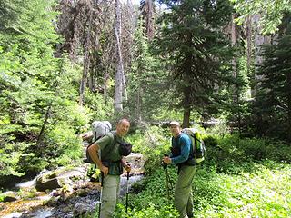
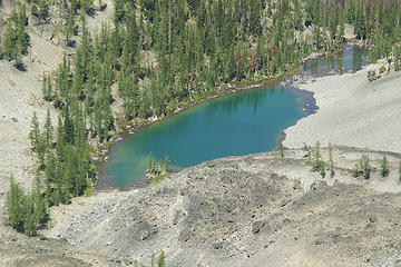
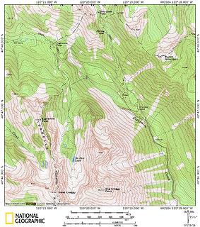 No Dice Lake Area  HMG Triplets. 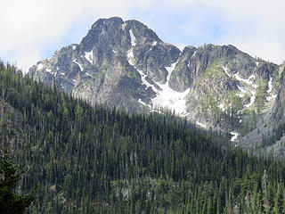 West Craggy 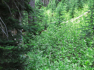 Not a flat or open spot in the drainage before the lake. 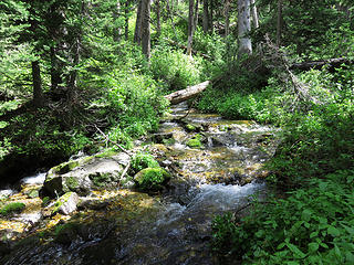 Eightmile Creek 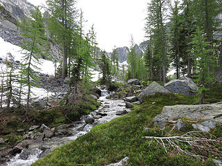 Nice outflow stream. 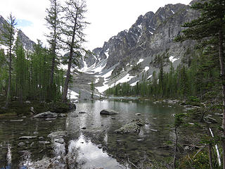 Advancing towards the lake. 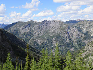 Billy Goat 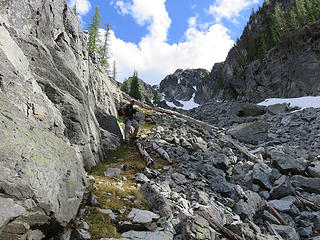 Looking at gully's going up to Eightmile mountain's ridge. 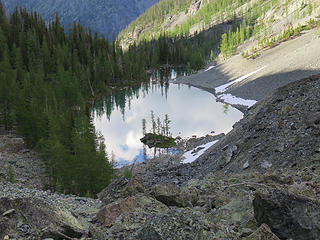 No Dice Lake from the moraine. 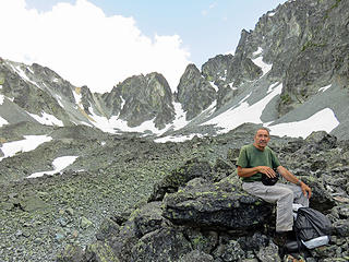 Steve taking a break high on the massive moraine 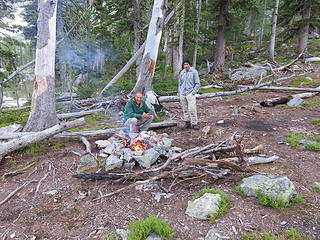 Warming up and drying off. 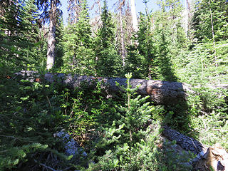 The path less travelled. 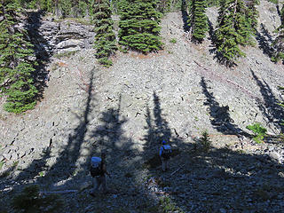 Descending into the gully. 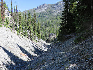 Hiking in the gully the Eightmile Trail is ahead and to the left below the cliff. 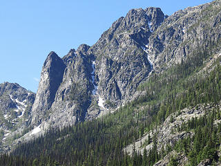 Eightmile Mountain to the right and below the vertical face to the left is the little tarn. 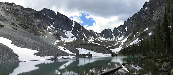 Looking across No Dice Lake and up at the moraine below the Craggies 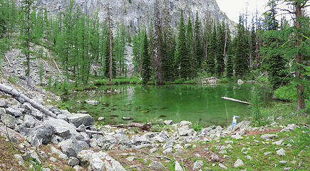 Tarn 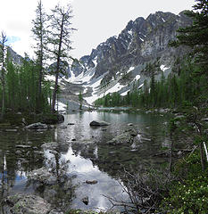 Near the North end of No Dice Lake 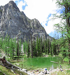 Steve and Hit the Trail at the tarn across from No Dice Lake
Living in the Anthropocene
Living in the Anthropocene
|
| Back to top |
  
|
|
HitTheTrail
Member

Joined: 30 Oct 2007
Posts: 5456 | TRs | Pics
Location: 509 |
Five hours to go 4.5 miles when two of those miles are on the beautifully groomed Eight Mile trail??? No Dice Lake is well named. There has to be a better way in for peak baggers, as for hardcore fisherman
.well I dont know. If you do go be with good companions. I have to admit the lake is one of the more scenic alpine lake basins I have been to in a while. Sort of glad I went. Anyway, its always good to get out with those two guys.
 Leaving the open valley 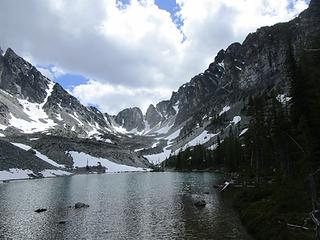 Campsite 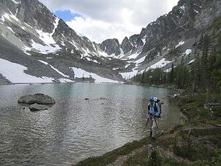 Me at No Dice 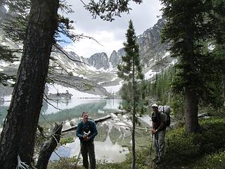 Wildernessed and Steve at No Dice 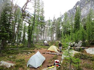 Nice settin 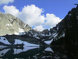 Sun goes down early in the basin 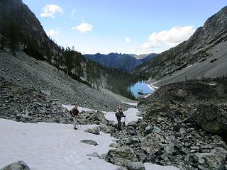 Heading down from the moraine 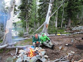 Evening levity 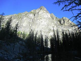 Something my daughter would probably want to climb 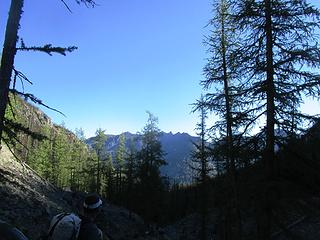 Looking toward Billy Goat Pass 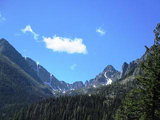 We camped right at the head of the basin
|
| Back to top |
|
|
wildernessed
viewbagger
Joined: 31 Oct 2004
Posts: 9275 | TRs | Pics
Location: Wenatchee |
 No Dice Lake from Big Craggy 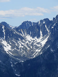 No Dice Lake Basin from Billy Goat summit. 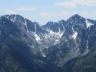 No Dice Lake Basin from Billy Goat summit. 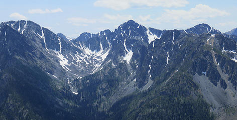 North Craggy - Big Craggy - No Dice Lake Basin - West Craggy - Eightmile Mtn.
Living in the Anthropocene
Living in the Anthropocene
|
| Back to top |
|
|
Distel32
Member

Joined: 03 Jun 2014
Posts: 961 | TRs | Pics
Location: Edmonds, WA |
|
Distel32
Member
|
 Fri Jul 15, 2016 1:23 pm |
|
|
|
| Back to top |
|
|
HitTheTrail
Member
Joined: 30 Oct 2007
Posts: 5456 | TRs | Pics
Location: 509 |
I saw several 1" to 2" minnows darting around the shoreline so they definitely are reproducing. And slightly larger fish were rising all over the lake. We also saw a lot of 6 to 8 inch size in the outlet.
|
| Back to top |
|
|
Backpacker Joe
Blind Hiker

Joined: 16 Dec 2001
Posts: 23956 | TRs | Pics
Location: Cle Elum |
Great trip Wildy. I didnt find any Dice when I went in there either. 
"If destruction be our lot we must ourselves be its author and finisher. As a nation of freemen we must live through all time or die by suicide."
Abraham Lincoln
"If destruction be our lot we must ourselves be its author and finisher. As a nation of freemen we must live through all time or die by suicide."
Abraham Lincoln
|
| Back to top |
|
|
wildernessed
viewbagger
Joined: 31 Oct 2004
Posts: 9275 | TRs | Pics
Location: Wenatchee |
| Backpacker Joe wrote: | | Great trip Wildy. I didnt find any Dice when I went in there either. |
It was a good trip overall, I didn't accomplish everything I wanted but once your back there it is a pretty remote feeling and beautiful. I didn't have or seek any beta so I drew up a path of least resistance and tried to follow it with the aid of the "brain trust". We rolled the dice and won. I have seen several reports of people dropping in from Eightmile, the Big Craggy / North Craggy saddle, and it looks pretty feasible dropping in from the ridge between Big and West Craggy.
Living in the Anthropocene
Living in the Anthropocene
|
| Back to top |
|
|
Get Out and Go
Member

Joined: 13 Nov 2004
Posts: 2128 | TRs | Pics
Location: Leavenworth |
Nice looking lake basin. 
"These are the places you will find me hiding'...These are the places I will always go."
(Down in the Valley by The Head and The Heart)
"Sometimes you're happy. Sometimes you cry.
Half of me is ocean. Half of me is sky."
(Thanks, Tom Petty)
"These are the places you will find me hiding'...These are the places I will always go."
(Down in the Valley by The Head and The Heart)
"Sometimes you're happy. Sometimes you cry.
Half of me is ocean. Half of me is sky."
(Thanks, Tom Petty)
|
| Back to top |
|
|
Bedivere
Why Do Witches Burn?

Joined: 25 Jul 2008
Posts: 7464 | TRs | Pics
Location: The Hermitage |
|
Bedivere
Why Do Witches Burn?
|
Sun Jul 17, 2016 7:01 pm |
|
|
Cool!
That lake has caught my eye on the maps a few times. 
|
| Back to top |
|
|
wildernessed
viewbagger
Joined: 31 Oct 2004
Posts: 9275 | TRs | Pics
Location: Wenatchee |
| Bedivere wrote: | | That lake has caught my eye on the maps a few times. |
Yeah it begs to be explored when you look across from Eightmile Pass, we were up around 7100' when we were looking at gully's to get us up on Eightmile Peak and we found one, but it was steepish, narrow, and full of snow which made it not desirable without an ice axe and crampons which we decided to not bring, but from that higher elevation we could see people out on the edge of the Pass area looking into the basin.
Living in the Anthropocene
Living in the Anthropocene
|
| Back to top |
|
|
|
|


