| Previous :: Next Topic |
| Author |
Message |
Gimpilator
infinity/21M


Joined: 12 Oct 2006
Posts: 1684 | TRs | Pics
Location: Edmonds, WA |
Mayumi and Brent invited me to to join them for a climb of Russian Butte. This peak raised my interest with a reputation for being long, challenging and not often climbed. We were disappointed to discover that the Middle Fork road was blocked by construction just before the Granite Lakes trailhead despite online claims that it would be open. This would make our hike 22 miles instead of the anticipated 18. We started hiking at 4:30am and did not finish until 1:50am.
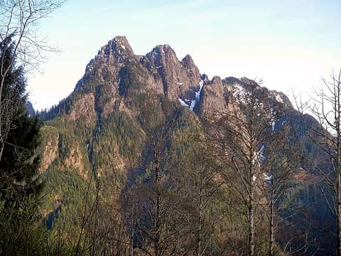 Russian Butte seen from Moolock, April 2014 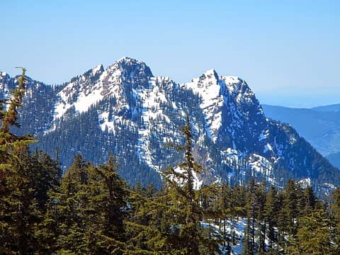 Russian Butte seen from Preacher Mountain, April 2014 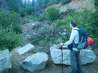 Thompson Point "trail" 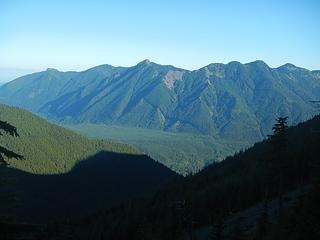 Si, Teneriffe, Green 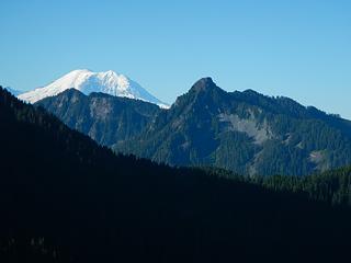 Rainier, Kent, McClellan 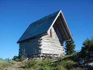 Thompson Point cabin 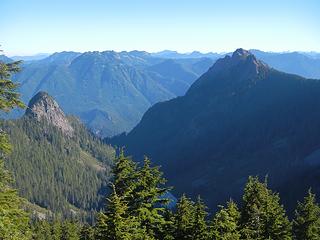 "Little Comrade" and Russian Butte 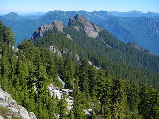 Russian Butte 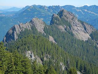 a closer view 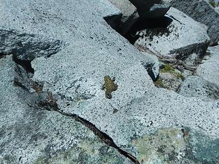 we saw a lot of these 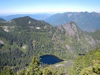 Gifford Lakes 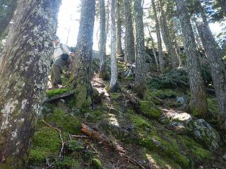 along the ridge 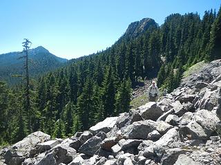 traversing below the east face with Revolution in the background 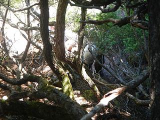 trees at the top of the gully 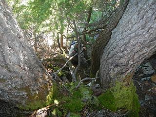 almost out 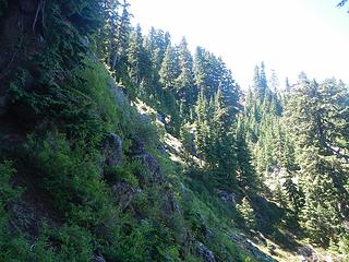 steep heather and minor cliffs on the northeast face 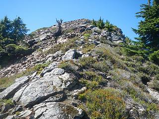 summit visible 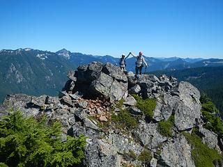 triumphant 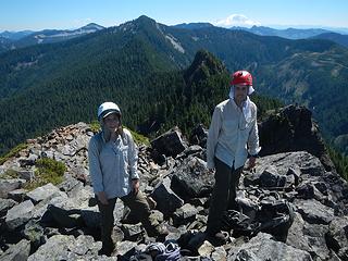 stoked 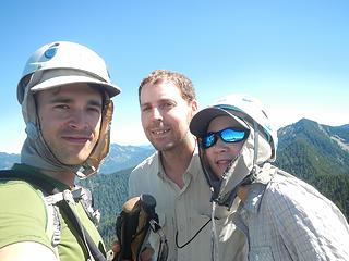 summit 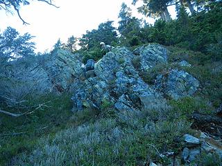 cliff band scramble 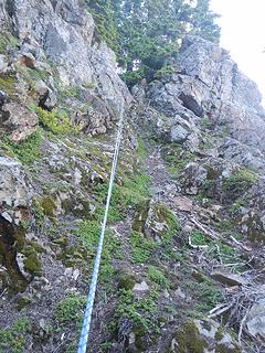 after rappelling 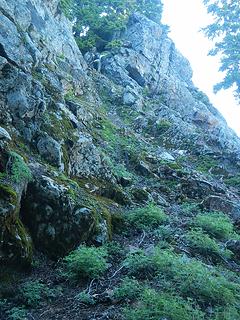 Brent scrambles the gully 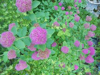 these smell good 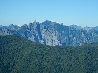 Garfield 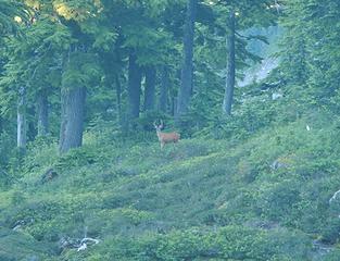 watching us 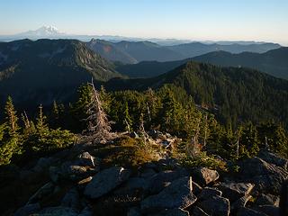 Revolution summit 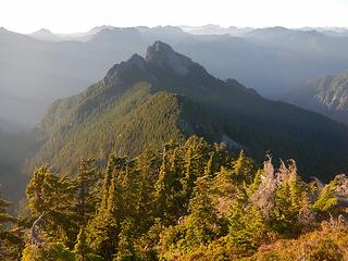 a last look at Russian Butte 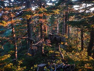 nice light 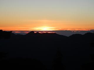 sunset 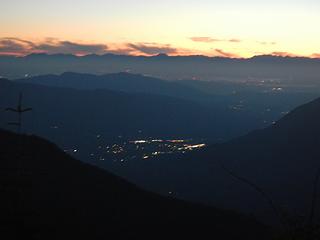 lights in the cities
|
| Back to top |
  
|
|
Mike Collins
Member

Joined: 18 Dec 2001
Posts: 3097 | TRs | Pics
|
Strong work on one of the more challenging for routefinding Homecourt Peaks. The Dreisbach route has danger. I ascended that very exposed route but descended to the Pratt River for my exit and then forded the Middle Fork. You guys took the scenic route. My total time for Russian Butte was under ten hours via Gifford Creek in the shortened October days. I took Gifford Creek until ~2,200 and exiting when a cairn appeared on the left.
|
| Back to top |
|
|
Fletcher
Member

Joined: 29 Jul 2009
Posts: 1870 | TRs | Pics
Location: kirkland |
|
Fletcher
Member
|
 Mon Jul 25, 2016 3:38 pm |
|
|
Damn... And I thought our 18+ hour day last week was long..
|
| Back to top |
|
|
Yana
Hater

Joined: 04 Jun 2004
Posts: 4212 | TRs | Pics
Location: Out Hating |
|
Yana
Hater
|
Mon Jul 25, 2016 4:32 pm |
|
|
That is a long one indeed. dicey and I did it in the spring some years ago - I think snow makes a lot of the terrain a lot more manageable/accessible, and the going faster. But you don't ever have to go back now. 
PLAY SAFE! SKI ONLY IN CLOCKWISE DIRECTION! LET'S ALL HAVE FUN TOGETHER!
PLAY SAFE! SKI ONLY IN CLOCKWISE DIRECTION! LET'S ALL HAVE FUN TOGETHER!
|
| Back to top |
|
|
puzzlr
Mid Fork Rocks

Joined: 13 Feb 2007
Posts: 7220 | TRs | Pics
Location: Stuck in the middle |
|
puzzlr
Mid Fork Rocks
|
Mon Jul 25, 2016 4:44 pm |
|
|
22 hours  . Perhaps your partners should sign an indemnity waiver at the trailhead (just kidding). Your experience and that of others doing this in one day confirms that for me it was the right choice to overnight at Thompson Point on the way in. It was still a really long day starting there.
When I went up last year I was really disappointed to not find the old register in a glass jar. I looked for it for almost 30 minutes before giving up. This peak is climbed so rarely that it's hard to believe someone who got all that way would destroy an original register, assuming someone did. Anyway, I'm glad to see the new one is being signed by such deserving climbers.
I must have found an easier way up through those cliff bands on the NE side because I only had one spot with a 6 foot step with never any thought that I'd need a rope. But it is a little complicated in there -- I gained the summit ridge well north of the high point. . Perhaps your partners should sign an indemnity waiver at the trailhead (just kidding). Your experience and that of others doing this in one day confirms that for me it was the right choice to overnight at Thompson Point on the way in. It was still a really long day starting there.
When I went up last year I was really disappointed to not find the old register in a glass jar. I looked for it for almost 30 minutes before giving up. This peak is climbed so rarely that it's hard to believe someone who got all that way would destroy an original register, assuming someone did. Anyway, I'm glad to see the new one is being signed by such deserving climbers.
I must have found an easier way up through those cliff bands on the NE side because I only had one spot with a 6 foot step with never any thought that I'd need a rope. But it is a little complicated in there -- I gained the summit ridge well north of the high point.
|
| Back to top |
|
|
fernweh
Member
Joined: 16 Sep 2013
Posts: 2 | TRs | Pics
|
|
fernweh
Member
|
Tue Jul 26, 2016 1:02 am |
|
|
Excellent trip report as always.
Thank you for helping us find the way to the summit of Russian Butte!
It truly was a suffer fest, and I am still tired.
Here is the gps track of the day for now. Pictures to come later, sleep now.
gps track Russian Butte
In an attempted to add to this trip report.
Water, last water source is not long after the Thompson Lake trail junction. There are very few and small snow blocks left on the NE slopes of Revolution.
Bugs! They are far worse in the area between Revolution and Russian Butte than about anyplace I have been to in the PNW. misquitoes, biting knats, horese flies.
https://goo.gl/photos/BdbfBafZqdkwPhcy7
"try not, do or do not" Yoda
"try not, do or do not" Yoda
|
| Back to top |
|
|
awilsondc
Member

Joined: 03 Apr 2016
Posts: 1324 | TRs | Pics
|
Wow, that is a looooooong day! Nice work on such a rarely climbed summit! 
|
| Back to top |
|
|
Brushbuffalo
Member

Joined: 17 Sep 2015
Posts: 1887 | TRs | Pics
Location: there earlier, here now, somewhere later... Bellingham in between |
Impressive work! An ultra day 
Thompson Point cabin
Passing rocks and trees like they were standing still
Passing rocks and trees like they were standing still
|
| Back to top |
|
|
Hikerdood
Member
Joined: 09 May 2016
Posts: 108 | TRs | Pics
Location: Bothell, Wa. |
The cabin was built in the 90's. Just recently sold to DNR. They are trying to figure out what to do with it. I have been there numerous times now.
It used to have a very nice roof on it, which half of it is now down the side of the mountain. With the roof like it is now, it can only be a matter of time before the environment destroys it...
|
| Back to top |
|
|
Hikerdood
Member
Joined: 09 May 2016
Posts: 108 | TRs | Pics
Location: Bothell, Wa. |
|
| Back to top |
|
|
Brushbuffalo
Member
Joined: 17 Sep 2015
Posts: 1887 | TRs | Pics
Location: there earlier, here now, somewhere later... Bellingham in between |
Thanks for the info, hikerdood.
( dumb question but I assume you mean the 1890s?)
Passing rocks and trees like they were standing still
Passing rocks and trees like they were standing still
|
| Back to top |
|
|
puzzlr
Mid Fork Rocks
Joined: 13 Feb 2007
Posts: 7220 | TRs | Pics
Location: Stuck in the middle |
|
puzzlr
Mid Fork Rocks
|
Tue Jul 26, 2016 8:51 pm |
|
|
No, 1990s, fairly recent. Forterra bought it but plans to turn it over to the DNR. Many inholders have a troubled history with the DNR so won't sell to them directly. I really need to write up what I've learned about this cabin on my website. It keeps coming up over and over. I doubt it will be there for too many more years -- it doesn't make sense any more without road access -- maintenance is impossible.
|
| Back to top |
|
|
mayumi
Member
Joined: 14 Apr 2011
Posts: 4 | TRs | Pics
|
|
mayumi
Member
|
Thu Jul 28, 2016 12:20 am |
|
|
Thanks again Gimpilator. We enjoyed all that Type 2 fun. My muscles have recovered but I'm still covered in itchy bug bites.
After looking at the pictures one more time, it appears you entered the wrong date in the summit register - you entered August 24 instead of July 24. Did you do that intentionally so that we'd have a reason to go back, to correct it? Brent is already planning the next trip out there. I think I would sit that one out 
|
| Back to top |
|
|
RichP
Member

Joined: 13 Jul 2006
Posts: 5634 | TRs | Pics
Location: here |
|
RichP
Member
|
Thu Jul 28, 2016 9:24 am |
|
|
Congratulations on getting that one. Sometimes the little peaks are the ones that kick your butt.
I like Monty's idea of camping on the ridge if I ever get out there.
|
| Back to top |
|
|
Mark Hadland
#thehad

Joined: 30 Jun 2018
Posts: 50 | TRs | Pics
Location: Seattle |
Super report and thanks for the detailed writeup and photos! Amazing push for a single day. Having just gone up Revolution Peak in snow, thoughts and any research or info on Russian Butte in Winter? Some of the ALW and HC100 Peaks seem more manageable with good snow cover.
cheers,
Mark
|
| Back to top |
|
|
|
|


