| Previous :: Next Topic |
| Author |
Message |
cartman
Member


Joined: 20 Feb 2007
Posts: 2800 | TRs | Pics
Location: Fremont |
|
cartman
Member
|
 Mon Aug 22, 2016 10:03 am |
|
|
A few years ago, Eric E. (raising3hikers) was recovering from an injury--after taking impromptu flying lessons from a golf cart, of all things--and put together a very accurate list of Washington's Top 500 Peaks with 400' of clean prominence.
Being intrigued by certain peak lists even if I have no intention of ever completing them since they often give good leads for interesting places to go, I started keeping track of which of the Top 500 I'd done and concentrating a bit on doing more of them. Incidentally, the lowest peak on the Top 500 is at 7177'.
This weekend, Tyler (christensent) joined me to do a little bit of a milestone, my 250th Washington Top 500 summit.
(Edit: I initially wrote the report with limited info for others to guess which summit, but that was guessed fairly early - see below, so I've rewritten the report.)
I'd been up to Hawkeye on a great trip last August after climbing Old Snowy and Ives with Dustin. Last Monday, Jeff H. invited me to come on a day trip to Hawkeye Point in the Goat Rocks via the Berry Patch Trail and I thought just maybe I'd be able to run over to my namesake peak, Johnson Pk. I gave it a shot, but ran out of time due to distance and terrain. So this weekend I resolved to give it another go, but this time from the west.
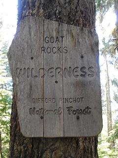
Tyler and I drove down to the Lily Basin TH at the west end of the Goat Rocks, elevation 4200'. The roads are in quite good shape as there is active logging just outside the Wilderness boundary.
The trail is also in fine shape the entire way, starting in decent forest and almost immediately enters the Goat Rocks Wilderness.
 Into the Goat Rocks 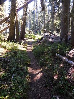 Nice forest trail 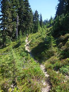 Ridge trail 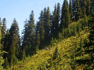 More ridge traversing 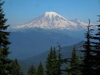 First Rainier view 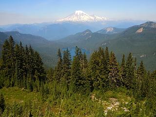 Rainier and Packwood Lake 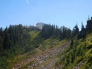 Peek-a-Peak 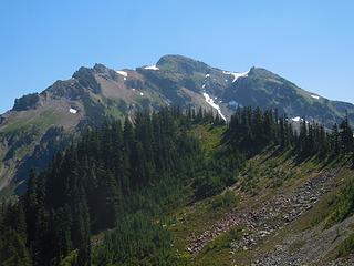 Our Mountain 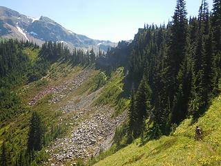 Trail to pass 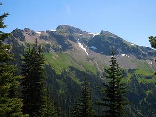 Peak from the other side of pass 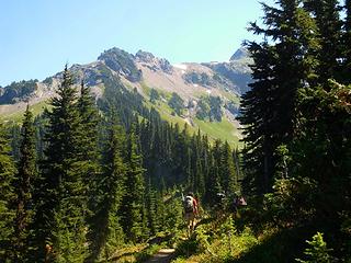 Continuing on 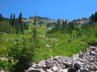 Off trail start 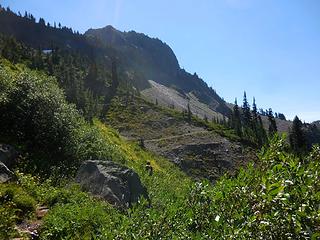 Trail below 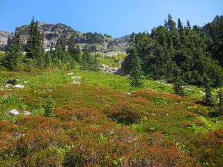 Up meadows 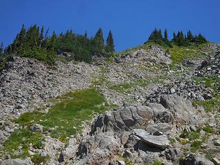 Meadow choss 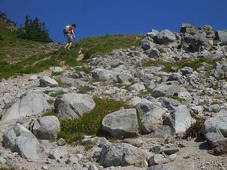 Easier terrain on top of ridge 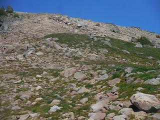 Upper slopes 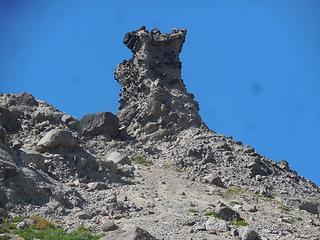 Gendarme 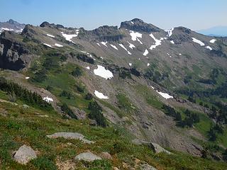 Neighbors 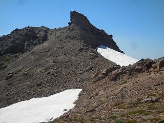 Same gendarme, different view 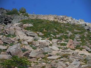 Nearing the summit 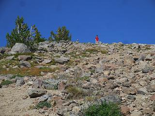 Tyler at the top 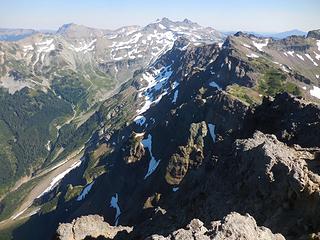 Summit view 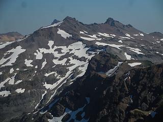 Old Snowy, Ives 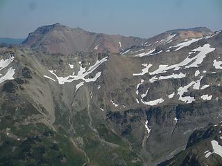 Tieton 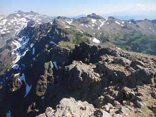 Old Snowy, Ives, Hawkeye, Adams 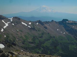 Adams haze 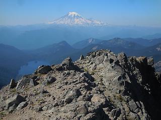 Rainier 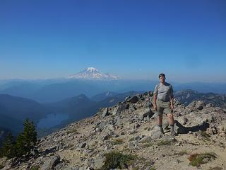 Johnson on Johnson 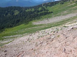 West side basin 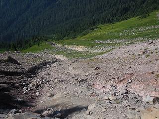 Choss drop 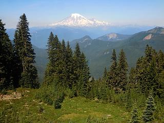 Rainier 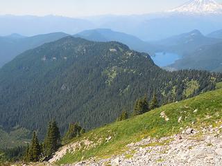 Ridge approach 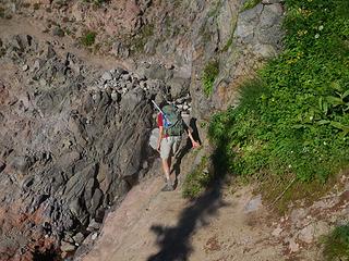 Trail crux 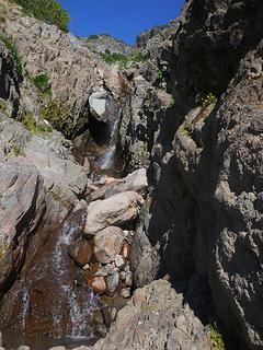 Trail falls and pool 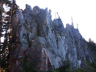 Trail crag 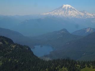 Rainier, Packwood Lake
|
| Back to top |
  
|
|
Gimpilator
infinity/21M

Joined: 12 Oct 2006
Posts: 1684 | TRs | Pics
Location: Edmonds, WA |
|
| Back to top |
|
|
reststep
Member
Joined: 17 Dec 2001
Posts: 4757 | TRs | Pics
|
|
reststep
Member
|
Mon Aug 22, 2016 11:47 am |
|
|
"The mountains are calling and I must go." - John Muir
|
| Back to top |
|
|
cartman
Member
Joined: 20 Feb 2007
Posts: 2800 | TRs | Pics
Location: Fremont |
|
cartman
Member
|
Mon Aug 22, 2016 11:53 am |
|
|
Yep--obviously, should have requested anyone who'd done it to DQ themselves, otherwise that was too easy.
|
| Back to top |
|
|
Gimpilator
infinity/21M
Joined: 12 Oct 2006
Posts: 1684 | TRs | Pics
Location: Edmonds, WA |
I have not done Johnson, nor did the photo of goat hair help me narrow it down to the Goat Rocks. But the summit photo of Old Snowy, Ives, and Tieton gave it away.
|
| Back to top |
|
|
Jetlag
Member
Joined: 17 Aug 2010
Posts: 1410 | TRs | Pics
|
|
Jetlag
Member
|
Mon Aug 22, 2016 12:04 pm |
|
|
Good TR, Eric, from an area I haven't visited in some time.
Half of the top 500 now climbed - not too shabby!
|
| Back to top |
|
|
cartman
Member
Joined: 20 Feb 2007
Posts: 2800 | TRs | Pics
Location: Fremont |
|
cartman
Member
|
Mon Aug 22, 2016 12:05 pm |
|
|
| Gimpilator wrote: | | I have not done Johnson, nor did the photo of goat hair help me narrow it down to the Goat Rocks. But the summit photo of Old Snowy, Ives, and Tieton gave it away. |
Good call. I thought about leaving that picture out, but figured I had to include some sort of summit shot to not make it too hard. Thought maybe the angle would make it less obvious.
|
| Back to top |
|
|
Brushbuffalo
Member

Joined: 17 Sep 2015
Posts: 1887 | TRs | Pics
Location: there earlier, here now, somewhere later... Bellingham in between |
Wait, was this a "guess the peak?" What am I missing.....you identified it, Eric. 
Passing rocks and trees like they were standing still
Passing rocks and trees like they were standing still
|
| Back to top |
|
|
cartman
Member
Joined: 20 Feb 2007
Posts: 2800 | TRs | Pics
Location: Fremont |
|
cartman
Member
|
Mon Aug 22, 2016 12:29 pm |
|
|
I initially wrote the report with limited info and pics for others to guess which summit, but that was guessed quickly, so I wrote the complete report as promised.
Should have anticipated that would be confusing--next time, separate threads!
|
| Back to top |
|
|
Brushbuffalo
Member
Joined: 17 Sep 2015
Posts: 1887 | TRs | Pics
Location: there earlier, here now, somewhere later... Bellingham in between |
Got it. Thanks for the clarification.
Keep us guessing! Fun.
Passing rocks and trees like they were standing still
Passing rocks and trees like they were standing still
|
| Back to top |
|
|
raising3hikers
Member
Joined: 21 Sep 2007
Posts: 2344 | TRs | Pics
Location: Edmonds, Wa |
nice going  half way done, time to go get the other 250! half way done, time to go get the other 250!
|
| Back to top |
|
|
ejain
Member

Joined: 27 Apr 2009
Posts: 1498 | TRs | Pics
Location: Seattle, WA |
|
ejain
Member
|
Mon Aug 22, 2016 6:34 pm |
|
|
|
| Back to top |
|
|
christensent
Member

Joined: 05 Nov 2011
Posts: 658 | TRs | Pics
|
Correct, the road contained only a half dozen potholes and could be traveled in any vehicle with ease and speed.
Learning mountaineering: 10% technical knowledge, 90% learning how to eat
Learning mountaineering: 10% technical knowledge, 90% learning how to eat
|
| Back to top |
|
|
Yana
Hater

Joined: 04 Jun 2004
Posts: 4212 | TRs | Pics
Location: Out Hating |
|
Yana
Hater
|
Tue Aug 23, 2016 12:42 pm |
|
|
And where might one find this list?
PLAY SAFE! SKI ONLY IN CLOCKWISE DIRECTION! LET'S ALL HAVE FUN TOGETHER!
PLAY SAFE! SKI ONLY IN CLOCKWISE DIRECTION! LET'S ALL HAVE FUN TOGETHER!
|
| Back to top |
|
|
Magellan
Brutally Handsome

Joined: 26 Jul 2006
Posts: 13116 | TRs | Pics
Location: Inexorable descent |
|
Magellan
Brutally Handsome
|
Tue Aug 23, 2016 3:14 pm |
|
|
| Yana wrote: | | And where might one find this list? |

|
| Back to top |
|
|
|
|
You cannot post new topics in this forum
You cannot reply to topics in this forum
You cannot edit your posts in this forum
You cannot delete your posts in this forum
You cannot vote in polls in this forum
|
Disclosure: As an Amazon Associate NWHikers.net earns from qualifying purchases when you use our link(s). |


