| Previous :: Next Topic |
| Author |
Message |
ChinookPass
Member


Joined: 21 Aug 2009
Posts: 145 | TRs | Pics
|
| Quote: | | Trip report of the year! up.gif up.gif Thanks for taking the time to write it up. |
Ditto. Inspiring stuff there.
|
| Back to top |
  
|
|
Nancyann
Member

Joined: 28 Jul 2013
Posts: 2319 | TRs | Pics
Location: Sultan Basin |
|
Nancyann
Member
|
 Tue Sep 06, 2016 7:51 pm |
|
|
Beautiful, mesmerizing trip report. Makes me want to go there next year. Heads up to my hiking partners! 
|
| Back to top |
|
|
andrewskurka
Member
Joined: 07 Sep 2016
Posts: 2 | TRs | Pics
Location: Boulder, CO |
Nice trip report. I think it's fantastic that you took some existing routes and mixed-and-matched them to get something that works best for you.
A few questions and comments, if you'd be willing.
1. You climbed Wind River Peak as an out-and-back. I assume you wanted to avoid the West Gully, and maybe didn't want to commit to the extra miles of Coon Lake Pass. Did the out-and-back feel weird, and would you do this section of the route again?
2. Mentioned the possibility of walking the Divide north of Wind River Peak. Just for fun, or you think it's the best route available? Seems like a lot of up and down to me, and additional exposed terrain.
3. Why did you follow the Divide to Hay Pass, rather than dropping down earlier towards Golden Lakes?
4. Really like your alternate to Alpine Lakes. That stretch is rather austere, whereas Shangri La Lakes looks to be more of that Sound of Music terrain that you get in the upper North Fork. Counter-intuitively, the route across the flat looks friendlier than the lower route following the drainage to the west. Will have to check that out -- Alpine Lakes is a liability.
5. I concur with your comments about the North Fork. It's at least as good as Titcomb, and it feels more special because fewer people get back there.
6. The "trail" as you descend to the North Fork from "the notch" is too good to be a use trail. Forrest McCarthy had an interesting post a few years ago about Indian-built trails in the Indian Pass area. They were probably responsible for this one, too. http://forrestmccarthy.blogspot.com/2012/09/wind-river-range-indian-pass.html
7. Good call on bailing at Dinwoody Creek. I know it's a long walk out, but it's much better than getting pinned down by bad weather up on the Divide. That final section really only goes in good weather. You can't force it.
|
| Back to top |
|
|
Cascade Dan
Member

Joined: 24 Sep 2003
Posts: 35 | TRs | Pics
Location: Seattle, WA |
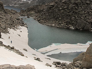
Re #4 We went west thru what is called Hellroaring Creek, Hellroaring Lake then a pass N and NW to Shangri La. Where the minister was trapped for 13 days . Better than Alpine Lakes we figured. Hit steep hard snow north of Hellroaring Lake, ice axes and crampons helped us out, depends on timing and the year. Did not see anyone for 8 or so days.
|
| Back to top |
|
|
Earthbound
Member
Joined: 25 Oct 2008
Posts: 16 | TRs | Pics
|
| andrewskurka wrote: | | Nice trip report. I think it's fantastic that you took some existing routes and mixed-and-matched them to get something that works best for you.
A few questions and comments, if you'd be willing. |
Hey Andrew. Good questions. My answers follow:
1. Ice Lakes trail was beautiful, and the North Fork Trail into the Cirque was scenic as well, although a little too crowded for my taste. The out and back on Wind River Peak was fine. Short side climb so retracing steps on descent no big deal.
Coon Lake Pass not appealing as I did Temple Pass and Little Sandy creek on CDT. I wanted to see new stuff on this trip. But given the beauty of Temple Pass, I think this may be a really good route - maybe the best route.
West Gully route would have been an option for us, but midway through day 1 we decided energy expenditure of full pack climb over Wind River Peak would not be super enjoyable with our heavy packs. If one has the energy, I suspect West Gully route would be quite scenic, although I have never done it. Just some loose rock to deal with in the gully eh?
Our itinerary for day 1 and 2 was actually flexible, depending on how our bodies were feeling from heavy packs and altitude. Best case scenario would have had us heading over Wind River Peak with full packs, and headed north along the divide from there, but it was not to be. Planning these trips during winter cabin fever, I sometimes imagine I can do more than my body can handle.  2. Yes, would have been a lot of up and down, and with heavy packs. Given our lack of acclimatization this early in trip, we decided fun/suffering ratio too low to do this high traverse. The thought was to follow divide over Big Sandy Mountain and descend class 2 ramp near Dog Tooth into Lizard Meadows. Would have been epic, but better to do at end of trip with light packs.
3. Didn't notice that option for a shortcut to Golden Lakes. Guess I should've bought your route description. Still, enjoyed seeing the lakes near Hay Pass.
4. Yes, I looked at route over what Nancy calls "Bloody Hell Pass", and felt it was a lot like the route past Alpine Lakes. The Goat Friendly High Route, in contrast, was very pleasant and scenic walking, although it is also significantly longer than the other options.
5. Love that area of upper north fork bull lake creek. And titcomb is sublime as well, especially views of upper titcomb area while climbing Fremont - talk about sound of music!
6. Agree too good to be a use trail. My thought was that NOLS groups built it, but your link is fascinating. Thanks for that.
7. Agreed. And it gives me an excuse to do a long trip exploring northern section that includes climb of Gannet next year. There is a lot to see in this section of the Winds.
Take care Andrew. Thanks for inspiring us all with your adventures!
2. Yes, would have been a lot of up and down, and with heavy packs. Given our lack of acclimatization this early in trip, we decided fun/suffering ratio too low to do this high traverse. The thought was to follow divide over Big Sandy Mountain and descend class 2 ramp near Dog Tooth into Lizard Meadows. Would have been epic, but better to do at end of trip with light packs.
3. Didn't notice that option for a shortcut to Golden Lakes. Guess I should've bought your route description. Still, enjoyed seeing the lakes near Hay Pass.
4. Yes, I looked at route over what Nancy calls "Bloody Hell Pass", and felt it was a lot like the route past Alpine Lakes. The Goat Friendly High Route, in contrast, was very pleasant and scenic walking, although it is also significantly longer than the other options.
5. Love that area of upper north fork bull lake creek. And titcomb is sublime as well, especially views of upper titcomb area while climbing Fremont - talk about sound of music!
6. Agree too good to be a use trail. My thought was that NOLS groups built it, but your link is fascinating. Thanks for that.
7. Agreed. And it gives me an excuse to do a long trip exploring northern section that includes climb of Gannet next year. There is a lot to see in this section of the Winds.
Take care Andrew. Thanks for inspiring us all with your adventures!
|
| Back to top |
|
|
Earthbound
Member
Joined: 25 Oct 2008
Posts: 16 | TRs | Pics
|
| Cascade Dan wrote: | | Re #4 We went west thru what is called Hellroaring Creek, Hellroaring Lake then a pass N and NW to Shangri La. Where the minister was trapped for 13 days . Better than Alpine Lakes we figured. Hit steep hard snow north of Hellroaring Lake, ice axes and crampons helped us out, depends on timing and the year. Did not see anyone for 8 or so days. |
Did you notice any of the big, loose boulders that Nancy Pallister warns about around that Pass Dan? Was the Hellroaring Creek drainage scenic?
|
| Back to top |
|
|
Cascade Dan
Member
Joined: 24 Sep 2003
Posts: 35 | TRs | Pics
Location: Seattle, WA |
We had lots of hard snow, boulders at the outlet, not really loose down there, no more than expected.
|
| Back to top |
|
|
Cascade Dan
Member
Joined: 24 Sep 2003
Posts: 35 | TRs | Pics
Location: Seattle, WA |
 Wind River Hike 2009
|
| Back to top |
|
|
kenbee
Member

Joined: 15 Nov 2010
Posts: 104 | TRs | Pics
Location: seattle |
|
kenbee
Member
|
Fri Sep 09, 2016 12:42 am |
|
|
Great report and pics from an amazing place! I just got back from an 11-day solo in the northern Winds (trip report coming if I ever get it together)--the wildest, remotest, and most breathtaking terrain I've ever been in. The part of the CD you missed at the north end is stunning, but it sounds like you made a good decision...and nothing can detract from the rest of your accomplishment. Bravo...
|
| Back to top |
|
|
Earthbound
Member
Joined: 25 Oct 2008
Posts: 16 | TRs | Pics
|
| kenbee wrote: | | Great report and pics from an amazing place! I just got back from an 11-day solo in the northern Winds (trip report coming if I ever get it together)--the wildest, remotest, and most breathtaking terrain I've ever been in. The part of the CD you missed at the north end is stunning, but it sounds like you made a good decision...and nothing can detract from the rest of your accomplishment. Bravo... |
Totally looking forward to your trip report. I'm excited to explore northern section next year, so I am curious about your trip.
|
| Back to top |
|
|
thunderhead
Member
Joined: 14 Oct 2015
Posts: 1519 | TRs | Pics
|
Well that looks amazing. Gotta get to the winds. Thanks for the writeup and the inspiration!
|
| Back to top |
|
|
Sourstraw
Member

Joined: 09 Oct 2008
Posts: 154 | TRs | Pics
|
Awesome! My husband and I completed the high route this summer as well! We did the Wind River Peak/Cirque section last summer (prior to even knowing that the high route existed), so we skipped that bit, and went from Skull Lake to Trail Lakes Trailhead, about 80 miles. What an awesome trip. I'm writing about it on my blog (anastasiaallison.com), but I need to share a trip report here as well. I'm definitely a Wind River addict for life!
|
| Back to top |
|
|
Cascade Dan
Member
Joined: 24 Sep 2003
Posts: 35 | TRs | Pics
Location: Seattle, WA |
We always purchase the license/permit before going on Reservation Lands, for the last 25 years at least.
|
| Back to top |
|
|
Earthbound
Member
Joined: 25 Oct 2008
Posts: 16 | TRs | Pics
|
|
| Back to top |
|
|
Cascade Dan
Member
Joined: 24 Sep 2003
Posts: 35 | TRs | Pics
Location: Seattle, WA |
|
| Back to top |
|
|
|
|


