| Previous :: Next Topic |
| Author |
Message |
kenbee
Member


Joined: 15 Nov 2010
Posts: 104 | TRs | Pics
Location: seattle |
|
kenbee
Member
|
 Tue Sep 13, 2016 7:04 pm |
|
|
I just returned a couple of weeks ago from a hike that ranks as the trip of a lifetime: an 11-day, largely off-trail solo backpack through some of the wildest and remotest parts of the northern Wind River Range of Wyoming. It was my 61st birthday presentor dareto myself, and it was simply one of the most incredible experiences Ive ever had!
My usual summer hiking partner David and I have been to the Winds twice now in the past few years. In 2012 we did a 10 day loop in the central part of the range, taking in Titcomb Basin, Indian Basin, and some off-trail rambling along the Continental Divide near there. The next year, we decided to do the route in this report, but fire near the trailhead forced us at the last minute into an equally rewarding Plan B in the southern part of the range. This year, with David in Europe, I had my chance to take care of unfinished business as well as reconnect with the rewards of an extended solo.
I started at the Green River Lakes trailhead. Unlike the several parties heading south at the same time, I went north from there on the Highland Trail (also the CD Trail at this point, even though it avoids the Divide), crossing over into the Roaring Fork, which I followed east up into the high country. That led to Crescent Lake, and then south through unworldly terrain just this side of the Continental Divide: Daphne Lake, Bear Lake, Bear Basin, Kevin and Connie Lakes, and then up onto the Divide to continue south to Baker Lake. From there I worked back west, gradually descending down to Golden Lakes, Elbow Lake No. 2, and over Lost Eagle Peak and White Rock back down to the Highland Trail, for a final leg north back to the trailhead.
Im not particularly interested in numbers when I go out, so I dont know what my pack weighedit was lighter than I would have expected, since I got bitten by a bit of ultralight bug as I was prepping for this
thankfully! Ive never used a GPS, so I dont have an accurate breakdown of mileage and elevation gain, eitherI do know the total miles werent as impressive as 11 days might imply, as it was an adventurous route done at a wimpy pace: short days, early camps, and in this case, two layover camps. I like to think of it as thorough-hiking, as opposed to thru-hiking. I find it more satisfying, and my body likes it, too!
The first 2 days, and the last half of the last day, were on good trail. Everything in between was off-trail, on a loop that I pieced together mostly from Nancy Pallisters excellent guidebook to off-trail ramblings in the Winds, along with various tidbits from the internet and maps. I had my first and only encounter with other humans on the 10th daya group of 4 hunters. Prior to that, I saw a moose (in the first 2 hours of the trip), probable bear scat, deer, a coyote, numerous bighorn sheep, tons of marmots, pikas and other critters, 2 weasels, various raptors
and a wolverine! Best of all, a grand total of about 5 mosquitos (and only one bite, for which the sucker payed dearly).
The weather was perfect
as in made-to-order. Mostly bright and sunny, with enough drama and bluster to keep it interesting at times, and a couple of days of classic mid-afternoon hail/sleet/snow to remind me of where I was at. The only rain I encountered while hiking came in the last 15 minutes of the last day. Every night was crystal clear, with the Milky Way and every star in the sky on full display. I had 2 or 3 memorable sunsets, and the last days sunrise had me wondering if the Archangel Michael was about to descend for a chat.
Once in a blue moon, if were lucky, we have a trip that unfolds as this one didwhere virtually everything falls into place just perfectly and each decision turns out to be the right one. This trip moved the bar for meIve done longer trips with partners, Ive done an equally long solo (this one was the follow-up to it that Ive intended to do for the 30 years since), and Ive done things that incorporated elements of this trip
but Ive never done anything that put it all together like this. It was a trip without highlightsthe entire thing was a never-ending spectacle, from start to finish!
Anyway
an accounting:
On Sunday, August 21, after a 2-day drive from Seattle, I rattled my way up the long washboard road along the Green River, to the Green River Lakes campground and trailhead. My excitement at finally doing this was tempered by plenty of anxiety
Id never done a solo quite this adventurous, and my insecurities were out in forcemostly concerns over whether I could physically do it
and hyper-awareness that I was in grizzly country. It didnt help that I had washed down my big lunch in Pinedale with a couple of beers, which tends to not be a good thing on ones first day at altitude.
That night at the campground was surprisingly cold, but clear and beautiful, with several coyote choruses throughout the night to serenade me. I slept little, and fitfully, as is usual. The next morning I got up and immediately got down to the business of trying to rationalize a reason to bailthis would be a recurring theme for the next 2 or 3 days!
Nevertheless, I packed up, drove over to the trailhead, signed the register, fought the urge to flee, and set off down the trail. Between the parking lot and the fork in the trail below, I encountered more people (a half dozen) than I would the rest of the trip. They all headed south on the Highland Trail, and I headed north, towards the Roaring Fork (as good a name for a river as there ever was).
It was hot and sunny, and the trail was clear and easy to follow as it gradually angled up the ridge above the Green River valley. Views were magnificent, and the whole scene was classic western, complete with sagebrush and abandoned log cabin. As I expected, the anxieties and butterflies started to give way a bit to the reality of feet on the ground.
The trail moved up into groves of aspen and conifers (much yelling and babbling on my part to keep the grizzlies alert), and 2 hours in I had my first wildlife encounter: a moose grazing a few feet off the trail up ahead. I passed through the burn zone from the 2013 fire that kept David and I from doing this that year.
Surprisingly, the trail crosses the Roaring Fork on a nice, substantial bridge. I was under the impression that the trail to this point was spotty, and afterwards was unmaintained and probably more spotty. Not at all
the entire route to Crescent Lake was clear and easy to follow. Spent the first night tucked away in the woods a couple of miles up Roaring Fork.
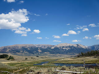 Near the end of the long, rough road up to Green River Lakes trailhead. 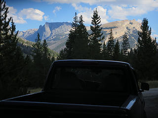 My truck's view from the pre-hike campsite. 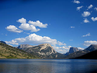 The famous Squaretop Mountain, with White Rock to its left. My trip ended with a descent from the top of White Rock...with a stunning side view of Squaretop. 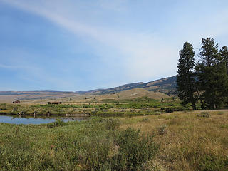 The beginning of the hike, heading north towards the Roaring Fork. 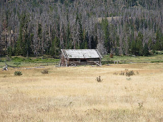 Upper Green River valley 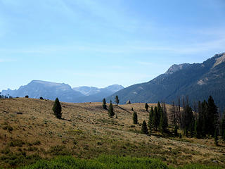 Upper Green River valley 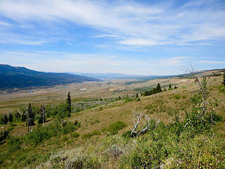 Upper Green River valley 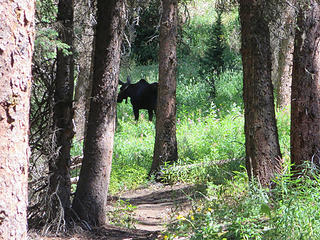 First wildlife sighting...2 hours into the trip. 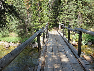 I was happily surprised to find a bridge here...the unmaintained trail on the other side was in excellent shape the rest of the way to Crescent Lake. 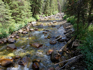 Roaring Fork 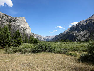 Roaring Fork valley 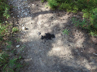 Suspicious... 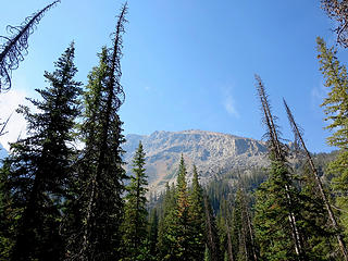 The north side of Osborn Mountain. 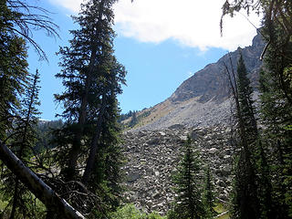 The end of river hiking, and the start of the climb up the outlet stream of Crescent Lake. 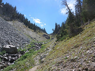 The last, steep section approaching Crescent Lake. 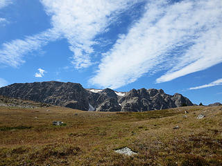 Osborn Mountain 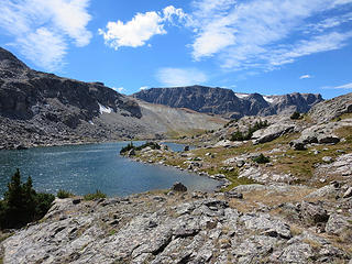 Elevation 10,739 ft. 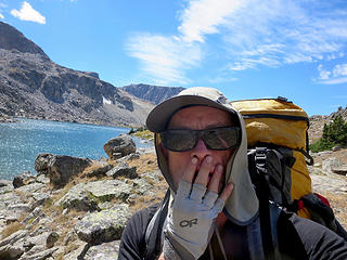 Gasping at the splendor, and at the little hand in my sunglasses. 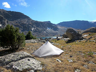 The pod docked for a couple of nights. 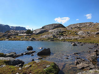 Crescent Lake 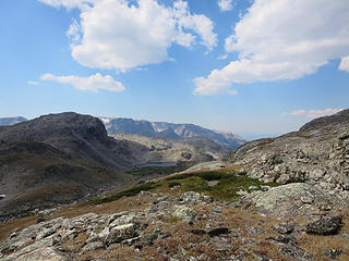 Looking back down into the Roaring Fork headwaters 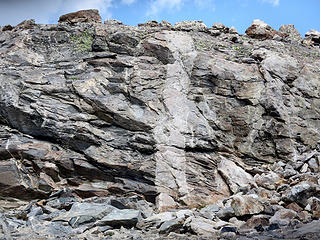 Upper Crescent Lake drainage 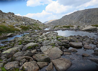 Upper Crescent Lake drainage 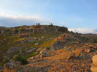 Alpenglow, the second afternoon at Crescent Lake. 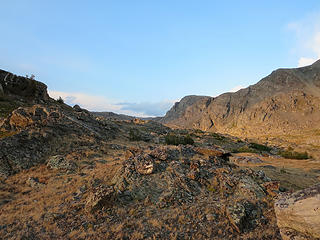 Crescent Lake 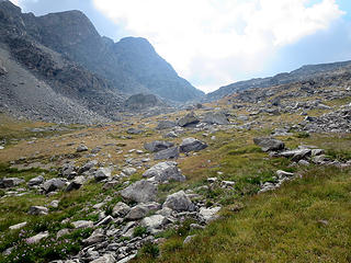 Beginning of the off-trail trek to Daphne Lake, day 4. 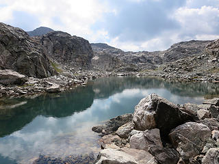 Tarn above Crescent Lake 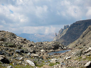 The spires of Osborn Mountain. 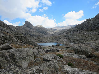 Between Crescent and Daphne Lakes 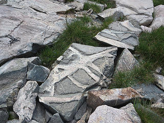 Between Crescent and Daphne Lakes 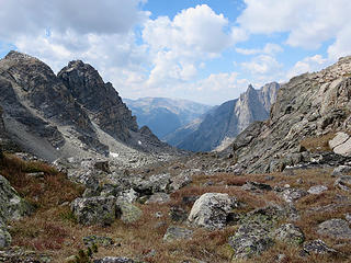 Between Crescent and Daphne Lakes 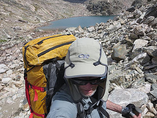 Between Crescent and Daphne Lakes 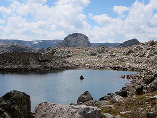 Between Crescent and Daphne Lakes 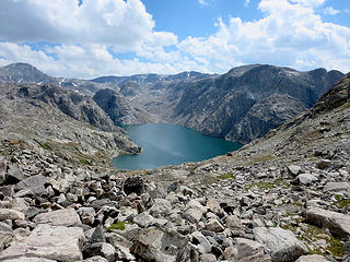 The first stunning view of Bear Lake, at the beginning of the traverse over to Daphne Lake.  Osborn Mountain crags, as a brief hailstorm moves in. 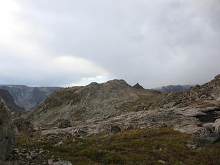 Light shows during my brief hail/sleet showers. 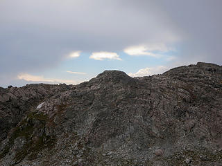 Daphne Lake outlet 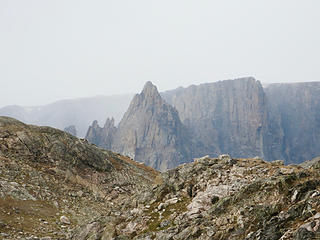 Yes, it's Mordor. 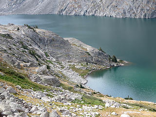 There is a bald eagle on top of the lakeside bush, lower right corner. 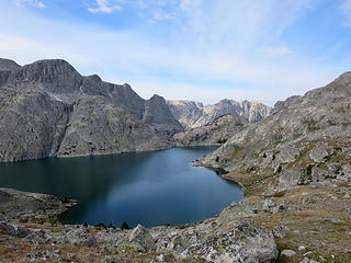 The traverse above Bear Lake, going to Bear Basin. 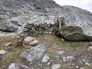 Unexpected architecture.  Bear Basin 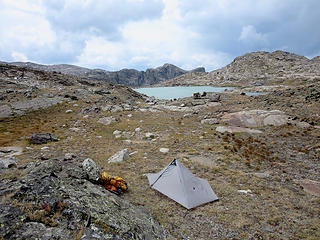 Camp number 4, out on the peninsula of Rocking Horse Lake. 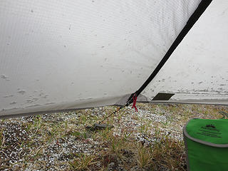 The afternoon hailstorm. 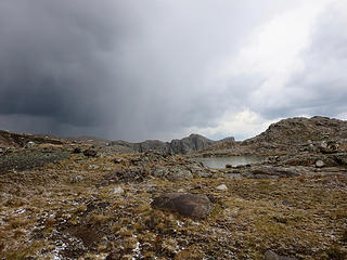 Bear Basin 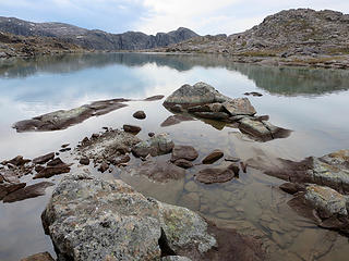 View towards the outlet of Rocking Horse Lake. 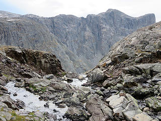 Outlet of Rocking Horse Lake, entering the abyss down into Bear Lake. 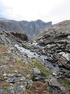 Bear Basin 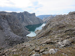 The southern end of Bear Lake, from above the outlet of Rocking Horse Lake. 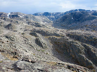 View of tomorrow's hike...an incredible valley of meadows, granite and cascades between lower Bear Basin and Kevin Lake. 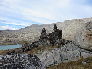 Bear Basin  Bear Basin 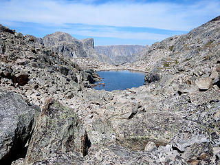 Leaving Bear Basin for Kevin Lake, one encounters this nightmarish tarn...cliffs on the left, endless talus on the right, and car-sized boulders in between. I chose the cliffs... 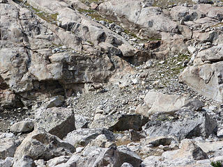 Look closely at the center... 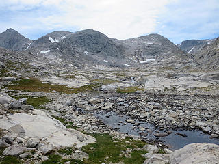 Photos cannot capture how awe-inspiring this hidden valley is. 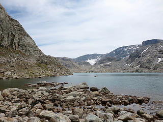 Lower Kevin Lake 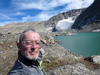 Upper Kevin Lake and Connie Glacier 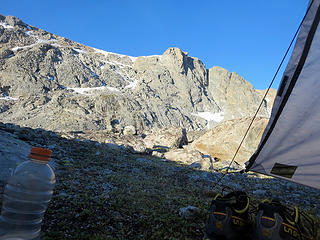 A very chilly, windy and beautiful campsite. 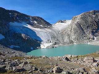 The slopes above the Connie Glacier and lakes, heading up to the Continental Divide. 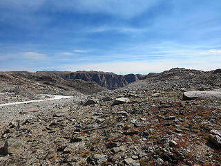 First glimpse of the eastern half of the continent. 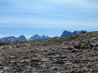 View south over the slopes of Yukon Peak to the peaks of the crest. The big snow patch on the right horizon is Gannett Peak, highest point in Wyoming. 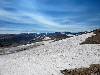 Snow slopes on side of Yukon Peak. 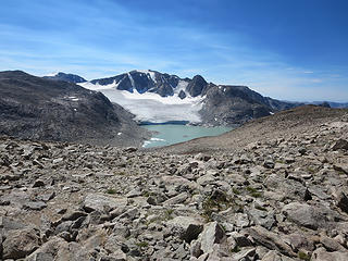 Klondike Peak, Sourdough Glacier, and Iceberg Lake. 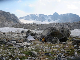 Camp number 6...just above Baker Lake with Klondike Peak and Sourdough Glacier in the background. 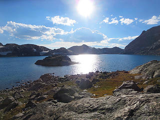 Baker Lake 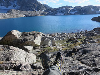 Baker Lake 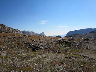 The beginning of an amazing day-hike, on the saddle above Baker Lake, looking east. 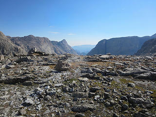 Approaching the astonishing view looking down Grasshopper Creek. 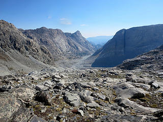 Grasshopper Creek 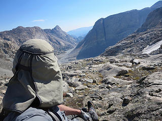 Context, again... 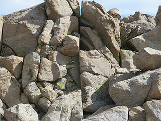 Continental Divide 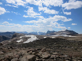 Continental Divide 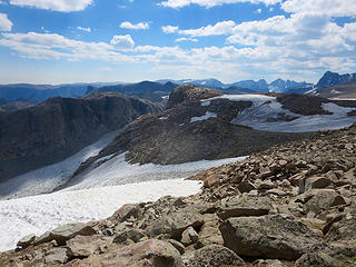 Upper reaches of the Grasshopper Glacier. 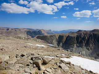 Continental Divide 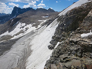 Cliffs above the Grasshopper, Gannett, and Dunwoody Glacier area. 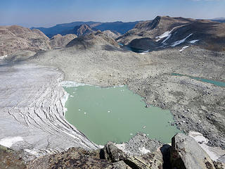 Viewed from the top of sheer cliffs, hundreds of feet above the glacier. 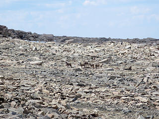 Another sheep herd on the slopes of Pedestal Peak 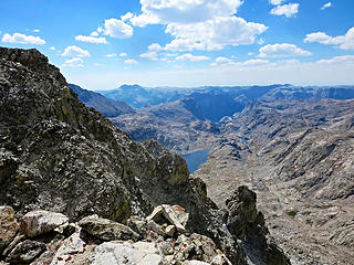 Tourist Creek headwaters 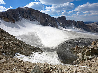 Sourdough Glacier 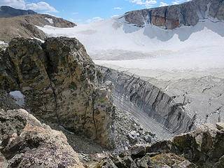 Sourdough Glacier 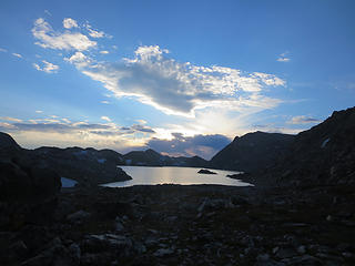 Baker Lake 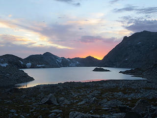 Baker Lake 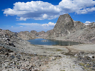 Part of the arduous, complex moonscape between Baker Lake and Golden Lakes. 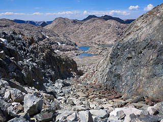 One of several boulder chutes to navigate along the route. 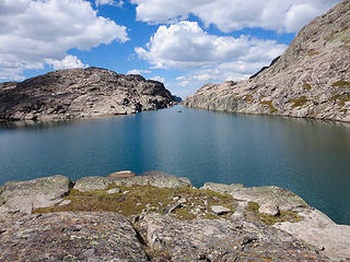 Lake 11,440 with its amazing infinity pool, dropping over a thousand feet into the headwaters of Slide Creek. 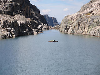 Between Baker and Golden Lakes 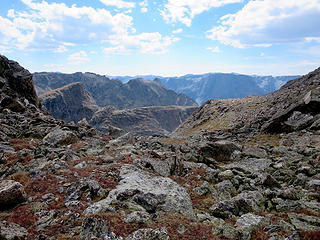 Between Baker and Golden Lakes 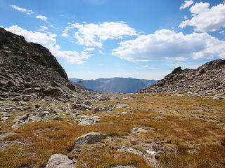 On the plateau above the Golden Lakes, looking towards the top of the 700+ ft. talus descent to Lower Golden Lake. 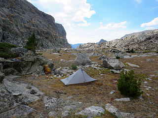 Campsite 7, on the island (accessible with nimble feet) in the middle of the lake. 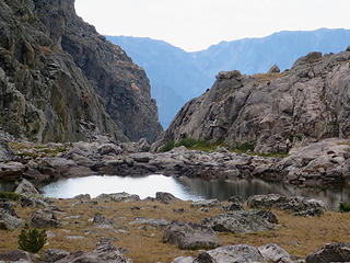 Lower Golden Lake 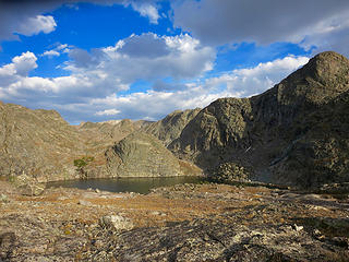 Late afternoon light explains the name of these lakes (the upper 2 of which are inaccessible from this one). 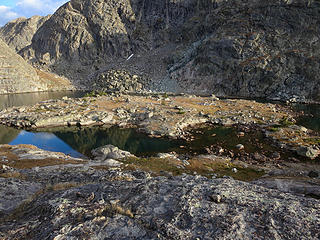 Scale is deceptive: my tarp is a tiny silver triangle near the upper center edge of the island. 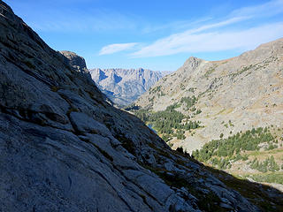 From the bench above Golden Lakes, looking down Elbow Creek towards the Green River. 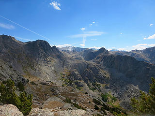 Looking across the headwaters of Elbow Creek at the hanging valley of the 3 Golden Lakes, hidden behind the cliffs in the center of the photo. The J Glacier is in the background. 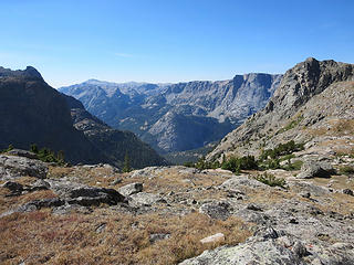 The upper Green River valley. 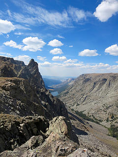 Lost Eagle Peak on the left, Slide Lake down below, and Green River Lakes (and my trailhead) off in the distance. 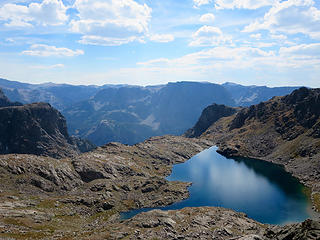 Too small to see, my camp is on the bench separating the lake from the canyon below. 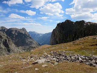 Above Elbow Lake No. 2 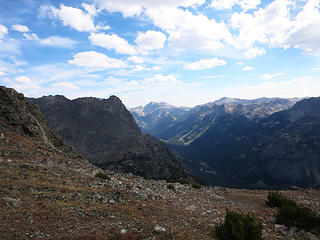 Above Elbow Lake No. 2 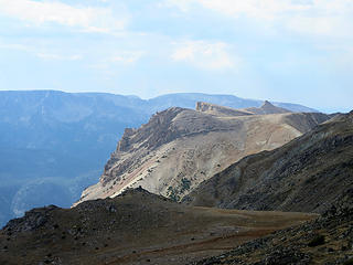 Tomorrow's route...final leg back to the trailhead. 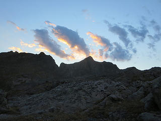 Last sunset begins. 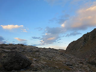 Last sunset. 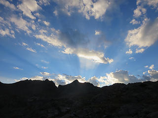 Last sunRISE, the next morning. 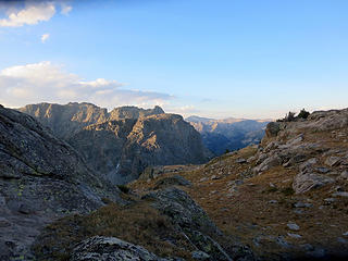 Last sunrise. 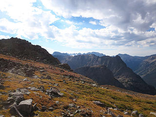 Final day, traversing from Lost Eagle Peak towards White Rock. 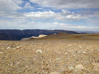 Although called a "Peak", it's more of a vast plateau. White Rock is lit in the background. 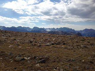 One of the last views of the high country. 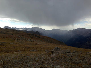 After days of stunning clear weather, a storm moves in during my final few hours out. 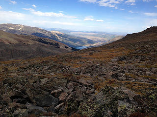 Another view down towards the Green River Lakes and my lonely truck. 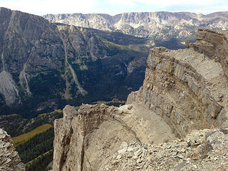 View of the Green River valley from above the cliffs of White Rock 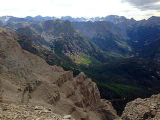 The headwaters of the Green River from the top of the White Rock cliffs. 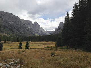 Down in the valley, on maintained trails, for the first time in 8 days. 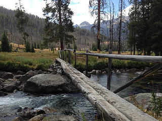 Clear Creek 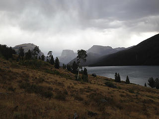 The first time I get actually rained on, during the last 15 minutes of an 11-day trip! 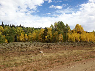 Meanwhile, on the drive back down the Green River valley, the Fall colors have exploded and are at their peak--on Sept. 1. 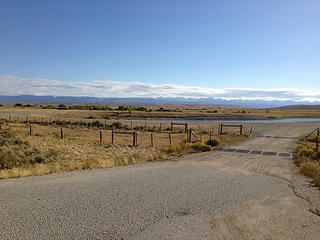 At this point, I cranked up The Modern Lovers' "Roadrunner," and headed home...
|
| Back to top |
  
|
|
meck
Member

Joined: 31 Dec 2010
Posts: 920 | TRs | Pics
|
|
meck
Member
|
Tue Sep 13, 2016 8:32 pm |
|
|
Wow Kenbee! That looks like it was one great trip! Thank you for sharing your photos and narrative (really enjoyed vicariously "tagging along" for the journey). I really enjoyed all of those photos, that's some gorgeous terrain. Does that area (at least the "trailed" area) get a lot of visitors?
*Just say NO to Rent-Seeking, don't give up the concept of "ownership"*
*Just say NO to Rent-Seeking, don't give up the concept of "ownership"*
|
| Back to top |
|
|
kenbee
Member
Joined: 15 Nov 2010
Posts: 104 | TRs | Pics
Location: seattle |
|
kenbee
Member
|
Tue Sep 13, 2016 9:00 pm |
|
|
Thanks, Meck! In answer to your question: even though I saw almost no one, the Highline Trail going south from Green River Lakes is one of the main routes along the entire length of the range, so it apparently does get lots of traffic. I was only on that part for a short time my last day, and my timing was just right for not seeing anyone. I doubt that many head north from there as I did, other than thru-hikers doing the CDT.
|
| Back to top |
|
|
Earthbound
Member
Joined: 25 Oct 2008
Posts: 16 | TRs | Pics
|
What a great trip and trip report! I love how you shared your doubts and fears. We all go through that, but few of us have the guts to publicly admit it. Bravo! I also love how you took your time and savored the scenery. I'm really trying to get myself to slow down like this as well, and your trip is an inspiration for the kind of travel I want to be doing more of. I also love the route you took. Many of the areas you visited are places I also want to explore next year. Thanks for sharing Kenbee!
|
| Back to top |
|
|
Distel32
Member
Joined: 03 Jun 2014
Posts: 961 | TRs | Pics
Location: Edmonds, WA |
|
Distel32
Member
|
Wed Sep 14, 2016 6:32 am |
|
|
Nice 
|
| Back to top |
|
|
Bugs
Member
Joined: 02 May 2016
Posts: 140 | TRs | Pics
Location: Redmond |
|
Bugs
Member
|
Thu Sep 15, 2016 8:28 am |
|
|
Very nice! Thank you for the pictures.
A friend and I spent a month in there one August many years ago.
On the second to last night, a storm dumped three feet of powder snow and continued as a blizzard the next day. We plowed out through the wind and white-outs and finally got low enough to be out of the snow.
Love that place!
|
| Back to top |
|
|
Sourstraw
Member

Joined: 09 Oct 2008
Posts: 154 | TRs | Pics
|
Awesome trip - I think my husband and I actually saw you camped at Baker Lake! We completed the Wind River High Route, and we actually were coming down the granite slabs just above Iceberg Lake Pass and we saw a solo hiker walking past the tarn at the pass. I recognize your tent as well. We filled up our water bottles at that little tarn and then headed up the hill on the other side to get back up to the divide (ultimately, we climbed Downs Mountain that day, camped at the bottom of Downs and then hiked out to Trails Lake Trailhead the following day).
I'm writing about our trip on my blog (anastasiaallison.com). This was our 2nd summer in the Winds and it is pretty much amazing!!
|
| Back to top |
|
|
topshot
Member
Joined: 29 Jul 2017
Posts: 3 | TRs | Pics
|
|
topshot
Member
|
Sat Jul 29, 2017 1:45 pm |
|
|
| Quote: | | My original plan (and one of the reasons I planned this route the way I did) was to follow the ridge line of White Rock all the way down until it dropped onto the Highline Trail, alongside the lower Green River Lake. That would take me along the tops of the cliffs that overlook Squaretop Mountain and the entire Green River headwaters. Alas, that had to be abandoned, as there was one spot at the top that would have involved a bit of at least class 3 climbingin reality it was probably easy enough, but with a pack and 10 days of unbroken good fortune, I really didnt want to screw up on the last day. |
Nice report. This was nearly the reverse of the same route I did about a week earlier. I went up Tourist Creek and out over Osborn Mtn. This year I was planning on going up your original way down (along the ridgeline of White Rock), so was wondering if you could expound upon where you found this class 3+ section and why you perceived it to be that difficult (or a picture if you have one). I like your little island campsite, too!
|
| Back to top |
|
|
Mtngirl717
wanderwoman

Joined: 05 May 2015
Posts: 101 | TRs | Pics
|
 WOW, love trips like these, thanks for sharing! WOW, love trips like these, thanks for sharing!
What is it you plan to do with your one wild and precious life?
-Mary Oliver
What is it you plan to do with your one wild and precious life?
-Mary Oliver
|
| Back to top |
|
|
kenbee
Member
Joined: 15 Nov 2010
Posts: 104 | TRs | Pics
Location: seattle |
|
kenbee
Member
|
Sun Jul 30, 2017 11:23 am |
|
|
Hi Topshot! Thanks...and, in retrospect, I'm not sure the spot I described was as daunting I thought at the time. I was in the final stretch of 11 days, and was pretty tired and was getting pretty conservative, I think. But for the record, if you look at a topo, the high point of the ridge is a point 11284 and further along to the SE is another point 11246--that is the one that stopped me. And the higher one looked even more intimidating from what I could tell. From the map it looks like you just skirt both of them to the east, but it looked too steep and loose. However, I don't know what it would be like coming up--I do know from The Google that people have ascended that way. I would love to hear a report if you try it!
And, if all goes well, I will be back this year (for the eclipse atop the continental divide!) doing a 12-day point-to-point from Elkhart to Green Lakes, coming down Tourist Creek...many intersecting paths in the Winds!
And thanks, too, Mtngirl717!
|
| Back to top |
|
|
Matt Lemke
High on the Outdoors

Joined: 15 Jul 2010
Posts: 2052 | TRs | Pics
Location: Grand Junction |
|
Matt Lemke
High on the Outdoors
|
Sun Jul 30, 2017 3:26 pm |
|
|
Oh The memories. ..I Did much of the same route, just climbing up downs mountain and pedestal peak in 2011. Bear basin was a lifechanging experience. Absolutely loved that place
|
| Back to top |
|
|
topshot
Member
Joined: 29 Jul 2017
Posts: 3 | TRs | Pics
|
|
topshot
Member
|
Sun Jul 30, 2017 6:13 pm |
|
|
I can likely handle that part of the ridge. I'll definitely give it a go. I'll be there for the eclipse as well. If you want to see a small taste for Tourist Creek drainage you can watch the first portion of my trip report that you can find at my Youtube page. Looks to be from 1:30 (Green River) to 6:20 (pass). Of course, it will look quite different coming down.
|
| Back to top |
|
|
kenbee
Member
Joined: 15 Nov 2010
Posts: 104 | TRs | Pics
Location: seattle |
|
kenbee
Member
|
Mon Jul 31, 2017 10:54 pm |
|
|
I've read your report on that trip many times, Matt...it was a big inspiration for the trip I reported here!
And I've enjoyed your videos Topshot many a time, as well!
|
| Back to top |
|
|
topshot
Member
Joined: 29 Jul 2017
Posts: 3 | TRs | Pics
|
|
topshot
Member
|
Tue Aug 01, 2017 8:13 pm |
|
|
11 days is a fair bit of food. Do you use a pair of Ursacks? I think I could fit 8 into one.
|
| Back to top |
|
|
|
|
You cannot post new topics in this forum
You cannot reply to topics in this forum
You cannot edit your posts in this forum
You cannot delete your posts in this forum
You cannot vote in polls in this forum
|
Disclosure: As an Amazon Associate NWHikers.net earns from qualifying purchases when you use our link(s). |


