| Previous :: Next Topic |
| Author |
Message |
neek
Member


Joined: 12 Sep 2011
Posts: 2338 | TRs | Pics
Location: Seattle, WA |
|
neek
Member
|
 Sat Sep 17, 2016 6:21 pm |
|
|
No doubt I was not alone last week watching the weekend forecast turn from OK to bad to worse. On Tuesday, right around when my weekend plans started changing from hiking to housework, I got an email from Jon about some crazy plan to head out Thursday to climb Mount Formidable. Yeah right, I thought, and went back to work. The next morning I was emailing him about what equipment to bring.
The last (and first) trip I had done with Jon was an attempt on Jack Mountain, where I learned I could sit back and leave all the routefinding to him (and to cartman who masterminded that adventure). For this trip we teamed up with Philip who also proved capable of keeping us on track and likely made the return hike (in the dark) much less stressful through the setting of one strategic GPS waypoint. On my own I probably would have spent the night running around like a rat in a maze--this one with no food at the end, since all the gas stations we passed on the drive home were closed.
Starting around 10:30 AM on Thursday, we made quick time up to Cascade Pass. Didn't run into as many people as the full parking lot suggested--all on Sahale Arm perhaps. Headed up the trail labeled "toilet" which in my opinion isn't the best description of the Ptarmigan Traverse but maybe that's how the park service keeps people from wandering out of the national park. The views improved as we climbed higher (they're already pretty great from the parking lot), and after a combination of good trail, reasonable gully crossings, and talus wandering, we reached the edge of the Cache Glacier. Slushy at the bottom, the glacier was not heavily crevassed, and we did not rope up. The location of Cache Col was obvious and we reached it around 2:00 PM.
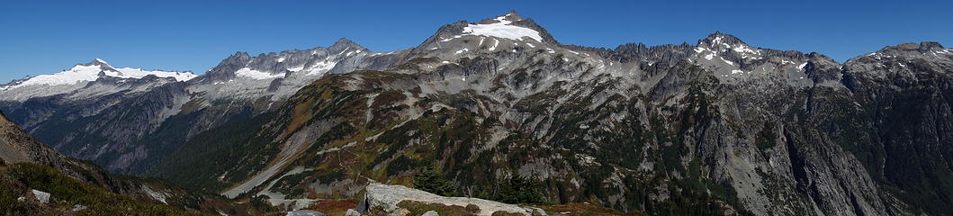 1. Sahale in the middle (trail up the arm visible). Eldorado and Forbidden to the left, Buckner to the right 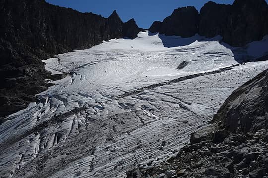 2. Cache Glacier and Col 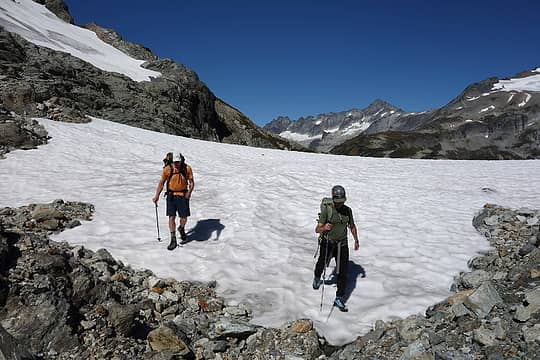 3. 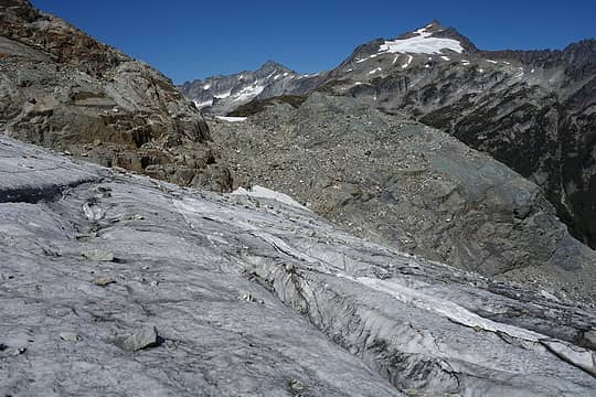 4. Part way up, looking back 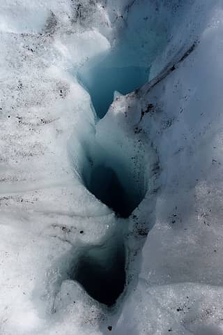 5. Holes that little streamlets flowed into 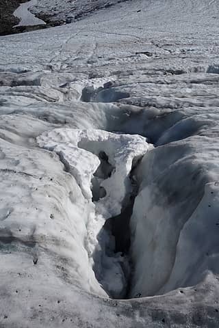 6. 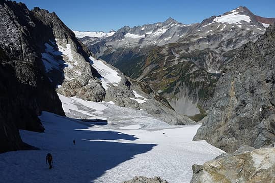 7. Nearly at the top 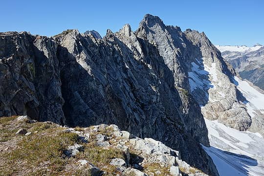 8. 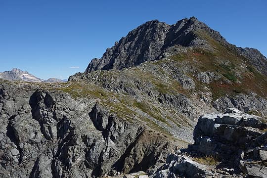 9. Mix-up Peak 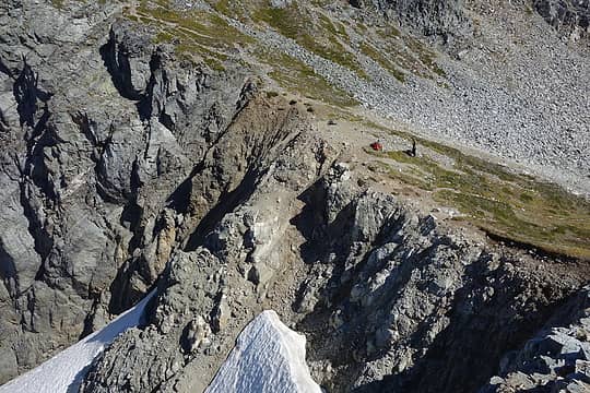 10. At the col 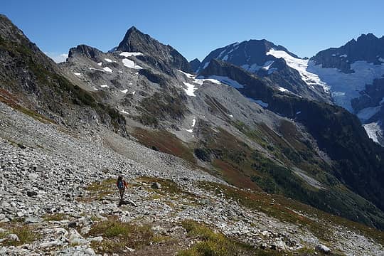 11. Heading south from Cache Col 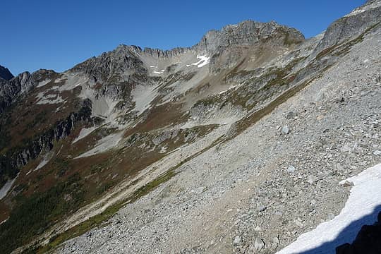 12. Looking back an hour later 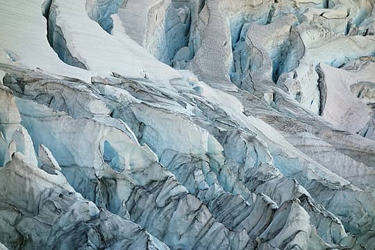 13. Icefall on the Middle Cascade Glacier 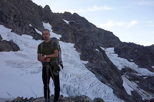 14. Philip in front of the glacier (we still had not yet set foot on it) 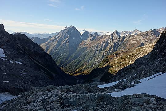 15. Johannesburg 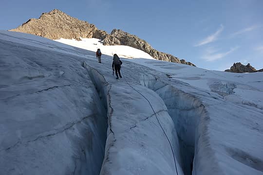 16. Roped up for this one 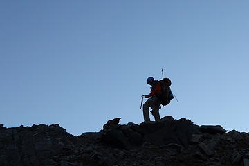 17. At the top 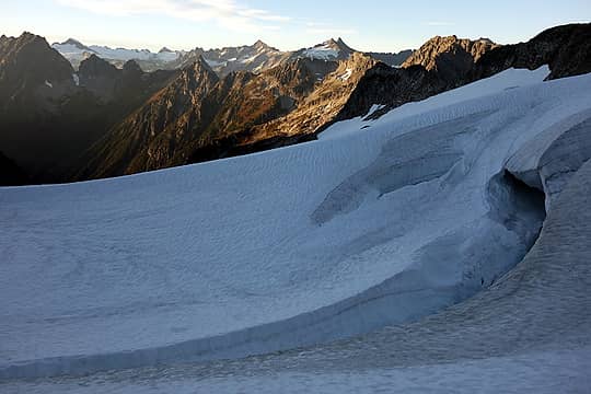 18. Sahale now looks far away 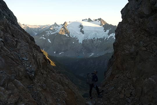 19. Spider-Formidable Col, first view of Sentinel Peak 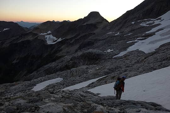 20. Looking for a camp spot 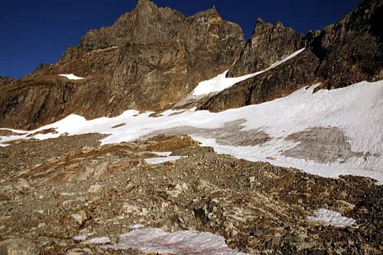 21. Moonlit shot, best I could do with a point-and-shoot camera balanced on a rock in the wind 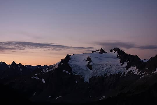 22. Sentinel sunrise 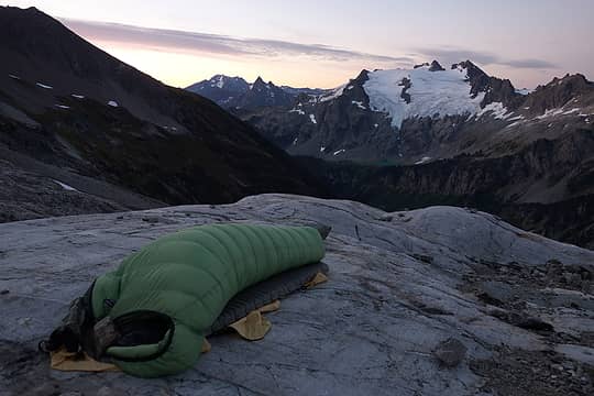 23. Doesn't get any better 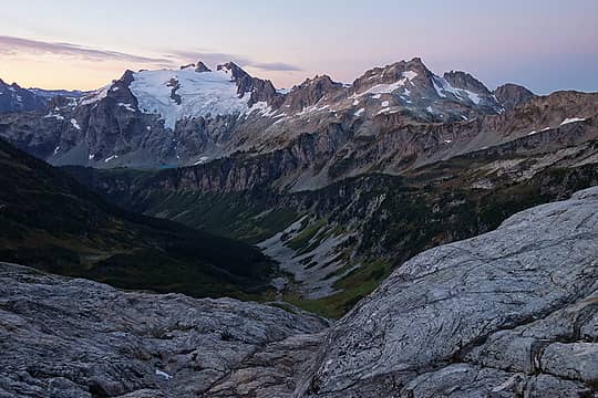 24. Sentinel Peak and Le Conte Mountain 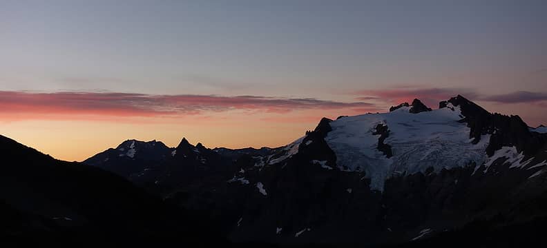 25. 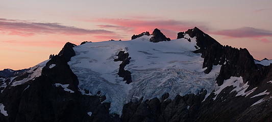 26. 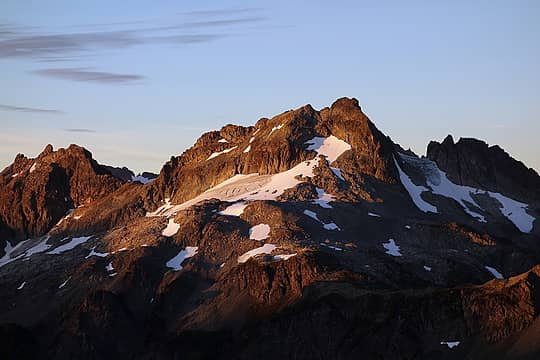 27. 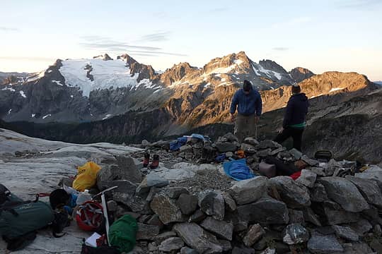 28. 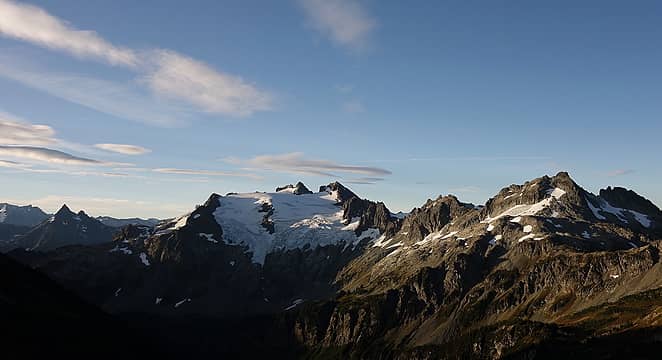 29. 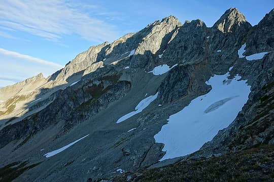 30. Head for those two snowpatches in the upper left 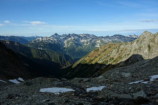 31. Sloan, Pugh, Buckindy ... too many to name 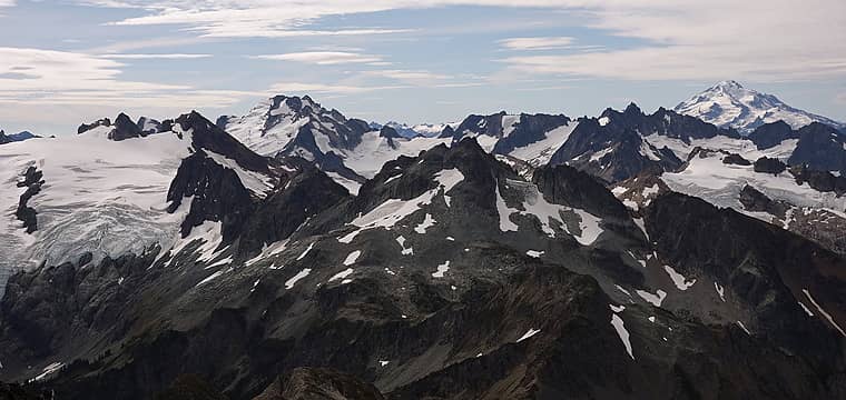 32. Glacier Peak is almost directly south. Dome Peak has come into view as well 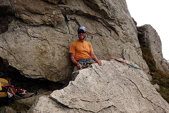 33. Jon getting his belay on 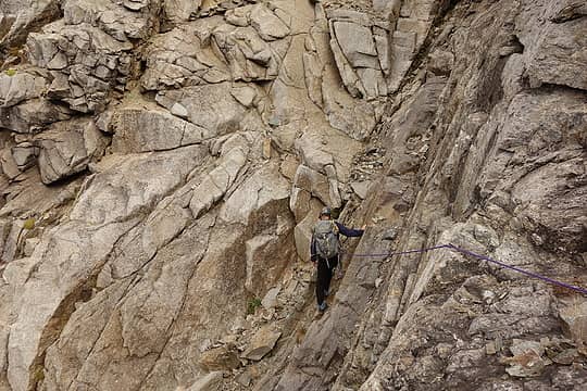 34. Philip getting his climb on 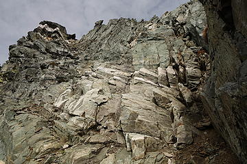 35. You'll see this point with the white band; summit is a ways to the right 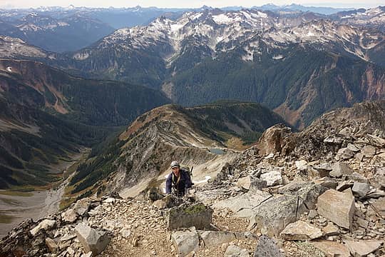 36. Almost there 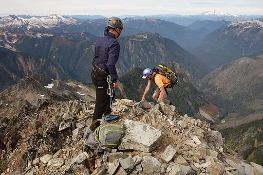 37. Topping out 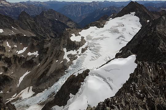 38. Middle Cascade Glacier 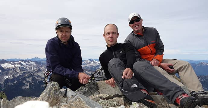 39. Summit group shot 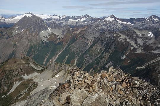 40. Looking north over much of the territory we covered the day before. The trail near Kool-Aid Lake is even visible if you zoom in 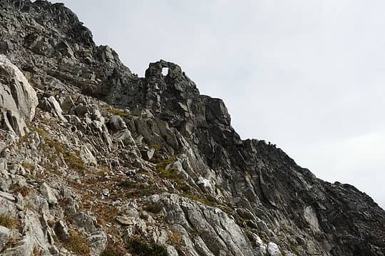 41. Arch 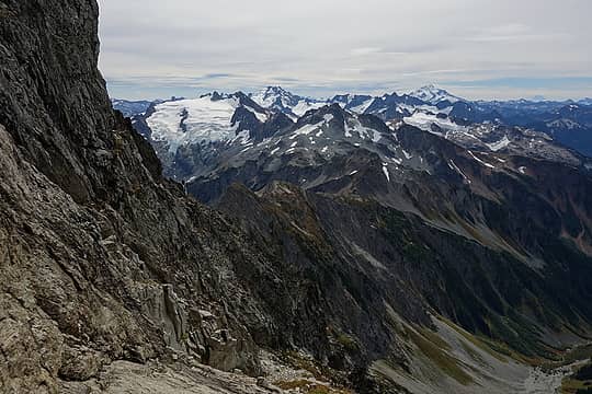 42. 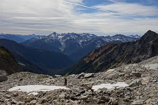 43. 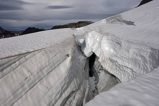 44. 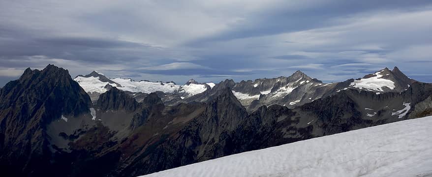 45. Getting cloudy 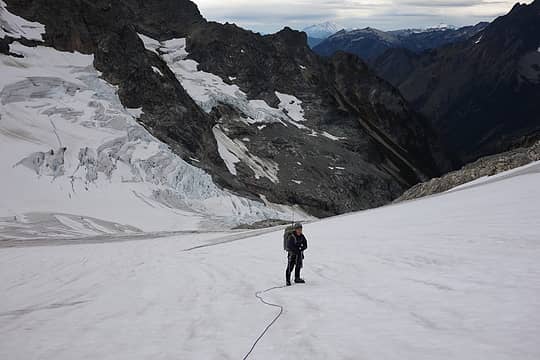 46. Ready to descend the glacier 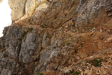 47. Red Ledge 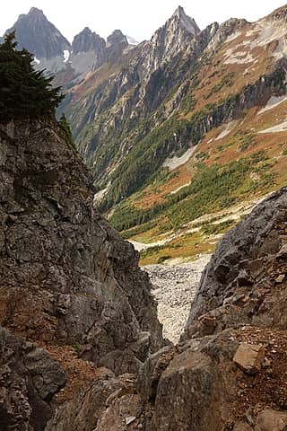 48. From Red Ledge 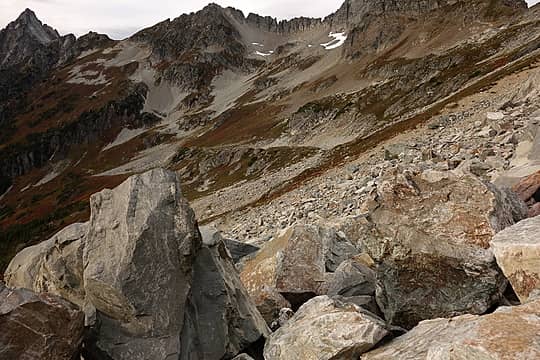 49. Talus, very typical of the entire route 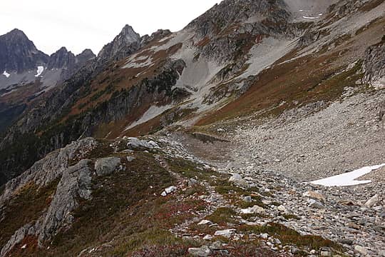 50. Kool-Aid Lake area
|
| Back to top |
  
|
|
Matt
Tea, Earl Grey, Hot

Joined: 30 Jan 2007
Posts: 4307 | TRs | Pics
Location: Shoreline |
|
Matt
Tea, Earl Grey, Hot
|
Sun Sep 18, 2016 1:01 am |
|
|
| neek wrote: | 23. Doesn't get any better 34. Philip getting his climb on |
Nice trip. That bivy site and that ledge look very familiar.
As beacons mountains burned at evening. J.R.R. Tolkien
As beacons mountains burned at evening. J.R.R. Tolkien
|
| Back to top |
|
|
cartman
Member

Joined: 20 Feb 2007
Posts: 2800 | TRs | Pics
Location: Fremont |
|
cartman
Member
|
Sun Sep 18, 2016 5:43 am |
|
|
Great trip any time, especially fine to do it in late season. Thanks for all the good pics.
We did this in two days as well in late Aug 2005, but made the mistake of only going as far as Kool-aid Lake to camp. 22 hour second day, longest I've ever had in the mountains--and no GPS to find that critical trail from the bottom of the Cache Glacier to Cascade Pass in the dark.
|
| Back to top |
|
|
Distel32
Member
Joined: 03 Jun 2014
Posts: 961 | TRs | Pics
Location: Edmonds, WA |
|
Distel32
Member
|
Sun Sep 18, 2016 6:44 am |
|
|
|
| Back to top |
|
|
OutOfOffice
Member

Joined: 02 Jun 2015
Posts: 91 | TRs | Pics
Location: Seattle |
|
| Back to top |
|
|
Roald
Member

Joined: 06 Aug 2007
Posts: 367 | TRs | Pics
Location: Seattle |
|
Roald
Member
|
Sun Sep 18, 2016 10:22 pm |
|
|
Thanks, Nick, for posting your pics (so that is what you were doing while waiting for us all that time!) and nice write up. What a cool trip with cool-headed partners.
Below are some more pictures from this trip. This was my second visit to the area, but the first time I visited the Ptarmigan Traverse it was pretty much covered in snow and we were on skis (trip report here). This time of year the PT is simply delightful, with late season colors and relatively easy travel afforded by a boot path much of the way.
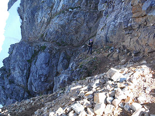 Nick on Red Ledge 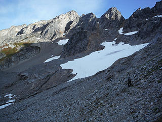 Formidable's south basins 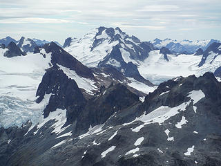 Dome Peak, from Formidable 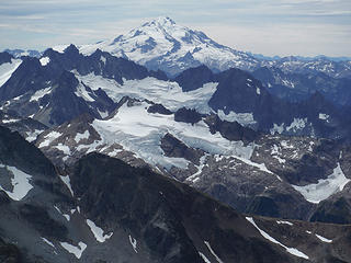 Glacier Peak from Formidable 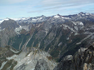 Name that peak, looking north from Formidable 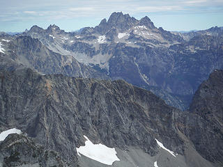 Looking Goode 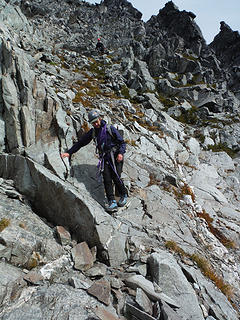 Philip dancing down Formidable 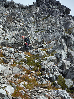 Nick scrambling down 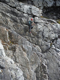 Nick on Formidable, "ledge route" 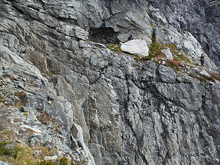 Philip across the chasm on the "ledge route" 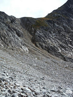 Gulley up to the saddle north of Pt. 7285 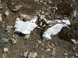 White rocks 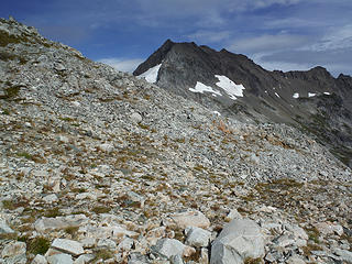 Ptarmigan Traverse 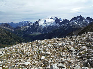 Sentinel Peak 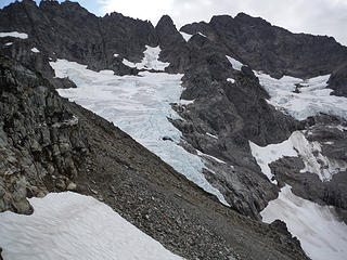 Looking south on PT 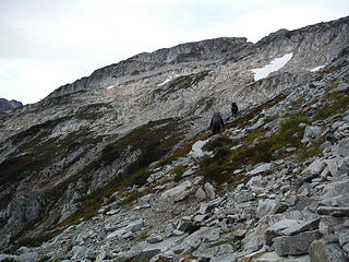 PT walking 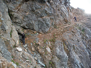 Red ledge on the return
|
| Back to top |
|
|
Brushbuffalo
Member

Joined: 17 Sep 2015
Posts: 1887 | TRs | Pics
Location: there earlier, here now, somewhere later... Bellingham in between |
| Roald wrote: | This is not a good depiction, but the complexity and variety of rock in the North Cascades is simply crazy:
White rocks |
Complexity is why it has taken many good geologists many years to try to figure out the geology of the North Cascades. It would be a lot easier if the North Cascades was primarily a volcanic mountain range as it is from The Columbia River south.
It isn't just the rocks. The structures ( folds, faults, unconformities) really make the picture difficult to piece together. Add to that the "jungle", ice/snow, and overburden that covers much of the bedrock and it's a wonder that we understand it at all.
Passing rocks and trees like they were standing still
Passing rocks and trees like they were standing still
|
| Back to top |
|
|
Gimpilator
infinity/21M

Joined: 12 Oct 2006
Posts: 1684 | TRs | Pics
Location: Edmonds, WA |
Nicely done.  Bummer about the rain on the way out. I went with a 20 percent forecast yesterday and got rained on steadily all day long.
|
| Back to top |
|
|
Matt Lemke
High on the Outdoors

Joined: 15 Jul 2010
Posts: 2052 | TRs | Pics
Location: Grand Junction |
|
Matt Lemke
High on the Outdoors
|
Wed Sep 21, 2016 12:38 am |
|
|
| Brushbuffalo wrote: | | Roald wrote: | This is not a good depiction, but the complexity and variety of rock in the North Cascades is simply crazy:
White rocks |
Complexity is why it has taken many good geologists many years to try to figure out the geology of the North Cascades. It would be a lot easier if the North Cascades was primarily a volcanic mountain range as it is from The Columbia River south.
It isn't just the rocks. The structures ( folds, faults, unconformities) really make the picture difficult to piece together. Add to that the "jungle", ice/snow, and overburden that covers much of the bedrock and it's a wonder that we understand it at all. |
Hey BB are you a geologist as well??
|
| Back to top |
|
|
Brushbuffalo
Member
Joined: 17 Sep 2015
Posts: 1887 | TRs | Pics
Location: there earlier, here now, somewhere later... Bellingham in between |
| Matt Lemke wrote: | | Hey BB are you a geologist as well?? |
Yes. Retired in 2014 after teaching geology, meteorology, and oceanography at Whatcom Community College beginning in 1971.
Passing rocks and trees like they were standing still
Passing rocks and trees like they were standing still
|
| Back to top |
|
|
Blowdown
Sawin' Logs ...

Joined: 24 Aug 2011
Posts: 376 | TRs | Pics
Location: On the Summit |
|
Blowdown
Sawin' Logs ...
|
Wed Sep 21, 2016 9:01 am |
|
|
Outstanding! "Doesn't get any better" indeed!
|
| Back to top |
|
|
Jackal
Member

Joined: 21 Jul 2012
Posts: 102 | TRs | Pics
Location: Mazama |
|
Jackal
Member
|
Thu Sep 22, 2016 6:08 pm |
|
|
Neek, thoroughly enjoyed slowly going through all your photos. Really nice compositions and exposures. And what a fantastic first-time trip in the area.
|
| Back to top |
|
|
|
|
You cannot post new topics in this forum
You cannot reply to topics in this forum
You cannot edit your posts in this forum
You cannot delete your posts in this forum
You cannot vote in polls in this forum
|
Disclosure: As an Amazon Associate NWHikers.net earns from qualifying purchases when you use our link(s). |


