Brushbuffalo
Member


Joined: 17 Sep 2015
Posts: 1887 | TRs | Pics
Location: there earlier, here now, somewhere later... Bellingham in between |
With a day of decent weather to get out before the next storm, the usual question was, What to do?
Dave T. and I had gone to Round Mountain on a hot summer day in 2015 and believe it or not, we missed the new trail!  We drove the brushy access road FS 1850 past the point where having a scratchless truck was still possible, then after parking we walked the road for a few hundred more yards, seeing cut alder saplings on the increasingly overgrown road to make me think we were on route. "Nuts to this, where's that trail?" we thought, so then we bushwhacked uphill, knowing the trail was on the ridge top. There were a lot more flies than rock outcrops to keep it geologically interesting, so frustrated in never finding the trail, we bagged it.
Dave must have thought this of me for not researching the route or at least persisting a bit more with the heat, brush,and flies...... the "stupid" being me! : We drove the brushy access road FS 1850 past the point where having a scratchless truck was still possible, then after parking we walked the road for a few hundred more yards, seeing cut alder saplings on the increasingly overgrown road to make me think we were on route. "Nuts to this, where's that trail?" we thought, so then we bushwhacked uphill, knowing the trail was on the ridge top. There were a lot more flies than rock outcrops to keep it geologically interesting, so frustrated in never finding the trail, we bagged it.
Dave must have thought this of me for not researching the route or at least persisting a bit more with the heat, brush,and flies...... the "stupid" being me! :  This time I checked a bit into it, and not wanting to take the "winter route" used by r3h, Matt and Dicey, and others, but preferring to use the summer higher start and the "new trail", I used mainly Redwic's clear directions. The only difference I noted is that the turn off at Deer Creek Pass to FS 1850 was at 12.4 miles up (according to my odometer) from the turn onto FS 18 from Swede Haven Road, not 11.8 as his directions say. However there are no other left turns nearby so finding this short spur road isn't confusing at all. A couple of water bars might make it best to park a low-clearance car at the junction and walk the short spur to the trail start.
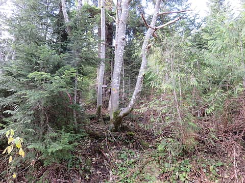 Trail start is marked with flagging and small yellow metal tags on trees for blind folks like I was in 2015. 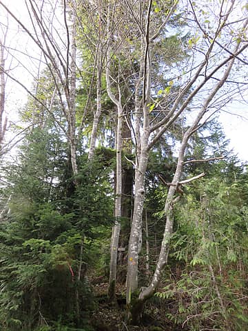 How did we miss this obvious start to the trail at a wide spot in FS 1850 0.2 mile from Deer Creek Pass? 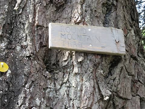 There is a sign on the huge old Douglas fir at the trailhead, just 20 feet off the road. Note the round yellow tag at left...round for Round. 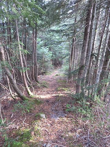 Trail. 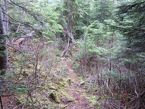 More trail! 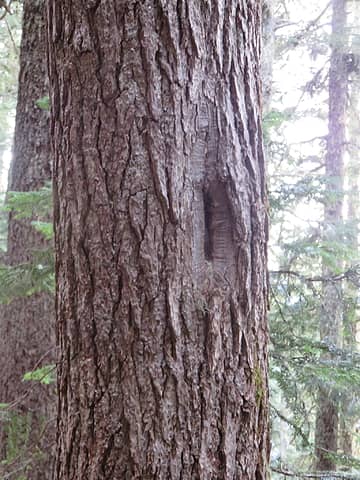 Blazes along the old trail are still evident even with bark overgrowth. ![First views open to Whitehorse Mountain, and eastern plain of North Fork of Stillaguamish River. In [url=https://washingtonlandscape.blogspot.com/2012/11/glacier-peak-and-sauk-stiiliguamsih.html]prehistory the Sauk River flowed this way toward t[/url]he west (right). The very low divide is a main reason for the tremendous prominence of Round Mountain for a summit of only moderate elevation.](https://cloud.nwhikers.net/30727044262_320x240.jpg) First views open to Whitehorse Mountain, and eastern plain of North Fork of Stillaguamish River. In prehistory the Sauk River flowed this way toward the west (right). The very low divide is a main reason for the tremendous prominence of Round Mountain for a summit of only moderate elevation. 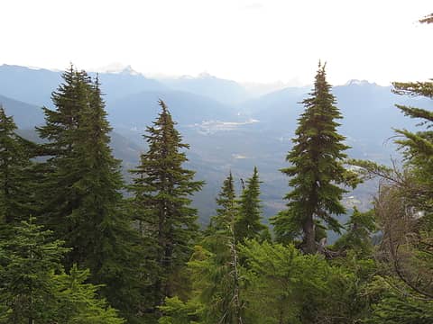 Not the best lighting today with haze before a warm front moving in (the next day dropped an inch or two of rain all over the Puget Sound area). Visible from left are White Chuck, Pugh, Sloan, and Prairie. Glacier Peak barely shows in the haze just over the shoulder of White Chuck. 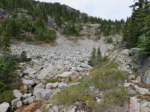 At the end of the obvious trail in the forest, you enter this basin. I took the broad talus slope to the right, then cut back left above minor cliffs. Angular boulders are sorted with larger clasts lower, smaller up high. This fact and the unweathered appearance of the rock surfaces strongly suggests a significant rockfall event(s), probably within the past few centuries. 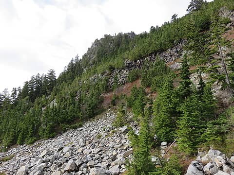 You could also traverse across the lower part of this talus slope to go left of the minor cliffs and straight up. 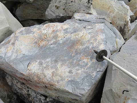 Sometimes mistaken for either glacial striations or 'slickensides' due to faulting, in this case the slickensides are due to slippage of one large block against a base. 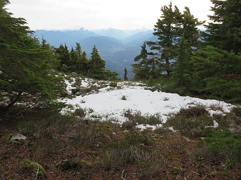 A smidgeon of snow left on the summit. 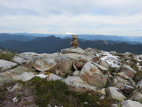 Broad summit of Round Mountain. Although the old trail was allegedly built for a lookout, there is no evidence I could find that a building was ever there. If anything it might have been a tent with possibly an Osborne firefinder, but I haven't seen written evidence of that either, including in Fish & Spring's or in Kresek's books. Eric W., Redwic, or Paul M., what do you know? 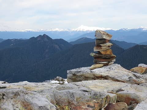 Cairn is obvious, but no register....mildly surprising considering the well-known prominence of Round Mountain. Baker teasing on the left, Shuksan just left of cairn, Finney Peak in middle distance. Rock of the summit block is rhyolite, either flows or ash-flow tuff ( Tbr). 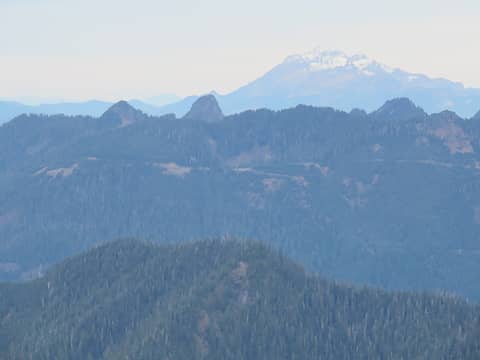 Gee Point, the afternoon destination. It's the one on the left. The pointy one is Gee Peak.Twin Sisters massif through the haze. 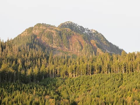 The rugged Mount Higgins massif, illuminated in one of the few sunny moments of the day. 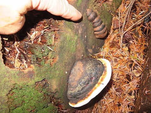 Interesting hard fungus of some sort on a log. 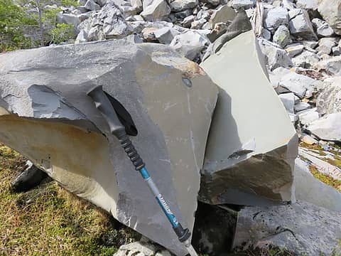 Beautiful freshly-fractured rock. It is fine grained and well-sorted. It is a fine-grained sandstone (Tbs). 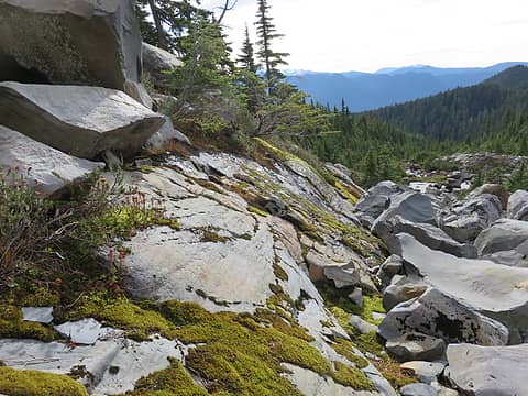 This basin on the south side of Round Mountain was glaciated in the past. 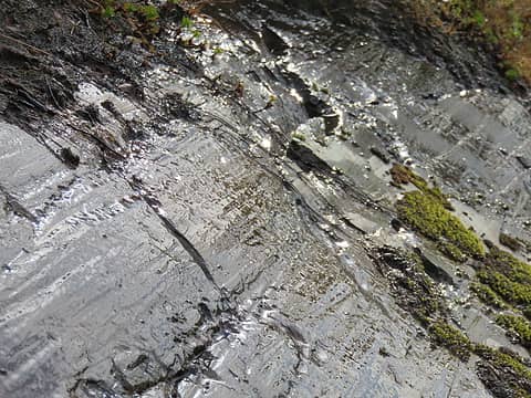 Striations and polish on bedrock. Striations are caused by pebbles being dragged across rock by moving ice. Individual striations are seldom more than a few meters long because the scratching pebble is worn away into the fine particles that cause polish, similar to abrasion with the grit glued to your sandpaper. 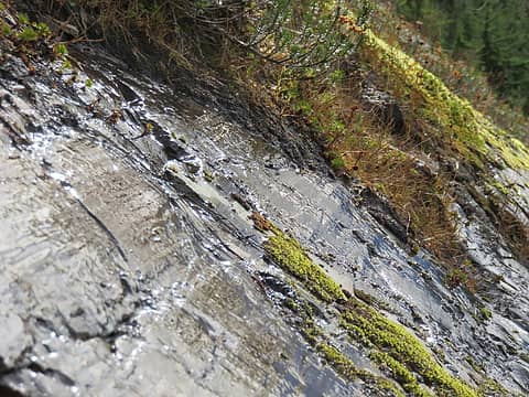 Polished striated bedrock. These features can also occur on individual loose blocks carried by ice. 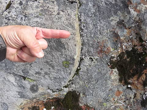 A step indicates the direction of ice movement more reliably than individual striations. 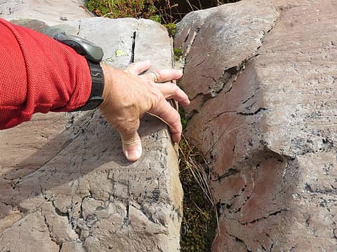 Here is a larger step in rock. Which way did the ice move? 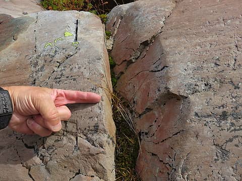 That-a-way! 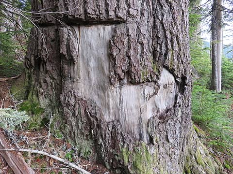 Map-in-bark of Texas, but with mountainous West Texas missing  . Also, the upper panhandle is too fat.....oh well, maybe not such a good map after all! 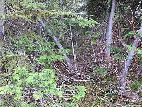 On my hike back down, a bit east of Coney Pass after ascending a minor bump, I carelessly followed the old trail for a few minutes until realizing my error. I bushwhacked diagonally up back to the new trail.....not recommended in this stuff when there is a trail to follow! 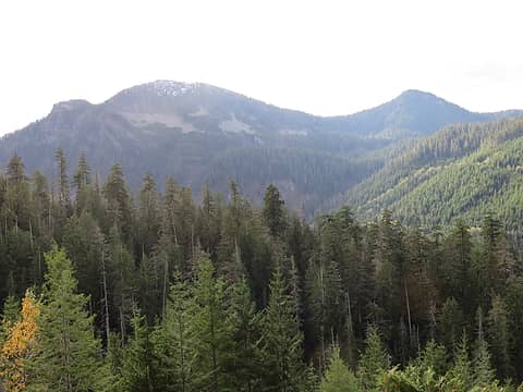 Looking south to Round from FS18 on the drive north to Gee Point. Orbit is the summit on the far right. 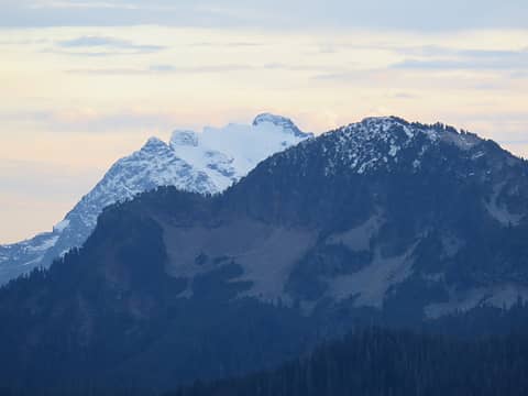 Another view of Round.Trail basically follows the left profile to Coney Pass, the obvious gap. Whitehorse looming in the background. 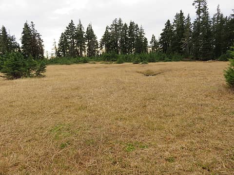 Here is the "mini Grand Park" right on the trail. 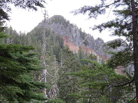 Although views are minimal on the trail, you do get this nice one of the summit of Gee Point from a few steps off the trail past mini Grand Park. 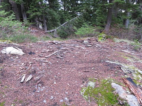 What is left of the old storage cabin, just before the steep part to the summit. 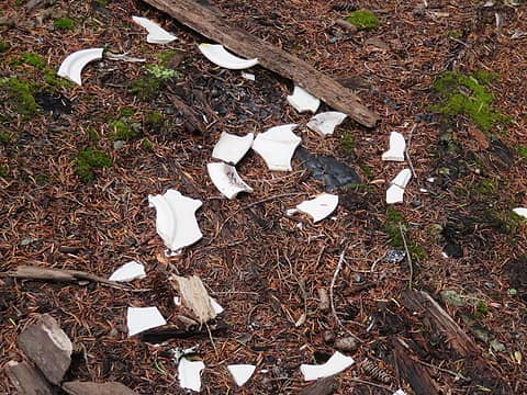 Did someone not like dinner? ![There one 30 foot section of Class 2+ or low 3. Did I do this in running shoes on steep snow in 1996....yikes! Maybe I had an axe, I don't recall. A slip [i:9438889f7c]probably[/i:9438889f7c] wouldn't be fatal. :dizzy: In his long out-of-print booklet [u:9438889f7c]Winter Climbs: One Day Ascents[/u:9438889f7c], the late, great Dallas Kloke recommended taking a rope and slings for a winter climb of Gee Point. I can see why, but with no snow it is easy enough with care and if one is not acrophobic.](https://cloud.nwhikers.net/30542451900_240x320.jpg) There one 30 foot section of Class 2+ or low 3. Did I do this in running shoes on steep snow in 1996....yikes! Maybe I had an axe, I don't recall. A slip probably wouldn't be fatal.  In his long out-of-print booklet Winter Climbs: One Day Ascents, the late, great Dallas Kloke recommended taking a rope and slings for a winter climb of Gee Point. I can see why, but with no snow it is easy enough with care and if one is not acrophobic. 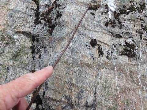 Phone wire along the way. Bedrock geology in this area is complex; dominant rock is Shuksan greenschist ( Kes) ![Not much evidence of a structure on top, just the usual rusty nails, broken glass fragments, and odds and ends. No concrete foundation blocks. The building was a 10 x 10 ' L-5 type, such as the sole remaining one in Washington at [url=http://www.pbase.com/nolock/image/152406457]Mebee Pass[/url].](https://cloud.nwhikers.net/30806855096_320x240.jpg) Not much evidence of a structure on top, just the usual rusty nails, broken glass fragments, and odds and ends. No concrete foundation blocks. The building was a 10 x 10 ' L-5 type, such as the sole remaining one in Washington at Mebee Pass. 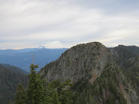 There are some rugged little peaks in the "Gee Whiz group", such as this one to the north (Gee Peak, I think). Mr. Kloke and probably Dr. Roper have given provisional names to a number of them, including related names such as Whiz Peak, Golly Peak, Exclamation Point, Awe Peak, and Gosh Peak. In background, the cloud cap descending over Baker and the lowering ceiling of altostratus clouds are forerunners of the warm front that hit that night. 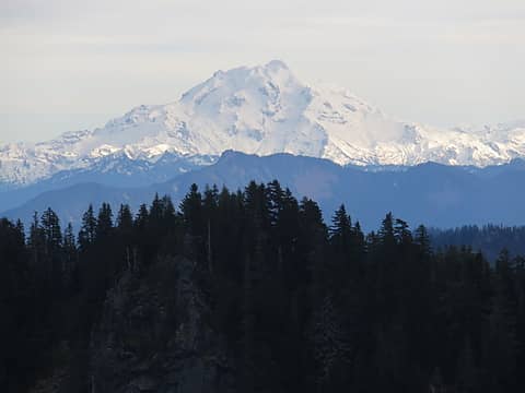 Another view, this one of Glacier Peak. Frostbite Ridge is the left skyline, and the (now) seldom-climbed Sitkum Glacier in right of center. 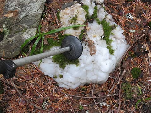 Large hunk of quartz. I should have stuck in the pack!
Passing rocks and trees like they were standing still
Passing rocks and trees like they were standing still
|


![First views open to Whitehorse Mountain, and eastern plain of North Fork of Stillaguamish River. In [url=https://washingtonlandscape.blogspot.com/2012/11/glacier-peak-and-sauk-stiiliguamsih.html]prehistory the Sauk River flowed this way toward t[/url]he west (right). The very low divide is a main reason for the tremendous prominence of Round Mountain for a summit of only moderate elevation.](https://cloud.nwhikers.net/30727044262_09a580101a_h.jpg#1600x1200+https://farm6.staticflickr.com/5688/30727044262_9876fea1c5_o.jpg#2048x1536+31a39d1ce2_k.jpg#2048x1536+09a580101a_h.jpg#1600x1200+610dd76fc3_b.jpg#1024x768)


![There one 30 foot section of Class 2+ or low 3. Did I do this in running shoes on steep snow in 1996....yikes! Maybe I had an axe, I don't recall. A slip [i:9438889f7c]probably[/i:9438889f7c] wouldn't be fatal. :dizzy: In his long out-of-print booklet [u:9438889f7c]Winter Climbs: One Day Ascents[/u:9438889f7c], the late, great Dallas Kloke recommended taking a rope and slings for a winter climb of Gee Point. I can see why, but with no snow it is easy enough with care and if one is not acrophobic.](https://cloud.nwhikers.net/30542451900_d1eea3de60_h.jpg#1200x1600+https://farm6.staticflickr.com/5340/30542451900_150a90026f_o.jpg#2048x1536+76a14be213_k.jpg#1536x2048+d1eea3de60_h.jpg#1200x1600+b0ff32a09a_b.jpg#768x1024)

![Not much evidence of a structure on top, just the usual rusty nails, broken glass fragments, and odds and ends. No concrete foundation blocks. The building was a 10 x 10 ' L-5 type, such as the sole remaining one in Washington at [url=http://www.pbase.com/nolock/image/152406457]Mebee Pass[/url].](https://cloud.nwhikers.net/30806855096_9f79597137_h.jpg#1600x1200+https://farm6.staticflickr.com/5521/30806855096_a9c44da776_o.jpg#2048x1536+840c7485c2_k.jpg#2048x1536+9f79597137_h.jpg#1600x1200+75788150e2_b.jpg#1024x768)


