| Previous :: Next Topic |
| Author |
Message |
Gimpilator
infinity/21M


Joined: 12 Oct 2006
Posts: 1684 | TRs | Pics
Location: Edmonds, WA |
Have you seen Part 1?
Upon arriving in Guatemala we were excited to join forces with Greg Slayden. We employed the Adrenalina company to sort out logistics as far as transportation and hotels go. They would not allow us to climb Volcan de Agua. Over the years I had heard of routine muggings on that peak, but I was under the impression that you could hire off duty police officers to accompany you. In any case, it was off the itinerary.
There was more bad news. 6 hikers had just died of hypothermia on Volcán Acatenango when we were in Mexico. This was the most tragic event ever in Guatemalan mountaineering history. Acatenango was on our itinerary and the tragedy would have consequences which directly affected our trip. Adrenalina informed us that for the time being they were legally required to provide us with guides on all the hikes at no extra cost. Damn!
Greg and John took the news well, but I hate hiking with guides and only do it when legally required (only once before on Kilimanjaro). I used to be a mountain guide, so Im very well familiar with the dynamic from both sides. Anyhow, I would just have to accept that, but I knew in my gut that it would lead to hassles, delays and possibly restrictions as well as attenuate rewards contingent upon our own route finding.  I tried to bear in mind that 6 people had just lost their lives and the government was now protecting one of its most valuable resources, tourism.
January 22 - Volcán Pacaya - 8373'
video link
During the drive to our first volcano, Greg was speaking to our guide for the day in Spanish. I dont understand much Spanish, but I could follow enough to tell that the guide was not going to allow us to go to the actual summit. Something about too dangerous peligroso and prohibited prohibito. By the time we got to the trailhead I had decided to do the hike by myself and go to the summit.
In hindsight, I should have told Greg and John what I was doing, but I was frustrated and not willing to have a guide prevent me from getting the peak. So it was time to play the dumb tourist. I hiked fast and the guide as well as John and Greg were immediately out of sight. I made quick progress through the jungle and came out into the open onto a mars like landscape of bare rock. I tried to bear in mind that 6 people had just lost their lives and the government was now protecting one of its most valuable resources, tourism.
January 22 - Volcán Pacaya - 8373'
video link
During the drive to our first volcano, Greg was speaking to our guide for the day in Spanish. I dont understand much Spanish, but I could follow enough to tell that the guide was not going to allow us to go to the actual summit. Something about too dangerous peligroso and prohibited prohibito. By the time we got to the trailhead I had decided to do the hike by myself and go to the summit.
In hindsight, I should have told Greg and John what I was doing, but I was frustrated and not willing to have a guide prevent me from getting the peak. So it was time to play the dumb tourist. I hiked fast and the guide as well as John and Greg were immediately out of sight. I made quick progress through the jungle and came out into the open onto a mars like landscape of bare rock.
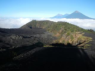 the main lava flow below from several years prior and Fuego, Atitlan, and Acatenango in the distance 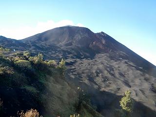 Pacaya above 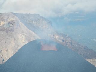 lava! 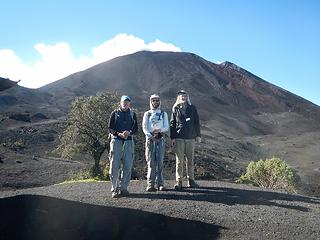 after the foolish ascent 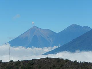 Fuego and Atitlan 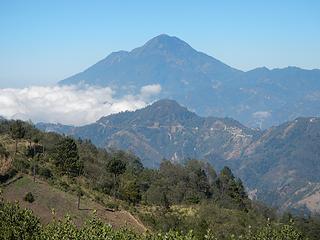 Tacana 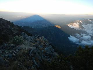 mountain shadow 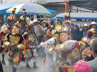 traditional music and dance 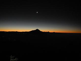 predawn view of Tajumulco 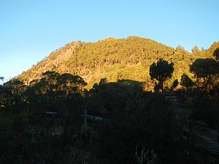 Tacana above 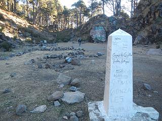 international border 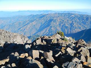 Pena Blanca in the distance 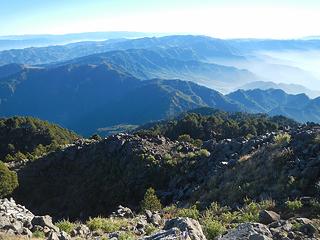 Chemal peaks in the far distance 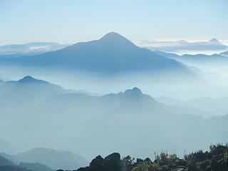 Tajumulco 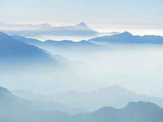 Santa Maria 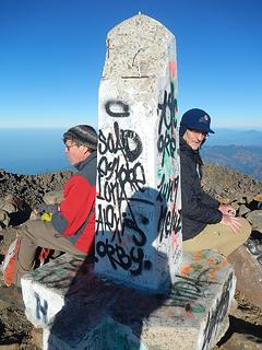 two friends sitting on the summit in different countries 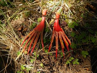 Birds feet? Nope. Flower petals fallen from a tree. 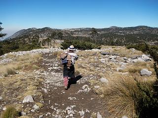 following guide #2 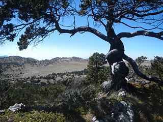 Cuervos summit tree 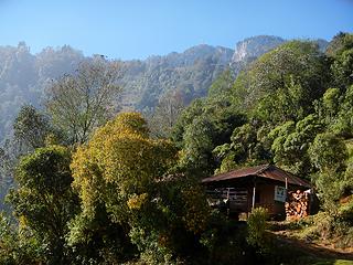 the peak above 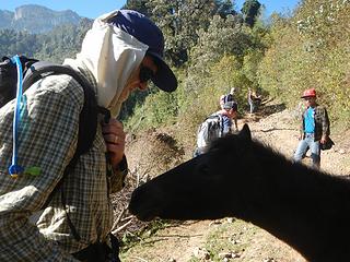 Greg making a friend 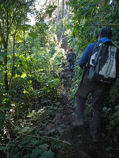 in the jungle 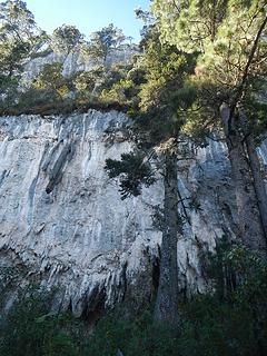 overhanging limestone cliffs 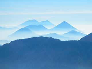 Acatenango, Fuego, Atitlan 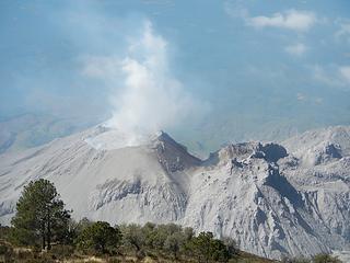 Santiaguito 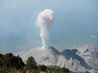 eruption! 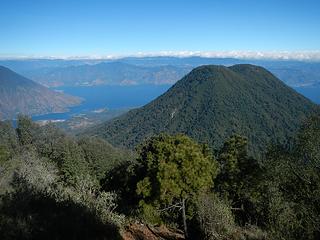 Volcan Toliman 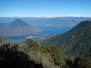 Lake Atitlan and Volcan San Pedro 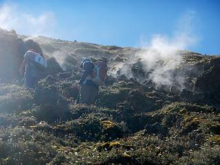 passing by some vents 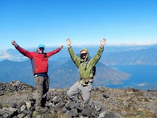 Atitlan summit 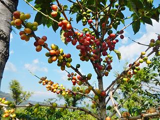 coffee cherries 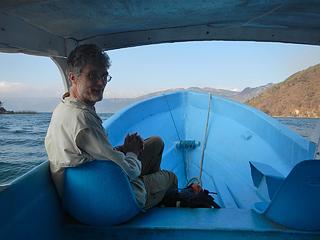 reunited 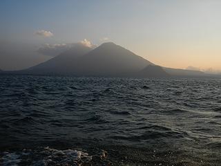 Atitlan and Toliman 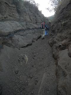 minor trail erosion 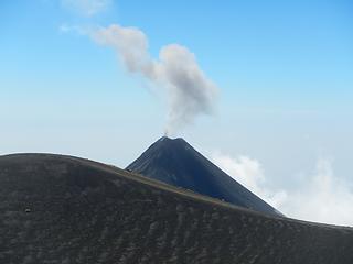 a minor eruption 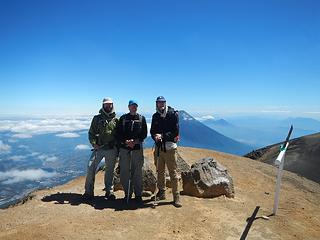 Acatenango summit 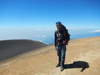 our machete wielding 14 year old guide 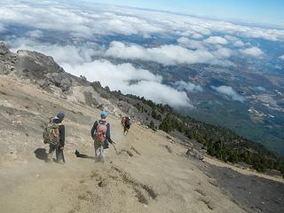 descending
|
| Back to top |
  
|
|
Brushbuffalo
Member

Joined: 17 Sep 2015
Posts: 1887 | TRs | Pics
Location: there earlier, here now, somewhere later... Bellingham in between |
Vulcan Pacayo- pushing the edge a bit too far for another summit?
Judgment vs. desire= mental battle
Who among of us hasn't crossed the line a time or two, or more?  I had, until I made a conscious decision to become an old climber rather than a too-bold climber.
Careful out there, Gimp!
I had, until I made a conscious decision to become an old climber rather than a too-bold climber.
Careful out there, Gimp! 
Passing rocks and trees like they were standing still
Passing rocks and trees like they were standing still
|
| Back to top |
|
|
Gimpilator
infinity/21M
Joined: 12 Oct 2006
Posts: 1684 | TRs | Pics
Location: Edmonds, WA |
Absolutely right Doug. It was idiotic. I could have written the story differently to make my choices look better, but I decided not to hide the facts. I have no intention to ever get that close to volcanic activity again.
|
| Back to top |
|
|
Brushbuffalo
Member
Joined: 17 Sep 2015
Posts: 1887 | TRs | Pics
Location: there earlier, here now, somewhere later... Bellingham in between |
| Gimpilator wrote: | | decided not to hide the facts. I have no intention to ever get that close to volcanic activity again. |
Thanks for your candor, Adam.
Having said what I did about judgment vs. desire and all that, I have to admit that what you did at Pacaya must have been tremendously stimulating in the doing, and mind-blowing to the max upon reflection afterwards!
However, I want to offer up some amateur psychology.
Negative-event feedback (doing something with high risk but surviving) tends to cause us to minimize our perception of risk because nothing seriously bad happened. The next time a similar scenario becomes easier to plunge into, even easier the next time, then finally  ...BOOM!
Risk = "probability of an occurrence" times "consequences of the occurrence"
It isn't the objective assessment of risk but rather the subjective perception of risk that changes. Statisticians, scientists, and insurance execs. tend to be good at assessment (objectively based), while most of us are better at perception with its subjective basis.
Am I advocating, then, just to stay inside to minimize risk?
Hardly. People keel over on their sofas and die all the time while watching TV and subconsciously "being safe."
Besides, virtually everyone who participates in NWHIKERS forum would probably die of sheer boredom if we were so totally paranoid to the point of never taking any chances "out there." ...BOOM!
Risk = "probability of an occurrence" times "consequences of the occurrence"
It isn't the objective assessment of risk but rather the subjective perception of risk that changes. Statisticians, scientists, and insurance execs. tend to be good at assessment (objectively based), while most of us are better at perception with its subjective basis.
Am I advocating, then, just to stay inside to minimize risk?
Hardly. People keel over on their sofas and die all the time while watching TV and subconsciously "being safe."
Besides, virtually everyone who participates in NWHIKERS forum would probably die of sheer boredom if we were so totally paranoid to the point of never taking any chances "out there."
Passing rocks and trees like they were standing still
Passing rocks and trees like they were standing still
|
| Back to top |
|
|
puzzlr
Mid Fork Rocks

Joined: 13 Feb 2007
Posts: 7220 | TRs | Pics
Location: Stuck in the middle |
|
puzzlr
Mid Fork Rocks
|
 Sat Feb 11, 2017 5:53 pm |
|
|
It's really fun to read this report because I was in Guatemala at the same time you were, but our schedules didn't allow our paths to cross, even though we tried to make it work.
My wife and I spent a week around Lake Atitlan with a church group building outhouses and vented stoves on a Habitat for Humanity organized trip. I highly recommend this kind of trip if you want to feel like you're doing something meaningful beyond feeling disgruntled at misguided immigration policies. If you don't want people immigrating here, do something to help make their lives more bearable!
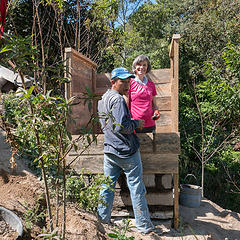 Work on outhouse #1 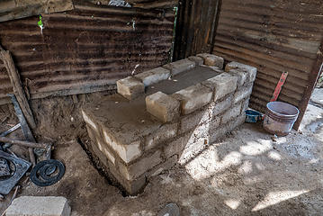 Work on stove #1 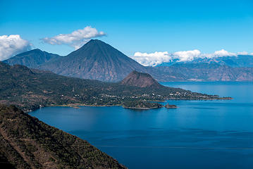 Lake Atitlan with Volcan San Pedro in back. The bump on the penninsula is Cerro De Oro 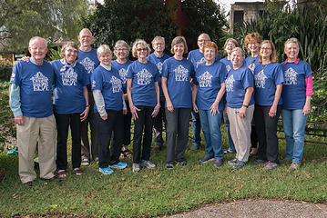 UCC Habitat for Humanity group 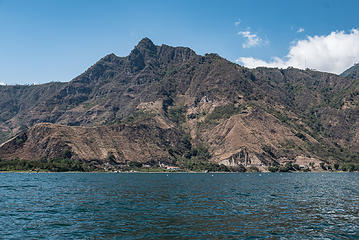 Indians Nose from the boat ride to Santa Clara 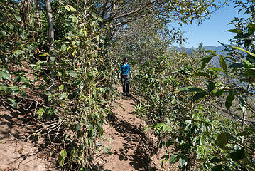 The trail goes through fields of coffee plants 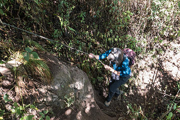 One of the steep parts on the trail 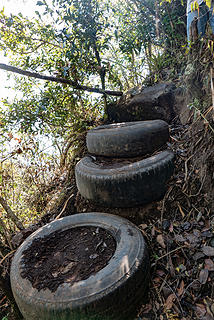 Innovative trail construction materials 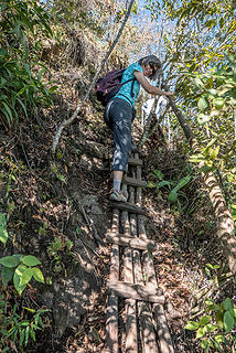 Creative trail work 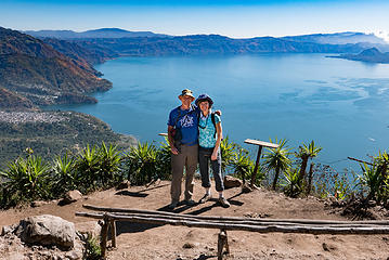 Indian Nose view point 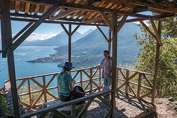 A rest stop shelter on the trail to San Juan 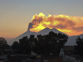 Volcan Fuego erupting with the sun setting behind the ash cloud
|
| Back to top |
|
|
Gimpilator
infinity/21M
Joined: 12 Oct 2006
Posts: 1684 | TRs | Pics
Location: Edmonds, WA |
| Brushbuffalo wrote: | | However, I want to offer up some amateur psychology. |
I appreciate your thoughts Doug. As a matter of fact, my major at WWU was Psychology, so I was quite aware of the processes at work within me during the ascent and after the fact. I'd like to to point out that with the No Spray policy, the general silence on this issue from the rest of the community probably speaks of disapproval much louder than words.
I cast my vote along with the consensus that it was idiotic to climb Pacaya. I was operating on less information than I ought to have had to be in such a dangerous place and I allowed summit fever to take hold. It's as simple as that. Will I do something stupid like that again sometime in my life? Probably. Will I do it if an active volcano is involved? NEVER.
| puzzlr wrote: | While there we were able to enjoy a spectacular eruption of Fuego as we ate in a roof-top restaurant. It's not uncommon for Fuego to erupt, but we knew this was something out of the ordinary when even the local waiters where taking photos with their cell phones. Later on when it got dark the fountains of lava at the summit were awesome, but my camera couldn't capture that.
Volcan Fuego erupting with the sun setting behind the ash cloud |
Monty, thanks for tacking on your report. It's wonderful to see your photos and hear about the important work you were doing there. I'm sorry we weren't able to connect abroad. Your view of Fuego's eruption is awesome and I bet the lava at night left a lasting impression.
|
| Back to top |
|
|
Matt Lemke
High on the Outdoors

Joined: 15 Jul 2010
Posts: 2052 | TRs | Pics
Location: Grand Junction |
|
Matt Lemke
High on the Outdoors
|
Tue Apr 18, 2017 11:49 am |
|
|
I am so jealous! I've been wanting to see a volcanic eruption for years!
|
| Back to top |
|
|
ree
Member

Joined: 29 Jun 2004
Posts: 4399 | TRs | Pics
|
|
ree
Member
|
Tue Apr 18, 2017 12:01 pm |
|
|
Wow, such an impressive trip report!! And the pictures were sensational to boot.
I know for sure I don't have your determination. Yipes, inhaling those gases!
Glad you took such nice shots, and I could enjoy it vicariously. I wouldn't think to go hiking in Guatemala. Seems like there would be a lot of nasty bugs and snakes. (Where there?)
The terrain in your pictures is lovely, and definitely worth a trip. Such amazing volcanoes.
Enjoyable write up.
|
| Back to top |
|
|
Washakie
Member

Joined: 18 Aug 2010
Posts: 402 | TRs | Pics
Location: Ann Arbor, MI |
|
Washakie
Member
|
Fri Oct 27, 2017 3:30 pm |
|
|
I spent a coule of days at the lake over 20 years ago. Didn't do any climbing though. Beautiful place.
"What is the color when black is burned?" - Neil Young
"We're all normal when we want our freedom" - Arthur Lee
"The internet can make almost anyone seem intelligent" - Washakie
"What is the color when black is burned?" - Neil Young
"We're all normal when we want our freedom" - Arthur Lee
"The internet can make almost anyone seem intelligent" - Washakie
|
| Back to top |
|
|
|
|
You cannot post new topics in this forum
You cannot reply to topics in this forum
You cannot edit your posts in this forum
You cannot delete your posts in this forum
You cannot vote in polls in this forum
|
Disclosure: As an Amazon Associate NWHikers.net earns from qualifying purchases when you use our link(s). |


