| Previous :: Next Topic |
| Author |
Message |
puzzlr
Mid Fork Rocks


Joined: 13 Feb 2007
Posts: 7220 | TRs | Pics
Location: Stuck in the middle |
|
puzzlr
Mid Fork Rocks
|
 Fri Mar 17, 2017 11:04 am |
|
|
After many days of rain and dangerous avalanche conditions it was finally time to get out on a sunny Thursday east of the crest. The low elevation and timbered slopes in this area were considered safe and everything we observed bore that out -- there was only about 3-4 feet of well packed snow in most areas.
Our party of five started at Twentynine Pines campground, traversed over Tarzan Butte, climbed Teanaway Butte and returned along the Jungle Creek road. The entire route was 12.5 miles with ~3300' of total gain and took about 8 hours with breaks on both summits.
I didn't do a lot of planning or map research before leaving -- mainly just sketched a rough route to download into my GPS. Had I looked at Google Earth or one of the other somewhat up-to-date maps I would have realized what we quickly found out. Most of the area by these two peaks is riddled with logging roads, old and new. We used them when they went in our direction and went cross country when they did not, but we kept running into more roads. With excellent snowshoeing conditions I think we ended up doing an efficient route even though it would be possible to use more roads. But where's the fun in that?
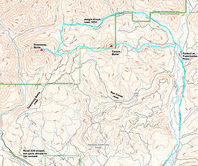 Open Street Map of snowshoe route 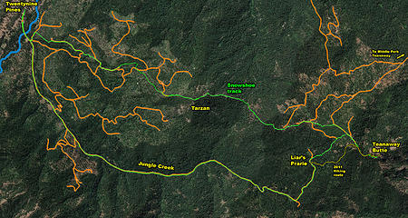 Google Earth view of route showing recently logged areas and the roads used to do the work. Fortunately, the logged areas are not complete clearcuts and left scattered standing trees, making it less bleak than it could have been. 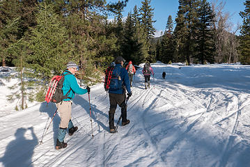 Heading out on the groomed road. It would be freshly groomed again today while we were hiking. But the grooming doesn't go up the Jungle Creek road -- it turns left toward Rye Creek. See the Teanaway Community Forest map. 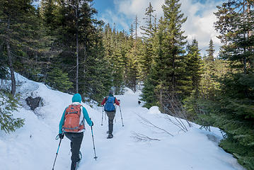 We started up a ridge off trail, but quickly ran into an old road that went in our direction, so we took it. 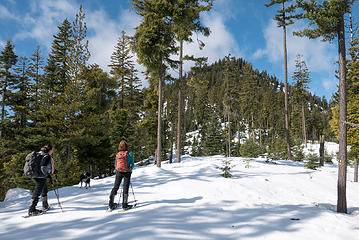 Tarzan Butte ahead. The slopes are steeper than they look. We went up along the treed ridge right of center 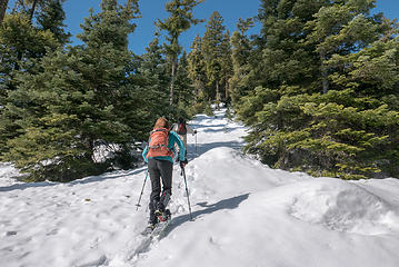 Lower down was a logging area with what is probably a cat track under the snow 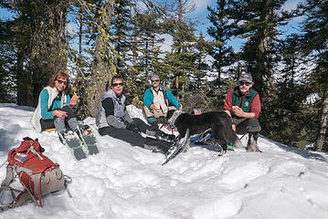 Top of Tarzan Butte 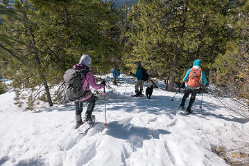 Tarzan and Teanaway Buttes 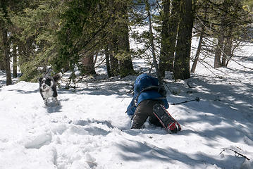 One of several face plants during the day 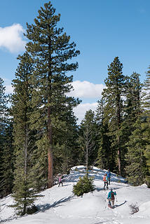 A particularly beautiful Ponderosa Pine 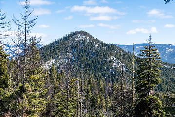 Tarzan Butte from slopes on Teanaway Butte 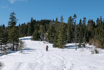 Coming across more logging roads on Teanaway Butte 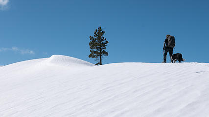 A lone tree grows on the summit of Teanaway Butte 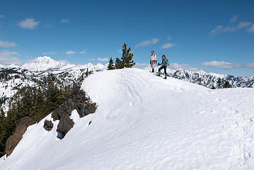 Teanaway Butte summit 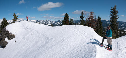 Teanaway Butte summit 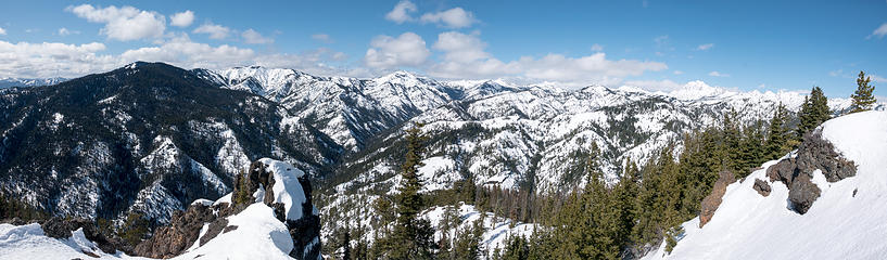 Teanaway Butte summit panorama. Includes Yellow Hill, Elbow, Jolly, Skookum, Malcom, Koppen, Stuart. 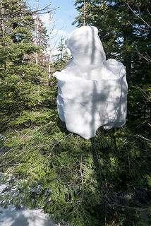 Snow creature nesting in a small tree 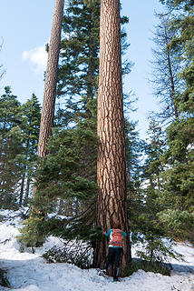 A magnificent Ponderosa Pine at Liars Prarie 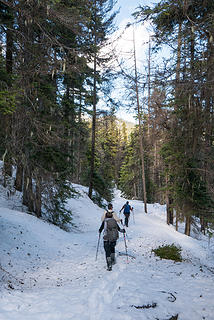 Walking down the road from Liars Prairie 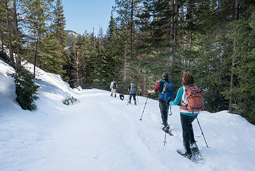 The long snowshoe out the Jungle Creek road 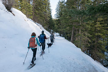 The long, long snowshoe out the Jungle Creek road 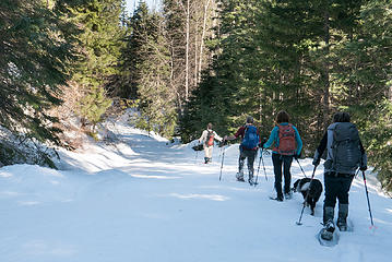 The long, long, long snowshoe out the Jungle Creek road 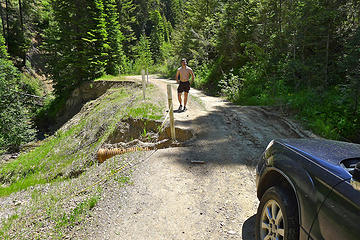 2011 washout 1.5 miles up the road.
|
| Back to top |
  
|
|
BarbE
Member

Joined: 28 Jul 2006
Posts: 1153 | TRs | Pics
|
|
BarbE
Member
|
Fri Mar 17, 2017 12:12 pm |
|
|
A beautiful day in the Teanaway with better than anticipated weather and a fun snowshoe to Tarzan and Teanaway Butte.
Glad we started with the interesting ridge route and saved the long tedious roadwalk for the end.
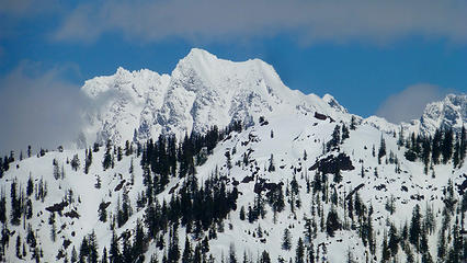 Stuart 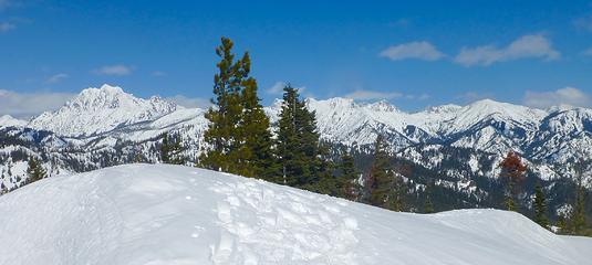 Summit views 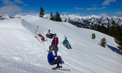 Teanaway Butte summit lunch 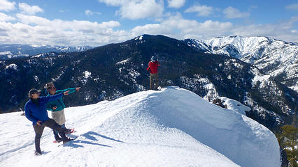 Peak pointers 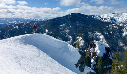 Looking West 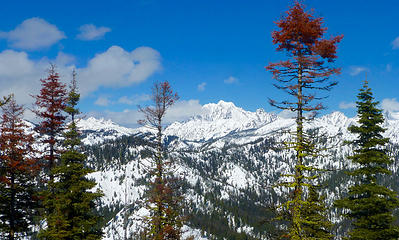 Stuart & friends 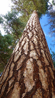 Ponderosa Pine @ Liars Prairie 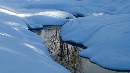 Jungle Creek
|
| Back to top |
|
|
RichP
Member

Joined: 13 Jul 2006
Posts: 5634 | TRs | Pics
Location: here |
|
RichP
Member
|
Fri Mar 17, 2017 12:14 pm |
|
|
It was a good day out with a fun group, but again that road walk was long! Snowdog really outdid us on that Tarzan holler. 
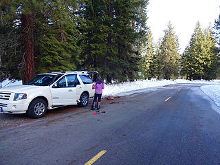 Parking near 29 Pines turnaround. 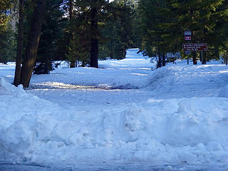 The North Fork Teanaway Rd still buried in snow. 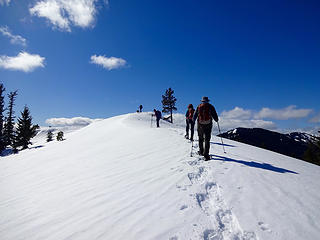 Arriving to Teanaway Butte. 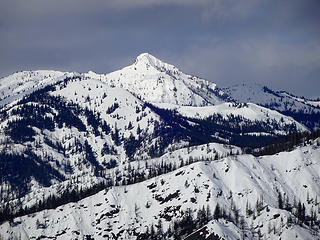 The Louvre. 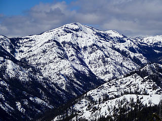 Jolly Mtn. 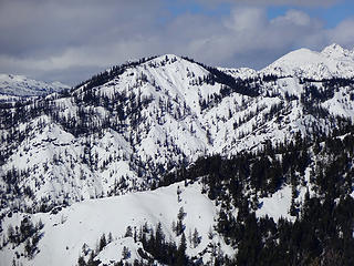 Malcom Mtn. 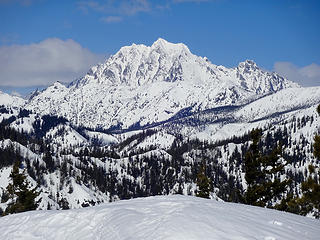 Stuart. 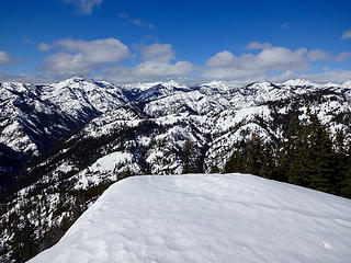 Teanaway peaks.  Colchuck to Little Annapurna. 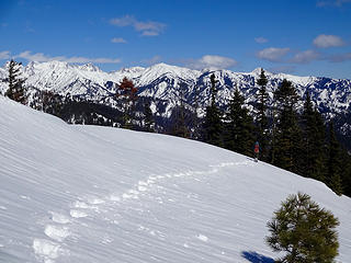 Heading down.
|
| Back to top |
|
|
puzzlr
Mid Fork Rocks
Joined: 13 Feb 2007
Posts: 7220 | TRs | Pics
Location: Stuck in the middle |
|
puzzlr
Mid Fork Rocks
|
Fri Mar 17, 2017 12:39 pm |
|
|
BarbE - love that angle on the Ponderosa Pine shot. Shows why you're the artist and I just take snapshots!
|
| Back to top |
|
|
wildernessed
viewbagger

Joined: 31 Oct 2004
Posts: 9275 | TRs | Pics
Location: Wenatchee |
 Looks good ! Looks good !
Living in the Anthropocene
Living in the Anthropocene
|
| Back to top |
|
|
Chico
Member

Joined: 30 Nov 2012
Posts: 2500 | TRs | Pics
Location: Lacey |
|
Chico
Member
|
Sat Mar 18, 2017 2:50 pm |
|
|
| puzzlr wrote: | Google Earth view of route showing recently logged areas and the roads used to do the work. Fortunately, the logged areas are not complete clearcuts and left scattered standing trees, making it less bleak than it could have been. |
Former land owner had done some major cutting.
|
| Back to top |
|
|
Kim Brown
Member

Joined: 13 Jul 2009
Posts: 6899 | TRs | Pics
|
BarbE, beautiful photos! I really like the one of Jungle Cr!
"..living on the east side of the Sierra world be ideal - except for harsher winters and the chance of apocalyptic fires burning the whole area."
Bosterson, NWHiker's marketing expert
"..living on the east side of the Sierra world be ideal - except for harsher winters and the chance of apocalyptic fires burning the whole area."
Bosterson, NWHiker's marketing expert
|
| Back to top |
|
|
Distel32
Member
Joined: 03 Jun 2014
Posts: 961 | TRs | Pics
Location: Edmonds, WA |
|
Distel32
Member
|
Sun Mar 19, 2017 6:33 pm |
|
|
|
| Back to top |
|
|
|
|


