| Previous :: Next Topic |
| Author |
Message |
meck
Member


Joined: 31 Dec 2010
Posts: 920 | TRs | Pics
|
|
meck
Member
|
 Sat Apr 22, 2017 7:09 pm |
|
|
Maynard Peak, ONF (NE of Tyler Peak), Buckhorn Wilderness
Elevation gain ~1900', topped out at ~5065'
RT Distance: not far (2.5 miles?)
My mistake was that I did not hike this one yesterday! I took a chance with the weather , and decided to give Maynard Peak a try as it has been in the back of my mind for a while. Stefan, Schmidt Altitude, and Timmie and Crabio all have good TRs for this one (which I failed to research before heading out), but I think I took a slightly different approach to get to the ridge line than they did. My intended route was to head for the saddle between Maynard and Tyler from the road, and then hope for the best ascending Maynard from the south (past photos I'd taken from Tyler Peak, "the Castle", and Mt Townsend made it look possible).
I left FSR 2860 about 3/8ths of a mile west of where the 3 O'clock Ridge trail intersects the road (just before the road crosses Bungalo Creek) around 1015, and basically headed NNW into the Rhodies and trees. After a minute or two I came across some evidence that someone had been through the area recently with a machete (angle of cuts), and had literally "blazed a trail", as indicated by marks on some of the smaller trees in this second growth, in the direction I was going.... hmm I guess that works, and among all the various blazes I've seen I guess at least these were the smallest...
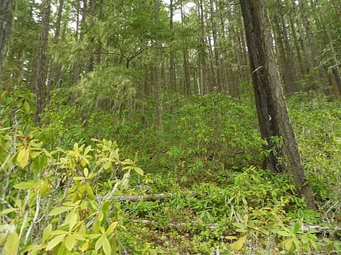 into the Rhody jungle! 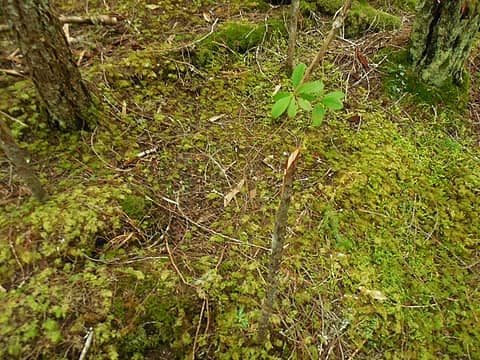 this tree dun got whacked! 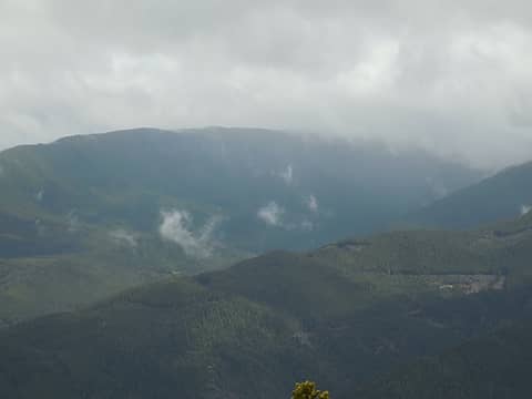 Mt Zion to the east 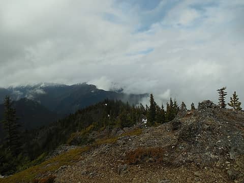 west to Blue Mtn 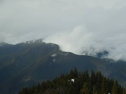 Cool cloud effects from the wind passing over the east ridge of Blue Mtn and shearing the clouds on the north side! 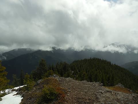 Mt Townsend & Dirty Face Ridge in the clouds 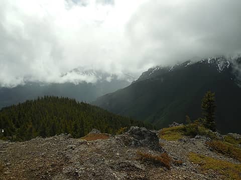 "The Castle" in the clouds, Tyler Peak in the clouds on the right 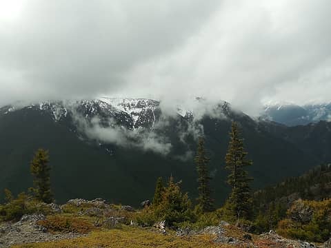 Tyler Peak in the clouds 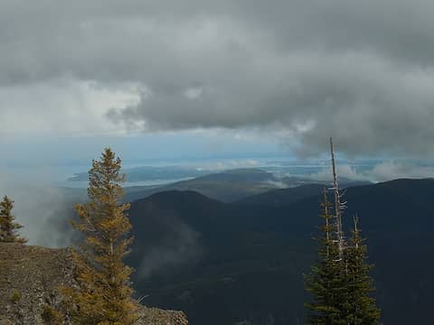 the Strait under the clouds 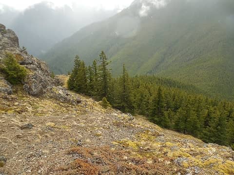 Heading back down 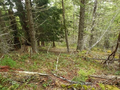 back through the forested slopes 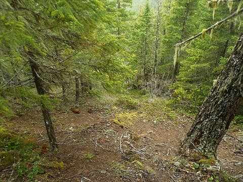 mostly looked like this until the dark thicket at the bottom, below the saddle 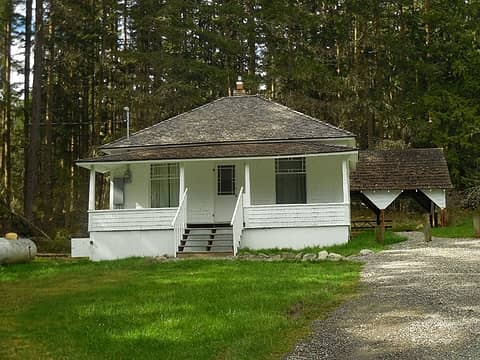 checked out the Louella cabin on the way out. 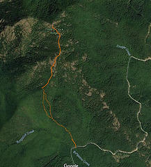 2 labels approximate path taken (dotted lines where I am not entirely sure where I was :-) )
*Just say NO to Rent-Seeking, don't give up the concept of "ownership"*
*Just say NO to Rent-Seeking, don't give up the concept of "ownership"*
|
| Back to top |
  
|
|
RichP
Member

Joined: 13 Jul 2006
Posts: 5634 | TRs | Pics
Location: here |
|
RichP
Member
|
Sat Apr 22, 2017 7:16 pm |
|
|
You must be reading my mind. I was just wondering about conditions over there. Look at those snow free slopes!
|
| Back to top |
|
|
reststep
Member
Joined: 17 Dec 2001
Posts: 4757 | TRs | Pics
|
|
reststep
Member
|
Sat Apr 22, 2017 7:55 pm |
|
|
Thanks for the report.
I am going to have to give that one a try one of these days
"The mountains are calling and I must go." - John Muir
"The mountains are calling and I must go." - John Muir
|
| Back to top |
|
|
Phil
Member

Joined: 02 Jul 2003
Posts: 2025 | TRs | Pics
Location: Shoreline, WA |
|
Phil
Member
|
Sat Apr 22, 2017 11:46 pm |
|
|
Thanks for the report. Looks like Baldy and Tyler still snowy probably
|
| Back to top |
|
|
|
|
You cannot post new topics in this forum
You cannot reply to topics in this forum
You cannot edit your posts in this forum
You cannot delete your posts in this forum
You cannot vote in polls in this forum
|
Disclosure: As an Amazon Associate NWHikers.net earns from qualifying purchases when you use our link(s). |


