| Previous :: Next Topic |
| Author |
Message |
Paul M
Member


Joined: 15 Jul 2008
Posts: 371 | TRs | Pics
|
|
Paul M
Member
|
 Sun Apr 23, 2017 9:50 am |
|
|
Stu F and I got out yesterday with the expectations of getting wet due to the forecast rain that was supposed to hit the region around 11am. We chose a popular lowland hike up Frailey Mountain (2,722 ft, P1162) since it was an easy ~12 mile RT mainly logging road walk. In the end we experienced strong winds, got some great views, and even beat the rain.
We approached our objective via HW530 from Oso. Turn north on Lake Cavanaugh Road follow it around the south east shoulder of Frailey Mountain where the road turns into Deer Creek Road. Park at the yellow DNR gate (48deg 18.2490 N, 121deg 58.3292 W). Follow the good road 2.7 miles to its end then walk up an ATV track thru a clear-cut and standing trees to the old Frailey Mountain Lookout site where a communication tower now exists. From there it is another 6.4 miles round trip to the true summit (2 candidates at 2722 ft and 2721 ft are actually 0.5 miles apart). There are some great views of Three Fingers to Whitehorse, The North sound, and even the top of Baker and the Twin Sisters from Frailey.
Be sure to check the gate before starting out. We did and were surprised to find it closed but not locked, allowing us to drive further and beat the rain altogether as it just started when we got back to the car precisely at 11am!
Quick totals: ~750 ft delta elevation and 6.4 miles RT (~12 miles and more elev if starting at the gate)
Some pictures follow (please excuse the lousy quality of mountain shots from the phone camera)
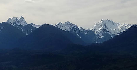 Whitehorse to Three Fingers from Deer Creek road 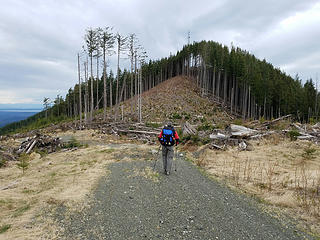 Stu approaching the Frailey Mountain lookout site 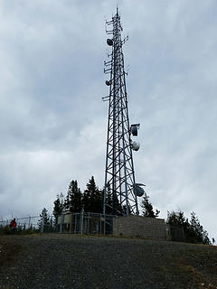 Communication tower at old lookout site 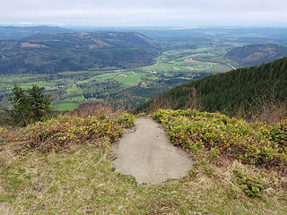 Old hang gliding launch ramp at lookout site 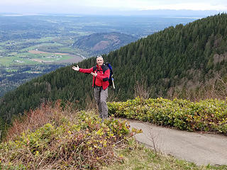 Stu contemplating his options 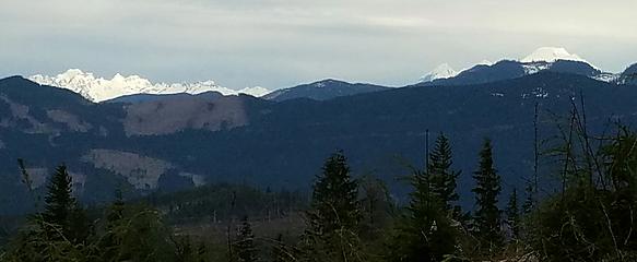 Twin Sisters and Mt Baker 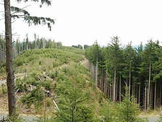 2722 ft Frailey Summit area from near 2721 ft area 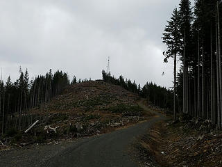 On the walk back to the old lookout site 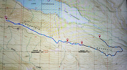 Frailey Mountain Route
|
| Back to top |
  
|
|
Nancyann
Member

Joined: 28 Jul 2013
Posts: 2319 | TRs | Pics
Location: Sultan Basin |
|
Nancyann
Member
|
Sun Apr 23, 2017 7:46 pm |
|
|
Nice views from the top! A few years ago, my hiking partner flew up there in a helicopter to clear some trees around the helipad up on top.
|
| Back to top |
|
|
|
|
You cannot post new topics in this forum
You cannot reply to topics in this forum
You cannot edit your posts in this forum
You cannot delete your posts in this forum
You cannot vote in polls in this forum
|
Disclosure: As an Amazon Associate NWHikers.net earns from qualifying purchases when you use our link(s). |


