| Previous :: Next Topic |
| Author |
Message |
wildernessed
viewbagger


Joined: 31 Oct 2004
Posts: 9275 | TRs | Pics
Location: Wenatchee |
Location : West of Twisp, Wa
Map : GTM - Buttermilk Butte, TOPO, NFS Sawtooth Wilderness Map
Stats : 8.5 miles, 4300' loop
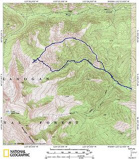 Little Bridge Creek - Little Bridge Creek Butte - Thompson Ridge Loop 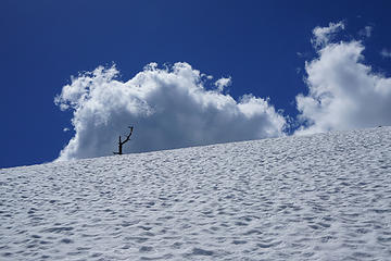 Kick in those steps ! 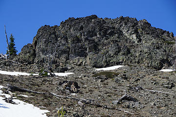 I kept shouting over to Steve from the opposite side of the gully "It looks like your sweating" but he looks pretty relaxed and comfortable now. 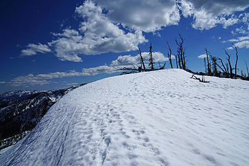 Piles of snow. 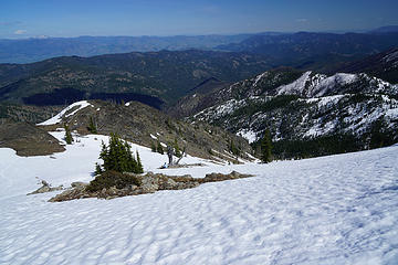 Hit the Trail thinking WTF, but a good payoff summit and Thompson Ridge run the next day. 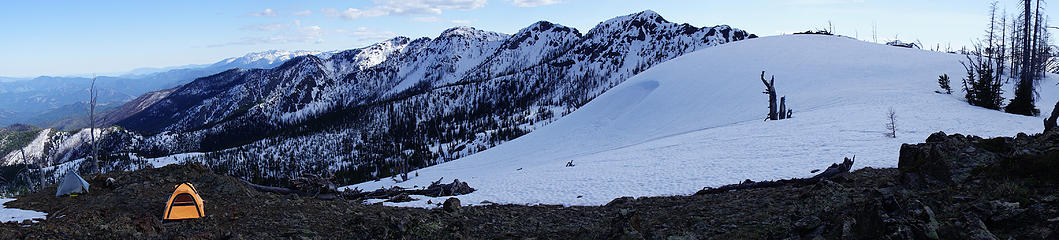 The only flat spots in the drainage and on the ridge were on this 7056' broad peak I will refer to as "Little Bridge Creek Butte". 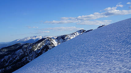 Must get to the top of the snow cone ! 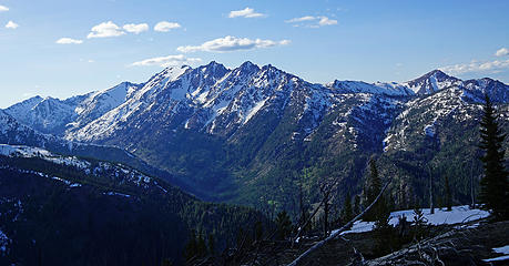 Wolf Creek Drainage - Gardner Ridge - Story - Milton 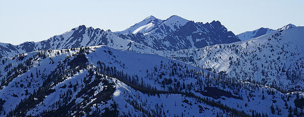 East Abernathy and Abernathy center background.
Living in the Anthropocene
Living in the Anthropocene
|
| Back to top |
  
|
|
HitTheTrail
Member

Joined: 30 Oct 2007
Posts: 5455 | TRs | Pics
Location: 509 |
This was sold to me as a trip where we would hike about 3 miles into the basin and set up camp where I would lounge around and hold down the fort while Batman and Robyn did the surrounding peaks. Well, it didnt quite play out along that line. In fact it turned into a butt kicking snow boot to the top where we camped with no water. It also turned into one of the best trips I have been on in a long time! Glad we decided to take a chance on the top and the road less traveled. Hope Wildernessed plans more of these trips that go wrong.
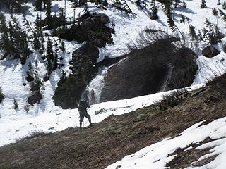 The entrance to the basin we decided not to enter 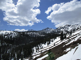 We decided to head up slope instead. 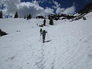 up 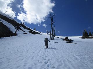 Wildernessed near the saddle 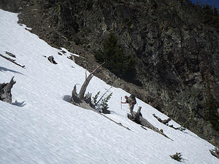 Steve going up 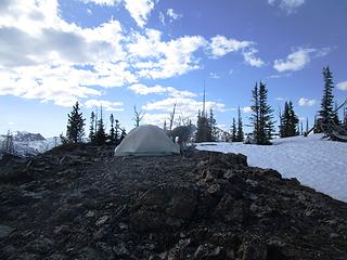 Wildernessed on the rocks 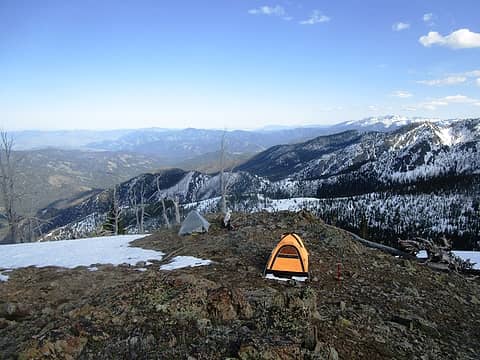 HitTheTrail and Steve on the rocks 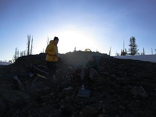 Evening hot toddy 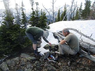 No running water up here 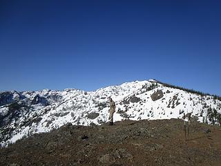 Steve with our campsite in the background which is just beyond the highpoint at the right of the photo. 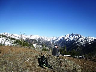 Shooting Wolf Creek, Gardner meadow, and Gardner 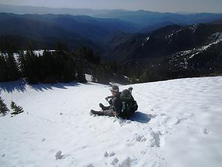 Whee 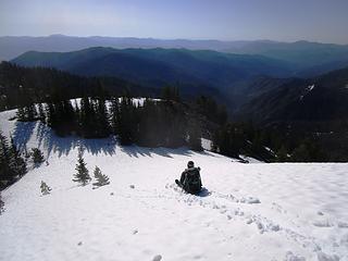 Whee 2 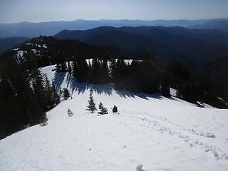 Butt almost fully wet by now
|
| Back to top |
|
|
wildernessed
viewbagger
Joined: 31 Oct 2004
Posts: 9275 | TRs | Pics
Location: Wenatchee |
Living in the Anthropocene
|
| Back to top |
|
|
Bootpathguy
Member

Joined: 18 Jun 2015
Posts: 1787 | TRs | Pics
Location: United States |
The simplicity of some photos sometimes can be the most beautiful.
Great report!  Thanks for sharing
Experience is what'cha get, when you get what'cha don't want
Experience is what'cha get, when you get what'cha don't want
|
| Back to top |
|
|
Bootpathguy
Member
Joined: 18 Jun 2015
Posts: 1787 | TRs | Pics
Location: United States |
Experience is what'cha get, when you get what'cha don't want
|
| Back to top |
|
|
HitTheTrail
Member
Joined: 30 Oct 2007
Posts: 5455 | TRs | Pics
Location: 509 |
| wildernessed wrote: | | I can confirm your a tough "old" guy I know I won't be in your boots when I am 73 y/o. |
Oh, c'mon give me a break. I won't be 72 until this fall.
|
| Back to top |
|
|
wildernessed
viewbagger
Joined: 31 Oct 2004
Posts: 9275 | TRs | Pics
Location: Wenatchee |
| HitTheTrail wrote: | | I won't be 72 until this fall. |
Math error, I forgot your ONLY 15 YEARS older than me !  , still strong work ! , still strong work !
Living in the Anthropocene
Living in the Anthropocene
|
| Back to top |
|
|
wildernessed
viewbagger
Joined: 31 Oct 2004
Posts: 9275 | TRs | Pics
Location: Wenatchee |
| Bootpathguy wrote: | |
The simplicity of some photos sometimes can be the most beautiful.
Great report!
Thanks for sharing |
I love those shots I should have taken more single shots many of the sweep pano''s had color differences at different angles but I did get the shots I needed for an upcoming trip.
Living in the Anthropocene
Living in the Anthropocene
|
| Back to top |
|
|
Distel32
Member
Joined: 03 Jun 2014
Posts: 961 | TRs | Pics
Location: Edmonds, WA |
|
Distel32
Member
|
 Tue May 30, 2017 6:15 am |
|
|
|
| Back to top |
|
|
wildernessed
viewbagger
Joined: 31 Oct 2004
Posts: 9275 | TRs | Pics
Location: Wenatchee |
I patched around 16 - 18 holes mostly very minute but one was on the side of the bath tub floor which was surprising. The rock was like a brillo pad. The floor on Big Sky cuben tents is no thicker than the fly so I should have known. I have never used a foot print on any tents though. Thanks for the tenacious and cuben tape Hit the Trail. Definitely will use a Tyvek foot print in the future. The weight, space, and design still beats anything I have experienced in the past.
Wildernessed on the rocks
Living in the Anthropocene
Living in the Anthropocene
|
| Back to top |
|
|
HitTheTrail
Member
Joined: 30 Oct 2007
Posts: 5455 | TRs | Pics
Location: 509 |
Geez, I saw the big holes but not the small ones. Now you have me worried about my Big Sky Soul X2. My NeoAir Xtherm sleeping pad did go flat though. Maybe I will check my tent floor also.
|
| Back to top |
|
|
|
|
You cannot post new topics in this forum
You cannot reply to topics in this forum
You cannot edit your posts in this forum
You cannot delete your posts in this forum
You cannot vote in polls in this forum
|
Disclosure: As an Amazon Associate NWHikers.net earns from qualifying purchases when you use our link(s). |


 Nice pics I did give a disclaimer though...
1. I can't confirm trail conditions.
2. I can't confirm terrain conditions.
3. Stream crossing and snow depth / quality unknown.
I can confirm your a tough "old" guy I know I won't be in your boots when I am 73 y/o.
Nice pics I did give a disclaimer though...
1. I can't confirm trail conditions.
2. I can't confirm terrain conditions.
3. Stream crossing and snow depth / quality unknown.
I can confirm your a tough "old" guy I know I won't be in your boots when I am 73 y/o. 


