| Previous :: Next Topic |
| Author |
Message |
Bloated Chipmunk
Cock Rock Searcher


Joined: 29 Jan 2007
Posts: 2993 | TRs | Pics
Location: Margaritaville |
DAY 1: The Long Awaited Departure
"The people who get on in this world are the people who get up and look for the circumstances they want, and if they can't find them, make them." --George Bernard Shaw
After 6.5 yrs. of fruitless attempts to make it to Yosemite, I finally managed a way to get there & perhaps the timing was perfect anyway--the drought had broke, the winter snow & rain had fallen, & the waterfalls were @ their peak. All the time & energy I spent struggling to inspire an apathetic partner were washed away in 'Nature's fountains' as I once again realized that the old sage advice is true: If you want to get something done you must do it yourself. Yosemite, bitch. Read it & weep.  We left SD on a Sat. AM w/the intent of staying @ a motel the 1st night, since the drive is several hrs. long & there'd be no sense fumbling around in the dark looking for a campsite. After muscling our way through L.A., stopping for lunch, & sailing up the San Joaquin Valley, we arrived in Los Banos ("The Bathroom"??) where we had the motel reservation. We dumped off some of our things & headed to the closest restaurant that served margaritas.
  I did my usual photo text to friends, this time expressing my excitement & relief for a long-awaited dream coming true. I rec'd some confused reactions, mostly from those to whom I hadn't even mentioned I was about to go to Yosemite -- I feared I might jinx the whole thing & therefore waited until I was @ least a stone's throw away from it to reveal my plan. I did my usual photo text to friends, this time expressing my excitement & relief for a long-awaited dream coming true. I rec'd some confused reactions, mostly from those to whom I hadn't even mentioned I was about to go to Yosemite -- I feared I might jinx the whole thing & therefore waited until I was @ least a stone's throw away from it to reveal my plan.
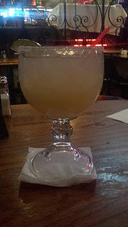
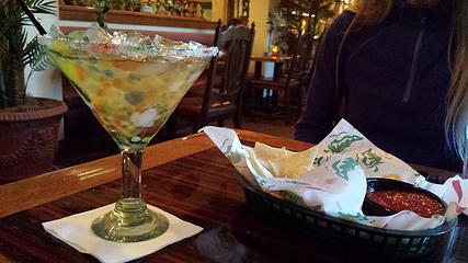 Pre-Yosemite margarita  DAY 2: B'fast @ the Courthouse, Finding Camp, Mirror Lk. Trail
Upon recommendation, we checked out a diner in town for b'fast, where we had a good meal & each rec'd a flower for Mother's Day, even though it was a holiday that applied to neither one of us.
DAY 2: B'fast @ the Courthouse, Finding Camp, Mirror Lk. Trail
Upon recommendation, we checked out a diner in town for b'fast, where we had a good meal & each rec'd a flower for Mother's Day, even though it was a holiday that applied to neither one of us.  From there, the search was on for a campsite. After looking around a bit, we found a nice spot along the Merced River about an hr. outside the Arch Rock entrance, @ McCabe Flat CG. We paid the fee for the week, set up the tents, & made a beeline to the park. From there, the search was on for a campsite. After looking around a bit, we found a nice spot along the Merced River about an hr. outside the Arch Rock entrance, @ McCabe Flat CG. We paid the fee for the week, set up the tents, & made a beeline to the park. 
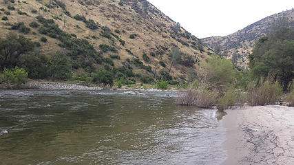
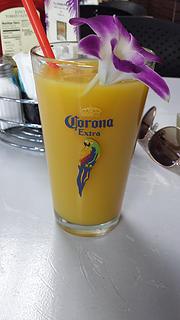 Mothers' Day OJ 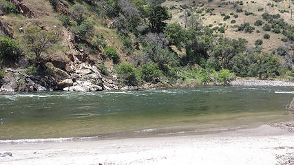 Beach @ our campground along the Merced River  "...I know no single wonder of nature on earth which can claim superiority over Yosemite. Just dream yourself for one hour in a chasm nearly 10 miles long, with egress, save for birds and water, but at three points, up the face of precipices from three thousand to four thousand feet high, the chasm scarcely more than a mile wide at any point, & tapering to a mere gorge, or canyon, at either end, with walls of mainly naked and perpendicular white granite, from three thousand to five thousand feet high, so that looking up to the sky from it is like looking out of an unfathomable profound--and you will have some conception of Yosemite." -- Horace Greeley, "In California--The Yosemite", An Overland Journey from New York to San Francisco in the Summer of 1859
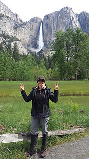
As we entered the park, sure enough it did indeed look like the pictures I'd been admiring for yrs. I will say, however, that El Capitan was even bigger than I'd imagined....a huge monolith of sheer granite cliff that is situated near the western end of the valley & one of the 1st opportunities for jaw-dropping awe.
"...I know no single wonder of nature on earth which can claim superiority over Yosemite. Just dream yourself for one hour in a chasm nearly 10 miles long, with egress, save for birds and water, but at three points, up the face of precipices from three thousand to four thousand feet high, the chasm scarcely more than a mile wide at any point, & tapering to a mere gorge, or canyon, at either end, with walls of mainly naked and perpendicular white granite, from three thousand to five thousand feet high, so that looking up to the sky from it is like looking out of an unfathomable profound--and you will have some conception of Yosemite." -- Horace Greeley, "In California--The Yosemite", An Overland Journey from New York to San Francisco in the Summer of 1859
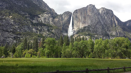
As we entered the park, sure enough it did indeed look like the pictures I'd been admiring for yrs. I will say, however, that El Capitan was even bigger than I'd imagined....a huge monolith of sheer granite cliff that is situated near the western end of the valley & one of the 1st opportunities for jaw-dropping awe.  1st, an obligatory shot of Yosemite Falls.
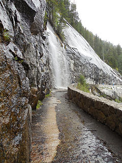
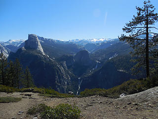
 Yosemite Falls 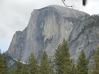 Half Dome 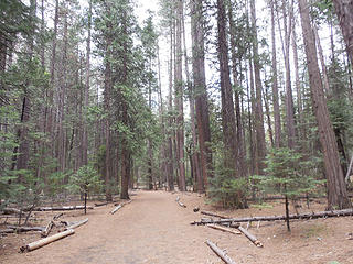 Trail to Mirror Lk. 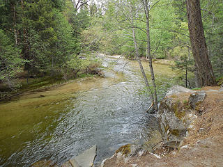 Tenaya Creek 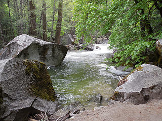 Tenaya Creek 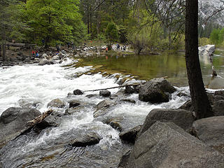 Tenaya Creek 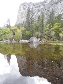 Mirror Lk. 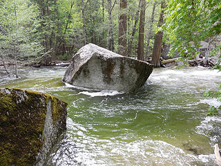 Tenaya Creek 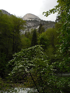 North Dome(?) above 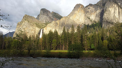 Bridalveil Falls 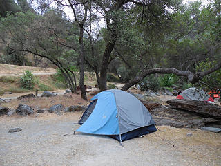 My tent 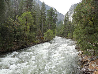 Merced River 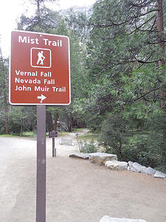 Mist Trail TH 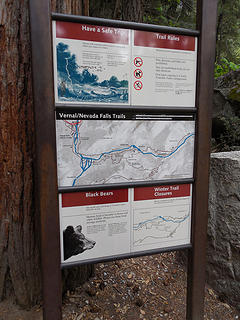 Another sign 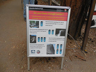 That's a lot of water... 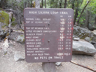 Lots of options 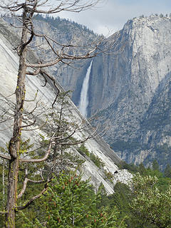 View back toward Yosemite Falls 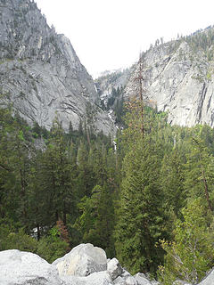 Illilouette Gorge 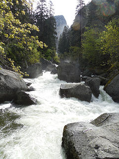 Merced River 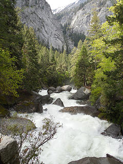 Merced River 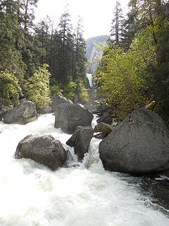 View of Vernal Fall 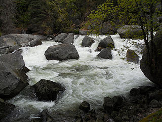 Merced River 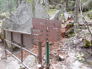 Trail sign 
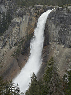
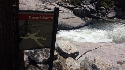
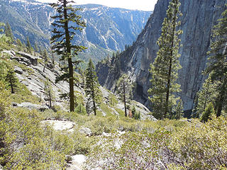
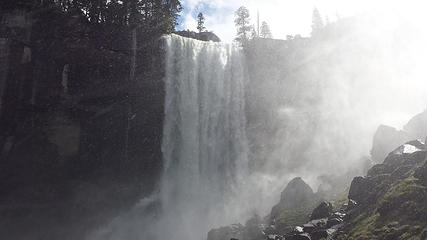 Vernal Fall. I can see why they call this the Mist Trail. 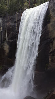 Vernal Fall 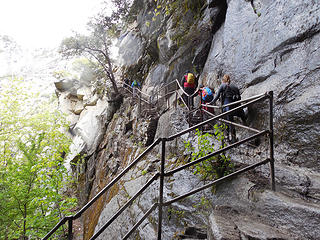 Great, time to walk along a cliff edge 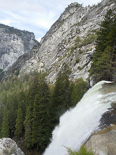 Top of Vernal Fall 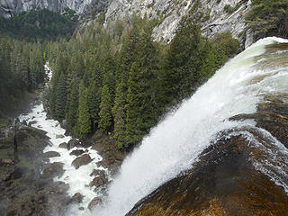 Top of Vernal Fall 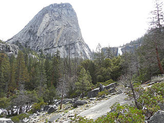 Liberty Cap. The light patch on left side was where rock broke loose in 1872 during the Owens Valley Earthquake, startling John Muir out of bed. 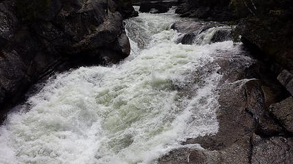 Merced River 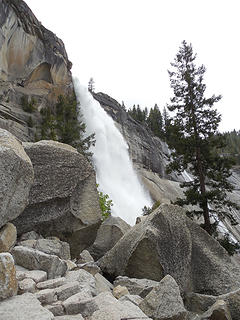 Nevada Fall as seen from the side as we climb up 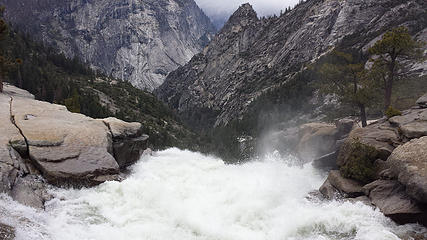 Top of Nevada Fall 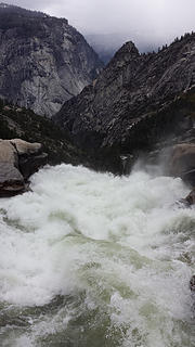 Top of Nevada Fall 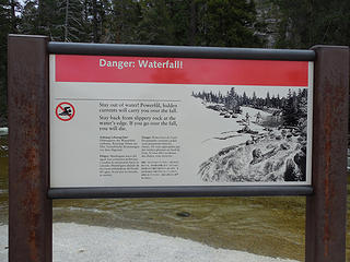 "If you go over the fall, you will die." 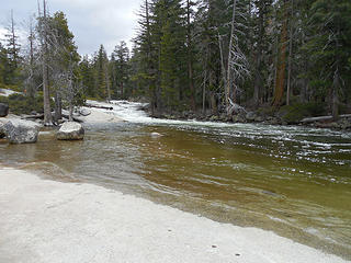 Looks relatively calm, but don't chance it... 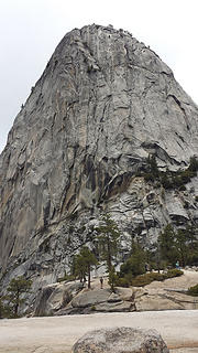 Liberty Cap 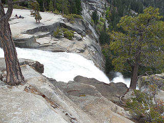 Lip of Nevada Fall 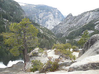 Looking down 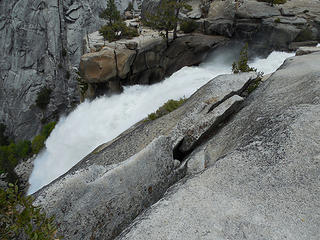 Lip of Nevada Fall 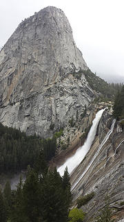 Liberty Cap & Nevada Fall 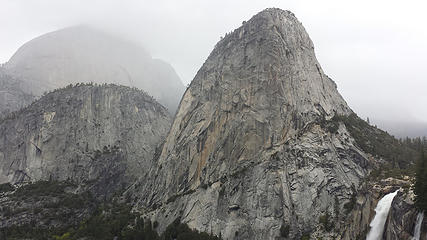 Liberty Cap & Nevada Fall 
 Gonna get wet... 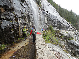 Wet hikers  @ least there was a nice view back toward Nevada Fall. @ least there was a nice view back toward Nevada Fall.
 Nevada Fall 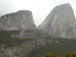 Mt. Broderick & Liberty Cap 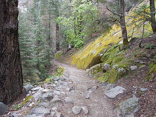 Heading down a mossy section of the JMT 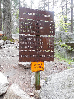 Trail sign 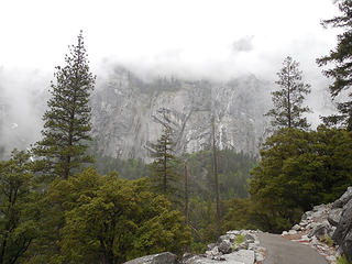 Low clouds 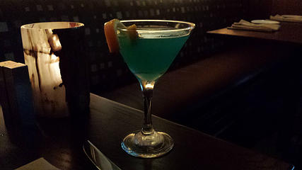 Yosemite Glacier Martini 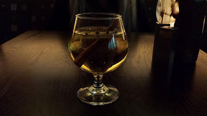 Hot Toddy 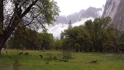 Deer grazing in Yosemite Valley 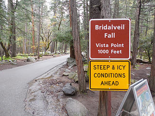 Bridalveil Fall TH 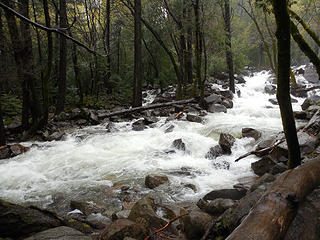 Bridalveil Creek 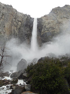 Bridalveil Fall 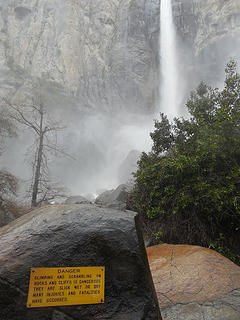 Bridalveil Fall 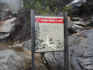 "Strong currents can batter you to death against the rocks." 
 BC w/Yosemite Falls 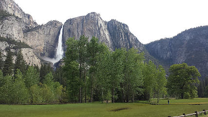 Yosemite Fall 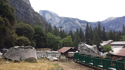 Leaving the village & heading up to Lower Yosemite Fall  1/2 Dome  Shady trail  Mossy rocks 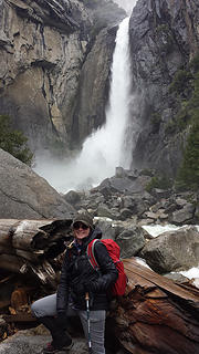 BC w/Lower Yosemite Falls 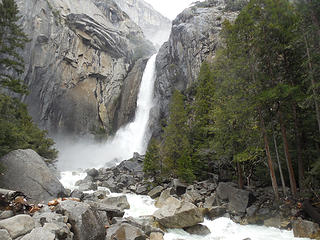 Lower Yosemite Fall 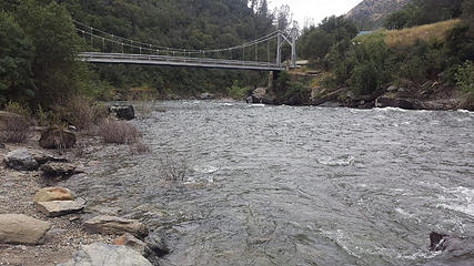 The bridge @ Briceburg  I also saw a sign about an upcoming prom for old people. I also saw a sign about an upcoming prom for old people. 
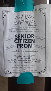 "Senior Citizen Prom" 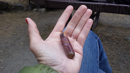 Tiny dildo  We lazed about camp reading books & enjoying the sound of the river, before cooking dinner & hitting the sack.
 Merced River 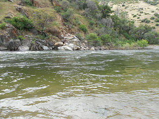 Calm waters here 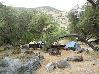 Our tents 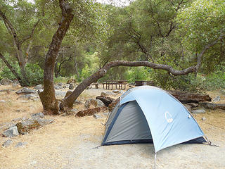 My tent 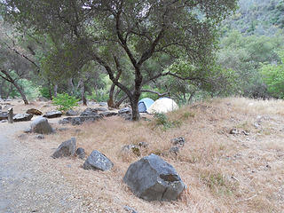 Our campsite 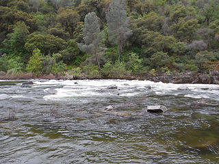 The river as seen from a couple campsites over  Gushing 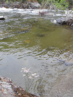 @ the water's edge 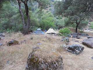 Our tents 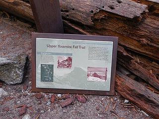 Sign along Upper Yosemite Fall trail 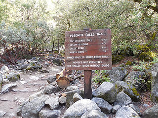 Trail sign 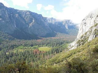 View near Columbia Rock 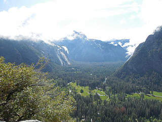 View near Columbia Rock 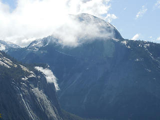 1/2 Dome in the clouds 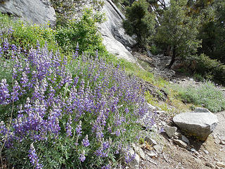 Blooms along the trail 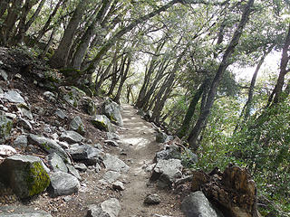 Shady section 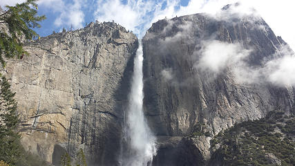 Upper Yosemite Falls 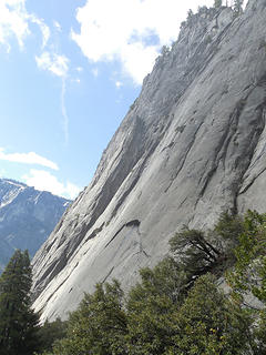 Cliff below Eagle Tower 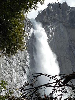 Lots of water 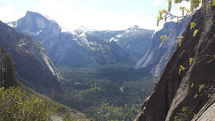 View from near Columbia Rock 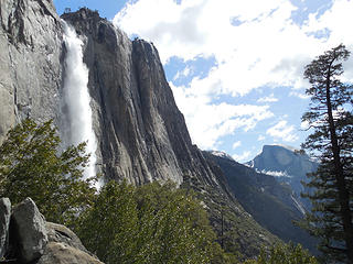 Side view 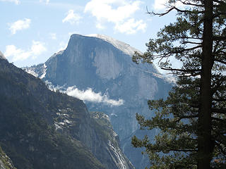 1/2 Dome outta the clouds now 
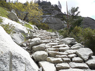 I don't think I've ever hiked a trail with this many granite steps 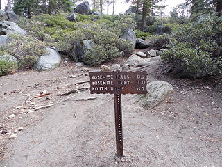 Trail sign 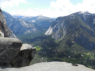 Viewpoint above the falls 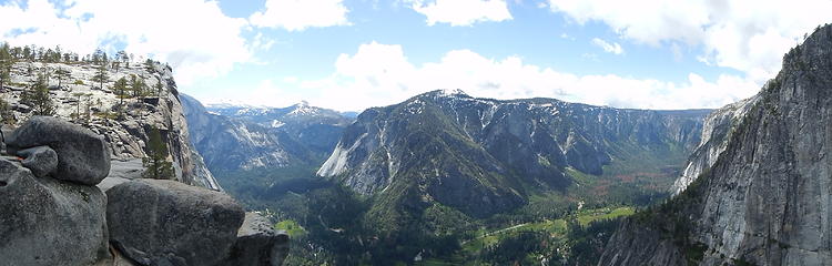 Pano 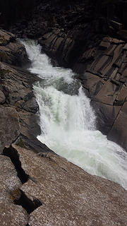 Upper Yosemite Falls just above the big drop 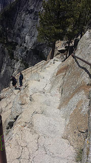 Narrow exposed trail that brings you to the overlook @ the brink 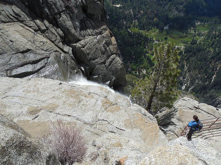 Upper Yosemite Falls overlook 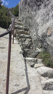 Heading back up the steps 
 Yep, this would be bad. Really, really bad. 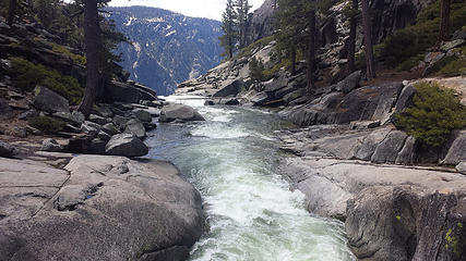 Yosemite Creek just above the falls 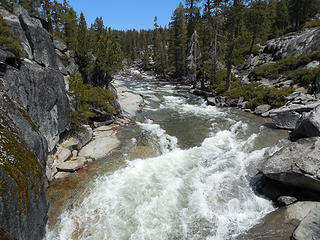 Looking upriver 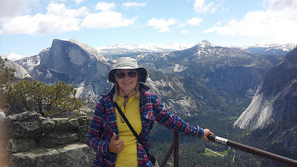 BC @ Yosemite Pt. 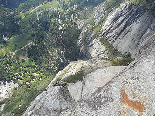 Section of trail we came up 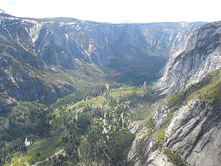 Yosemite Pt. view 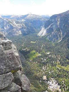 Yosemite Pt. view 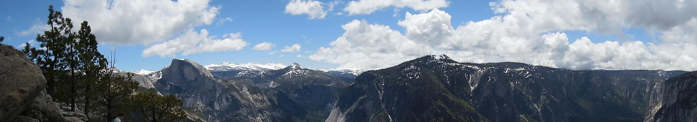 Yosemite Pt. pano 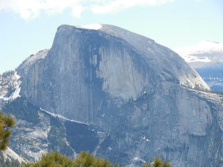 Do I really need to label this photo?? 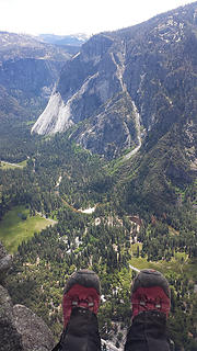 Boot shot @ Yosemite Pt. 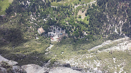 @ the brink of the 3,000' cliff 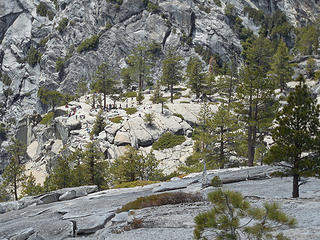 Peeps @ the fall overlook 
 Heading back down 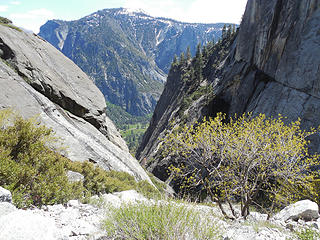 Going through the gap 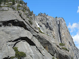 Looking back up @ the fall 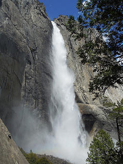 I can still feel the mist 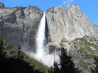 Upper Yosemite Fall in the afternoon 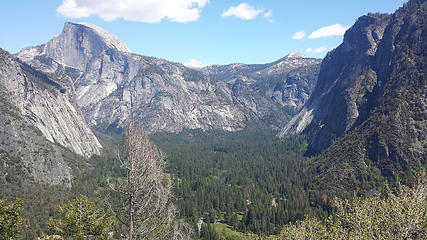 The upper end of the valley 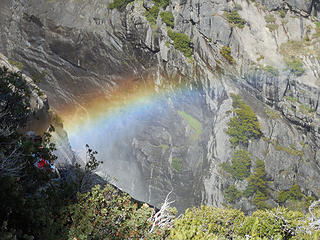 Rainbow 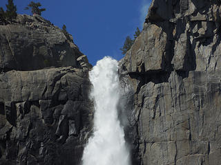 Zoom of the top of Upper Yosemite Falls 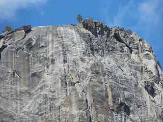 Yosemite Point 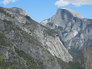 1/2 Dome 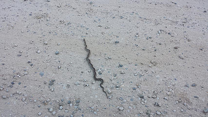 Snake on the rd. as we drove back to camp 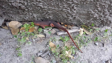 Salamander  Like that's not vague... 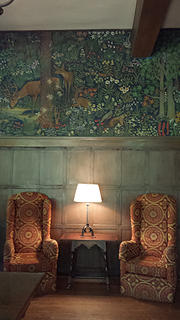 The Majestic Hotel 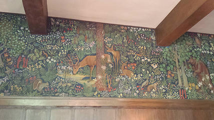 The Majestic Hotel 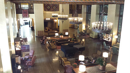 The Majestic Hotel  View out the window from where we had brunch 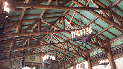 The Majestic Hotel restaurant ceiling 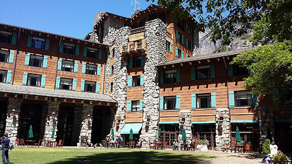 The Majestic Hotel 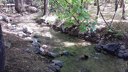 Creek behind hotel 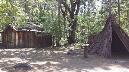 Outside the Indian Museum 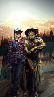 Me & John Muir 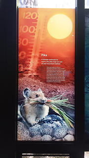 Info about pikas 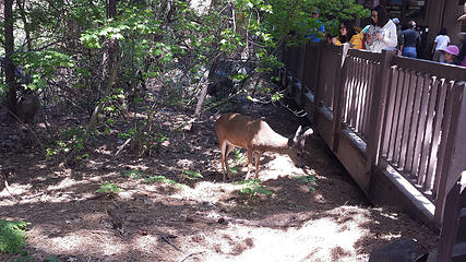 Deer outside the grocery store  Deer outside the grocery store 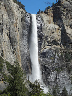 Bridleveil Falls 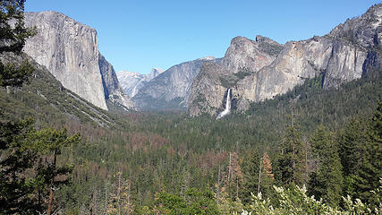 Tunnel View 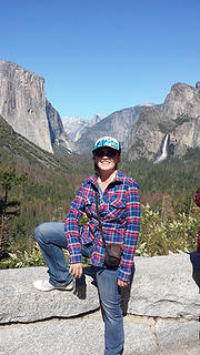 BC @ Tunnel View 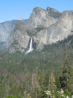 Bridalveil Fall 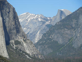 Tunnel View 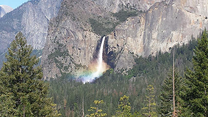 Rainbow @ the base of Bridalveil Falls 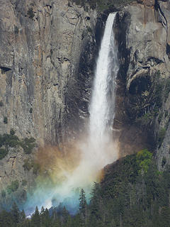 Bridalveil Fall rainbow 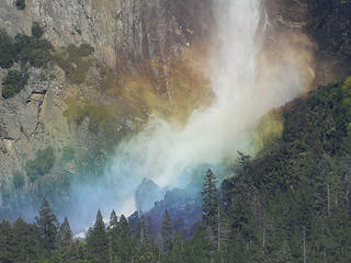 Bridalveil Fall rainbow 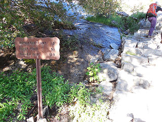 TH sign 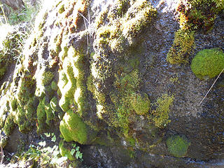 Mossy rock 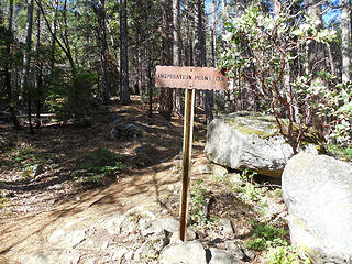 Trail sign 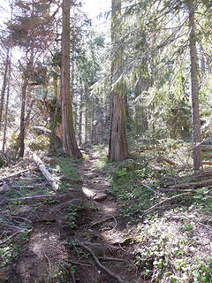 Woodsy trail 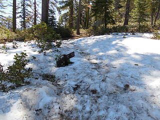 Gettin' snow-covered :-( 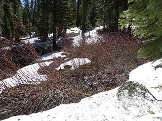 Hmmm 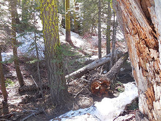 Nope. Kept losing trail & the motivation to trudge thru snow just wasn't there. Been there, done that. 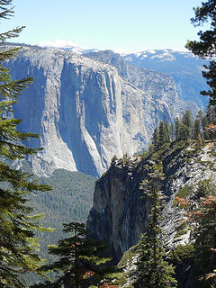 Cliffs 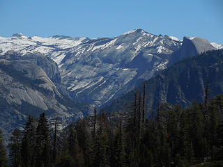 Went further back down the trailhead & found this nice viewpoint instead to take my break. 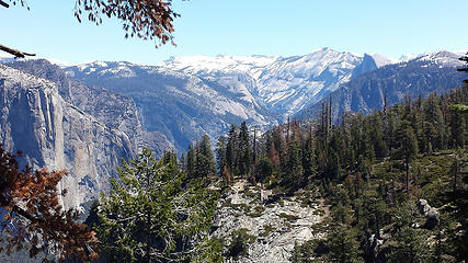 Viewpoint along the trail 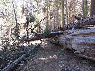 Lots of blowdowns along this trail 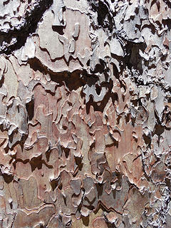 Bark 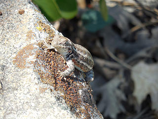 Lizard 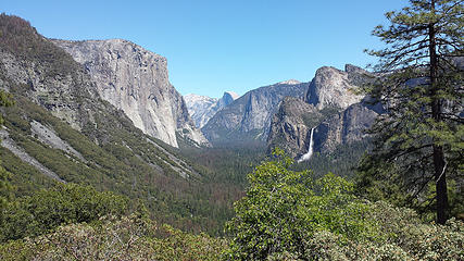 Just above Tunnel View, w/o the crowds 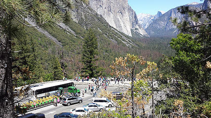 Tourists 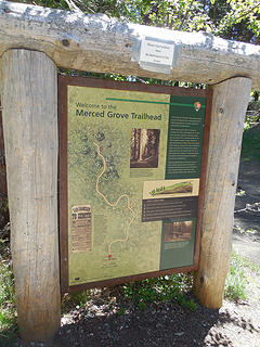 Sign @ Merced Grove TH 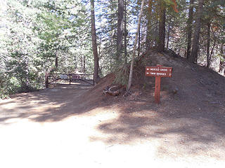 Junction 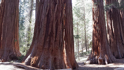 Sequoias @ Merced Grove 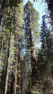 Sequoias @ Merced Grove 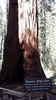 Sequoias @ Merced Grove 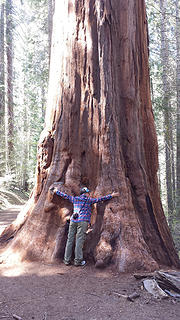 Treehugger 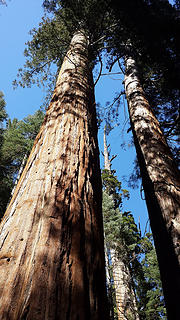 Sequoias @ Merced Grove 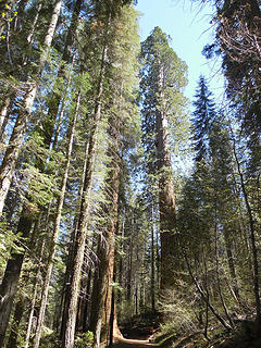 Sequoias @ Merced Grove 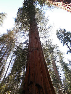 Sequoias @ Merced Grove 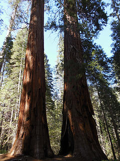 Sequoias @ Merced Grove 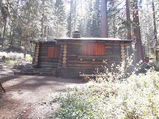 Cabin 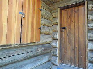 Cabin 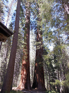 Sequoias @ Merced Grove 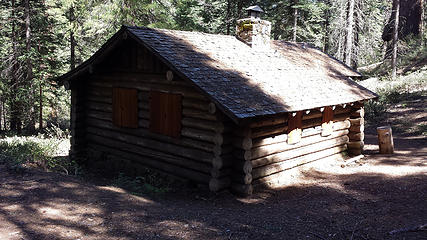 Cabin 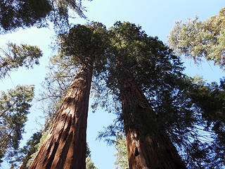 Sequoias @ Merced Grove 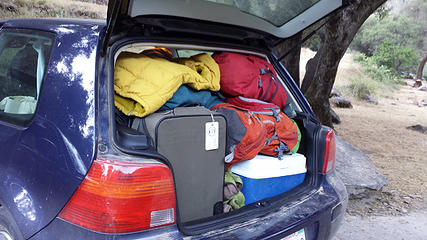 The most stuffed my car has ever been 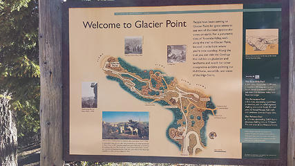 Sign @ Glacier Pt. 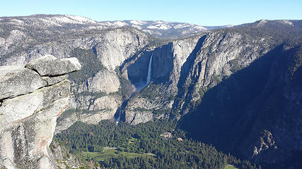 Yosemite Falls as seen from Glacier Pt. 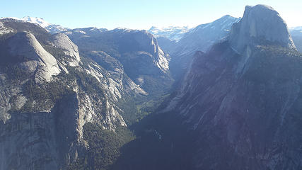 Glacier Pt. view 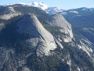 North Dome, Basket Dome 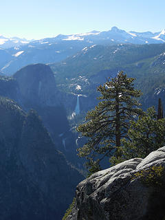 Nevada Fall 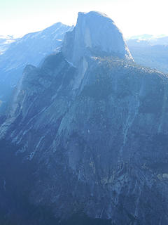 1/2 Dome 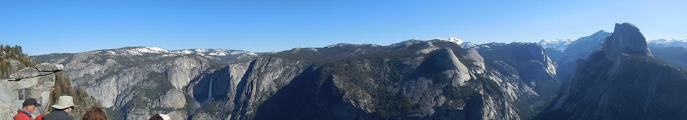 Glacier Pt. pano 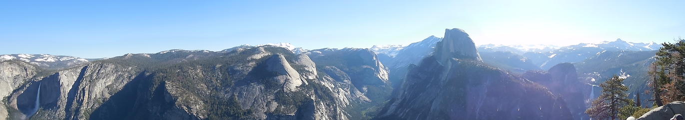 Glacier Pt. pano 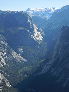 Looking up the valley  Glacier Pt. view 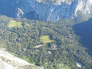 Yosemite Valley far below  Still snowy in the high country 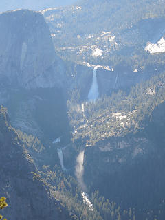 Nevada & Vernal Falls 
 Half Dome as seen from Washburn Pt. 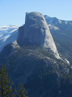 Half Dome as seen from Washburn Pt. 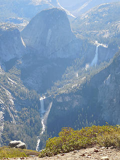 Liberty Cap w/Nevada & Vernal Falls 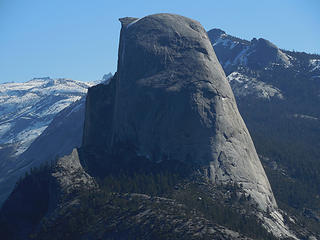 Half Dome as seen from Washburn Pt.  Back in town, my companion was uninterested in finishing off the trip right, so I had to go by myself. Back in town, my companion was uninterested in finishing off the trip right, so I had to go by myself. 
 Post "Yosemite, bitch!" marg
Home is where the hiking is.
"Peaks that have come and gone four times should halt a man in his steps." -- William O. Douglas
A balanced diet is a margarita in each hand.
Home is where the hiking is.
"Peaks that have come and gone four times should halt a man in his steps." -- William O. Douglas
A balanced diet is a margarita in each hand.
|
| Back to top |
  
|
|
wildernessed
viewbagger

Joined: 31 Oct 2004
Posts: 9275 | TRs | Pics
Location: Wenatchee |
Lots of water this year, great photos, one of my best memories after a day of hiking was swimming with the kids in the Merced River when it was over a 100 degrees late season.
Living in the Anthropocene
Living in the Anthropocene
|
| Back to top |
|
|
Magellan
Brutally Handsome

Joined: 26 Jul 2006
Posts: 13116 | TRs | Pics
Location: Inexorable descent |
|
Magellan
Brutally Handsome
|
 Tue Jun 13, 2017 9:12 am |
|
|
Very, very cool. Thanks for sharing BC
|
| Back to top |
|
|
Ski
><((((°>

Joined: 28 May 2005
Posts: 12832 | TRs | Pics
Location: tacoma |
|
Ski
><((((°>
|
Tue Jun 13, 2017 10:09 am |
|
|
"I shall wear white flannel trousers, and walk upon the beach.
I have heard the mermaids singing, each to each."
"I shall wear white flannel trousers, and walk upon the beach.
I have heard the mermaids singing, each to each."
|
| Back to top |
|
|
Mesahchie Mark
A Lerxst

Joined: 10 May 2005
Posts: 700 | TRs | Pics
Location: In Wonderland |
Awesome - great pics! Been 11 years since I've been there - gotta go back now!
|
| Back to top |
|
|
Gimpilator
infinity/21M

Joined: 12 Oct 2006
Posts: 1684 | TRs | Pics
Location: Edmonds, WA |
Thanks for all that you put into this report. I enjoyed it. Have not been to Yosemite yet, myself.
|
| Back to top |
|
|
Bloated Chipmunk
Cock Rock Searcher
Joined: 29 Jan 2007
Posts: 2993 | TRs | Pics
Location: Margaritaville |
Home is where the hiking is.
"Peaks that have come and gone four times should halt a man in his steps." -- William O. Douglas
A balanced diet is a margarita in each hand.
|
| Back to top |
|
|
zephyr
aka friendly hiker

Joined: 21 Jun 2009
Posts: 3370 | TRs | Pics
Location: West Seattle |
|
zephyr
aka friendly hiker
|
Tue Jun 13, 2017 10:23 pm |
|
|
Great report. I appreciate all the info and details. Great photos too. This one was a little nerve-wracking. Vertigo anyone?
| Bloated Chipmunk wrote: | Section of trail we came up |
So did you drive this road into the park? Looks like you dodged a bullet. (aerial video at the link) ~z
Quote from San Luis Obispo News Tribune (original article in Sacramento Bee):
A large rockslide on Monday afternoon is going to keep the Arch Rock Entrance at Yosemite National Park closed at least throughout the weekend.
About 4,000 tons of rock broke away from the cliff adjacent to El Portal Road, which is an extension of Highway 140. The slab slid down the cliff and broke into many pieces after hitting a ledge. The debris fanned out over 1,000 feet, according to a release from the National Park Service.
One-third of the debris landed on El Portal Road. About 150 feet of the road is covered with 15-20 feet of rocks, with the largest boulder weighing 130 tons, according to the NPS.
The road itself sustained damage, as well as the retaining wall.
Yosemite National Park staff will be assessing the road and surrounding area at least until the weekend, . After staff finish the assessment, crews will begin to remove the debris and repair the road.
There is no estimate for when the road will reopen.
|
| Back to top |
|
|
Frodo Barefoot
Member

Joined: 09 Apr 2015
Posts: 91 | TRs | Pics
|
Very nice! Nothing more fulfilling than a realized dream, especially one this long in the making!
|
| Back to top |
|
|
olderthanIusedtobe
Member

Joined: 05 Sep 2011
Posts: 7709 | TRs | Pics
Location: Shoreline |
| Bloated Chipmunk wrote: | | I will say, however, that El Capitan was even bigger than I'd imagined....a huge monolith of sheer granite cliff that is situated near the western end of the valley & one of the 1st opportunities for jaw-dropping awe. |
I had the same experience. No photo truly can give you the scale of it. Have to be on the Valley floor gazing up at that cliff to appreciate just how big it is.
|
| Back to top |
|
|
olderthanIusedtobe
Member
Joined: 05 Sep 2011
Posts: 7709 | TRs | Pics
Location: Shoreline |
Looks like a great trip. Yosemite is one of a kind.
Next time ya gotta check out Tuolumne Meadow part of the Park...
|
| Back to top |
|
|
olderthanIusedtobe
Member
Joined: 05 Sep 2011
Posts: 7709 | TRs | Pics
Location: Shoreline |
Did you see California ground squirrels? They were everywhere in the Valley when I was there. Cute as can be, but shameless beggars I think. I'm pretty sure they've figured out how cute they are.
|
| Back to top |
|
|
Bloated Chipmunk
Cock Rock Searcher
Joined: 29 Jan 2007
Posts: 2993 | TRs | Pics
Location: Margaritaville |
Home is where the hiking is.
"Peaks that have come and gone four times should halt a man in his steps." -- William O. Douglas
A balanced diet is a margarita in each hand.
|
| Back to top |
|
|
zephyr
aka friendly hiker
Joined: 21 Jun 2009
Posts: 3370 | TRs | Pics
Location: West Seattle |
|
zephyr
aka friendly hiker
|
Thu Jun 15, 2017 8:27 pm |
|
|
| Bloated Chipmunk wrote: | | Yes, hwy. 140 is the one we took back 'n forth into the park everyday. I knew of a couple sections that historically are known to slide, but this sounds like maybe a slightly different spot. Sure thankful that we weren't caught in that! |
Wow. Just wow. Good timing on your part. I found a video link.
Do you remember driving this section? ~z
|
| Back to top |
|
|
Bloated Chipmunk
Cock Rock Searcher
Joined: 29 Jan 2007
Posts: 2993 | TRs | Pics
Location: Margaritaville |
| zephyr wrote: | | Do you remember driving this section? ~z |
Yeah, looks familiar...we must've driven back & forth thru that section many times if that's along the 140 / El Portal Rd.
Home is where the hiking is.
"Peaks that have come and gone four times should halt a man in his steps." -- William O. Douglas
A balanced diet is a margarita in each hand.
Home is where the hiking is.
"Peaks that have come and gone four times should halt a man in his steps." -- William O. Douglas
A balanced diet is a margarita in each hand.
|
| Back to top |
|
|
|
|
You cannot post new topics in this forum
You cannot reply to topics in this forum
You cannot edit your posts in this forum
You cannot delete your posts in this forum
You cannot vote in polls in this forum
|
Disclosure: As an Amazon Associate NWHikers.net earns from qualifying purchases when you use our link(s). |


 Anyway, it was too busy munching on a plant to beg anything from me. I watched the cutie for a bit until it lost its footing & slipped off the rock it was on, exposing its fat belly while it tumbled down & then scampered off.
  Yep, Tuolumne Meadows is a possibility for this fall.