| Previous :: Next Topic |
| Author |
Message |
bertman
Member


Joined: 17 Jul 2006
Posts: 362 | TRs | Pics
|
|
bertman
Member
|
 Tue Aug 08, 2017 6:10 pm |
|
|
I attempted a hike to Lake Isabel. I succeeded.
http://www.wta.org/go-hiking/hikes/lake-isabel
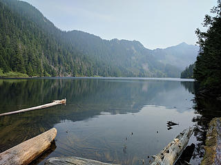 Lake Isabel 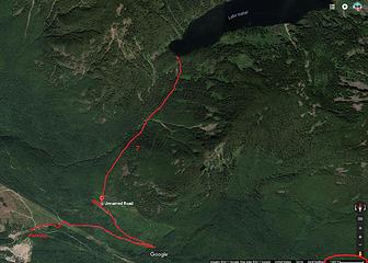 Rough track 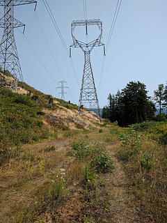 under the powerline 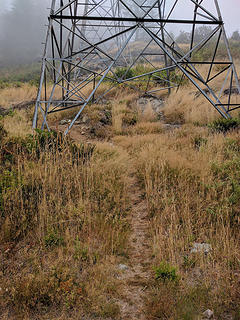 climb beneath the tower to reach the upper road 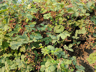 ripe blackberries 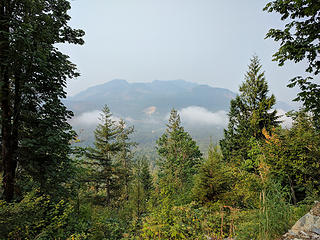 hazy 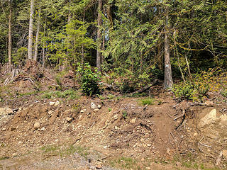 trail from spur road, barely visible 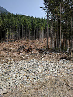 just before top of clearcut, head east 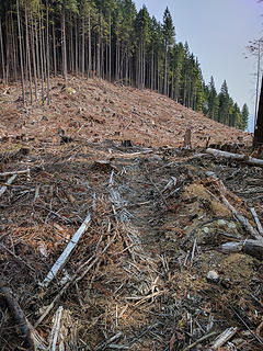 heading east through clearcut to intersect trail 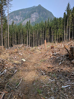 trail through clearcut heading north 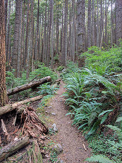 start of trail proper 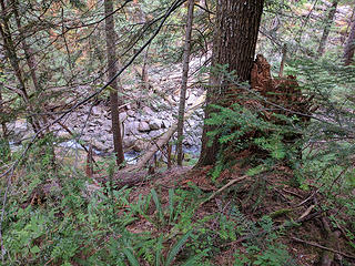 May Creek 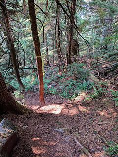 very steep, look for flags 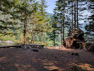 campsite 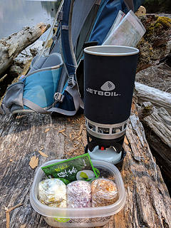 lunch 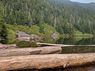 log jam at outlet 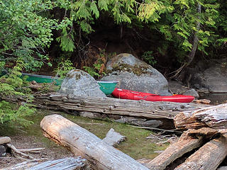 canoe and kayak
|
| Back to top |
  
|
|
bertman
Member
Joined: 17 Jul 2006
Posts: 362 | TRs | Pics
|
|
bertman
Member
|
Tue Aug 08, 2017 6:18 pm |
|
|
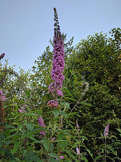
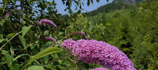
BTW, anyone know what kind of flower this is?
 flower
|
| Back to top |
|
|
kitya
Fortune Cookie

Joined: 15 Mar 2010
Posts: 842 | TRs | Pics
Location: Duvall, WA |
|
kitya
Fortune Cookie
|
Wed Aug 09, 2017 6:25 am |
|
|
|
| Back to top |
|
|
flatsqwerl
Member
Joined: 23 Feb 2010
Posts: 1049 | TRs | Pics
Location: tacoma |
Bertman, back in 1980 or so, my brother and I lived at the lake for a month in a camp near the inlet. We built a large 2-log raft that we paddled about the lake. Many stories from that period! It is a beautiful lake.
|
| Back to top |
|
|
bertman
Member
Joined: 17 Jul 2006
Posts: 362 | TRs | Pics
|
|
bertman
Member
|
Thu Aug 10, 2017 10:47 pm |
|
|
thanks kitya!
flatsqwerl, that's neat!
|
| Back to top |
|
|
Brockton
Member

Joined: 02 Aug 2012
Posts: 266 | TRs | Pics
Location: West Seattle |
|
Brockton
Member
|
Fri Aug 11, 2017 12:02 pm |
|
|
I don't think that's fireweed. The flowers don't look right or the leaf and branch structure. I don't know what it is, but when I zoom in to the photo, the flowers remind me of something in the Boraginaceae family.
|
| Back to top |
|
|
Backpacker Joe
Blind Hiker

Joined: 16 Dec 2001
Posts: 23956 | TRs | Pics
Location: Cle Elum |
Anybody fly in there while you were there?
"If destruction be our lot we must ourselves be its author and finisher. As a nation of freemen we must live through all time or die by suicide."
Abraham Lincoln
"If destruction be our lot we must ourselves be its author and finisher. As a nation of freemen we must live through all time or die by suicide."
Abraham Lincoln
|
| Back to top |
|
|
zephyr
aka friendly hiker

Joined: 21 Jun 2009
Posts: 3370 | TRs | Pics
Location: West Seattle |
|
zephyr
aka friendly hiker
|
Sat Aug 12, 2017 4:46 pm |
|
|
| bertman wrote: | BTW, anyone know what kind of flower this is?
flower |
| Brockton wrote: | | I don't think that's fireweed. The flowers don't look right or the leaf and branch structure. I don't know what it is, but when I zoom in to the photo, the flowers remind me of something in the Boraginaceae family. |
I agree with Brockton on this. The colors and habit look similar, but there are differences. Note the leaves for one. Compare how the sets of leaves are attached to the stem. I don't have the botannical term at hand, but someone here will know. Here is a very recent report from the ALW posted by geyer. Look at his opening photo. This is more what fireweed should look like in my opinion. ~z
| geyer wrote: | 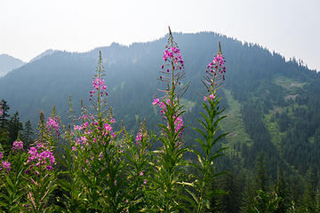 Flowers and haze |
|
| Back to top |
|
|
Gwen
LO Girl-of-the-Month
Joined: 14 Feb 2010
Posts: 1673 | TRs | Pics
|
|
Gwen
LO Girl-of-the-Month
|
Sat Aug 12, 2017 4:55 pm |
|
|
Another in agreement that it's not fireweed. Almost looks like some sort of butterfly bush to me. I'll have to hunt it out, see what I can find.
Tomorrow's not promised to anyone, so be bold, scare yourself, attempt something with no guarantee of success. You'll be amazed at what you can achieve. -Olive McGloin
Tomorrow's not promised to anyone, so be bold, scare yourself, attempt something with no guarantee of success. You'll be amazed at what you can achieve. -Olive McGloin
|
| Back to top |
|
|
zephyr
aka friendly hiker
Joined: 21 Jun 2009
Posts: 3370 | TRs | Pics
Location: West Seattle |
|
zephyr
aka friendly hiker
|
Sat Aug 12, 2017 5:23 pm |
|
|
| Gwen wrote: | | Another in agreement that it's not fireweed. Almost looks like some sort of butterfly bush to me. |
Well, you could very well be correct. If so, then that's why the foliage in particular looked so familiar and why I couldn't find it here. Hmmm. ~z
|
| Back to top |
|
|
bertman
Member
Joined: 17 Jul 2006
Posts: 362 | TRs | Pics
|
|
bertman
Member
|
Tue Aug 15, 2017 11:08 am |
|
|
Here's a close up of that mysterious flower. Many of them were bent over from the weight.
 unknown_closeup
|
| Back to top |
|
|
Nancyann
Member
Joined: 28 Jul 2013
Posts: 2318 | TRs | Pics
Location: Sultan Basin |
|
Nancyann
Member
|
Tue Aug 15, 2017 11:44 am |
|
|
I'm sure that is a butterfly bush, like Gwen said. They are a noxious weed and grow profusely in the foothills around Sultan and Goldbar. I even have one in my yard that keeps growing back after I cut it down. The butterflies and hummingbirds like them though!
|
| Back to top |
|
|
|
|


