| Previous :: Next Topic |
| Author |
Message |
puzzlr
Mid Fork Rocks


Joined: 13 Feb 2007
Posts: 7220 | TRs | Pics
Location: Stuck in the middle |
|
puzzlr
Mid Fork Rocks
|
 Wed Aug 16, 2017 1:41 pm |
|
|
Dissent is a bump on the north ridge of Mount Defiance, Pt 4573 on the topo. The name is appropriate as a milder form of defiance. Surprisingly, four people agreed to join me on a hike out to this minor high point with only 133' of prominence. The attraction to me is its central position overlooking the Pratt River valley, giving a unique view of the peaks and valleys in that area.
Open this map full screen.
We went up the old Mason Lake trail and continued on the Mt Defiance trail to 4840' at the last switchback before it swung over to the east ridge. We crossed the large talus field above Lake Kulla Kulla heading for a 5000' low point on the north ridge. There is one spot where it's an easy scramble to the top -- in most places slabby rocks make it difficult to gain the ridge.
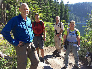
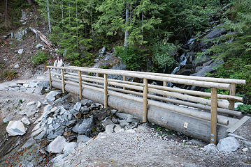 Mason Creek bridge 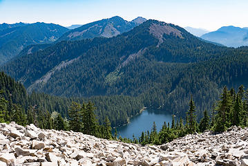 Traversing above Kulla Kulla Lake 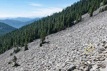 Traversing above Kulla Kulla Lake 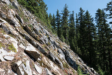 Slabby rocks on the east side of the ridge. It was an easy scramble in the trees beyond. 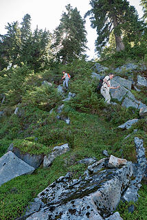 Descending to the talus with the aid of a handline 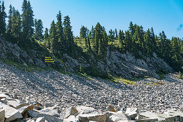 Where we got down to the talus 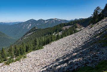 First view of Dissent, the rocky point at the end of the north ridge of Defiance. 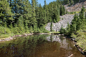 Dragonfly Pond, name for the iridescent insects seen there. 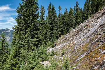 Traversing below the slabby rock slopts of Defiance's north ridge 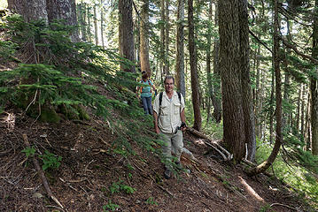 Richp in the open alpine forest 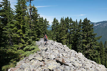 After traversing below the north ridge for a while we intersected it at an open talus area. 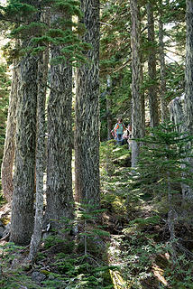 The ridge walk out to Dissent was mostly open forest 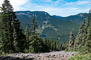 A view point of Spider Lake with P3, Web, Dirtybox, Mailbox and Thompson Point on the skyline 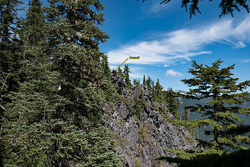 A glimpse of the summit block 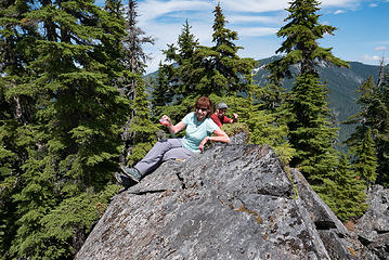 BarbE and Penguin on the summit 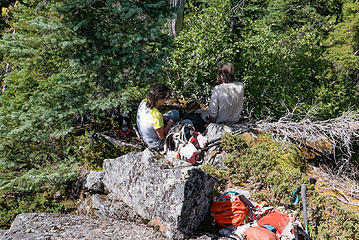 Elle and Richp prefer the shade 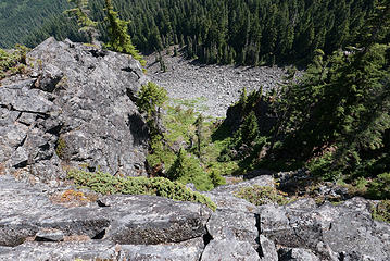 Cliffs on the east side 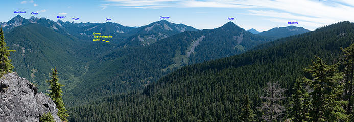 View east from the top 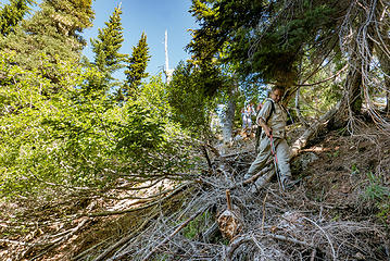 Richp demonstrating his flexability 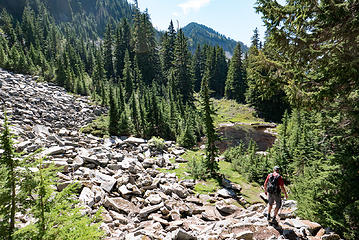 Dragonfly Pond again on the return trip 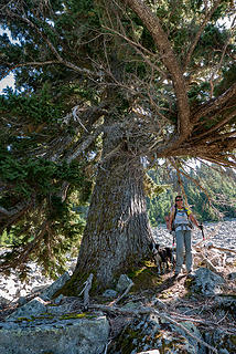 Elle and an ancient tree growing alone in the talus field 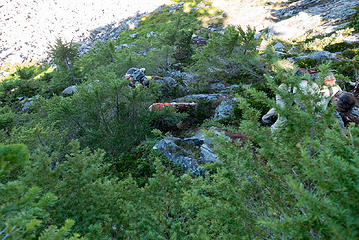 Scrambling back up to the ridge line. We didn't need a rope this direction. 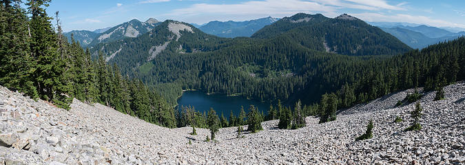 The beautiful traverse over Lake Kulla Kulla with pioneering trees finding a way to survive in the middle of the talus field. 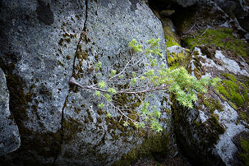 Young tree growing out of a crack 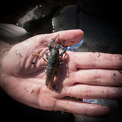 Richp found a crayfish in Mason Lake
|
| Back to top |
  
|
|
RichP
Member

Joined: 13 Jul 2006
Posts: 5634 | TRs | Pics
Location: here |
|
RichP
Member
|
Wed Aug 16, 2017 1:47 pm |
|
|
That was a fun day out and my first time on the old Mason Lake Trail which is in dandy shape.
Dragonfly Pond would make a nice and secluded camp spot on the grassy shore and is the only water source in that area. We did see some bear poo right next to it.
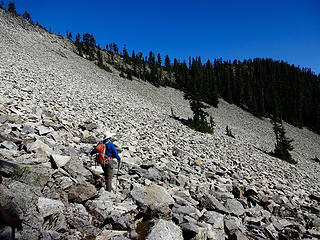 The talus slope before crossing the ridge. 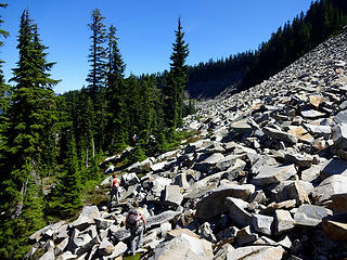 The other side of the ridge. 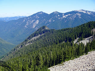 Dissent with Preacher and Caroline above. 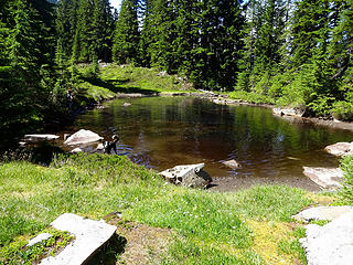 Izzy at the pond. 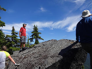 The summit rock.
|
| Back to top |
|
|
BarbE
Member

Joined: 28 Jul 2006
Posts: 1153 | TRs | Pics
|
|
BarbE
Member
|
Wed Aug 16, 2017 3:31 pm |
|
|
I'm taking a wild guess, Puzzlr's summit register won't be overflowing with entries anytime soon.  Interesting hard route, not your typical I-90 destination.
 Still fresh 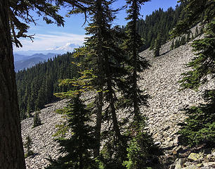 Boulder fields - theme of the day 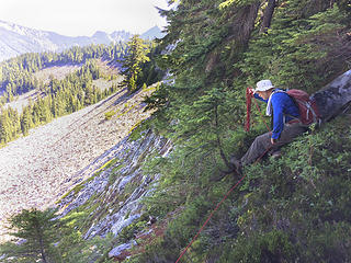 Puzzlr rigging a handline 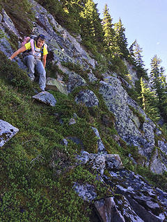 Steepish 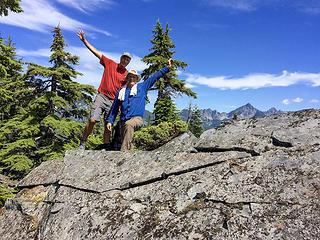 Conquerers of the mighty Dissent
|
| Back to top |
|
|
zephyr
aka friendly hiker

Joined: 21 Jun 2009
Posts: 3370 | TRs | Pics
Location: West Seattle |
|
zephyr
aka friendly hiker
|
Wed Aug 16, 2017 4:37 pm |
|
|
| puzzlr wrote: | Richp found a crayfish in Mason Lake |
Great creative adventure. Okay, how do the crayfish get up there? Would they migrate up via the outlet stream? What a journey that would be for them. ~z
|
| Back to top |
|
|
RichP
Member
Joined: 13 Jul 2006
Posts: 5634 | TRs | Pics
Location: here |
|
RichP
Member
|
Thu Aug 17, 2017 1:47 pm |
|
|
| zephyr wrote: | | puzzlr wrote: | Richp found a crayfish in Mason Lake |
Great creative adventure. Okay, how do the crayfish get up there? Would they migrate up via the outlet stream? What a journey that would be for them. ~z
. |
Maybe this is the answer?
| Quote: | | Crayfish invasions are often attributed to the historically common use of crayfish as live fishing bait (Lodge et al. 2000; DiStefano et al. 2009). Like regulations on prohibited species,
live bait regulations vary between states and provinces of the Pacific Northwest. The most common practice, implemented
by Idaho, Oregon, and Washington, is to permit the use of live crayfish only in the water body where the organism was captured. British Columbia allows live crayfish as bait in streams but not lakes, while Montana allows the use of live crayfish on all waters not restricted to artificial lures. We recommend allowing live bait only in the water where the organism was directly captured as a precautionary means of reducing risk of introductions, but others have strongly recommended complete bans on use of live crayfish as bait (Lodge et al. 2000). |
We do have both native and invasive species in the area.
http://www.invasivespecies.wa.gov/documents/Fisheries_2011a_Cray.pdf
|
| Back to top |
|
|
zephyr
aka friendly hiker
Joined: 21 Jun 2009
Posts: 3370 | TRs | Pics
Location: West Seattle |
|
zephyr
aka friendly hiker
|
Fri Aug 18, 2017 6:52 pm |
|
|
Thanks for the explanation, RichP. Bait never entered my mind since I don't fish. I was initially stumped on how they could gain such altitude or clamber over the many water falls and boulders in an outlet stream. (Did birds drop them in? haha) But bait usage makes perfect sense. ~z
|
| Back to top |
|
|
Blowdown
Sawin' Logs ...

Joined: 24 Aug 2011
Posts: 375 | TRs | Pics
Location: On the Summit |
|
Blowdown
Sawin' Logs ...
|
Sun Aug 20, 2017 6:53 pm |
|
|
Great report and photos, Puzzlr. I'm always impressed by your scholarly explorations of the Snoqualmie region.  Outstanding photo and viewpoint! Nice work!
|
| Back to top |
|
|
|
|


