| Previous :: Next Topic |
| Author |
Message |
williswall
poser


Joined: 30 Sep 2007
Posts: 1968 | TRs | Pics
Location: Redmond |
A Glacier Peak circumnavigation was the cherry of my orbits of the 6 PNW volcanoes. My daughter and I attempted it last year, but for various reasons we decided to turn back on day 2 and return to the vehicle to preclude my wife having to do a difficult bail out if it came to that. With vacation and good weather, including no fires, in hand, I drove to the Grasshopper Meadows campground on Thursday night; the road is closed for the two miles up to White River campground, so everyone parks here. I bedded down in my truck in anticipation of setting out early the next morning. Link to my blog writeup on this trip, different for a different audience.
Day 1: Grasshopper Meadows to Little Giant Pass: 19.5 miles
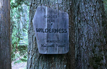
After exchanging emails with Luke (Distel32) I decided to do a CCW orbit, using the Buck Creek Trail (#789) for the turn to the north (Luke and Ben used the Spider Meadow/Lyman lake version). Since my hiking legs were somewhat sketchy, I decided to get the hard parts done first, then cruise on the PCT before tackling the Indian Creek trail on the last day. I set off at 6 AM, walking the closed road to the end of 6400, then Trail 1562 to Boulder Pass as I turned east. The first day is always easy in that everything is fresh and the body is starting with a clean sheet. The climb to Boulder Pass was enjoyable and people free, and I enjoyed fine weather along with this solitude as I surveyed my next destination, the Napeequa Valley and river crossing. Even from the heights one can tell the Napeequa is a special place, a broad plain with a wandering yet consistent river that is green without being overgrown with brush and trees. Despite having 5 days of food in my pack, I barely noticed it on my back as my total weight (with food and water) was only 16 pounds. This light load is welcome, especially on this descent from 6300 to 4400. When I reached the valley floor and surveyed the ford point it was evident that no searching was required, the gentle but broad waterway was but knee deep and I simply made a beeline straight for the opposite bank where the trail continued. Its a short trip down the valley to the ascent point but incredibly serene. The trail was easy to follow and the grasses were gently swaying in the wind as I followed the river downstream. I can see why many choose the route from High Pass down to the Napeequa in their orbit, but that shortens the trip considerably (total mileage for my iteration is 110 miles) and I was so looking forward to walking the Chiwawa River road to Trinity
..not. Up until this point I had experienced bouts of outdoor euphoria, but that hid in a corner once I was on the climb to Little Giant Pass. This trail can hardly be called such, its basically a guide for scrambling up the Chiwawa Ridge for 2000. As I climbed I noticed two parties camping in the Napeequa Valley, and didnt think much of it until I talked to a party of 3 the next day who camped below me at Little Giant. They said in 30 years of camping in the Napeequa prior to this year, they had only seen 4 other people. Counting the party of 3 that crossed paths with me descending, that would make about 9 just that day. I managed to finish that bit of scrambling up to Little Giant and, having no particular plan, I decided to set up camp for the evening at an open spot below the pass. For gear I was using an EE Recon bivy, an EE 30 degree quilt and a ZPacks Pocket Tarp, plus my Nunatak Skaha jacket; I did not want to be cold on this trip. I ate a bean burrito and settled in for the night.
 D1.1 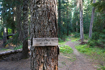 D1.2 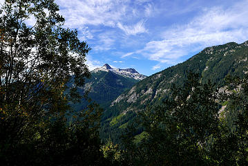 D1.3 climb to Boulder Pass 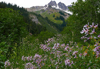 D1.4 flowers are still bloomin' 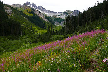 D1.5 more flower fields 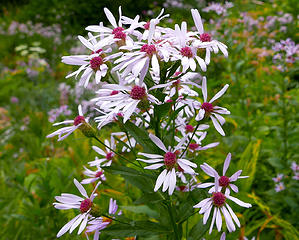 D1.6 pollen collectors 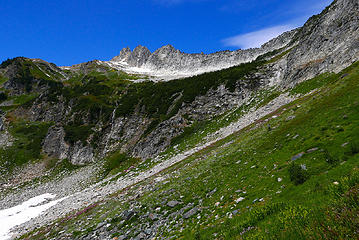 D1.7 entering alpine zone 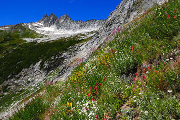 D1.8 splendor of the hills 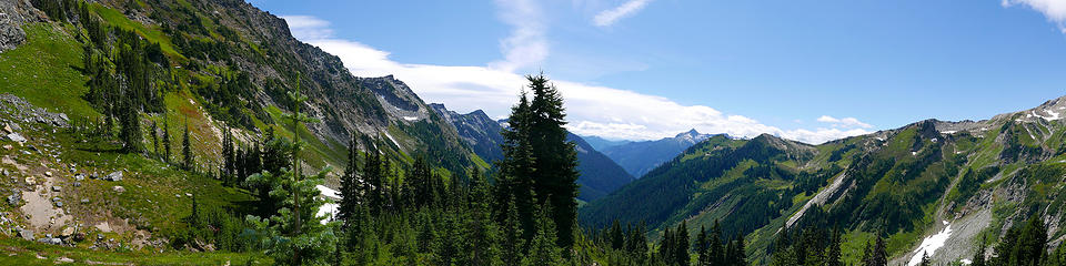 D1.9 Boulder Pass pano 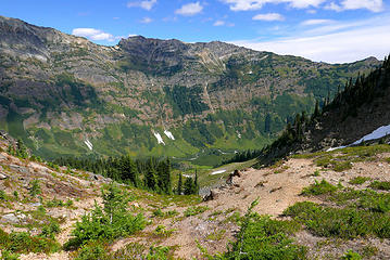 D1.10 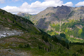 D1.11 trail down to the Napeequa 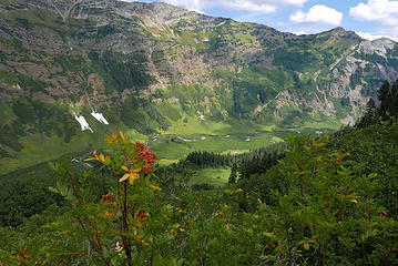 D1.12 descending to the Napeequa valley  D1.13 clean picking 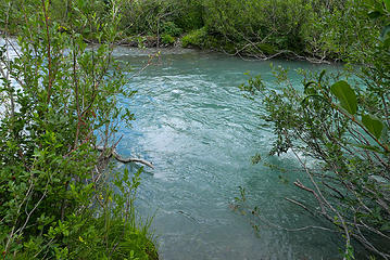 D1.14 Napeequa river ford point 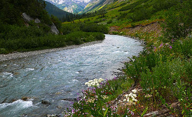 D1.15 Beautiful! 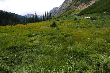 D1.16 Napeequa valley 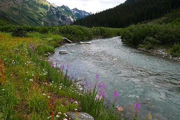 D1.17 more splendor 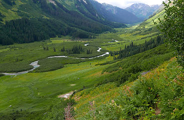 D1.18 Napeequa valley climbing to Little Giant Pass 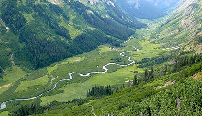 D1.19 looking towards High Pass 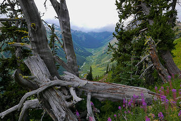 D1.20 parting is such...... 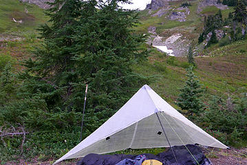 D1.21 bivy site below Little Giant Pass 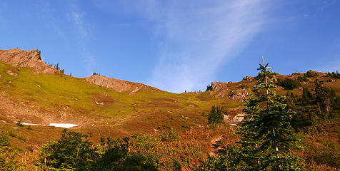 D2.1 sunrise descending from Little Giant Pass 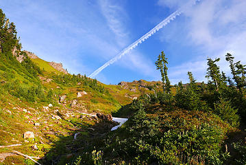 D2.2 morning skies 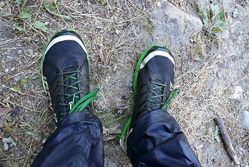 D2.3 shoe rinse after fording Chiwawa River 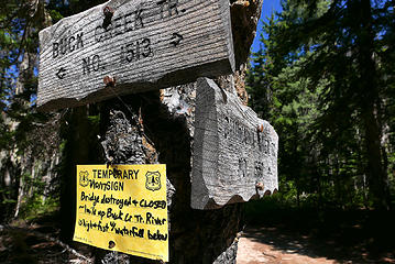 D2.4 not to be dissuaded 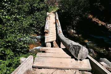 D2.5 "destroyed bridge" after crossing 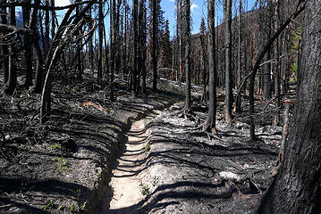 D2.6 Buck Creek fire zone 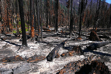 D2.7 Buck Creek fire ash residue 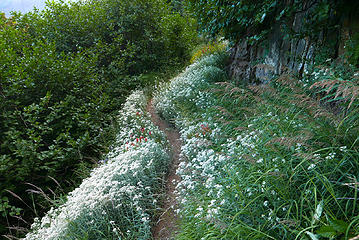 D2.8 climbing to Buck Pass 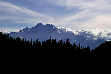 D2.9 Glacier Peak near Buck Pass 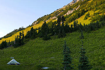 D2.10 no room at the Inn- bivy site Buck Pass 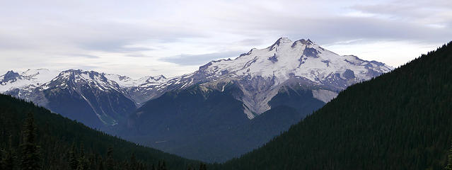 D3.1 Glacier Peak leaving Buck Pass on day 3 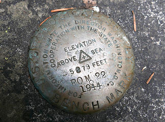 D3.2 bench mark at a creek 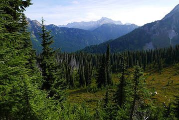 D3.3 descending from Middle Ridge 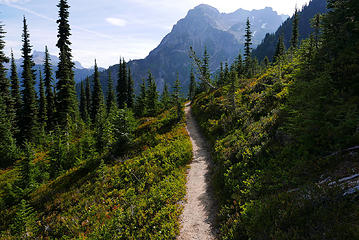 D3.4 nice trail 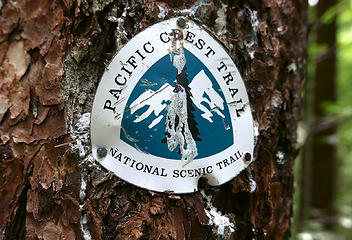 D3.5 only one of these I saw 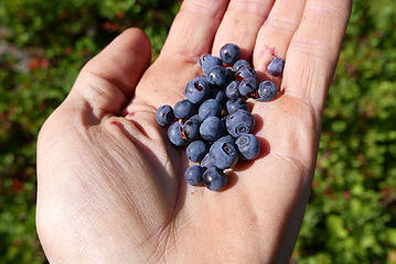 D3.6 stop and eat the berries 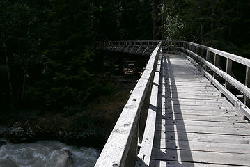 D3.7 Suiattle River bridge 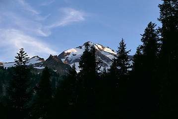 D3.8 peekaboo shot climbing to point 5900 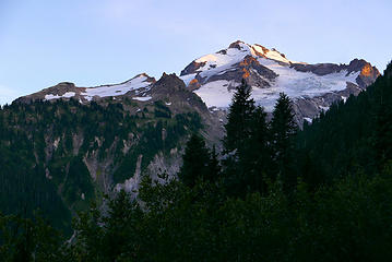 D3.9 more views on the climb 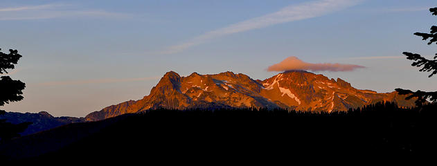 D3.10 alpenglow splendor 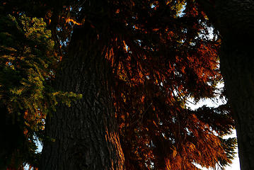 D4.1 sunrise on tree from bivy site 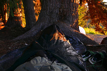 D4.2 no tarp required 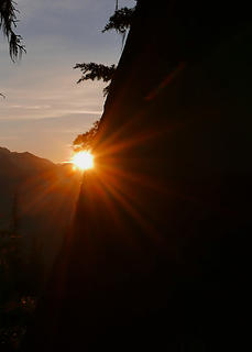 D4.3 tree eclipse 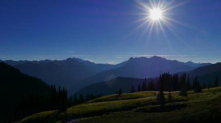 D4.4 eclipse day (a few hours to go) 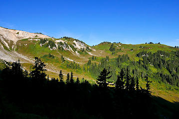 D4.5 spotting my viewing site 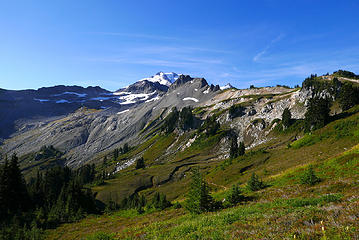 D4.6 even if the eclipse is a bust, the view isn't 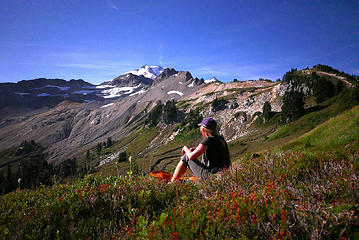 D4.7 Barbara awaits 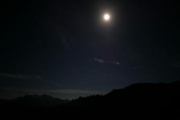 D4.8 my filter didn't cut it 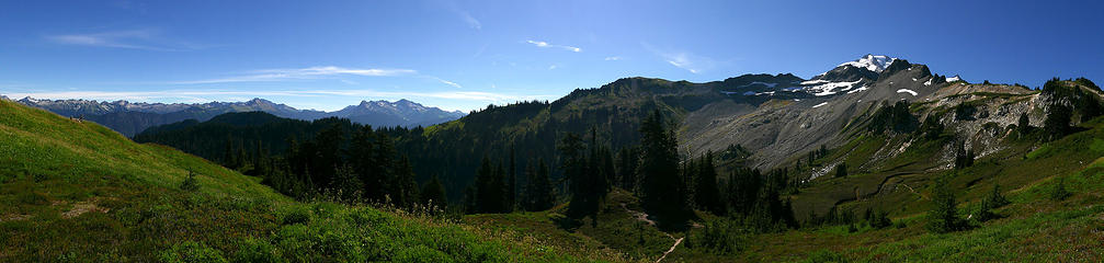 D4.9 pano from the knoll 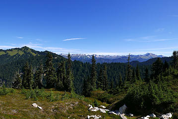 D4.10 onward to Milk Creek 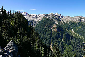 D4.11 descending to Milk Creek 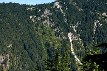 D4.12 can you find the trail? 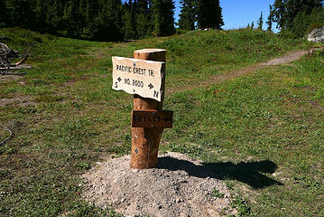 D4.13 new signage 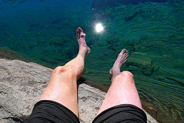 D4.14 after a dip in Mica Lake 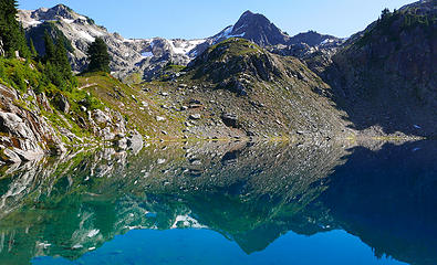 D4.15 Mica Lake 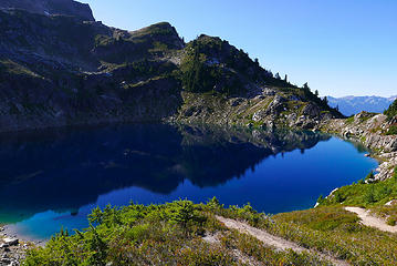 D4.16 Mica Lake2 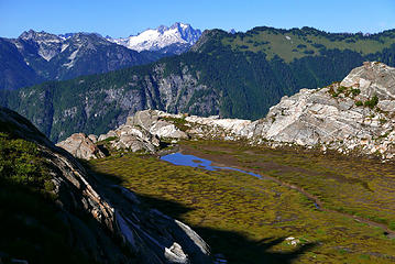 D4.17 climbing to Fire Creek Pass 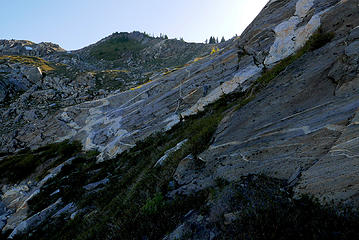 D4.18 you get the schist of it 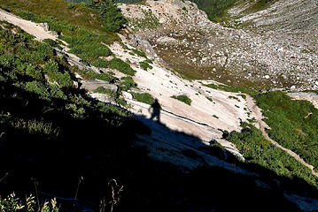 D4.19 trail selfie 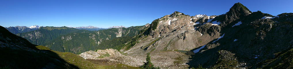 D4.20 below Fire Creek Pass pano 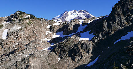 D4.21 another popup 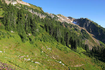 D4.22 descending from Fire Creek Pass 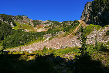 D4.23 looking back towards Fire Creek Pass 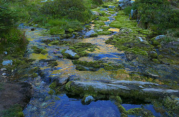 D4.24 water stop 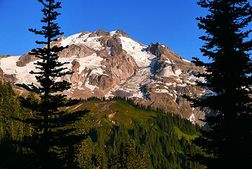 D4.25 mountain shot1 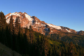 D4.26 mountain shot2 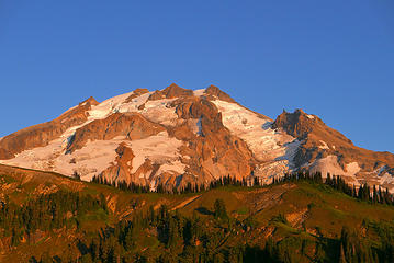 D4.27 mountain shot3 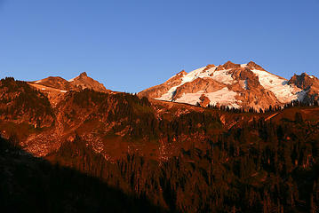 D4.28 the final alpenglow 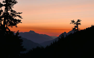 D4.29 my evening begins 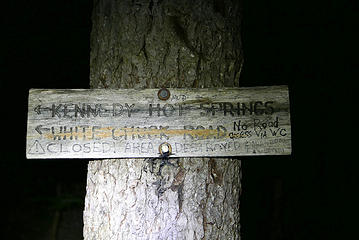 D4.30 about sums it up 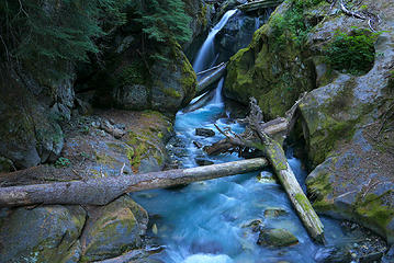 D5.1 crossing the White Chuck River 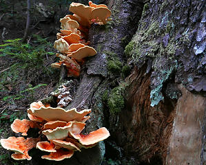 D5.2 orange delight 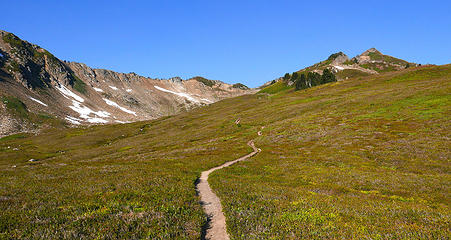 D5.3 trail to Red Pass 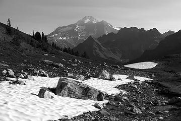 D5.4 White Chuck valley 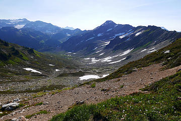 D5.5 White Chuck Basin from Red Pass 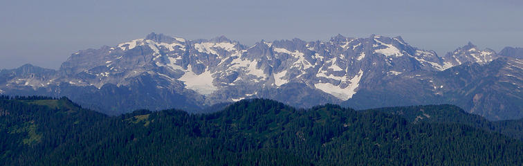 D5.6 receding glaciers 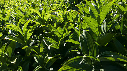 D5.7 catching the sun 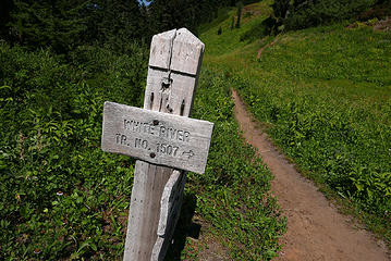 D5.8 let me think....not 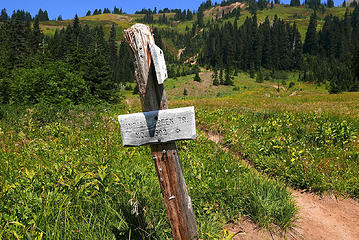 D5.9 bye bye PCT, hello Hell 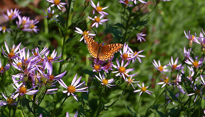 D5.10 clashing colors 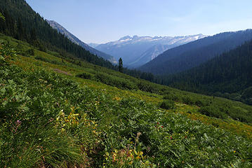 D5.11 Indian Creek-bugs, brush, heat, what's not to like? 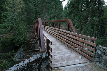 D5.12 Bridge to FSR 6400, only 2 miles to go 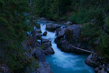 D5.13 White River....the end
|
| Back to top |
  
|
|
KekistaniProphet
LOL I WIN

Joined: 25 Sep 2016
Posts: 221 | TRs | Pics
|
Why didn't ye go over high pass bruuhh?
|
| Back to top |
|
|
mbravenboer
Member
Joined: 20 Oct 2013
Posts: 1422 | TRs | Pics
Location: Seattle |
 Nice trip. Appreciate the detailed write-up! Nice trip. Appreciate the detailed write-up!
|
| Back to top |
|
|
Brushbuffalo
Member

Joined: 17 Sep 2015
Posts: 1887 | TRs | Pics
Location: there earlier, here now, somewhere later... Bellingham in between |
Excellent! Fun read, too.
| williswall wrote: | | my worthless BD Spot. |
I agree, but it's only the second- to -worst light I've ever owned. The worst ? The French-made Wonderlight, popular in the '70s. Appropriately named, but not for the manufacturer's intended reason. You always wondered if it would work.
Passing rocks and trees like they were standing still
Passing rocks and trees like they were standing still
|
| Back to top |
|
|
JVesquire
Member
Joined: 28 Jun 2006
Posts: 993 | TRs | Pics
Location: Pasco, WA |
Great TR. That trip is a highlight of all of the trips I've ever done.
|
| Back to top |
|
|
mbravenboer
Member
Joined: 20 Oct 2013
Posts: 1422 | TRs | Pics
Location: Seattle |
On the headlamp issue, I always carry batteries and headlamp in a ziplock bag (batteries not in the headlamp). I guess it's kind of obvious, but maybe it helps.
|
| Back to top |
|
|
raising3hikers
Member
Joined: 21 Sep 2007
Posts: 2344 | TRs | Pics
Location: Edmonds, Wa |
thanks for sharing your trip!
|
| Back to top |
|
|
RichP
Member

Joined: 13 Jul 2006
Posts: 5634 | TRs | Pics
Location: here |
|
RichP
Member
|
 Wed Aug 23, 2017 7:30 pm |
|
|
Fantastic. 
|
| Back to top |
|
|
ChinookPass
Member

Joined: 21 Aug 2009
Posts: 145 | TRs | Pics
|
Nice volcano collection. I'm one sixth done. Hoping for the second next week. You saved the best for last, I think.
|
| Back to top |
|
|
Frodo Barefoot
Member

Joined: 09 Apr 2015
Posts: 91 | TRs | Pics
|
|
| Back to top |
|
|
NorDub
Member

Joined: 17 Jul 2015
Posts: 56 | TRs | Pics
Location: Redmond |
|
NorDub
Member
|
Thu Aug 24, 2017 8:07 am |
|
|
How do you like that bivy?
| Quote: | | For gear I was using an EE Recon bivy... |
|
| Back to top |
|
|
Opus
Wannabe

Joined: 04 Mar 2006
Posts: 3700 | TRs | Pics
Location: The big rock candy mountain |
|
Opus
Wannabe
|
Thu Aug 24, 2017 9:24 am |
|
|
Nice! I'm planning to do this same loop in the near future, though at a slightly slower pace. Any issues with bugs?
|
| Back to top |
|
|
williswall
poser
Joined: 30 Sep 2007
Posts: 1968 | TRs | Pics
Location: Redmond |
| NorDub wrote: | How do you like that bivy?
| Quote: | | For gear I was using an EE Recon bivy... |
|
I like it, especially the long zipper; makes entry and exit super easy, and the total package is tiny. Great for overall ventilation, views, and critter and bug protection.
OPUS, bugs were definitely on the decline. Only once did I use my B4 (bug protection half "suit") at a food stop. Of course, they were still horrible going through Indian River.
| KekistaniProphet wrote: | | Why didn't ye go over high pass bruuhh? |
Seems like most orbiters do this route CW over High Pass, possibly due to Woodmansee's description in "Trekking Washington." I wanted a longer trip and experience part of the (Spider Gap/Buck Pass) loop done on the eastern side.
|
| Back to top |
|
|
Nancyann
Member
Joined: 28 Jul 2013
Posts: 2319 | TRs | Pics
Location: Sultan Basin |
|
Nancyann
Member
|
Thu Aug 24, 2017 11:07 am |
|
|
Congratulations on completing your sixth volcano orbit! Beautiful photos! We were up in the area shortly before you, and also had many enjoyable conversations with section hikers and orbiters, who were very knowledgeable about the area. We did not see any long distance hikers, except for perhaps one lady in a skirt and straw hat who had no idea where she was, other than "we're at point 00 and headed for point 03."  Nice to hear about the 85 year old section hiker, so inspirational!
|
| Back to top |
|
|
braincloud
Summit Seeker

Joined: 30 Jul 2008
Posts: 186 | TRs | Pics
Location: The crooked path |
Orbiting the volcanos!! I just completed summiting all of them. Now I have an idea of what to do next! (Your trip looks awesome).
|
| Back to top |
|
|
|
|
You cannot post new topics in this forum
You cannot reply to topics in this forum
You cannot edit your posts in this forum
You cannot delete your posts in this forum
You cannot vote in polls in this forum
|
Disclosure: As an Amazon Associate NWHikers.net earns from qualifying purchases when you use our link(s). |


