| Previous :: Next Topic |
| Author |
Message |
Nancyann
Member


Joined: 28 Jul 2013
Posts: 2316 | TRs | Pics
Location: Sultan Basin |
|
Nancyann
Member
|
 Mon Oct 16, 2017 11:56 am |
|
|
A couple of winters ago NWHikers Frank and I made it part way up Mineral Butte, which rises high above the Silver Creek Valley and the Mineral City ghost town site, which is becoming more inaccessible as time goes by.
It was raining and the snow made it slow going amongst the downed trees and brambles covering the Mineral Butte logging road, so we turned around.
I was able to talk Hiking Partner into giving it another try on Sunday, which is a day I never like to spend traveling on Highway 2, but since this was a last minute change in plans, we left late and planned on returning very late, hopefully missing the frustrating traffic nightmare that Sunday afternoon always promises.
We arrived at the road end, on the other side of the Howard Creek Bridge at 1pm, a great alpine start for a challenging day.  The first mile up the old road was quite pleasant, as it rises above the beautiful Salmon Creek which swirls and crashes through a rugged canyon below. As we progressed upwards though, the road became covered with a wide array of increasingly annoying vegetation, most notably the little berry vines I call "trippers". They were strewn everywhere across the road, quietly waiting for the right moment to cause me to fall flat on my face..
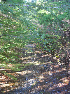 Mineral Butte Trail 10/15/17 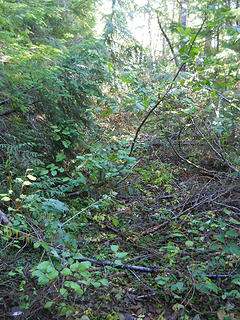 Mineral Butte Trail 10/15/17 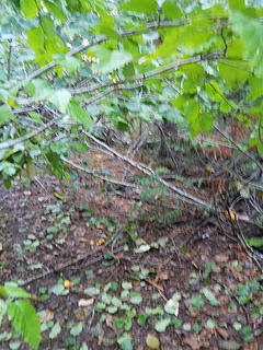 Mineral Butte Trail 10/15/17 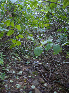 Mineral Butte Trail 10/15/17 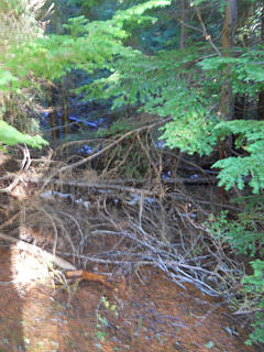 Mineral Butte Trail 10/15/17 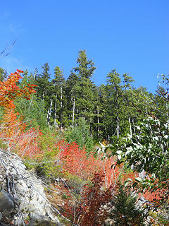 Mineral Butte Trail 10/15/17 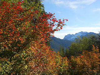 Gunn and Gunshy from Mineral Butte 10/15/17 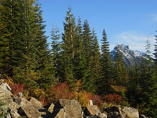 Spire Mountain from Mineral Butte 10/15/17 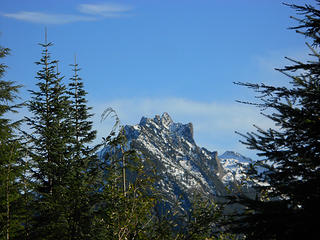 Spire Mountain from Mineral Butte 10/15/17 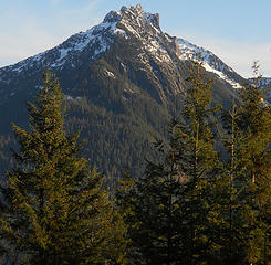 Spire Mountain from Mineral Butte 10/15/17 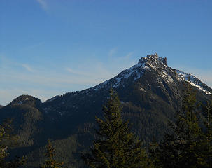 Spire Mountain from Mineral Butte 10/15/17 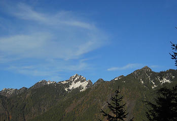 Peaks above Silver Creek drainage from Mineral Butte 10/15/17 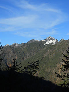 Peaks above Silver Creek drainage from Mineral Butte 10/15/17 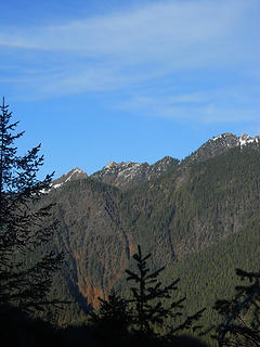 Peaks above Silver Creek drainage from Mineral Butte 10/15/17 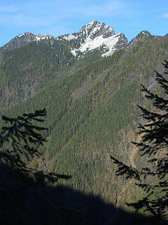 Peaks above Silver Creek drainage from Mineral Butte 10/15/17 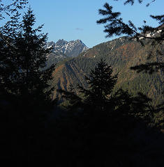 Peaks above Silver Creek drainage from Mineral Butte 10/15/17 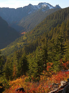 Elk Basin and headwaters of Elk Creek from Mineral Butte 10/15/17 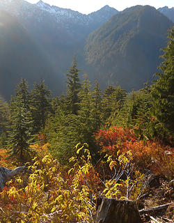 Headwaters of Salmon Creek from Mineral Butte 10/15/17 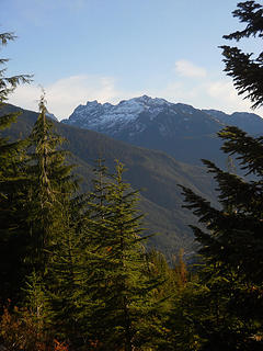 Gunn and Gunshy from Mineral Butte 10/15/17 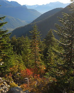 Looking south down the North Fork Skykomish drainage from Mineral Butte 10/15/17 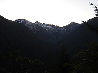 Prospect and Static Peaks from Mineral Butte 10/15/17 
|
| Back to top |
  
|
|
iron
Member

Joined: 10 Aug 2008
Posts: 6392 | TRs | Pics
Location: southeast kootenays |
|
iron
Member
|
Mon Oct 16, 2017 12:31 pm |
|
|
|
| Back to top |
|
|
Nancyann
Member
Joined: 28 Jul 2013
Posts: 2316 | TRs | Pics
Location: Sultan Basin |
|
Nancyann
Member
|
Mon Oct 16, 2017 12:43 pm |
|
|
I hope you can get this one, it's an interesting challenge and some unique views into some really wild and remote areas. What a mess the road is though, I'll be back with clippers!
|
| Back to top |
|
|
FiveNines
Member
Joined: 01 Oct 2010
Posts: 526 | TRs | Pics
|
Cool spot. Have fun exploring.
|
| Back to top |
|
|
Mike Collins
Member
Joined: 18 Dec 2001
Posts: 3096 | TRs | Pics
|
I did the ascent on May 31st when snowcover helped us avoid some of the brush. But from car to summit took 3 hrs.
|
| Back to top |
|
|
Nancyann
Member
Joined: 28 Jul 2013
Posts: 2316 | TRs | Pics
Location: Sultan Basin |
|
Nancyann
Member
|
Wed Oct 18, 2017 5:00 pm |
|
|
Mike, after reading Iron's TR and various replies to it, I wonder if you are one of the few who made it all the way to the summit in recent years. Three hours sounds pretty quick to me. After three hours of jungle warfare we only made it to 3200 feet.  Being able to do the upper part in snow sounds like the way to go. Of course, timing it so you don't have to slog through the washed out trail around the Index-Galena Road washout helps too!
On a related note, there was a gigantic crane parked at the Howard Creek Bridge, hopefully a step forward in the road repair.. Being able to do the upper part in snow sounds like the way to go. Of course, timing it so you don't have to slog through the washed out trail around the Index-Galena Road washout helps too!
On a related note, there was a gigantic crane parked at the Howard Creek Bridge, hopefully a step forward in the road repair..
|
| Back to top |
|
|
Mike Collins
Member
Joined: 18 Dec 2001
Posts: 3096 | TRs | Pics
|
|
| Back to top |
|
|
Nancyann
Member
Joined: 28 Jul 2013
Posts: 2316 | TRs | Pics
Location: Sultan Basin |
|
Nancyann
Member
|
Wed Oct 18, 2017 9:24 pm |
|
|
Interesting to read your WTA reports, Mike. Now the road is gated shortly after it splits from the Silver Creek Road, so there is a longer road walk. Your comment about traversing over to Crested Butte is very intriguing!
|
| Back to top |
|
|
iron
Member
Joined: 10 Aug 2008
Posts: 6392 | TRs | Pics
Location: southeast kootenays |
|
iron
Member
|
Thu Oct 19, 2017 8:43 am |
|
|
| Nancyann wrote: | | Interesting to read your WTA reports, Mike. Now the road is gated shortly after it splits from the Silver Creek Road, so there is a longer road walk. Your comment about traversing over to Crested Butte is very intriguing! |
keep in mind: mike collins is a machine, so his times are always ridiculous.
|
| Back to top |
|
|
Steve Erickson
Member
Joined: 13 Jun 2005
Posts: 210 | TRs | Pics
Location: Next door to my neighbors |
I have been up and over Mineral Butte many times. You can avoid quite a bit of the brushy road by going into the timber in a few different places. It is very steep, unless you want to zig zag, but I always opt for the direct route. You will have to cross the brushy road once near the old fork in the road and once again go into the timber. Rather than combat the brush, I take the timber route up to Mineral Butte.
|
| Back to top |
|
|
Nancyann
Member
Joined: 28 Jul 2013
Posts: 2316 | TRs | Pics
Location: Sultan Basin |
|
Nancyann
Member
|
Thu Oct 19, 2017 11:03 am |
|
|
Iron wrote: "keep in mind:mike collins is a machine, so his times are always ridiculous." After reading his recent trip NWHikers trip report, I had a suspicion that this was true.
|
| Back to top |
|
|
Nancyann
Member
Joined: 28 Jul 2013
Posts: 2316 | TRs | Pics
Location: Sultan Basin |
|
Nancyann
Member
|
Thu Oct 19, 2017 11:10 am |
|
|
|
| Back to top |
|
|
|
|


