| Previous :: Next Topic |
| Author |
Message |
Double_E
Member


Joined: 21 Jul 2005
Posts: 36 | TRs | Pics
Location: Seattle |
|
Double_E
Member
|
 Wed Sep 13, 2017 11:04 am |
|
|
#BelatedTripReport
A few weeks ago, I had about a day and a half to work with, so figured it was maybe time to hike the trail from the Dosewallips River to Constance Pass, which had been on my list for a while. Id done pretty much all other trails in the Dose drainage, so it was time to check this one off the list!  I biked the 6.5 miles up to the Dose trailhead/campground, which in itself was pretty cool, being there the first time in a long time. About two years ago, Id gone bike-camping at the Elkhorn Campground, but other than that, this was the first time Id been up that whole valley since 2002 I think (Lake Constance), and the last time Id been to the old Dose Trailhead was the mid-1990s, when you could still drive there. So this was pretty rad to go revisit this area.
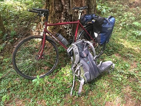
With a touring bike with 700x32c tires (or some might prefer a mountain bike), you can bike most of the way up to the old trailhead.... had to walk about 7or 8 sections though, some of them short, some of a couple hundred vertical feet (one very close to the current parking area, and then one very close to the Dose Campground).
I biked the 6.5 miles up to the Dose trailhead/campground, which in itself was pretty cool, being there the first time in a long time. About two years ago, Id gone bike-camping at the Elkhorn Campground, but other than that, this was the first time Id been up that whole valley since 2002 I think (Lake Constance), and the last time Id been to the old Dose Trailhead was the mid-1990s, when you could still drive there. So this was pretty rad to go revisit this area.
With a touring bike with 700x32c tires (or some might prefer a mountain bike), you can bike most of the way up to the old trailhead.... had to walk about 7or 8 sections though, some of them short, some of a couple hundred vertical feet (one very close to the current parking area, and then one very close to the Dose Campground).
 #multimodal 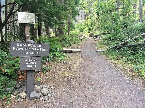 NPS boundary 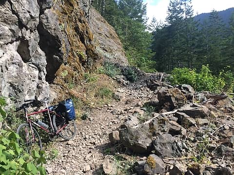 one of the several landslides/washouts on the Dose road 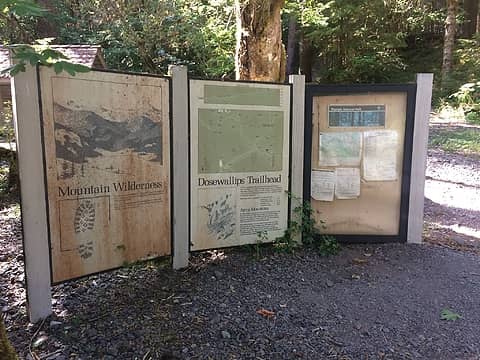 ye olde post-apocalyptic-feeling Dose trailhead signs 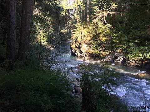 Dose Forks campsite 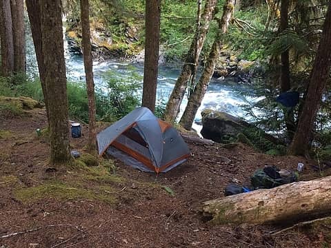 Dose Forks campsite 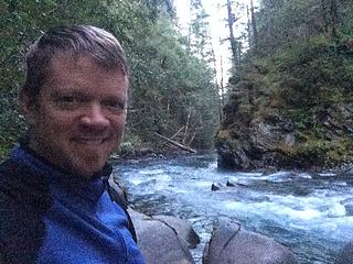 Dose Forks campsite 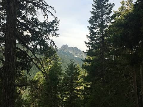 first sightings of big rocky things 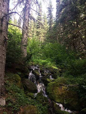 lovely little crick, near Sunnybrook Meadows 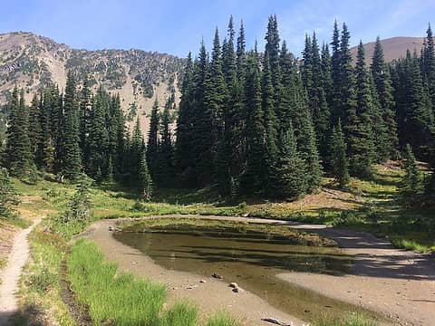 tiny pond near Sunnybrook Meadows... with a bazillion huge tadpoles in it. Took a pic of them but it didn't turn out too well 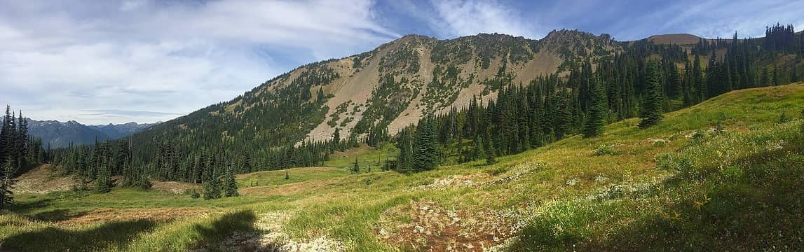 Sunnybrook Meadows 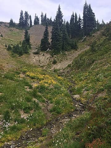 wildflowers near Sunnybrook Meadows 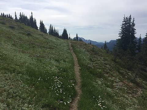 approaching 6576' peak 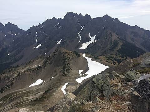 Mt Constance and its many huge neighbors, from top of 6576' unnamed peak 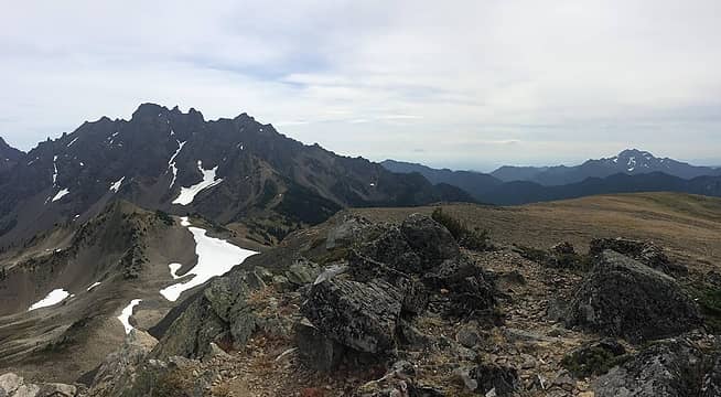 Mt Constance and its many huge neighbors, including ... The Brothers at far right?? 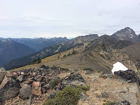 Mt Olympus in the distance, and Mt Mystery (?) on the right, from top of 6576' unnamed peak 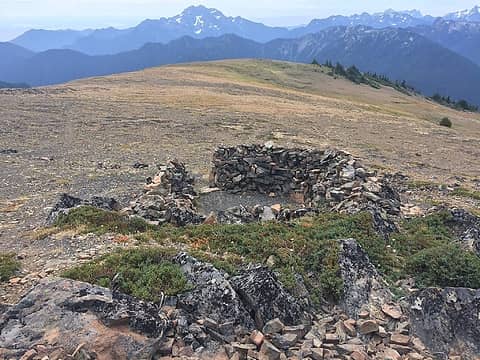 rock wall campsite shelter on top of 6576' unnamed peak en route to Constance Pass 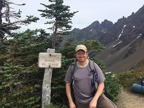 Constance Pass
|
| Back to top |
  
|
|
awilsondc
Member

Joined: 03 Apr 2016
Posts: 1324 | TRs | Pics
|
Looks like a nice trip! Good views from up that way, I like the unique feel of the Olympics. Need to get out that way for Constance soon! 
|
| Back to top |
|
|
reststep
Member

Joined: 17 Dec 2001
Posts: 4757 | TRs | Pics
|
|
reststep
Member
|
Wed Sep 13, 2017 12:41 pm |
|
|
Thanks for report and pictures from one of my favorite places in the Olympics.
I still need to do that route from Sunny Brook Meadows to Gunsight Pass. Don't know if it will ever happen but it is on my list.
"The mountains are calling and I must go." - John Muir
"The mountains are calling and I must go." - John Muir
|
| Back to top |
|
|
|
|
You cannot post new topics in this forum
You cannot reply to topics in this forum
You cannot edit your posts in this forum
You cannot delete your posts in this forum
You cannot vote in polls in this forum
|
Disclosure: As an Amazon Associate NWHikers.net earns from qualifying purchases when you use our link(s). |


