| Previous :: Next Topic |
| Author |
Message |
neek
Member


Joined: 12 Sep 2011
Posts: 2338 | TRs | Pics
Location: Seattle, WA |
|
neek
Member
|
 Thu Oct 05, 2017 1:45 pm |
|
|
Genesis
The Carne High Route has been getting a lot of attention lately, and now I know why. I can't add many practical details to the superb reports already posted on this site, except to confirm that 1) the road really is that bad, 2) the scenery really is that good, and 3) the trail is easy to follow, except where it's not.
I wasn't originally going to do this, for some reason thinking Buck would be a good idea, approaching via the Justus route and exiting via Louis Creek (in part to see what the Napeequa looks like in evening light, since most photos from Little Giant Pass are taken in the morning, if I could even make it there before dark), but then chickened out because this is really not a climb for someone like me to attempt solo. So I "settled" for the Carne/Leroy loop, and in the process got a good view of the proposed Buck approach, as well as had a probably much better time than I otherwise would have. The larches aren't quite prime (not much change from geyer's trip a few days earlier) but the blueberry foliage sure is, and anyway I prefer the contrast displayed by trees in various stages of chlorophyll loss, and wondering whether it's microclimate, age, genetics, or what that causes this to happen at different times.
The plan was to get an early start (which I did, which, along with providing plenty of time for reading and listening to music, is one of the benefits of insomnia), take a casual pace and spend the time being in the moment rather than stressing over all life's silly problems, and exit the boring Phelps Creek trail in the dark (indeed, the last half hour was on lamp). In addition to well-trod Maude and obligatory Carne (which is pronounced "carn", dang it, it's a dude's last name, Robert H. Carne from the early 1800s I believe, not at all related to Carne Asada), so-called Ice Box seemed like a reasonable summit to obtain, and in fact proved to be a fortuitous choice because the sky was sunniest and air clearest at this point of the day.
Booting up Carne
Not much to say here (thank goodness) - it's a trail all the way, bring your family etc.
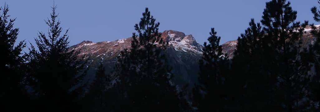 1. First light, Brahma peak or thereabouts, from approximately the parking lot 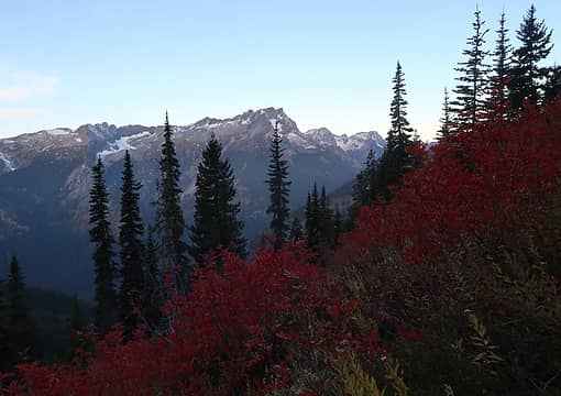 2. Buck Mountain preparing for illumination 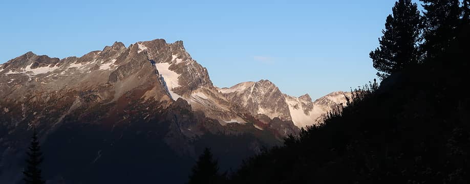 3. Buck Mountain illuminated 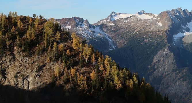 4. Clark 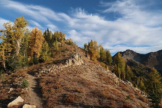 5. Ridge to Carne's summit 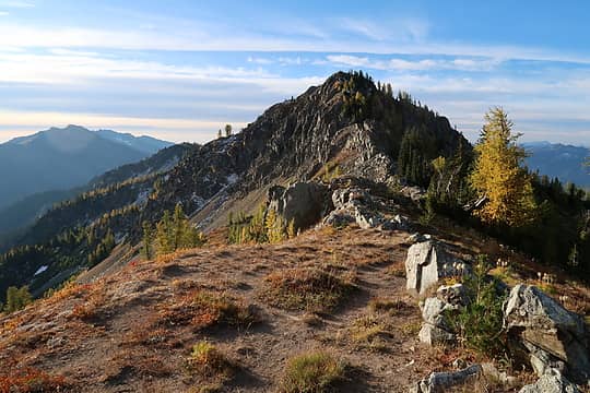 6. The other summit, "lookout site" (probably no longer there?) 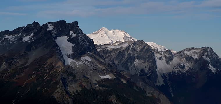 7. Glacier "peek" 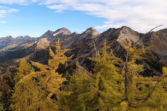 8. Maude, Ice Box, Peak 7919 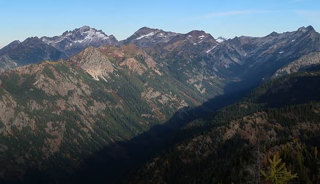 9. Fortress and Chiwawa ("you'll be seeing a lot of us today!") with some sinister looking peak behind Spider Gap 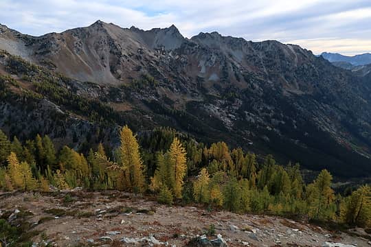 10. Larches, still fairly green 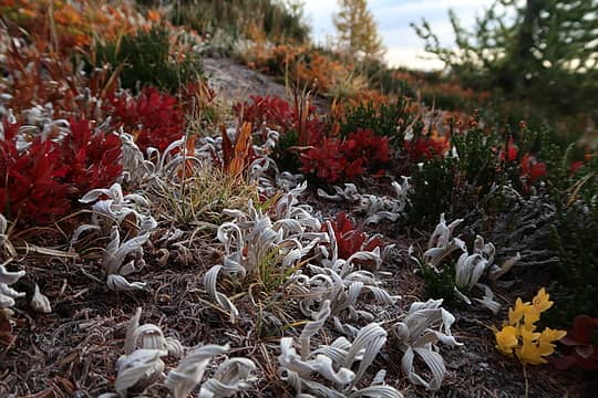 11. Colors 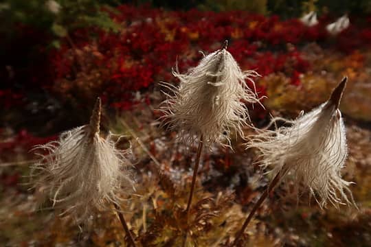 12. Western pasqueflower 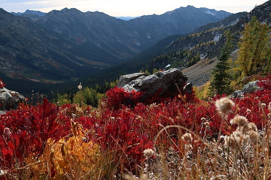 13. More colors 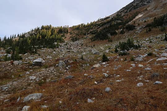 14. Went over the flat part (7000') of this shoulder 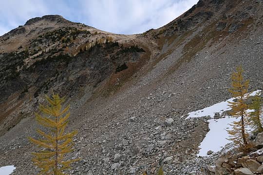 15. Stay to the right of the cliffs and approach the saddle 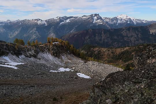 16. Dusting of snow on the other side of the shoulder I crossed 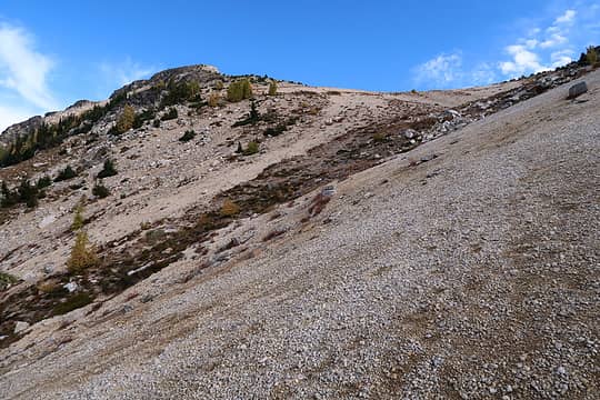 17. Almost there. The pumice and ash made this a bit like walking up a sand dune. 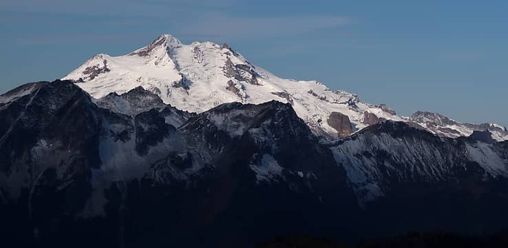 18. Glacier Peak 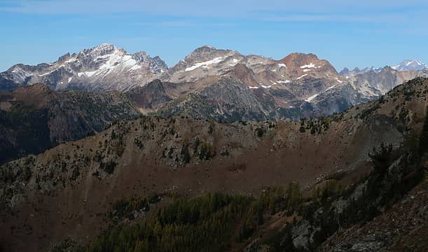 19. Fortress, Chiwawa, Red... Dome at far right 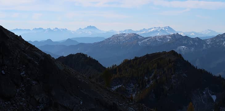 20. Smoke settling in to the south 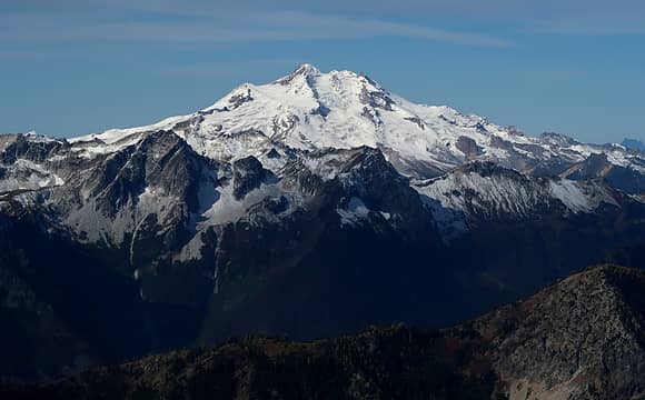 21. Glacier 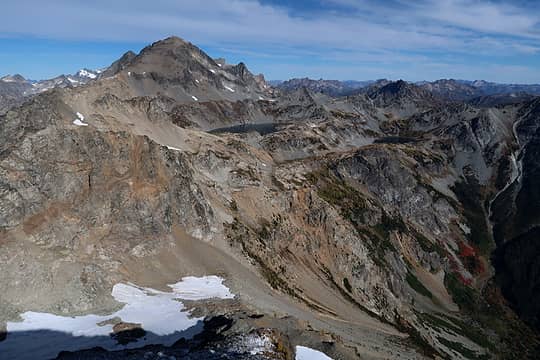 22. Maude and Ice Lakes 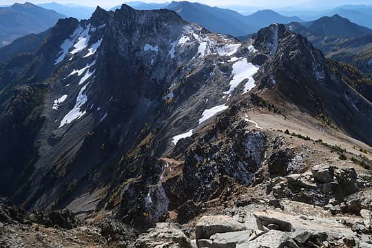 23. The rougher NE side of the ridge 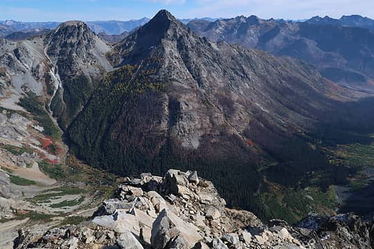 24. Spectacle Buttes 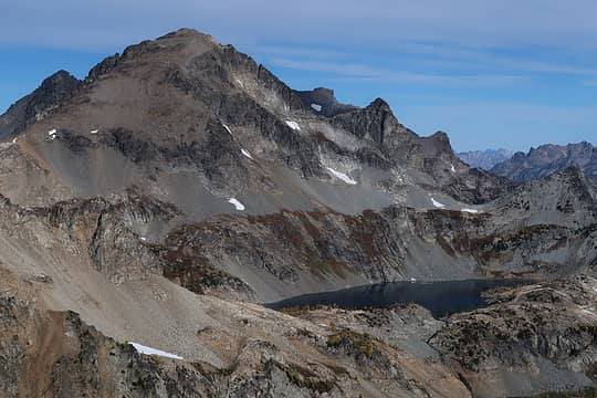 25. Maude and Upper Ice 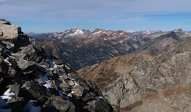 26. Familiar skyline, now with Baker 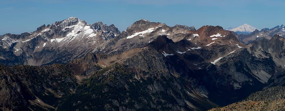 27. Pretty much the same thing but zoomed and cropped 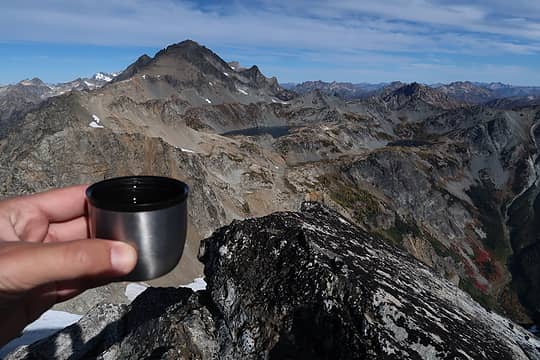 28. Summit tea (TM) 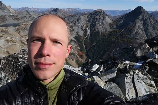 29. Mt. Baldy. There, I said it so you don't have to. 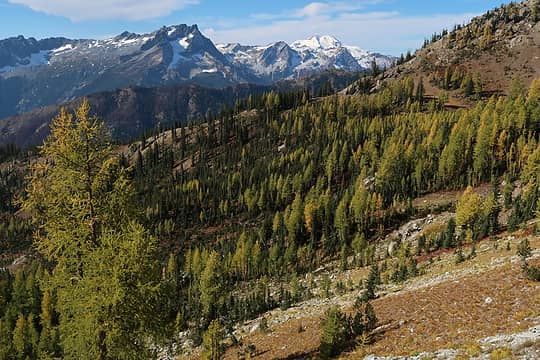 30. Larches still very green in this basin 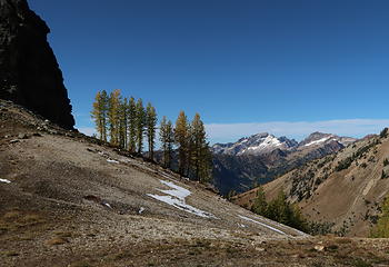 31. 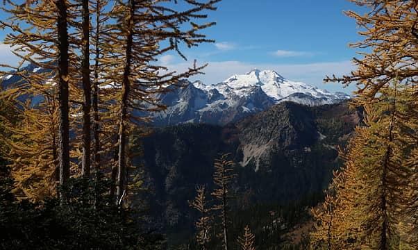 32. Glacier Peak framed by larches 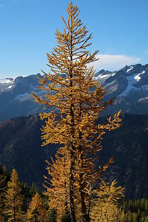 33. A reasonable specimen 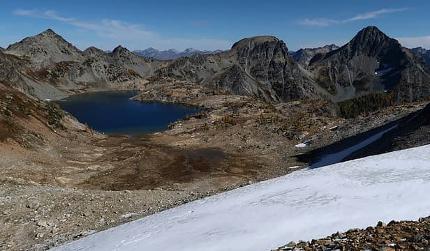 34. At the Maude-Freezer saddle, where Eric and I camped a few months ago 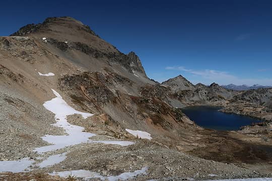 35. The classic Maude and Upper Ice Lake shot 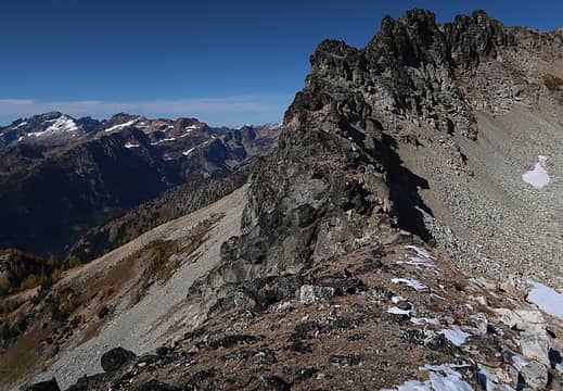 36. You drop down to the right 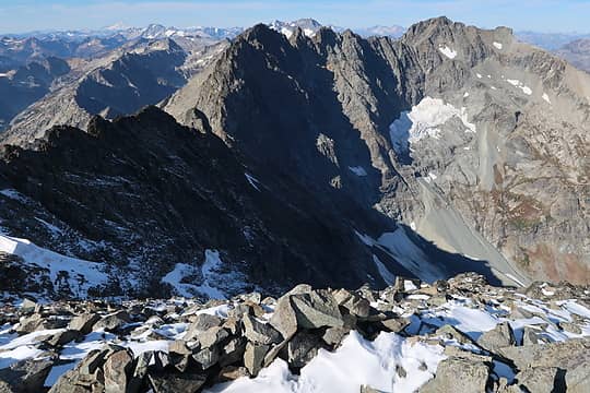 37. Summit shot 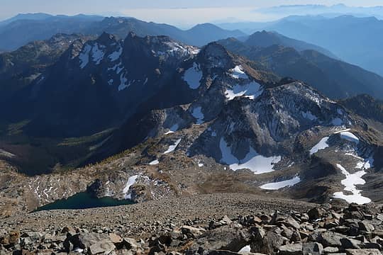 38. 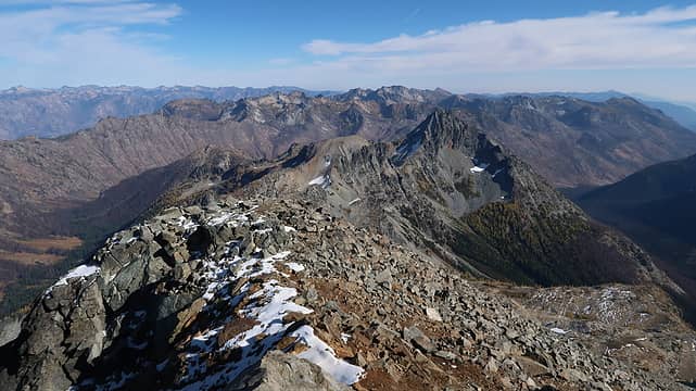 39. 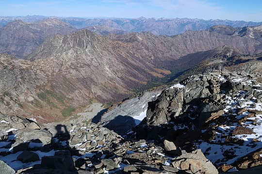 40. 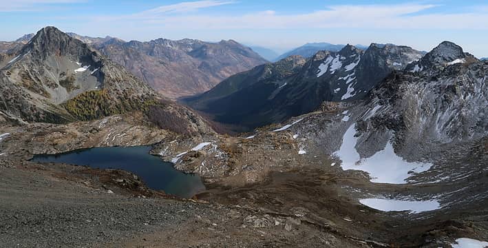 41. 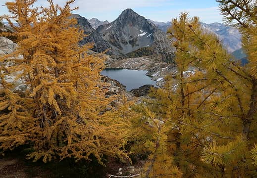 42. 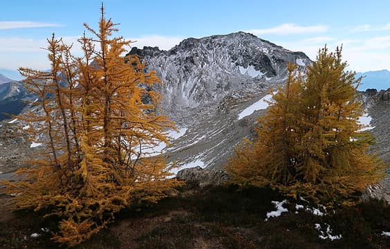 43. Freezer 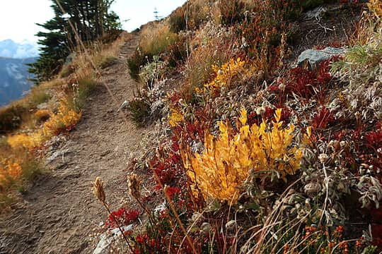 44. 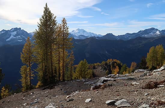 45. 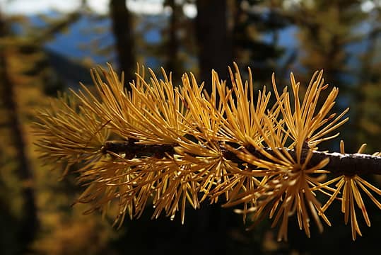 46. 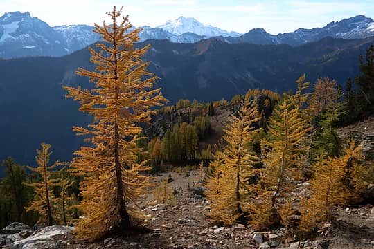 47. 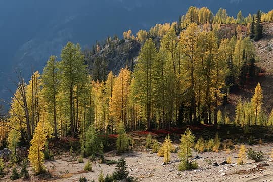 48. 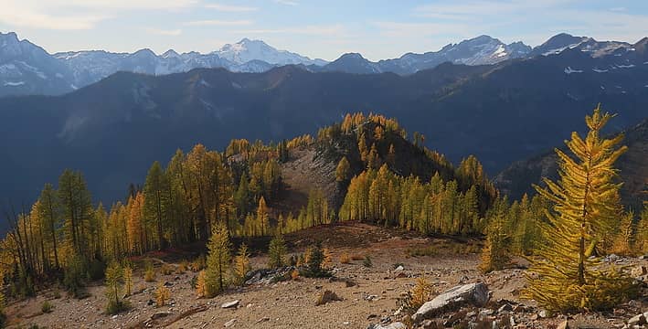 49. 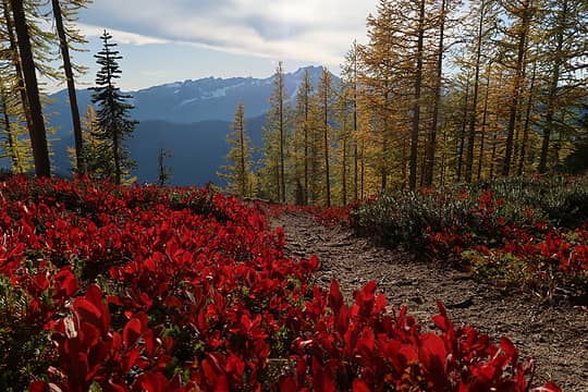 50. 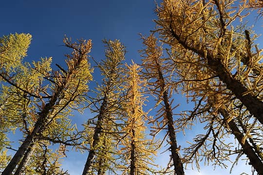 51. 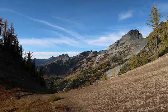 52. 7FJ 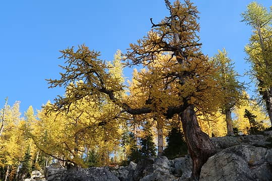 53. Big larch 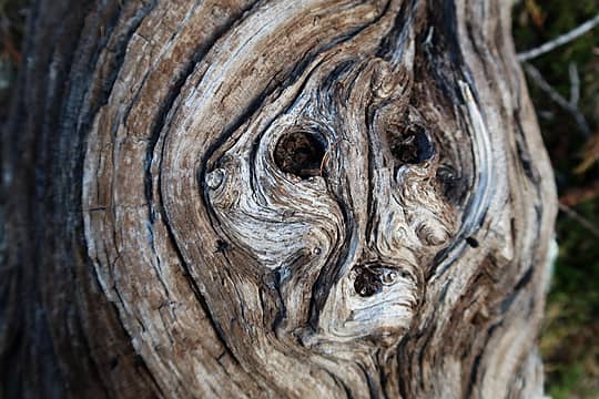 54. Who goes there? 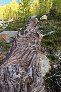 55. 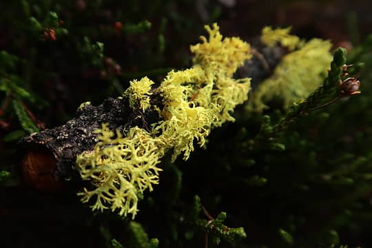 56. Lichen it 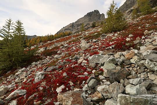 57. 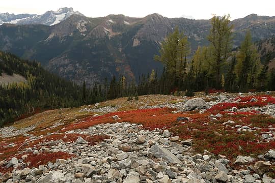 58. 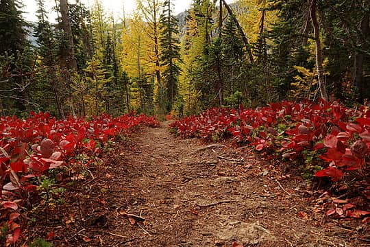 59. 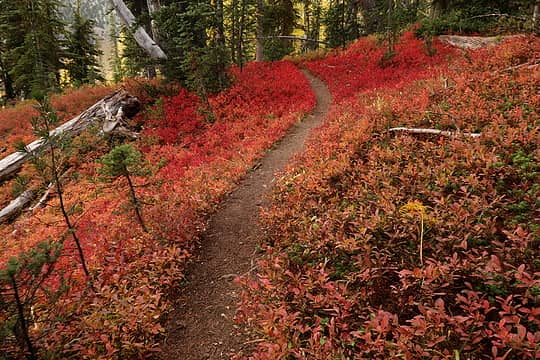 60. 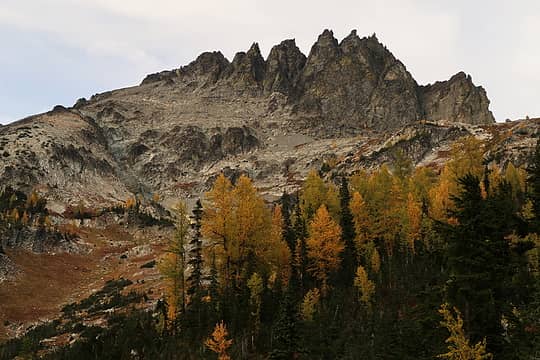 61. 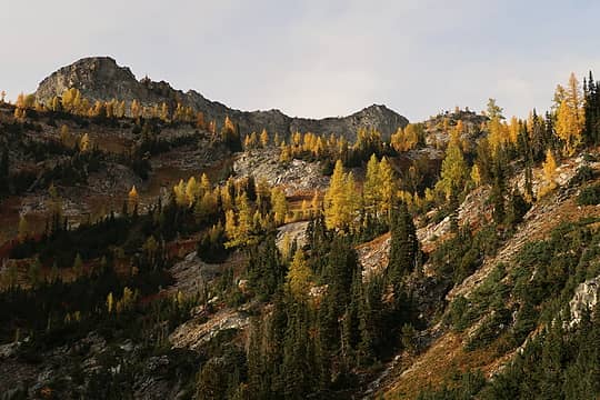 62. 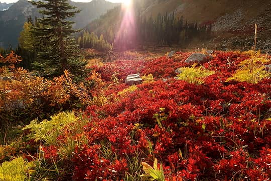 63. 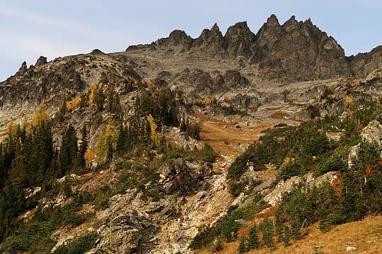 64. 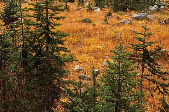 65. 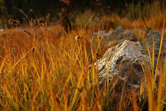 66. 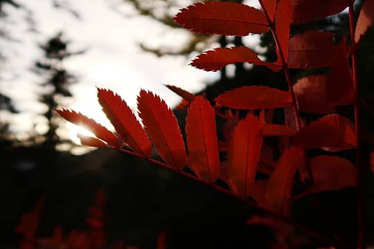 67. 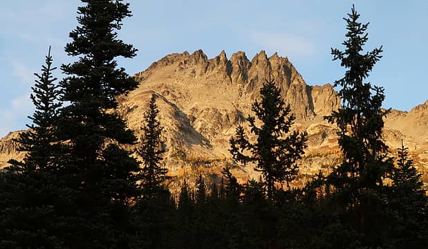 68. 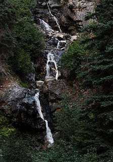 69. Final waterfall on Leroy Creek
|
| Back to top |
  
|
|
cartman
Member

Joined: 20 Feb 2007
Posts: 2800 | TRs | Pics
Location: Fremont |
|
cartman
Member
|
Thu Oct 05, 2017 8:36 pm |
|
|
|
| Back to top |
|
|
neek
Member
Joined: 12 Sep 2011
Posts: 2338 | TRs | Pics
Location: Seattle, WA |
|
neek
Member
|
Thu Oct 05, 2017 8:42 pm |
|
|
| cartman wrote: | | Isn't a carn a pile of rocks used to mark the route? |
Ha, there were a few cairns on the Carne route, but of course never where I needed them! Absence of cairns can lead to some degree of carnage, but ultimately fairly carnal knowledge of an area.
|
| Back to top |
|
|
cartman
Member
Joined: 20 Feb 2007
Posts: 2800 | TRs | Pics
Location: Fremont |
|
cartman
Member
|
Thu Oct 05, 2017 8:46 pm |
|
|
I regret bringing it up already. 
|
| Back to top |
|
|
Damian
Member

Joined: 18 Dec 2001
Posts: 3260 | TRs | Pics
|
|
Damian
Member
|
Thu Oct 05, 2017 9:23 pm |
|
|
|
| Back to top |
|
|
GaliWalker
Have camera will use

Joined: 10 Dec 2007
Posts: 4930 | TRs | Pics
Location: Pittsburgh |
|
GaliWalker
Have camera will use
|
Fri Oct 06, 2017 7:53 am |
|
|
Excellent trip and photos. The larches looked great!
|
| Back to top |
|
|
wildernessed
viewbagger

Joined: 31 Oct 2004
Posts: 9275 | TRs | Pics
Location: Wenatchee |
 Good Stuff ! Good Stuff !
Living in the Anthropocene
Living in the Anthropocene
|
| Back to top |
|
|
awilsondc
Member

Joined: 03 Apr 2016
Posts: 1324 | TRs | Pics
|
Some really beautiful photos there neek! Gonna have to go back for that high route!
|
| Back to top |
|
|
olderthanIusedtobe
Member
Joined: 05 Sep 2011
Posts: 7709 | TRs | Pics
Location: Shoreline |
You really captured a nice palette of fall colors. I was nearby on Wednesday and was thinking about doing the Carne/Leroy Cr. loop on Thursday but for some reason wasn't quite feeling it. Looks like I missed out, but Mt. David turned out to be pretty good too.
|
| Back to top |
|
|
Justus S.
Member
Joined: 17 Nov 2004
Posts: 1298 | TRs | Pics
Location: WA |
Nice trip, great fall colors.
|
| Back to top |
|
|
puzzlr
Mid Fork Rocks

Joined: 13 Feb 2007
Posts: 7220 | TRs | Pics
Location: Stuck in the middle |
|
puzzlr
Mid Fork Rocks
|
Sat Oct 07, 2017 10:33 pm |
|
|
Seems to me you were riding a rocket all day! I'd need three days for all that.
|
| Back to top |
|
|
OutOfOffice
Member

Joined: 02 Jun 2015
Posts: 91 | TRs | Pics
Location: Seattle |
8500ft gain!!! wow. Grueling day. Let me know next time you do one of these mid-week jaunts. I'll take the day off
|
| Back to top |
|
|
silence
Member

Joined: 25 Apr 2005
Posts: 4420 | TRs | Pics
|
|
silence
Member
|
Sun Jun 03, 2018 12:52 pm |
|
|
gorgeous ... you hit it perfectly!
PHOTOS
FILMS
Keep a good head and always carry a light bulb. Bob Dylan
PHOTOS
FILMS
Keep a good head and always carry a light bulb. Bob Dylan
|
| Back to top |
|
|
Brushbuffalo
Member

Joined: 17 Sep 2015
Posts: 1887 | TRs | Pics
Location: there earlier, here now, somewhere later... Bellingham in between |
Stunning pictures! Makes me eager to get back up there this Fall.
| neek wrote: | 6. The other summit, "lookout site" (probably no longer there?) |
Yep, no longer there.
Passing rocks and trees like they were standing still
Passing rocks and trees like they were standing still
|
| Back to top |
|
|
|
|
You cannot post new topics in this forum
You cannot reply to topics in this forum
You cannot edit your posts in this forum
You cannot delete your posts in this forum
You cannot vote in polls in this forum
|
Disclosure: As an Amazon Associate NWHikers.net earns from qualifying purchases when you use our link(s). |


