| Previous :: Next Topic |
| Author |
Message |
raising3hikers
Member


Joined: 21 Sep 2007
Posts: 2344 | TRs | Pics
Location: Edmonds, Wa |
There's been a lot of really nice trip reports for the Entiat area this fall but I haven't seen one for Bearcat Ridge. In that case, I've never seen a TR for Bearcat.
On Saturday, I arrived at the Entiat River TR and started hiking around 930am. As others have noted, the trail is in great shape. I reached the Snowbrushy trail junction and was happy to see it in good shape for the first couple of miles. A lot of work has been done in the area. There were a couple spots that the blowdown was a bit too much but some well placed cairns usually helped with the short detours. Further up the valley, the trees over the trail aren't much of a concern since they're so small. I made my way up to Milham Pass to some bright larches on the other side.
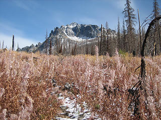 heading up the snowbrushy creek trail 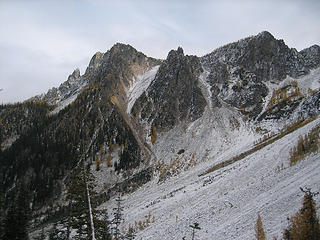 Bearcat Ridge with the gully I took just L of center 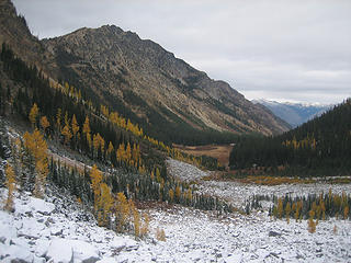 Emerald Park 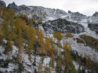 larches below Emerald 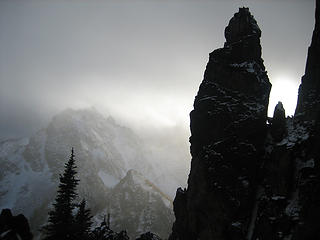 one of the Bearcat gendarmes 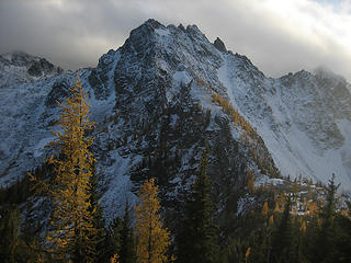 Emerald Pk from below Bearcat 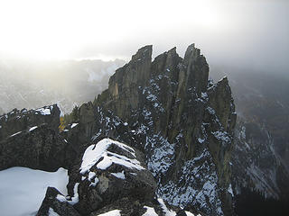 part of the Bearcat Ridge 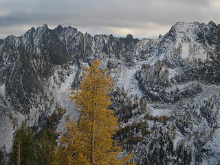 view over to Cloudcomb (L) 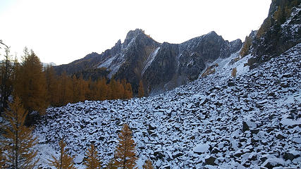 my last look at Bearcat Ridge 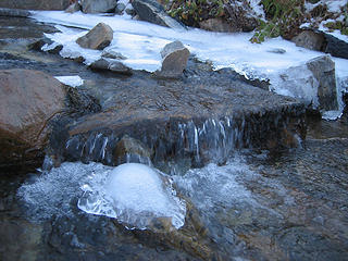 very happy to get some water here 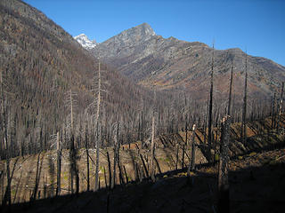 S Spectacle
|
| Back to top |
  
|
|
RichP
Member

Joined: 13 Jul 2006
Posts: 5634 | TRs | Pics
Location: here |
|
RichP
Member
|
 Sun Oct 15, 2017 5:32 pm |
|
|
| raising3hikers wrote: | | There's been a lot of really nice trip reports for the Entiat area this fall but I haven't seen one for Bearcat Ridge. |
Me neither. Great way to tuck this one in before the big snows start. Cool to see that Emerald Park is not burnt. 
|
| Back to top |
|
|
Stefan
Member

Joined: 17 Dec 2001
Posts: 5091 | TRs | Pics
|
|
Stefan
Member
|
Sun Oct 15, 2017 8:29 pm |
|
|
that is a lot of distance for that peak!!!
|
| Back to top |
|
|
BigBrunyon
Member
Joined: 19 Mar 2015
Posts: 1456 | TRs | Pics
Location: the fitness gyms!! |
Where'ja eat on the way back?
|
| Back to top |
|
|
iron
Member

Joined: 10 Aug 2008
Posts: 6392 | TRs | Pics
Location: southeast kootenays |
|
iron
Member
|
Mon Oct 16, 2017 10:11 am |
|
|
crazy that you used overnight gear - vs just carrying it in and out on the same day.
kind of a nasty looking peak...
|
| Back to top |
|
|
Fletcher
Member

Joined: 29 Jul 2009
Posts: 1870 | TRs | Pics
Location: kirkland |
|
Fletcher
Member
|
Mon Oct 16, 2017 9:21 pm |
|
|
|
| Back to top |
|
|
cascadetraverser
Member

Joined: 16 Sep 2007
Posts: 1407 | TRs | Pics
|
Nice! Agree with Rich to see the beautiful Emerald Park looking so nice. Did you get any looks towards Mirror Lake? That is a really cool infrequently visited spot that I suspect was burned....
|
| Back to top |
|
|
wildernessed
viewbagger

Joined: 31 Oct 2004
Posts: 9275 | TRs | Pics
Location: Wenatchee |
Living in the Anthropocene
Living in the Anthropocene
|
| Back to top |
|
|
MLHSN
What goes here?????

Joined: 09 Sep 2007
Posts: 1069 | TRs | Pics
Location: Wenatchee |
|
MLHSN
What goes here?????
|
Sat Oct 21, 2017 4:09 pm |
|
|
Always been curious of that ridge while looking over the maps. Thanks for the report.
|
| Back to top |
|
|
|
|


