| Previous :: Next Topic |
| Author |
Message |
mbravenboer
Member


Joined: 20 Oct 2013
Posts: 1422 | TRs | Pics
Location: Seattle |
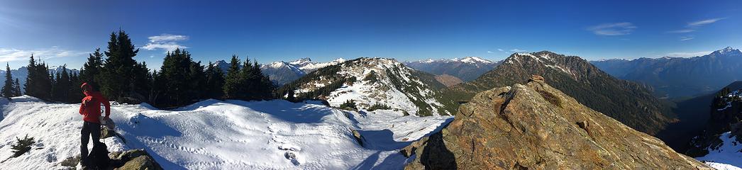
Thanks to Eve we found out that the Sourdough lookout was reachable with minimal snow. To make it a bit more interesting, we decided to do the loop up from Diablo to the lookout, and then down the Pierce Mountain trail to Ross Lake, returning via Ross Dam and the Diablo Lake trail.
jdk610 reported on this loop earlier ( https://www.nwhikers.net/forums/viewtopic.php?p=1060510 ). I should have read her report better, because we made a route mistake she clearly explained!
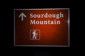
Diablo To Sourdough Mountain Lookout
There are a few blowdowns on the trail and a few remaining snow patches, but it was easy and we didn't need microspikes. This will likely be very different within a day though with the incoming weather.
The forest is fairly open, which makes the climb pretty enjoyable.
 Sourdough Mountain trailhead at Diablo 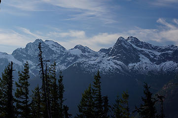 Colonial, Neve, and Pyramid early on the Sourdough Mountain trail 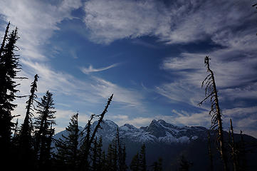 Sky 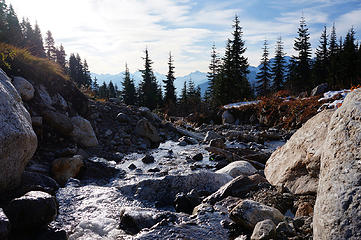 Crossing Sourdough Creek at about 5000ft 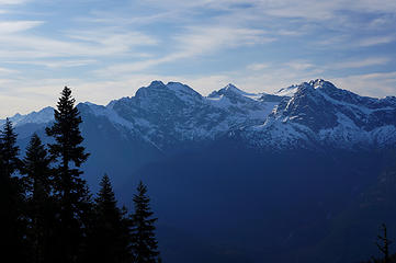 Colonial, Neve, and Pyramid early on the Sourdough Mountain trail 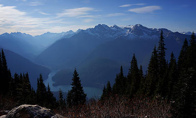 Thunder Arm of Diablo Lake 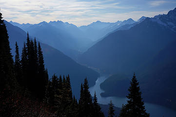 Thunder Arm of Diablo Lake 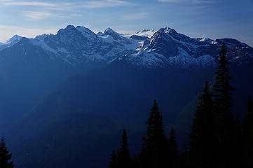 Colonial, Neve, and Pyramid at higher elevation. Other summits now show up, like Snowfield, Tricouni, and Primus 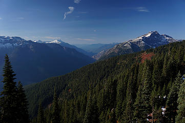 Looking west down the Skagit River drainage. Left is Big Devil, right is Davis 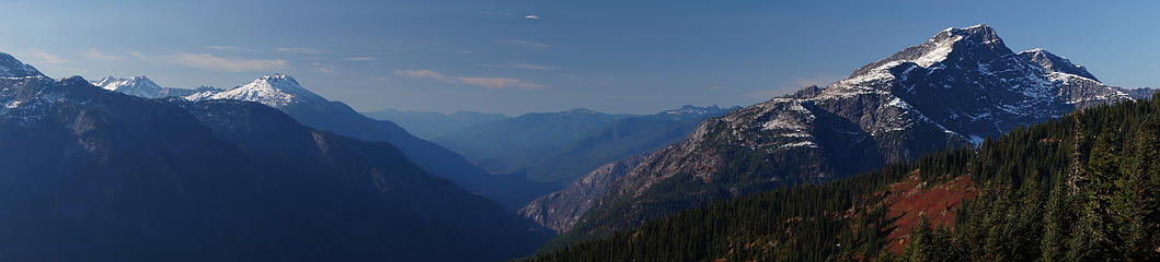 Looking west down the Skagit River drainage. Left is Big Devil, right is Davis 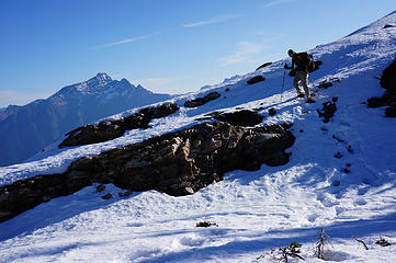 John along the NW Stetattle ridge 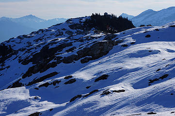 Sourdough Lookout 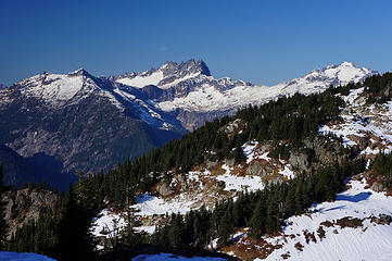 Terror, McMillan Spire, Luna 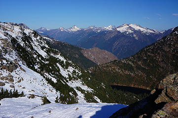 Looking north, with Sourdough Lake in the foreground and Rustic, Redoubt, Spickard, Prophet 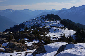 Sourdough Lookout 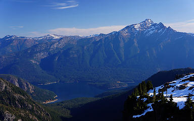 Jack Mountain and Ross Lake 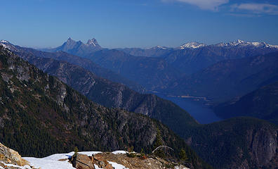 Hozomeen and Ross Lake 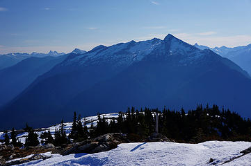 Ruby from the lookout  Lookout prepared for winter 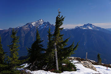 Jack and Crater from the lookout 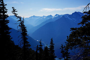 Thunder Arm from the lookout 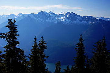 Colonial, Neve, Pyramid from the lookout 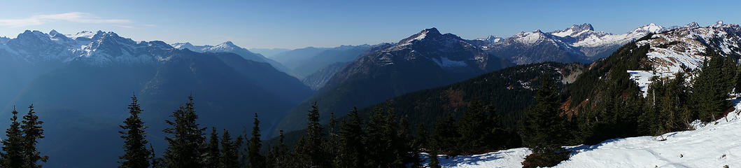 Panorama west 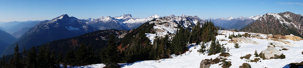 Panorama north-west 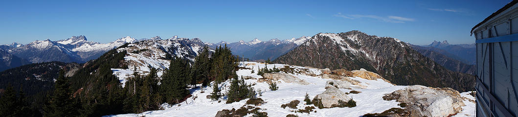 Panorama north 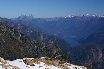 Hozomeen from the lookout 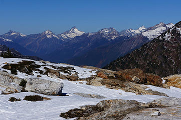 View north from the lookout 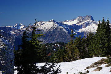 Despair, McMillan Spire, Terror 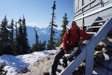 Martin at Sourdough Lookout 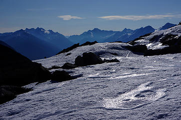 Snow, ice and panoramic views along the ridge 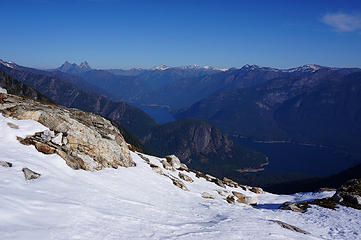 Hozomeen 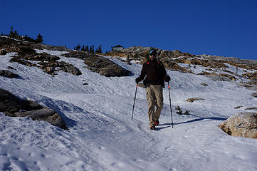 Descending from Sourdough Lookout 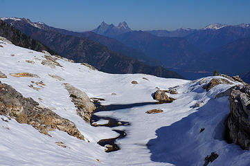 Hozomeen 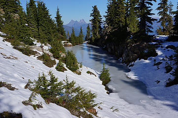 Frozen pond on the ridge descending from the lookout 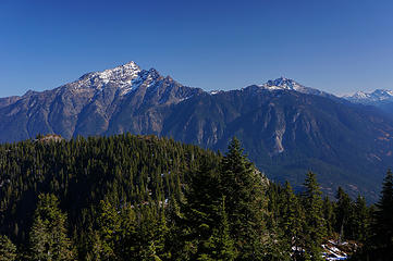 Jack & Crater, Pierce Mountain in foreground 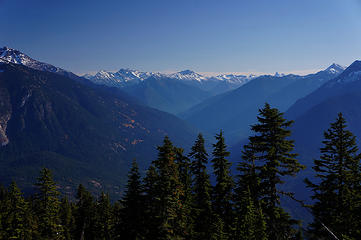 View towards Majestic Mountain 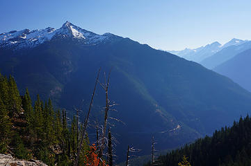 Ruby from ~4200ft on the Pierce Mountain Way trail 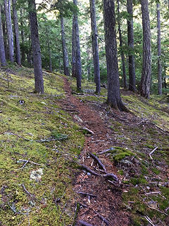 Pierce Mountain Trail is easy to follow 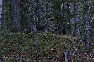 Mom and kid along Pierce Mtn trail 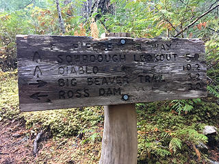 Intersection of Pierce Mtn Trail and Big Beaver Trail 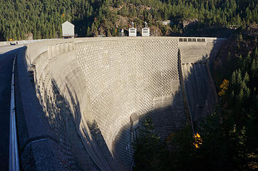 Ross Dam 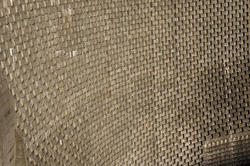 Ross Dam 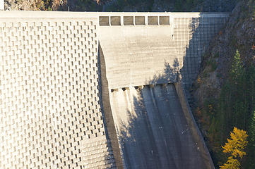 Splitgate of Ross Dam 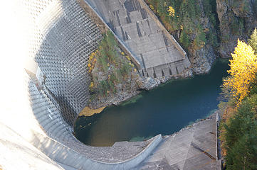 Ross Dam 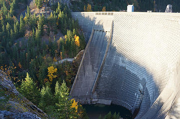 Ross Dam 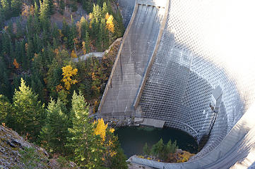 Ross Dam 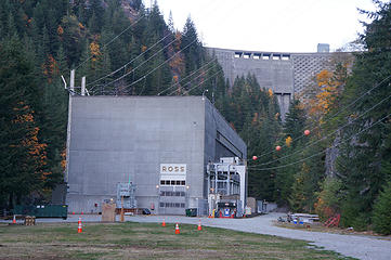 Ross Powerhouse 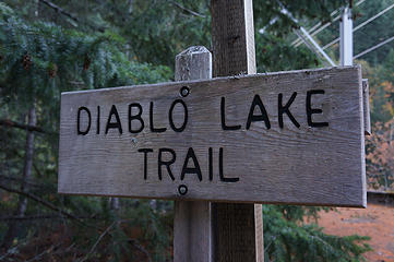 After descending from Ross Dam we continued on the Diablo Lake Trail 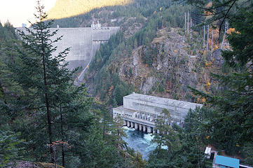 Ross Powerhouse 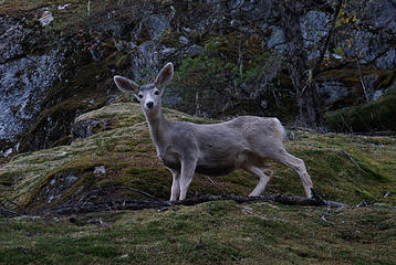 Deer (Diablo Lake Trail) 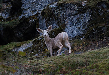 Deer (Diablo Lake Trail) 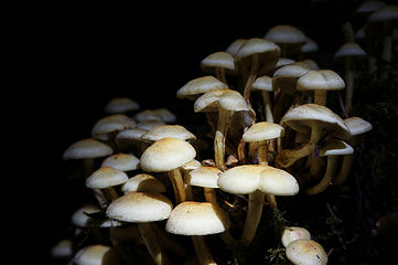 Some mushrooms glowing in the dark 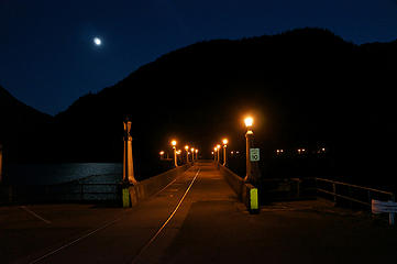 Diablo Dam 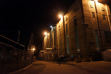 Diablo Powerhouse looks dark  GPS track of Sourdough Mountain / Pierce Mountain / Ross Dam / Diablo Lake loop. Note that at the ridge we assumed we couldn't find the trail down, and bushwacked. The trail turns out to be rerouted, approximately shown in blue. 19 miles, ~6700ft gain
|
| Back to top |
  
|
|
rbuzby
Attention Surplus
Joined: 24 Feb 2009
Posts: 1011 | TRs | Pics
|
|
rbuzby
Attention Surplus
|
 Tue Oct 31, 2017 3:20 pm |
|
|
Nice trip and pics.
In pic #14 above, with the caption "Looking north, with Sourdough Lake in the foreground and Rustic, Redoubt, Spickard, Prophet"
what is the mountain immediately to the left of Redoubt? The one at the far left (in the distance) is Bear mountain. To the right of Redoubt is Mox and Spickard, and probably Prophet at the far right. What is the peak between Redoubt and Bear? I'm, looking at GMAP4 and it doesn't have a name on the map I'm seeing.
|
| Back to top |
|
|
mbravenboer
Member
Joined: 20 Oct 2013
Posts: 1422 | TRs | Pics
Location: Seattle |
| rbuzby wrote: | | what is the mountain immediately to the left of Redoubt? |
Disclaimer: for the less obvious peaks I cheat a bit with the CalTopo 'view from here'  . I believe that's the one called Rustic. It's Pt 7747. It's the end-point of the SW ridge that starts halfway between Bear and Redoubt (between Pass Creek and Redoubt Creek). . I believe that's the one called Rustic. It's Pt 7747. It's the end-point of the SW ridge that starts halfway between Bear and Redoubt (between Pass Creek and Redoubt Creek).
|
| Back to top |
|
|
rbuzby
Attention Surplus
Joined: 24 Feb 2009
Posts: 1011 | TRs | Pics
|
|
rbuzby
Attention Surplus
|
Tue Oct 31, 2017 4:05 pm |
|
|
Thanks. I thought it was 7747 on the map but didn't know the name.
|
| Back to top |
|
|
mbravenboer
Member
Joined: 20 Oct 2013
Posts: 1422 | TRs | Pics
Location: Seattle |
| rbuzby wrote: | | I thought it was 7747 on the map but didn't know the name. |
I just looked it up in Beckey to confirm. It's indeed called Rustic, and the ridge is known as Rustic Ridge. Due to the coloring apparently, but I have never seen it up close. Will have to explore more north!
|
| Back to top |
|
|
goat
Member
Joined: 19 Mar 2016
Posts: 14 | TRs | Pics
Location: Seattle |
|
goat
Member
|
Tue Oct 31, 2017 8:13 pm |
|
|
Another fun trip, even with the bushwhacking! We probably wouldnt have found that spot around 4200 without our detour, so it was worth it.
I did the trip in trail runners and the icy snow meant my feet barely got wet. But Im sure that will change with the weather on the way.
I didnt take any memorable pictures, except for Martin advertising his new jacket and a certain hazelnut chocolate spread. Might need trademark clearance to post that!
|
| Back to top |
|
|
mbravenboer
Member
Joined: 20 Oct 2013
Posts: 1422 | TRs | Pics
Location: Seattle |
I assume you didn't want to expose my love for Nutella raisin bread and overly expensive gear, so I'll do it myself . It's a nice jacket though. Based on criticism on clothing color by people like radka I got a red one.
 Panorama with somebody eating a Nutella sandwich
|
| Back to top |
|
|
Brushbuffalo
Member

Joined: 17 Sep 2015
Posts: 1887 | TRs | Pics
Location: there earlier, here now, somewhere later... Bellingham in between |
Beautiful!!!
| mbravenboer wrote: | | We didn't hit the trail though, but decided to keep bushwhacking until we would meet the trail at about 4200ft. The correct trail is shown in blue on the map below, and also jdk610 explains it well in her report. |
A friendly tip: For your next trip on that loop, try doing it ccw. That way you follow the Pierce Mountain Way and come out in the meadows and slabs east of the lookout, from which point it is easy to find the trail down to Diablo. Then you won't have to search around for the vague upper part of the Pierce trail, which sort of fizzles out.
Passing rocks and trees like they were standing still
Passing rocks and trees like they were standing still
|
| Back to top |
|
|
|
|
You cannot post new topics in this forum
You cannot reply to topics in this forum
You cannot edit your posts in this forum
You cannot delete your posts in this forum
You cannot vote in polls in this forum
|
Disclosure: As an Amazon Associate NWHikers.net earns from qualifying purchases when you use our link(s). |


