| Previous :: Next Topic |
| Author |
Message |
Jake Robinson
Member


Joined: 02 Aug 2016
Posts: 521 | TRs | Pics
|
Steven (xuanxier) and I just returned from a quick tour of the Southwest, climbing as many interesting peaks as we could along our trip. The peaks we did (in chronological order) were Thimble Peak, Manly Beacon, Mount Whitney, Mount Muir, Telescope Peak, Mount Wilson, Charleston Peak, Moapa Peak, Angels Landing, and Lady Mountain.
Steven is a much better trip-reporter than I, and will be posting detailed reports on his personal website, so I'll try to keep this brief. (edit: I failed)
Day 1: Drive to Beatty
We drove 16 hours from Seattle to Beatty, Nevada (+ an extra 2 hours for Steven, as he came from Vancouver). When we arrived, we were so tired we slept in the front seats of the car in a parking lot.
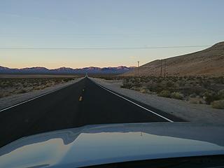 A long Nevadan highway 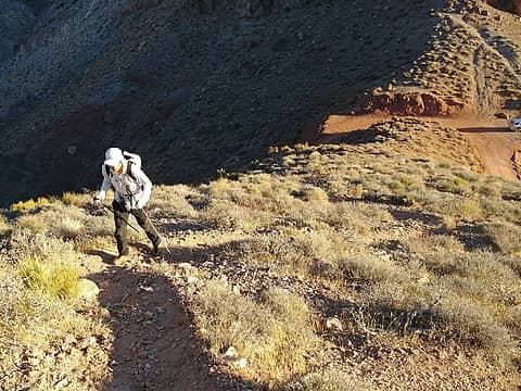 Steven hikes up Thimble 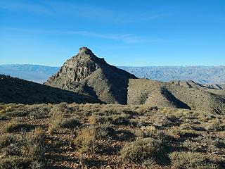 Nice looking little peak 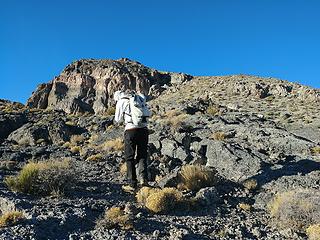 Up this class 2 to the top 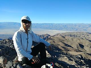 Summit shot 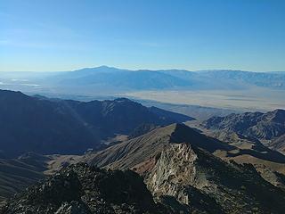 Views to Death Valley 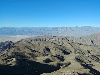 Whitney peeking out to the west 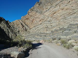 A rough and narrow drive with interesting geology 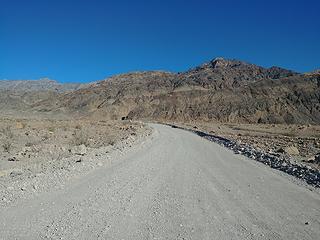 Looking back up to the canyon 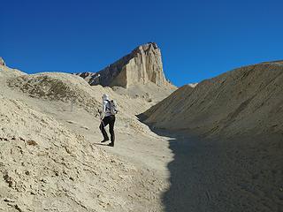 Steven heads for Manly Beacon 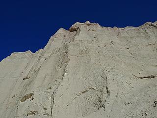 Steep dirt cliffs 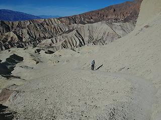 Crazy place 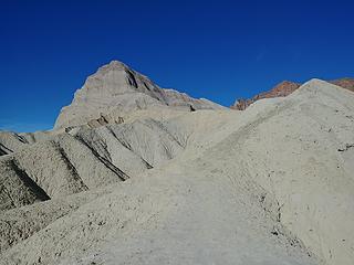 The route climbs the ridge on the right 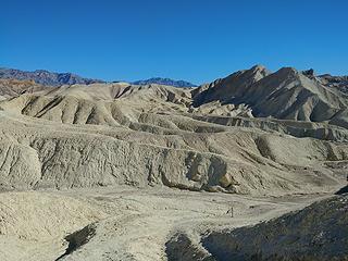 Looking towards Zabriski Point 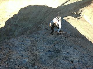 Steven on a minor scrambly bit 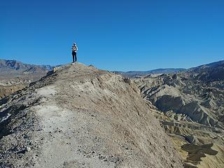 Steven on top 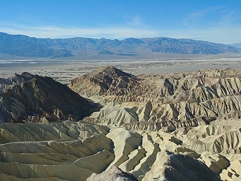 Looking back toward the trailhead and Death Valley 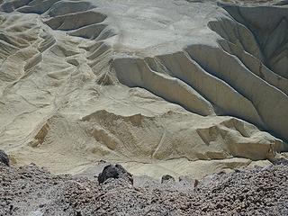 "Hey mom, look at those crazy people up there!" 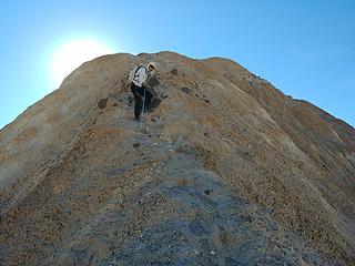 Descending 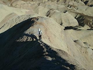 Descending 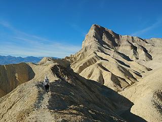 Off route on the way back 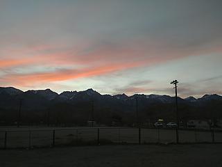 Sunset over Whitney from the Lone Pine McDonald's 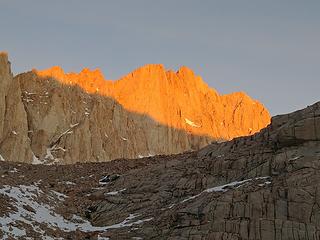 Crappy alpenglow shot from Trail Camp 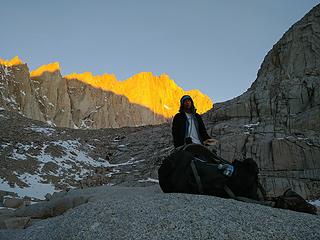 Steven at sunrise 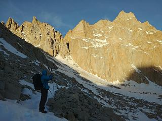 Golden hour from the "99 switchbacks" section 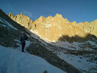 Up the endless switchbacks 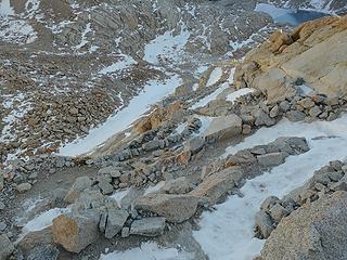 There are actually 99, I counted on the way down 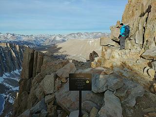 Steven at Trail Crest 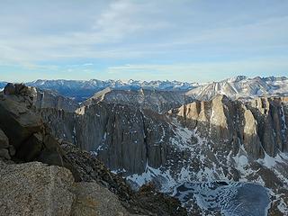 Dry 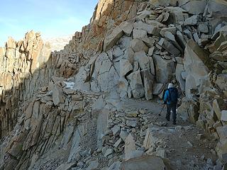 Nearly bare at 14,000 feet 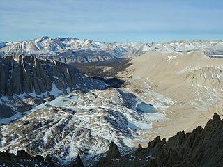 The aptly-named Guitar Lake was frozen 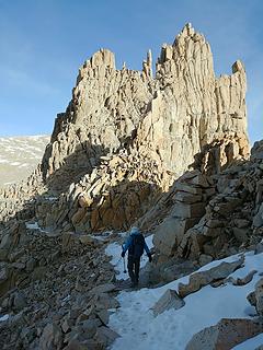 Upper reaches of the Whitney Trail 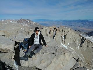 Steven on top 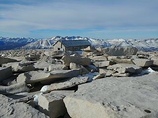 Summit hut 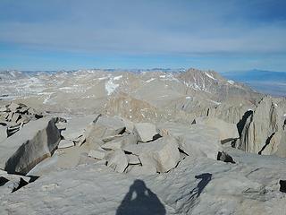 the Dry Sierra 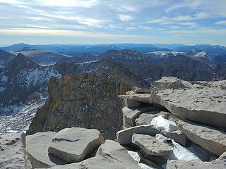 Looking back to Trail Crest 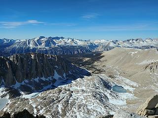 East 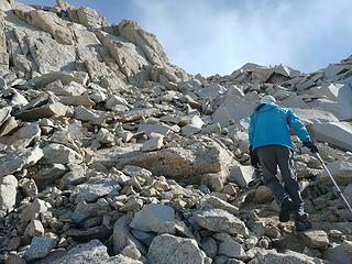 Steven approaching Muir 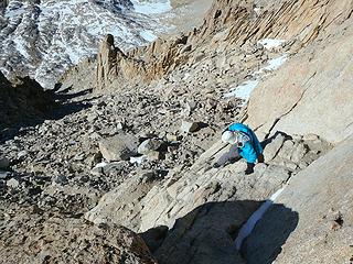 Scrambling 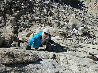 More scrambling 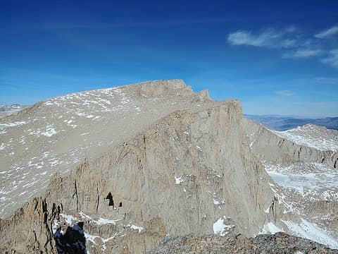 Whitney 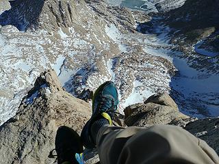 Obligatory shoe shot 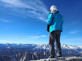 Steven atop Muir 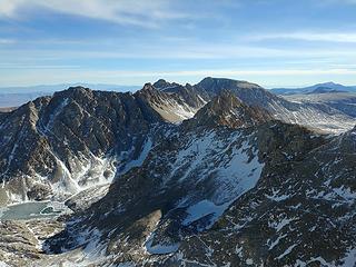 How many switchbacks can you count? 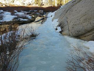 "Microspikes recommended" 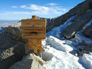 Back at Trail Crest 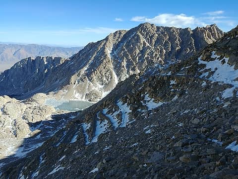 Down... 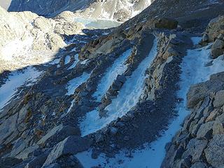 ...down... 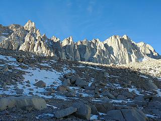 Almost Patagonian 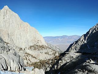 Out to the Portal 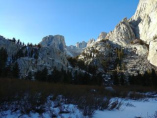 Back to Whitney 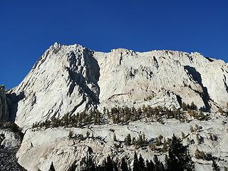 Beautiful rock 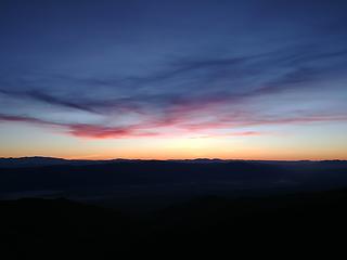 Dawn 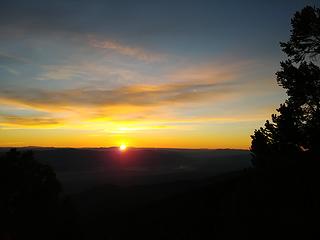 Sunrise 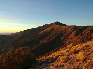 Telescope in the morning 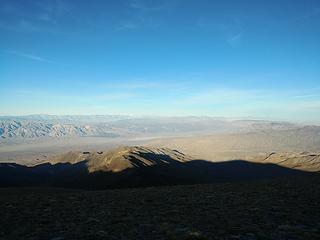 Hey, there's Whitney... 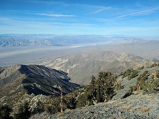 Summit views 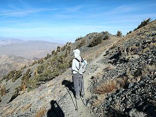 Steven near the summit 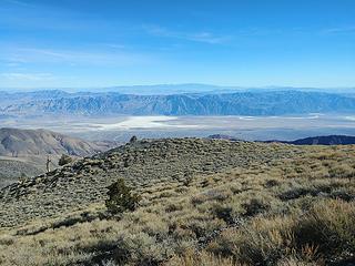 Looking down on below sea level terrain from 11k 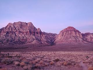 Why is this so red? 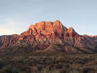 Wilson from the approach 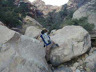 Starting up Oak Creek Canyon 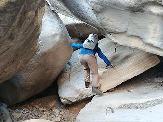 Boulder-hopping 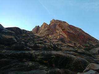 Steep canyon walls 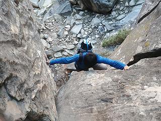 Awkward scrambling 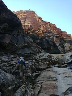 Steven climbs one of the easier waterfall steps 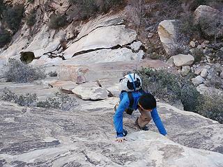 Start of the trickiest step 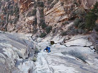 Crux section, class 4 and a bit downsloping/exposed 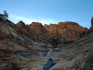 Summit above 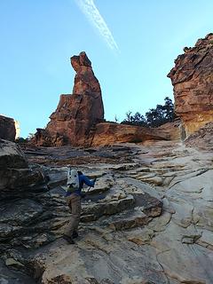 Steven beelines it for the top 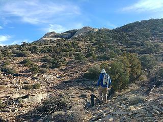 Nearing the summit 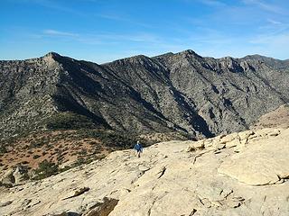 Change of scenery 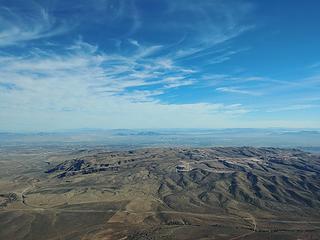 Vegas 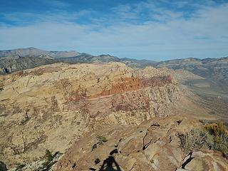 Rainbow Mountain 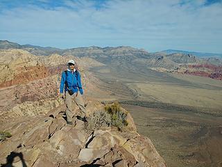 Summit shot 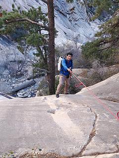 Descending the "batman rope" 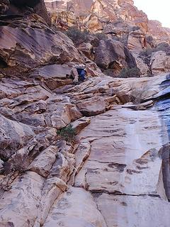 Awkward downclimbing 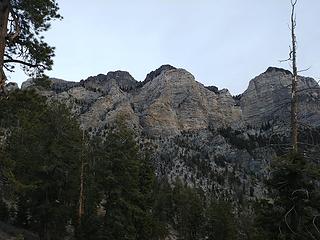 Cliffs of Mummy Mountain 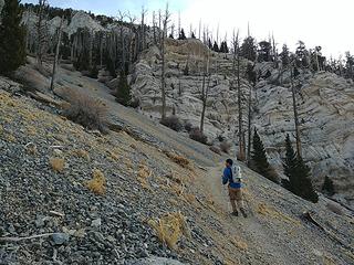 Heading up the North Loop trail 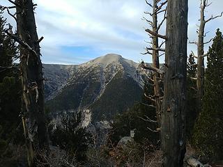 Summit, way over there 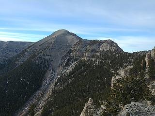 Closer 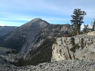 Ledge traversing 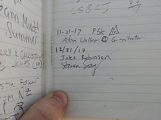 Hi Adam! 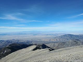 And there's Telescope...Deja vu... 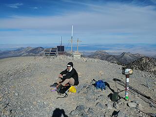 Steven on top 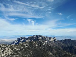 Mummy Mountain and clouds 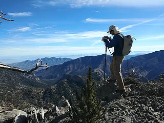 Taking photos 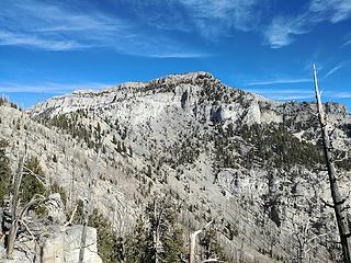 Mummy again 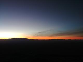 Dawn from Moapa 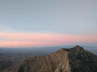 Morning on Moapa 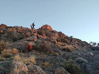 Steven with summit 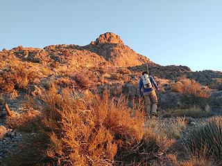 Traversing a ledge 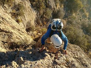 A bit of scrambling on grippy limestone 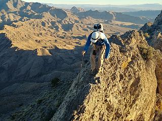 Precarious walking in spots 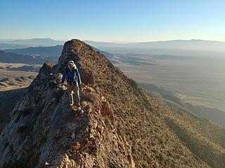 Traversing the ultra-cool but all too short summit ridge 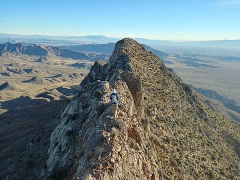 Near the top, heading back down 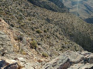 Exposure off the ridge 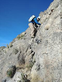 Downclimbing some stuff lower down 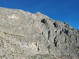 Moapa's south face - believe it or not, there's a non-technical route up there 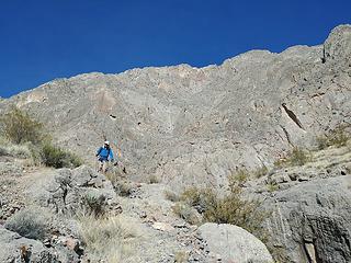 Steven descends 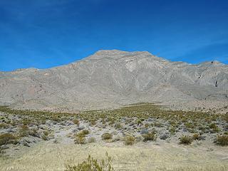 Moapa from the car 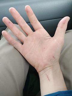 Cactus attack aftermath 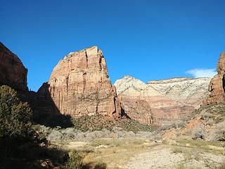 The Landing 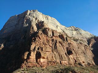 Beautiful Zion Canyon 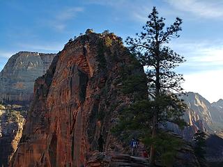 Steven joins the masses 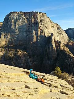 Steven on Angels Landing with the Great White Throne 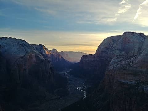 Looking down Zion Canyon near sunset 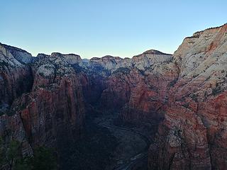 Looking up Zion Canyon near sunset 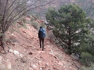 Steven starts up the unmaintained trail 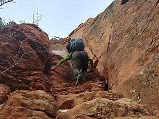 3rd classing on chopped steps 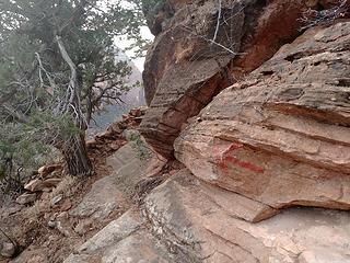 Painted arrows mark the way 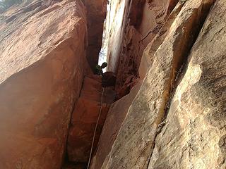 Steven at the top of the first technical pitch 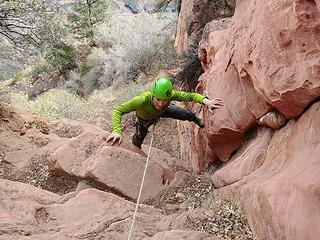 Steven climbing the second technical pitch 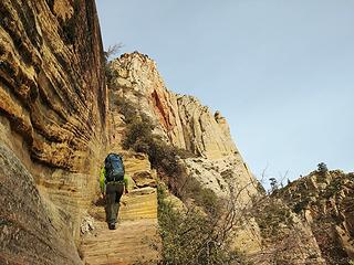 Up "the staircase" 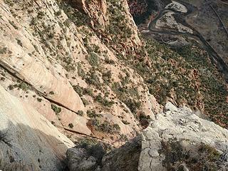 Ever-present exposure on this route 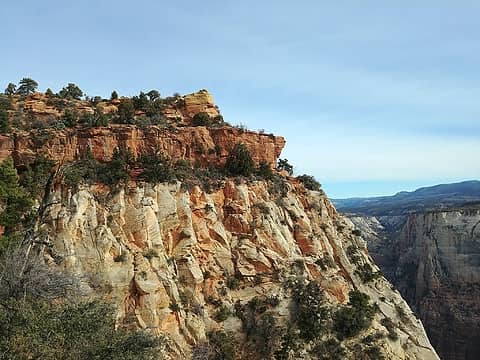 Summit 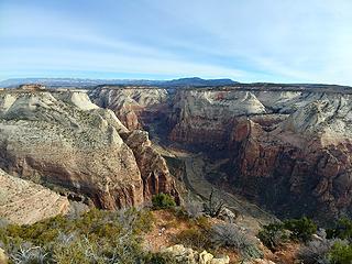 Looking up Zion Canyon from the summit 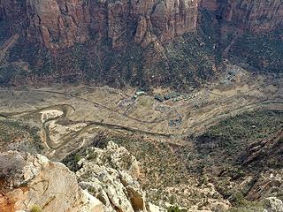 Zion Lodge, where we parked 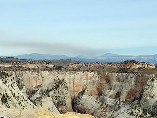 Fire? 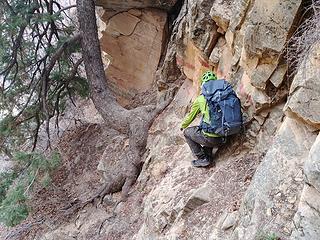 Descending 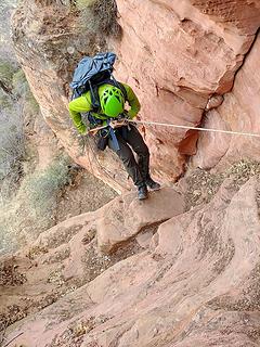 First rappel 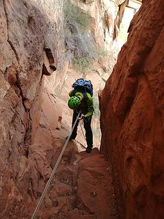 Second rappel 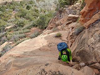 Downclimbing 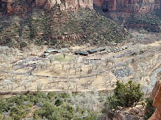 Zion Lodge 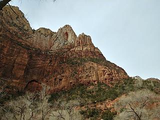 Lady Mountain from the parking lot. The route starts on the bottom right, climbs the first cliff band, traverses left above and through the cliffs, then gains the right-trending gully and follows it to the summit ridge
|
| Back to top |
  
|
|
awilsondc
Member

Joined: 03 Apr 2016
Posts: 1324 | TRs | Pics
|
|
| Back to top |
|
|
Gimpilator
infinity/21M

Joined: 12 Oct 2006
Posts: 1684 | TRs | Pics
Location: Edmonds, WA |
What a blast of a trip! You guys covered some ground I haven't seen yet. Really a great story and I can tell you had a lot of fun. It was good to see you both briefly. Next time, when I'm not in the middle of moving, we'll coordinate so I can join you.
|
| Back to top |
|
|
geyer
Member

Joined: 23 May 2017
Posts: 463 | TRs | Pics
Location: Seattle |
|
geyer
Member
|
 Wed Jan 03, 2018 6:31 pm |
|
|
Nice trip! Is Whitney normally that dry in the winter? Heck if I'd known it looked like that back around thanksgiving I might've changed my roadtrip to be more like yours
|
| Back to top |
|
|
xuanxier
Member

Joined: 09 May 2017
Posts: 80 | TRs | Pics
Location: Vancouver, BC |
|
xuanxier
Member
|
Wed Jan 03, 2018 7:58 pm |
|
|
That's a great write up and sums up really well. Felt like I'm going back through the trip for a second time. Jake's an excellent partner. One of the strongest I've ever hiked/climbed with.
There actually wasn't a lot of planning going on (spent a day to search up and that's about it) and instead we chose to let the story unfold itself, day after a day. Some objectives require timing (such as Whitney) that you simply can't fix the date. Another thing we tried was to mix things up and try seeing different stuffs each day. There's so much more to explore down in that corridor.
Re: Whitney. No it's not. Usually it's very snowy. Snowshoes, boots and windchill down to -20 F is probably the norm. That road is not technically maintained in winter too so if it snows down to low elevation then there's added distance. I just saw a post on Facebook that some parts of CA mountains have only 3% of the average snowpack right now.... Taking advantage of this dry conditions we figured it made sense to tag Whiteny, Telescope and Charlston the three higher altitude peaks.
|
| Back to top |
|
|
silence
Member

Joined: 25 Apr 2005
Posts: 4420 | TRs | Pics
|
|
silence
Member
|
Thu Jan 04, 2018 7:18 am |
|
|
Great trip and report. The lack snow in the Sierras is surprising and a little alarming ...the amount you encountered on the upper reaches of Whitney is about the same as it was when we did it in mid-Sept, 2003, particularly on the switchbacks.
PHOTOS
FILMS
Keep a good head and always carry a light bulb. Bob Dylan
PHOTOS
FILMS
Keep a good head and always carry a light bulb. Bob Dylan
|
| Back to top |
|
|
Jake Robinson
Member
Joined: 02 Aug 2016
Posts: 521 | TRs | Pics
|
| Gimpilator wrote: | | It was good to see you both briefly. Next time, when I'm not in the middle of moving, we'll coordinate so I can join you. |
Good to see you too, the shower and food was much appreciated. Thanks again!
Steven, thanks for the kind words. I had a great time on this trip! Your planning, routefinding, and technical skills are superb - much better than mine. I look forward to learning from you on future trips.
As for the snow situation: Steven already touched on this, but it's far from normal. Hiking bare trails all the way to 14,000 feet this time of year is pretty much unheard of, as far as I know. Quite disturbing.
|
| Back to top |
|
|
ree
Member

Joined: 29 Jun 2004
Posts: 4399 | TRs | Pics
|
|
ree
Member
|
Sun Jan 07, 2018 4:51 pm |
|
|
Wow - that's quite a trip! How cool to go from lowest to highest spots. I wanna do that too.  Nice trip report!
|
| Back to top |
|
|
silence
Member
Joined: 25 Apr 2005
Posts: 4420 | TRs | Pics
|
|
silence
Member
|
Mon Jan 08, 2018 8:21 am |
|
|
Good news, though we were thinking of heading down that way based on your report
URGENT - WINTER WEATHER MESSAGE
National Weather Service Las Vegas NV
333 AM PST Mon Jan 8 2018
CAZ519-521-090000-
/O.CON.KVEF.WS.W.0001.180109T0000Z-180110T0600Z/
Eastern Sierra Slopes-White Mountains of Inyo County-
Including Aspendell, Whitney Portal, Westgard Pass,
and Bristlecone Pine
333 AM PST Mon Jan 8 2018
...WINTER STORM WARNING REMAINS IN EFFECT FROM 4 PM THIS
AFTERNOON TO 10 PM PST TUESDAY ABOVE 7000 FEET...
* WHAT...Heavy snow expected. Travel will be very difficult to
impossible. Total snow accumulations of 10 to 20 inches, with
localized amounts up to 3 feet for the Sierra Nevada, 5 to 10
inches in the White Mountains.
* WHERE...Eastern Sierra Slopes and White Mountains of Inyo
County.
* WHEN...4 PM today to 10 PM Tuesday.
* ADDITIONAL DETAILS...Be prepared for significant reductions in
visibility at times. Mountain roads will become dangerous to
travel as they become slick and snow covered.
PRECAUTIONARY/PREPAREDNESS ACTIONS...
A Winter Storm Warning means significant amounts of snow are
forecast and severe winter weather conditions are expected or
occurring that will make travel dangerous. If you must travel,
keep a flashlight with extra batteries, food and water in your
vehicle in case of an emergency. Call 5 1 1 for the latest road
conditions.
PHOTOS
FILMS
Keep a good head and always carry a light bulb. Bob Dylan
PHOTOS
FILMS
Keep a good head and always carry a light bulb. Bob Dylan
|
| Back to top |
|
|
John Morrow
Member

Joined: 03 Apr 2007
Posts: 1526 | TRs | Pics
Location: Roslyn |
What a classy and aesthetic set of objectives you chose! Some there I hope to do someday but are on the edge of my comfort level. Nicely done. Was the routefinding pretty logical and straightforward on Lady? Hard to believe it was a maintained route by NPS at one time. Looks harder, but reminds me of the once maintained "Government Route" off the Island in the Sky, Canyonlands.
Tell me, what is it you plan to do with your one wild and precious life?-Mary Oliver
A nation that continues year after year to spend more money on military defense than on programs of social uplift is approaching spiritual doom.
― MLK Jr.
Tell me, what is it you plan to do with your one wild and precious life?-Mary Oliver
A nation that continues year after year to spend more money on military defense than on programs of social uplift is approaching spiritual doom.
― MLK Jr.
|
| Back to top |
|
|
Jake Robinson
Member
Joined: 02 Aug 2016
Posts: 521 | TRs | Pics
|
Silence - thanks for forecast update. They need all the snow they can get, so it's good to hear there's finally some headed their way.
| John Morrow wrote: | | What a classy and aesthetic set of objectives you chose! Some there I hope to do someday but are on the edge of my comfort level. Nicely done. Was the routefinding pretty logical and straightforward on Lady? Hard to believe it was a maintained route by NPS at one time. Looks harder, but reminds me of the once maintained "Government Route" off the Island in the Sky, Canyonlands. |
Thanks John! The routefinding on Lady isn't too bad if you bring a description. All the most confusing spots have arrows painted on the rock that point out the way to go. There are a few spots higher up that are sort of confusing, but not bad if you take your time.
And yes, it's hard to believe it was once a maintained and popular hike. There is a lot of exposed scrambling and it's really steep. I think people were just tougher back then.
|
| Back to top |
|
|
silence
Member
Joined: 25 Apr 2005
Posts: 4420 | TRs | Pics
|
|
silence
Member
|
Tue Jan 09, 2018 7:43 am |
|
|
Unfortunately NOAA is now downgrading the storm this morning ... saying it's warmer than predicted and amounts will only be 3 to 6 inches, with only 10 inches along the Sierra crest.
PHOTOS
FILMS
Keep a good head and always carry a light bulb. Bob Dylan
PHOTOS
FILMS
Keep a good head and always carry a light bulb. Bob Dylan
|
| Back to top |
|
|
xuanxier
Member
Joined: 09 May 2017
Posts: 80 | TRs | Pics
Location: Vancouver, BC |
|
xuanxier
Member
|
Sat Jan 13, 2018 12:59 am |
|
|
|
| Back to top |
|
|
|
|
You cannot post new topics in this forum
You cannot reply to topics in this forum
You cannot edit your posts in this forum
You cannot delete your posts in this forum
You cannot vote in polls in this forum
|
Disclosure: As an Amazon Associate NWHikers.net earns from qualifying purchases when you use our link(s). |


