| Previous :: Next Topic |
| Author |
Message |
RichP
Member


Joined: 13 Jul 2006
Posts: 5634 | TRs | Pics
Location: here |
|
RichP
Member
|
 Fri Jan 19, 2018 7:32 pm |
|
|
Looking for some better weather than predicted west of the crest and an easy hike, we chose Monahan which rises to the south of Easton. The mountain stands out in a solitary position separate from ridges on either side of I-90.
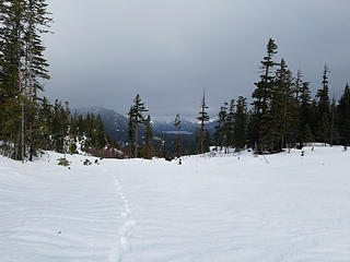
We parked at the end of the pavement at a plowed out spot on Cabin Ck Rd right where it becomes FR 41. The road continues to a snomobile sno park beyond here. We back tracked a few hundred yards to the power lines and started the hike on nearly bulletproof frozen snow for the first several hundred feet. I used microspikes for traction on this section while Monty and his son Eli donned snowshoes.
We left the power line swath after a few hundred feet of climbing and entered pleasant forest taking the crest of the ridge up to the treed summit. We finally found some good snow the last 500' but it is still quite thin at this point and maybe 1' in depth at most.
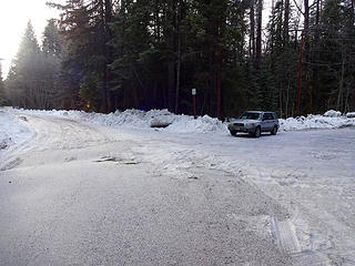 Parking at Cabin Ck Rd. The road turns into FR 41 at the end of the pavement. 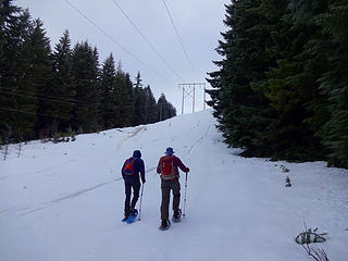 Starting the hike under power lines on crusty snow. 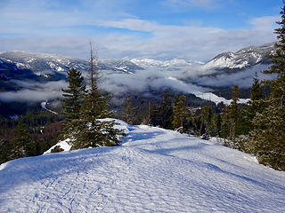 Views west on the ascent. 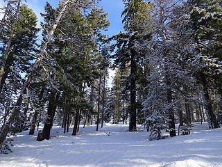 Nice forest higher up. 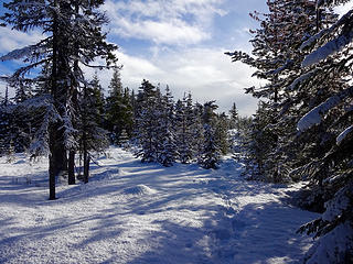 On the ridge top. 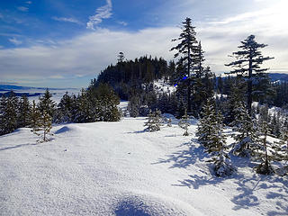 Monahan summit. 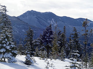 Cole Butte. 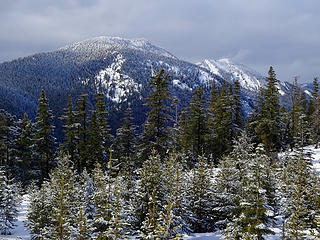 Cabin Mtn. 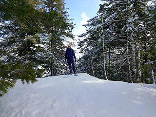 Eli on the summit, 3775.' 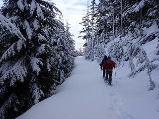 Taking the road down. We rejoined our ascent route lower down. 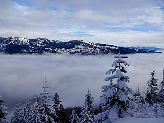 Easton Ridge 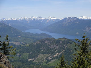 Cascade Crest.
|
| Back to top |
  
|
|
Jake Robinson
Member

Joined: 02 Aug 2016
Posts: 521 | TRs | Pics
|
Beautiful, thanks for the report! Cool to see blue sky today. It was snowing on Si this afternoon.
|
| Back to top |
|
|
EastKing
Surfing and Hiking

Joined: 28 Mar 2007
Posts: 2082 | TRs | Pics
Location: 77 miles from Seattle! |
|
EastKing
Surfing and Hiking
|
Sat Jan 27, 2018 8:25 pm |
|
|
Went there on 1/26/18. There is now a good amount of snow and snowshoes are now definitely needed. No views because it was snowing heavily but I could see many spots for pictures. We did the ridge which was forested so it had very little avy danger. Good alternative when there is high avy danger in other places.
YouTube | SummitPost
Saw the depths of despair. Now I am salvaging what time I have left on Earth.
YouTube | SummitPost
Saw the depths of despair. Now I am salvaging what time I have left on Earth.
|
| Back to top |
|
|
Paul M
Member

Joined: 15 Jul 2008
Posts: 371 | TRs | Pics
|
|
Paul M
Member
|
Sat Feb 03, 2018 7:20 pm |
|
|
A quick conditions update for this Saturday (3 Feb 2018).
Martin S and I followed the described route and found pleasant walking and snowshoeing up this P1K peak today. We saw some old tracks on the ridge (probably from EastKing still). A nice short and close in winter hike for sure. Thx for the initial report.
A few pics from today.
 Surprising views on this mixed precip day 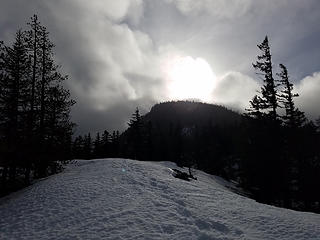 Pleasant ridge walk on Monahan Mtn 02032018 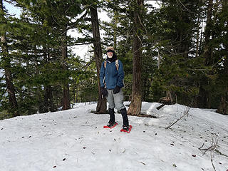 Martin on Monahan Mtn summit 02032018 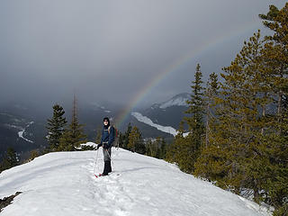 Proof Martin can be found at the end of the rainbow
|
| Back to top |
|
|
kitya
Fortune Cookie

Joined: 15 Mar 2010
Posts: 842 | TRs | Pics
Location: Duvall, WA |
|
kitya
Fortune Cookie
|
Sun Feb 04, 2018 7:35 pm |
|
|
| Paul M wrote: | | Martin S and I followed the described route and found pleasant walking and snowshoeing up this P1K peak today. We saw some old tracks on the ridge (probably from EastKing still). A nice short and close in winter hike for sure. Thx for the initial report. |
Could be mine too  I was there a week later than EastKing, just a week before you. We had 0 views I was there a week later than EastKing, just a week before you. We had 0 views  But I did a slight variation where I used road system to go up and ridge to go down. Also went to the little east high point after the summit, that was a lot of fun (there is a narrow scrambly section).
This is my gpx of both road system and the ridge way:
https://connect.garmin.com/modern/activity/2464496918 But I did a slight variation where I used road system to go up and ridge to go down. Also went to the little east high point after the summit, that was a lot of fun (there is a narrow scrambly section).
This is my gpx of both road system and the ridge way:
https://connect.garmin.com/modern/activity/2464496918
|
| Back to top |
|
|
puzzlr
Mid Fork Rocks

Joined: 13 Feb 2007
Posts: 7220 | TRs | Pics
Location: Stuck in the middle |
|
puzzlr
Mid Fork Rocks
|
Mon Feb 05, 2018 3:01 pm |
|
|
Funny how trips to some of these nondescript peaks come in waves. This is one peak that isn't going to get ruined by too much attention. The loggers already saw to that (not necessarily a criticism of logging in general).
I wonder why Garmin Connect is so slow to update their OpenStreetMap layer. I added all the logging roads in that area after we went up and they've propagated to most other renderings - https://www.openstreetmap.org/#map=14/47.2284/-121.1957&layers=C
|
| Back to top |
|
|
kitya
Fortune Cookie
Joined: 15 Mar 2010
Posts: 842 | TRs | Pics
Location: Duvall, WA |
|
kitya
Fortune Cookie
|
Mon Feb 05, 2018 5:51 pm |
|
|
It is funny how you describe one visit a week as a 'wave' )
|
| Back to top |
|
|
|
|


