| Previous :: Next Topic |
| Author |
Message |
Matt
Tea, Earl Grey, Hot


Joined: 30 Jan 2007
Posts: 4307 | TRs | Pics
Location: Shoreline |
|
Matt
Tea, Earl Grey, Hot
|
 Sat Feb 17, 2018 12:41 am |
|
|
Date: February 10, 2018
Destination: Oakes 5681 and "Acorn" 4724 (USGS Damnation)
People: Matt, Carla, GeoTom, Cartman, Elle, Barb, David, Steph
Dogs: Isabel
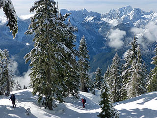
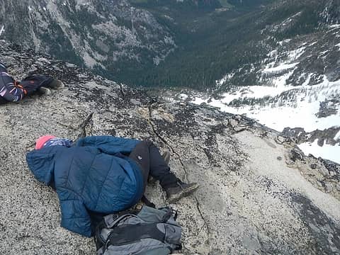
Oakes is a premier winter view scramble. It's 5000 feet uphill off trail, and has an open view only on top, but what a view! Ranges of dramatic peaks run on both sides the Diobsud-Bacon crest above Bacon creek to the west, and the Big Devil crest above the Skagit River to the east. And right in the center stands the bold spire of Triumph, like an exclamation point for the entire area.
But what about Acorn? Acorn was a side trip to a smaller peak solely for the sake of visiting a new summit. But it did have some interesting views up the Skagit valley.
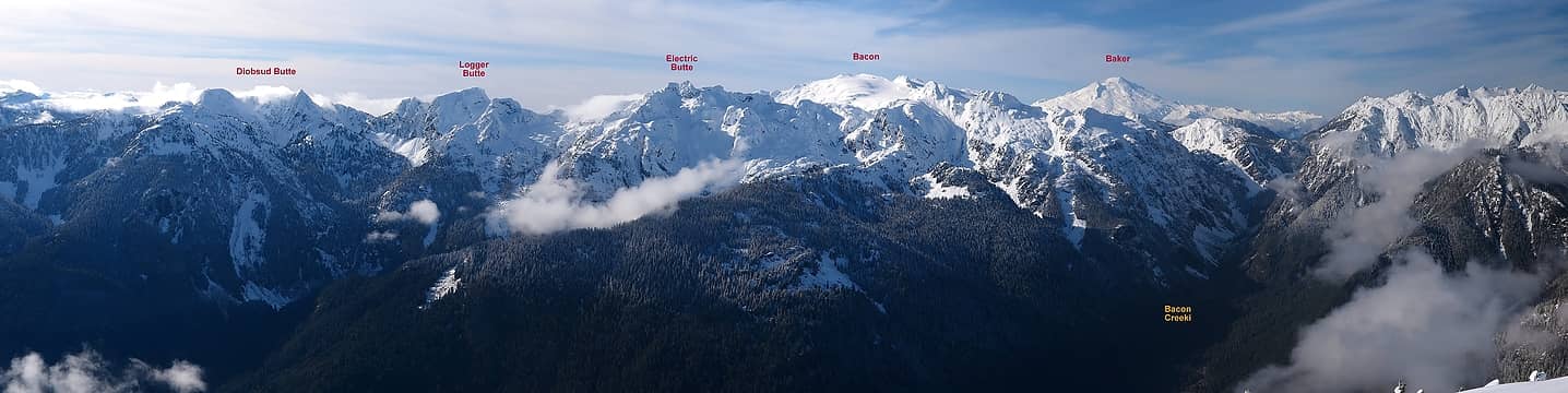 The Diobsud-Bacon crest 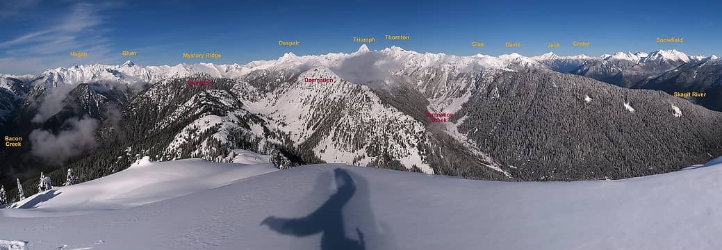 The Triumph crest 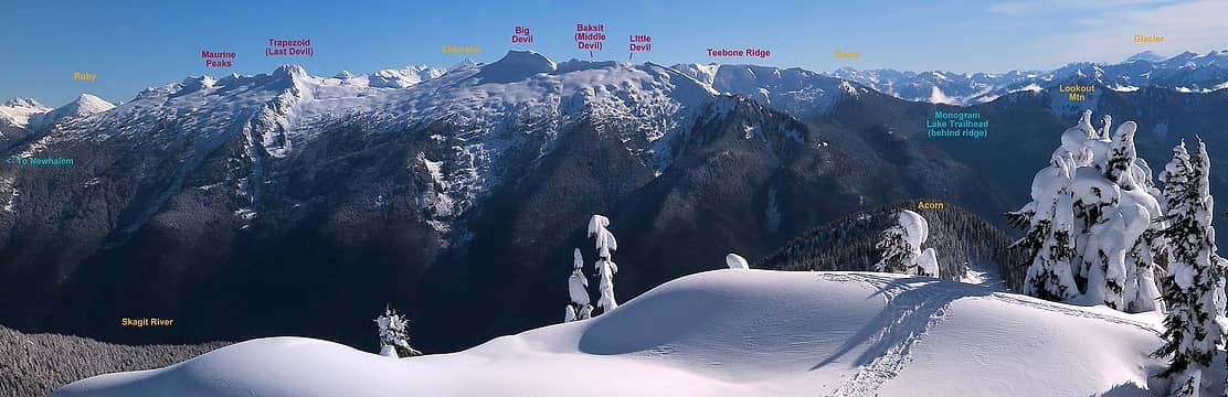 The Big Devil Crest (I once ran a traverse with Torok across the whole group, starting from Monogram Lake and ending at Newhalem) 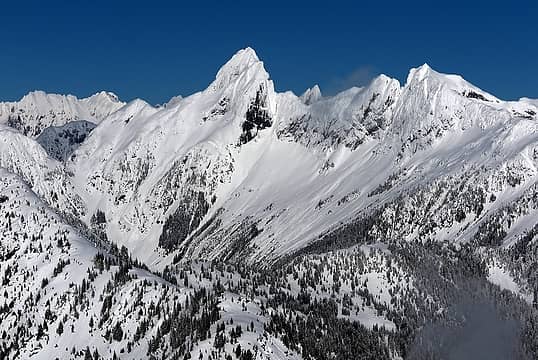 Triumph 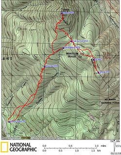 GPS Track 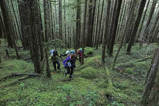 Hiking up through the mossy forest 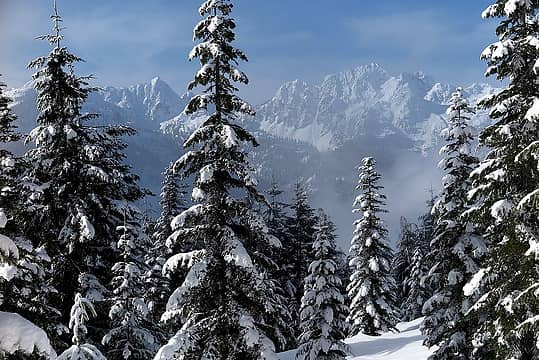 Diobsud & Logger materialize out of the clouds 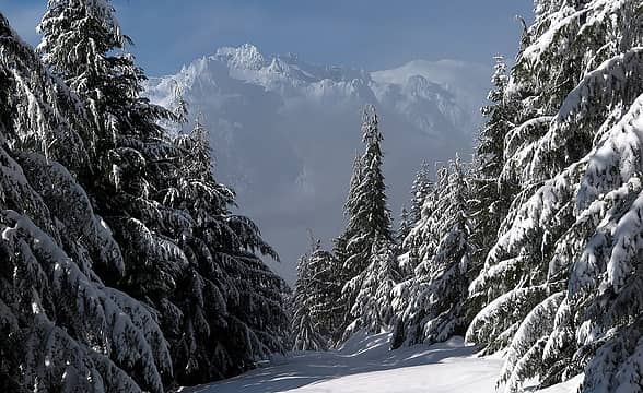 Electric & Bacon emerge also 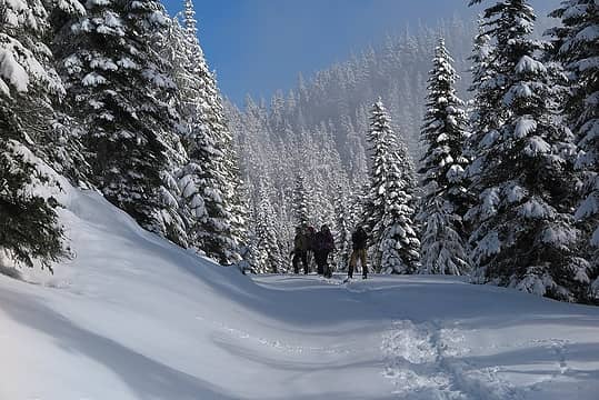 Turning uphill off the road. Oakes on the left. Acorn ahead on the right. 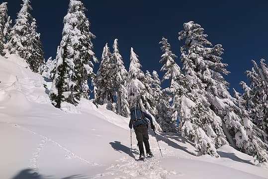 Snowy higher slopes 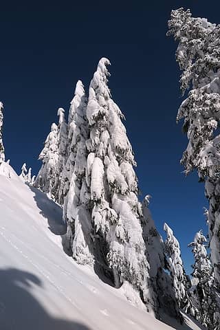 Steep trees 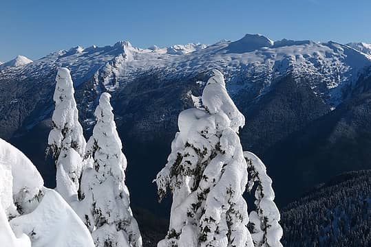 The Big Devil crest comes into view 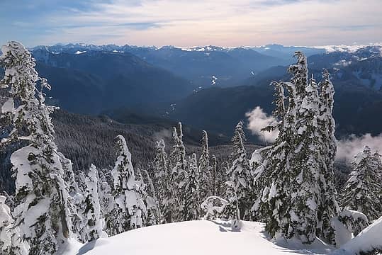 Long view back down the Skagit and all the way out to Whitehorse 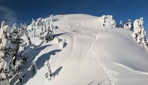 Party ahead on the summit 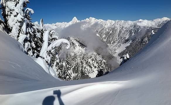 Triumph comes into view 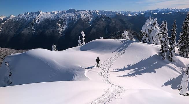 Tom coming up the last slope 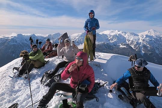 Enjoying the sunny summit 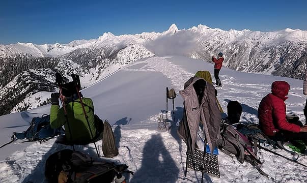 Lunch and photograph 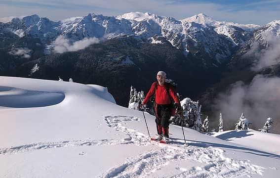 Me above the Bacon Creek crest 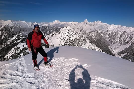 Me with Triumph and friends 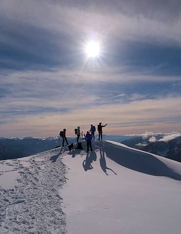 sunny winter summit 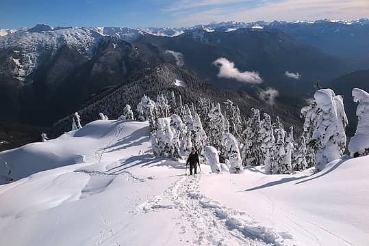 Eric arriving 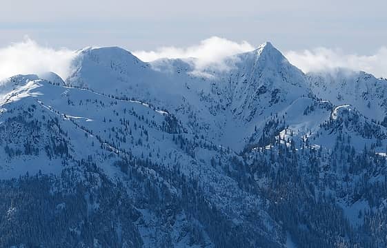 Diobsud Butte 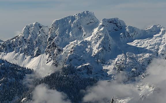 Logger Butte 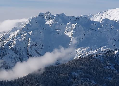 Electric Butte 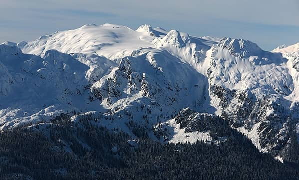 Bacon 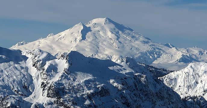 Baker 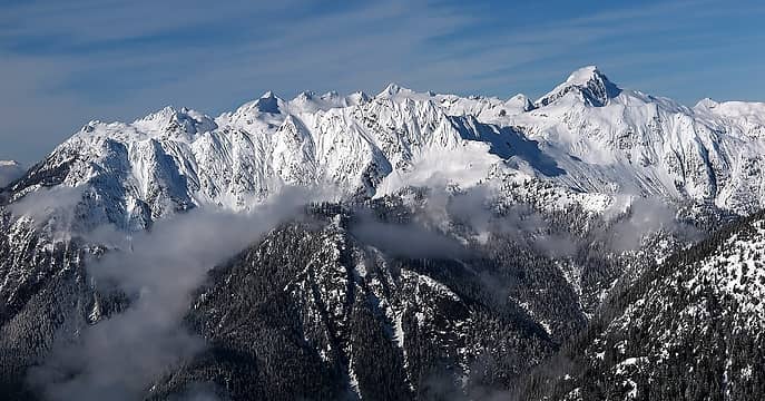 Hagan & Blum 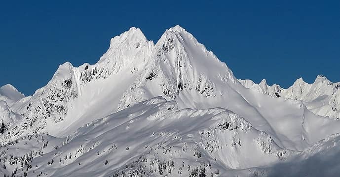 Despair 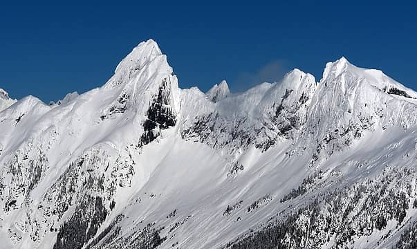 Triumph & Thornton 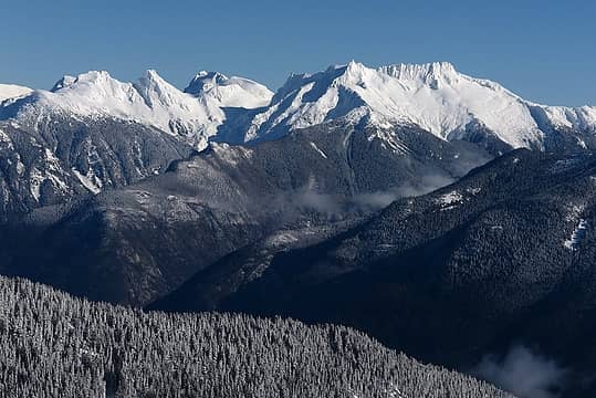 Pyramid, Pinnacle, Paul Bunyan's Stump, Colonial, Snowfield 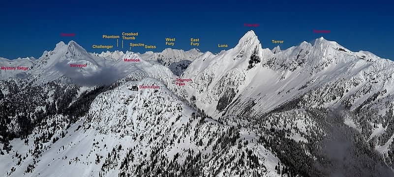 A full range of North Cascades emotion in this photo: Mystery, Challenge, Damnation, Fury, Terror, Despair, Triumph 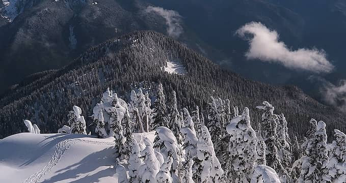 Looking down on Acorn from Oakes 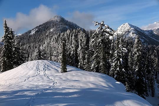 Looking back at Oakes & Damnation from Acorn 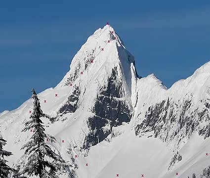 the route we took up the "easy" side of Triumph 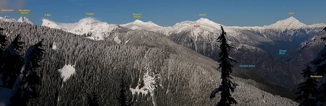 Looking up the Skagit 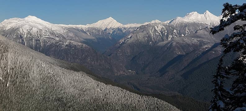 The Newhalem fire burn 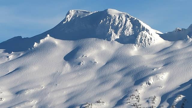 Cool rippled snow patterns across the valley on Big Devil 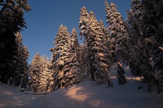 Last sunlight in the trees
As beacons mountains burned at evening. J.R.R. Tolkien
As beacons mountains burned at evening. J.R.R. Tolkien
|
| Back to top |
  
|
|
Fletcher
Member

Joined: 29 Jul 2009
Posts: 1870 | TRs | Pics
Location: kirkland |
|
Fletcher
Member
|
Sat Feb 17, 2018 2:41 am |
|
|
I did Oakes back in December, with a good forecast, but we were stuck in a white-out all day. Thanks for the views!
|
| Back to top |
|
|
BarbE
Member

Joined: 28 Jul 2006
Posts: 1153 | TRs | Pics
|
|
BarbE
Member
|
Sat Feb 17, 2018 11:09 am |
|
|
| Matt wrote: | A full range of North Cascades emotion in this photo: Mystery, Challenge, Damnation, Fury, Terror, Despair, Triumph |
Love this one! I wonder, who first named these peaks?
Sorry, the rest of your lazy group decided to loaf on Oakes while you tagged Acorn. I wonder, who first named these peaks?
Sorry, the rest of your lazy group decided to loaf on Oakes while you tagged Acorn.
 Tom and Matt near the summit 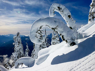 Ramhorns 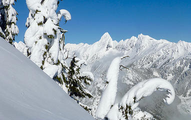 In awe of Triumph 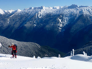 Matt reaches the summit 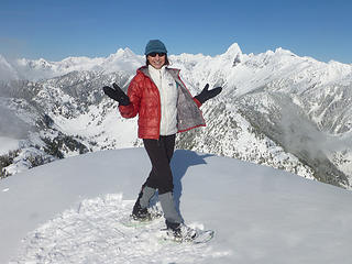 Between Triumph and Dispair 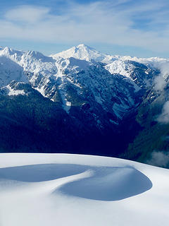 Mount Baker 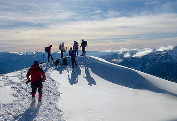 Summiteers 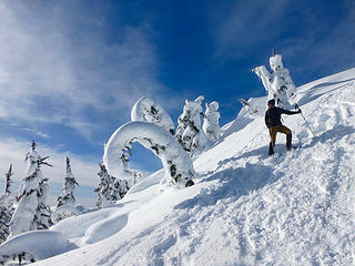 Leaving the summit 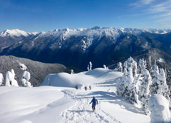 Leaving the summit/Acorn on the right 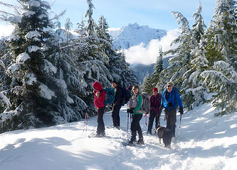 another road crossing
|
| Back to top |
|
|
RichP
Member

Joined: 13 Jul 2006
Posts: 5634 | TRs | Pics
Location: here |
|
RichP
Member
|
Sat Feb 17, 2018 11:20 am |
|
|
Great looking outing. I wonder how those logging roads that reach high up would go for a summer ascent?
|
| Back to top |
|
|
BarbE
Member
Joined: 28 Jul 2006
Posts: 1153 | TRs | Pics
|
|
BarbE
Member
|
Sat Feb 17, 2018 11:25 am |
|
|
Wouldn't it be sweet if you could drive to about 4300' and stroll another 1400' to the summit! 
|
| Back to top |
|
|
wildernessed
viewbagger

Joined: 31 Oct 2004
Posts: 9275 | TRs | Pics
Location: Wenatchee |
Living in the Anthropocene
Living in the Anthropocene
|
| Back to top |
|
|
Matt
Tea, Earl Grey, Hot
Joined: 30 Jan 2007
Posts: 4307 | TRs | Pics
Location: Shoreline |
|
Matt
Tea, Earl Grey, Hot
|
Sat Feb 17, 2018 11:59 am |
|
|
| RichP wrote: | | Great looking outing. I wonder how those logging roads that reach high up would go for a summer ascent? |
I know people used to use that road, but I thought I heard that it was unusable now, probably a washout somewhere low down. If anyone has specific info, it would be helpful to know.
As beacons mountains burned at evening. J.R.R. Tolkien
As beacons mountains burned at evening. J.R.R. Tolkien
|
| Back to top |
|
|
Fletcher
Member
Joined: 29 Jul 2009
Posts: 1870 | TRs | Pics
Location: kirkland |
|
Fletcher
Member
|
Sat Feb 17, 2018 12:19 pm |
|
|
I tend to recall that when we did it, with a lot less snow, it was fairly apparent that those roads were being inundated with brush.
|
| Back to top |
|
|
Yana
Hater

Joined: 04 Jun 2004
Posts: 4212 | TRs | Pics
Location: Out Hating |
|
Yana
Hater
|
Sat Feb 17, 2018 4:49 pm |
|
|
I'm concerned about the human to dog ratio of this trip.
PLAY SAFE! SKI ONLY IN CLOCKWISE DIRECTION! LET'S ALL HAVE FUN TOGETHER!
PLAY SAFE! SKI ONLY IN CLOCKWISE DIRECTION! LET'S ALL HAVE FUN TOGETHER!
|
| Back to top |
|
|
Matt
Tea, Earl Grey, Hot
Joined: 30 Jan 2007
Posts: 4307 | TRs | Pics
Location: Shoreline |
|
Matt
Tea, Earl Grey, Hot
|
Sat Feb 17, 2018 5:02 pm |
|
|
Yana is correct. One dog is worth about ten humans, so Izzy has us outnumbered.
As beacons mountains burned at evening. J.R.R. Tolkien
As beacons mountains burned at evening. J.R.R. Tolkien
|
| Back to top |
|
|
Nancyann
Member

Joined: 28 Jul 2013
Posts: 2319 | TRs | Pics
Location: Sultan Basin |
|
Nancyann
Member
|
Sat Feb 17, 2018 10:15 pm |
|
|
It looks like a fine group of NWHikers out having a great time. Gorgeous, absolutely stunning pictures!
|
| Back to top |
|
|
iron
Member

Joined: 10 Aug 2008
Posts: 6392 | TRs | Pics
Location: southeast kootenays |
|
iron
Member
|
Sat Feb 17, 2018 11:05 pm |
|
|
| Matt wrote: | | I know people used to use that road, but I thought I heard that it was unusable now, probably a washout somewhere low down. If anyone has specific info, it would be helpful to know. |
gated right at the main road. probably the biggest deterrent. i seem to recall that the road was in fine shape (or fine enough) when we did it ~ a decade ago. but, age, memory, wishful thinking, etc... may alter my facts.
|
| Back to top |
|
|
puzzlr
Mid Fork Rocks

Joined: 13 Feb 2007
Posts: 7220 | TRs | Pics
Location: Stuck in the middle |
|
puzzlr
Mid Fork Rocks
|
Sun Feb 18, 2018 12:00 am |
|
|
Thanks for all the labelled panos. What a day!
|
| Back to top |
|
|
Michael Lewis
Taking a nap
Joined: 27 Apr 2009
Posts: 629 | TRs | Pics
Location: Lynnwood, WA (for now) |
like it. i can almost feel the snow underfoot
|
| Back to top |
|
|
neek
Member

Joined: 12 Sep 2011
Posts: 2338 | TRs | Pics
Location: Seattle, WA |
|
neek
Member
|
Sat Mar 10, 2018 10:22 pm |
|
|
Did Oakes today. Great winter hike, thanks for the inspiration. We had to walk most of the road because there's snow on it now and we didn't have high clearance. Snowshoes went on around 2500'. Things were fairly sloppy toward the top, no surprise.
|
| Back to top |
|
|
|
|
You cannot post new topics in this forum
You cannot reply to topics in this forum
You cannot edit your posts in this forum
You cannot delete your posts in this forum
You cannot vote in polls in this forum
|
Disclosure: As an Amazon Associate NWHikers.net earns from qualifying purchases when you use our link(s). |


