| Previous :: Next Topic |
| Author |
Message |
Matt
Tea, Earl Grey, Hot


Joined: 30 Jan 2007
Posts: 4307 | TRs | Pics
Location: Shoreline |
|
Matt
Tea, Earl Grey, Hot
|
 Thu Apr 05, 2018 10:49 pm |
|
|
Date: March 31, 2018
Destination: Hawk Rock 5040 620P (USGS Evergreen Mtn)
Party: Matt, Carla (Dicey), Eric (Cartman)
"Hawk Rock" is the peakbagger's name for Point 5040 (640P) about 1.7 miles north of Eagle Rock on the west side of the Beckler River. We tried a route from the northwest that worked out well.
Short Route Description:
Drive the Beckler River Road 65 to about ¼ mile past the Rapid River Road junction, to a small stub road on the right. Hike (or drive in summer) the stub road 0.8 miles to where it makes a sharp switchback. Hike uphill northwest to Point 2416. Hike west slightly down to a saddle, then up forested slopes to reach Hawk Rock's north ridge circa 3800 feet. Follow the ridge crest to the summit.
(On the map below, red line is our route up. Disregard the purple line, which is our route down, with various stubs to look for views and a less successful descent line below Point 2416.)
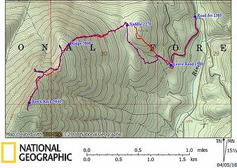 Hawk Rock GPS Track 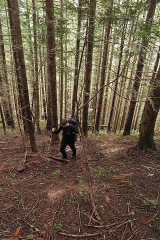 Eric hiking uphill in the second-growth forest 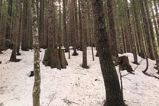 Memories of the big trees that once stood here 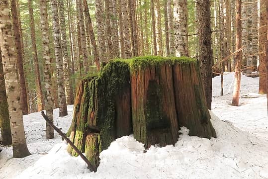 Another memory of the giants that once ruled here 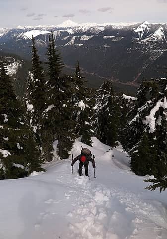 Carla hiking up the ridge crest 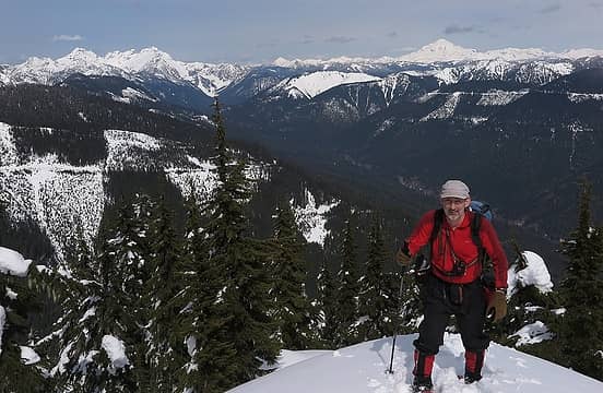 Me on the ridge crest 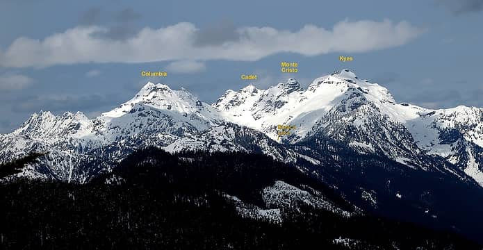 Looking NNW to the Monte Cristo Range 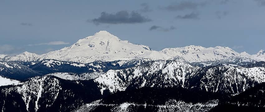 Looking NNE to Glacier Peak 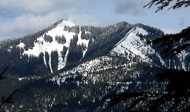 Looking northeast to Evergreen 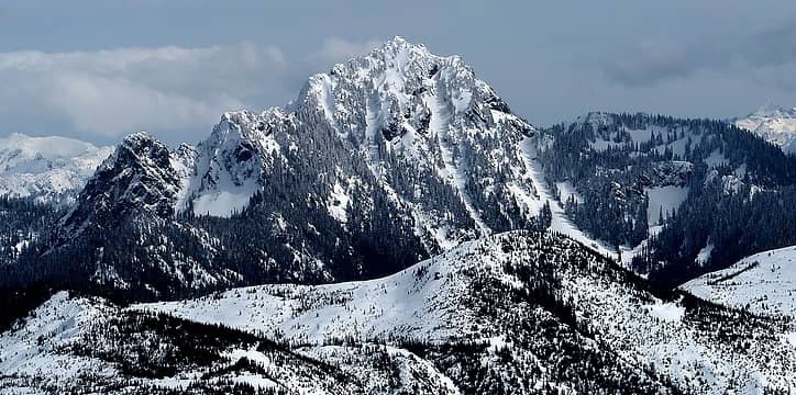 Looking southeast to Fernow 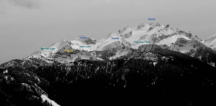 Daniel and neighbors 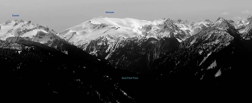 Hinman 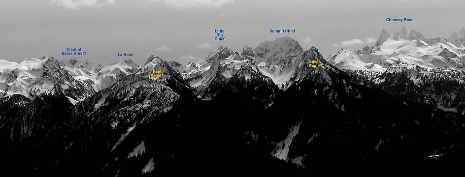 Summit Chief and Chimney Rock 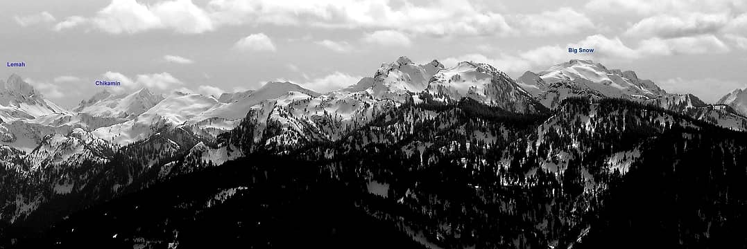 Lemah and Big Snow 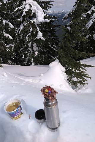 Soup, tea, and an Easter basket cookie baked by Sadie's Driver for lunch. 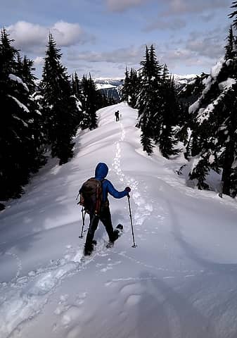 Hiking back down the ridge crest. 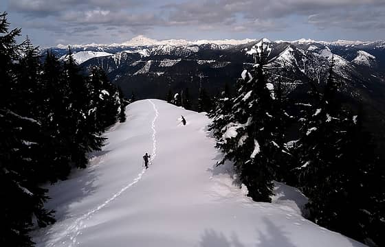 Further down the ridge crest 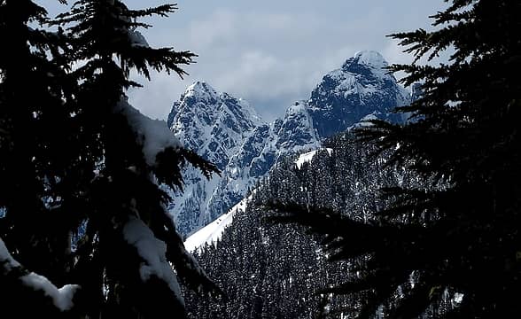 Baring 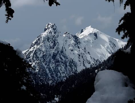 Gunn & Gunnshy 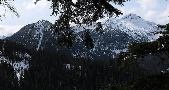 Eagle Rock & Townsend 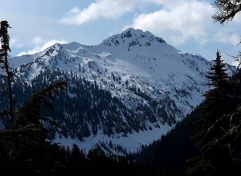 Townsend
As beacons mountains burned at evening. J.R.R. Tolkien
As beacons mountains burned at evening. J.R.R. Tolkien
|
| Back to top |
  
|
|
mbravenboer
Member

Joined: 20 Oct 2013
Posts: 1422 | TRs | Pics
Location: Seattle |
Nice trip! I hadn't noticed that one before. Thanks for the report.
The views of Monte Cristo and Hinman/Daniel were very nice. Impressive zoom! I love Chimney Rock covered in fresh snow.
|
| Back to top |
|
|
wildernessed
viewbagger

Joined: 31 Oct 2004
Posts: 9275 | TRs | Pics
Location: Wenatchee |
 Nice ridge and pics ! Nice ridge and pics !
Living in the Anthropocene
Living in the Anthropocene
|
| Back to top |
|
|
nordique
Member

Joined: 04 May 2008
Posts: 1086 | TRs | Pics
|
|
nordique
Member
|
Fri Apr 06, 2018 3:00 pm |
|
|
Great report--and thanks for the peak ID's!
|
| Back to top |
|
|
raising3hikers
Member
Joined: 21 Sep 2007
Posts: 2344 | TRs | Pics
Location: Edmonds, Wa |
|
| Back to top |
|
|
kitya
Fortune Cookie

Joined: 15 Mar 2010
Posts: 842 | TRs | Pics
Location: Duvall, WA |
|
kitya
Fortune Cookie
|
Sat Apr 21, 2018 8:15 pm |
|
|
how was beckler river road conditions? national forest website says it is still snow covered. is it?
|
| Back to top |
|
|
Matt
Tea, Earl Grey, Hot
Joined: 30 Jan 2007
Posts: 4307 | TRs | Pics
Location: Shoreline |
|
Matt
Tea, Earl Grey, Hot
|
Sat Apr 21, 2018 11:44 pm |
|
|
As of three weeks ago, it was clear to the junction with the Rapid River Road. Started to have some snow after that, but we didn't drive further to check it out. Probably much less snow now.
As beacons mountains burned at evening. J.R.R. Tolkien
As beacons mountains burned at evening. J.R.R. Tolkien
|
| Back to top |
|
|
Gimpilator
infinity/21M

Joined: 12 Oct 2006
Posts: 1684 | TRs | Pics
Location: Edmonds, WA |
I love those labeled panos Matt. Nice trip everyone. 
|
| Back to top |
|
|
Dr. T
Member
Joined: 03 Aug 2016
Posts: 80 | TRs | Pics
|
|
Dr. T
Member
|
Tue Apr 24, 2018 9:53 am |
|
|
Anyone think the road to evergreen lookout is open. It's about 10.5 miles from the rapid river road intersection, which is clear.
|
| Back to top |
|
|
rubywrangler
Member

Joined: 04 Aug 2015
Posts: 511 | TRs | Pics
|
No. I was up there two weeks ago. There was still many feet of snow on the road at 3600' and snow as far as I could see down the road from the ridge.
|
| Back to top |
|
|
|
|
You cannot post new topics in this forum
You cannot reply to topics in this forum
You cannot edit your posts in this forum
You cannot delete your posts in this forum
You cannot vote in polls in this forum
|
Disclosure: As an Amazon Associate NWHikers.net earns from qualifying purchases when you use our link(s). |


