| Previous :: Next Topic |
| Author |
Message |
wildernessed
viewbagger


Joined: 31 Oct 2004
Posts: 9275 | TRs | Pics
Location: Wenatchee |
Location :Started and Closed loop from Colockum Wildlife Area TH near the ranger HQ
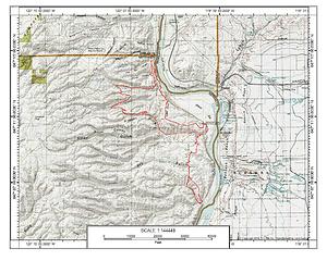
Maps : Naneum East / West Map from WDFW, Caltopo custom
Stats : 45 miles, 7300' gain r/t
Locations visited : Upper and Lower Tarpiscan Creeks, Cape Horn, West Bar, Tekison Creek, Brewton Gulch, Brewton Ridge, Stray Gulch, Dry Gulch, Brushy Creek, Quilomene Creek, Wanapum Lake
Colockum Wildlife Area
Quilomene Wildlife Area
Green Dot Maps
Finally a series of sunny, warm days forecasted by all the weather services so we took a chance and aired it out and what was an overnighter to West bar became a long backpack through West Bar and out to Brushy and Quilomene Creeks, Wanapum Lake and the Columbia River. Steve had been out to West bar and Tekison Creek while this was my first time but wanted to make it out to the mouth of Quilomene Creek after we spent some time on the opposite side of the Columbia River on Babcock Bench a few years back. We left early so we had time and what was a two day trip became a one day trip. We had maps, but that was old information after the wildfires and time most of the roads have been reclaimed by nature, Steve's beta after Tekison Creek was from memory 35 years ago but it's open country so we used the main "Green Dot" roads where we could and otherwise were meandering pretty efficiently through the scablands. It was full sun and hot every day with the hiking cycle being gain a ridge-drop into a drainage and repeat water was plentiful in the main creeks so we were good there. Brushy Creek is very brushy in places and we were worn out at the end of day #1. On day #2 we decided after looking at the maps to take a ridge out of the canyon near the Columbia River instead of going back through Brushy Creek and that worked out well all though the hiking on basalt was hard on the feet, we made it back to Tekison Creek had lunch at the creek then headed West up Brewton Gulch gaining Brewton Ridge and following that West then switchbacked down to a hunters camp along the South Fork of Tarpiscan Creek where we set up camp. We had some passing rain during the night but it was a dry dawn with clear skies. From there on day #3 we followed the road over to the North Fork of Tarpiscan Creek then above it quite a ways stopping for an early lunch with nice views of Cape Horn and the Tarpiscan drainages before closing the loop and arriving at the TH where we met Charlie H. and a friend just getting ready to head out on a backpack. In summary with all that travel we never saw one rattle snake, wildflowers were behind except in the West Bar / Tekison Creek area where it was stunning, we could actually see the I90 bridge and all most decided to thruhike to I90 but never planned for it and didn't know the road conditions or water availability, and it was spectacular and as always an adventure getting out with Steve. I hope they never put a trail in that area. Home now and healing up.  The morning of day #3 my camera read "Battery exhausted" but I did manage to get 8.2 GB of photos and video. I haven't even looked at the video yet. The morning of day #3 my camera read "Battery exhausted" but I did manage to get 8.2 GB of photos and video. I haven't even looked at the video yet.
 Colockum - Quilomene loop 2 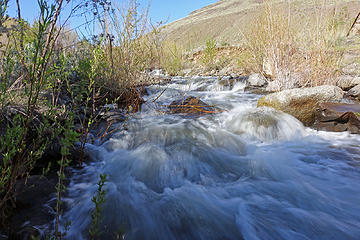 Tarpiscan Creek 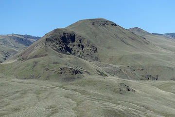 We hiked that entire ridge in years past from Colockum Rd. 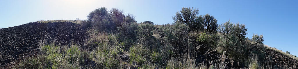 No way around the basalt piles. 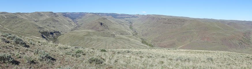 Tarpiscan Creeks. 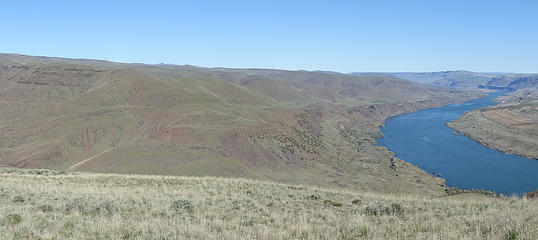 Colockum HQ in the far background. 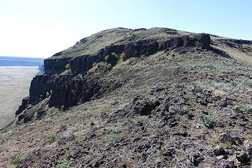 Cape Horn ahead ! 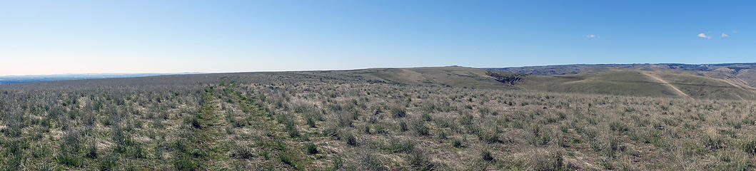 Hiking Cape Horns long South ridge.  West Bar is beyond massive as you slowly descend down different benches to the bottom. 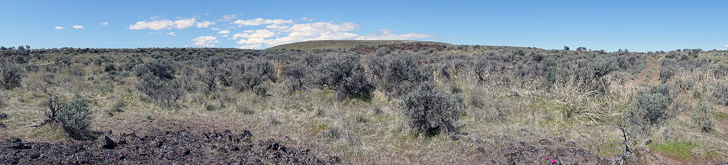 Got miles and miles of desert ? 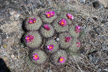 Hedge Hogs were in bloom from Cape Horn to Quilomene Creek.  Winding down an old road through scablands below Cape Horns South ridge. 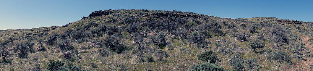 Phlox and rocks.  Dropping down through into West Bar. 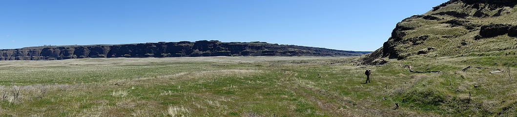 Entering the Northern section of West Bar. 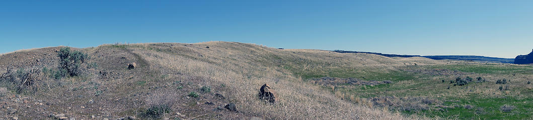 Wavy dunes in West Bar. 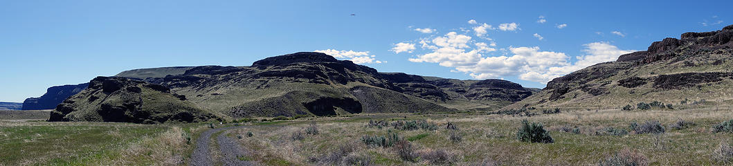 Entering Tekison Creek drainage from West Bar. 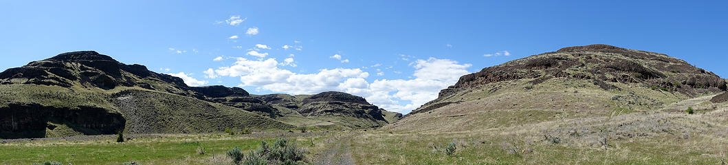 Tekison Creek drainage. 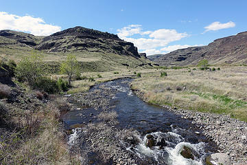 Tekison Creek 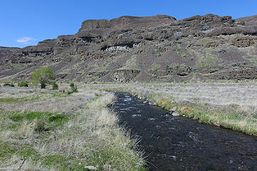 Lunch time at Tekison Creek. 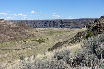 Looking down on Tekison Creek and West Bar. 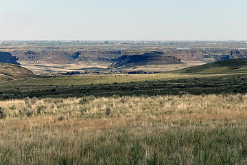 Potholes Coulee across the Columbia River. 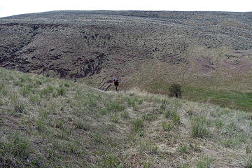 Steve pulling out of Dry Gulch. 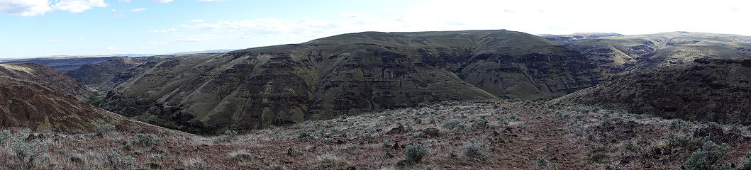 Brushy Creek drainage. 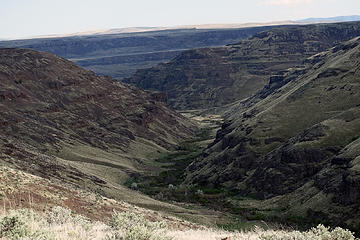 Looking East down Brushy Creek towards the Columbia River. The Gorge Amphitheater is across the river in the distance. 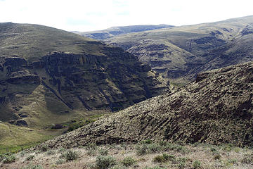 Dropping down into Brushy Creek. 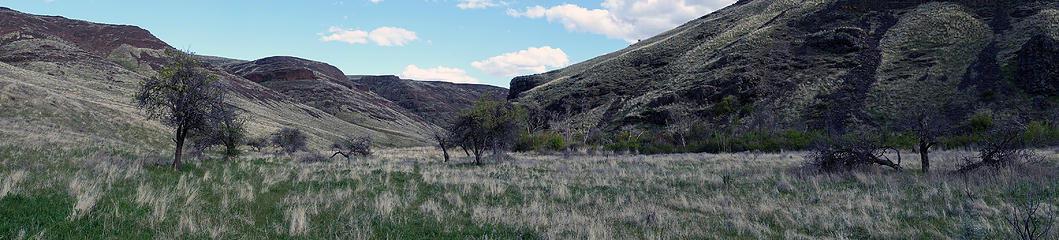 Hiking through a long gone homestead in Brushy Creek. 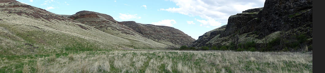 Brushy Creek drainage. 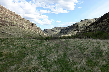 Brushy Creek drainage. 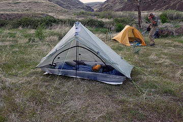 Camp night #1 after a 18.2 mile day. 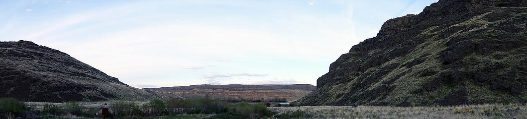 From our campsite where Brushy and Quilomene Creek converge to form Wanapum Lake at the mouth of the Columbia River. 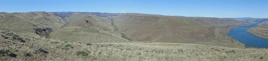 colockumpano 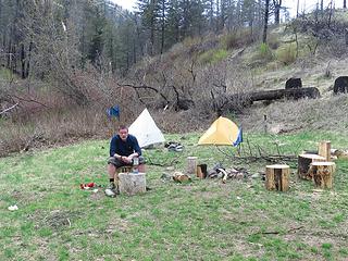 Day #2 camp and 35 miles of breaking in the body for 2018. 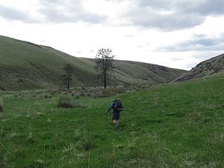 Grinding the final miles out towards Quilomene Creek. 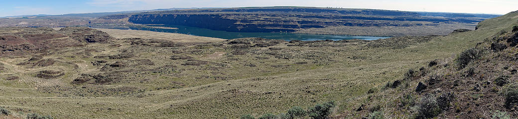 Layers of interesting terrain on West Bar. 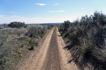 The road goes on forever... 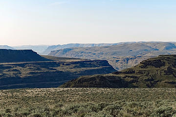 From high on a desert ridge looking back down at the Columbia River gorge. 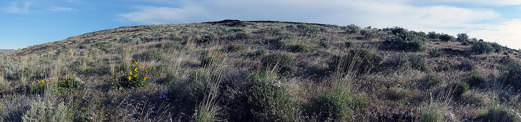 Climbing out of the Columbia gorge / Wanapum Lake area. 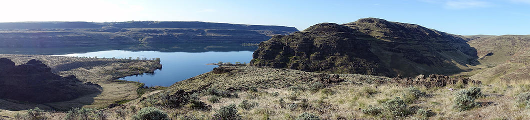 Wanapum Lake - Columbia River at the mouth of Brushy and Quilomene Creeks. 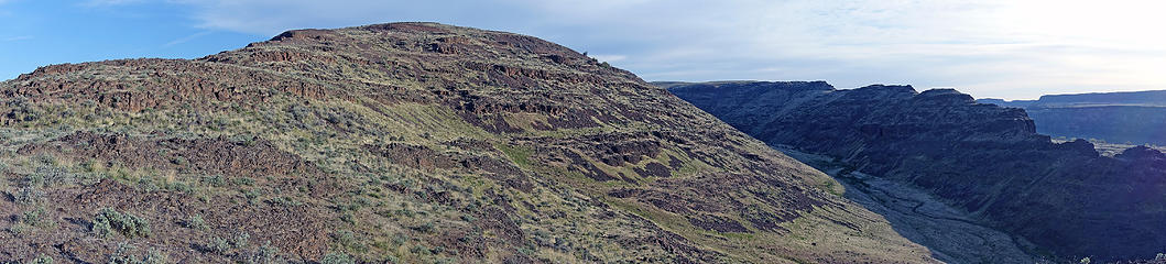 Dry Gulch to the right burned out by the wildfire could be a short cut in from Tekison Creek with an early water supply. 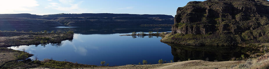 Wanapum Lake. 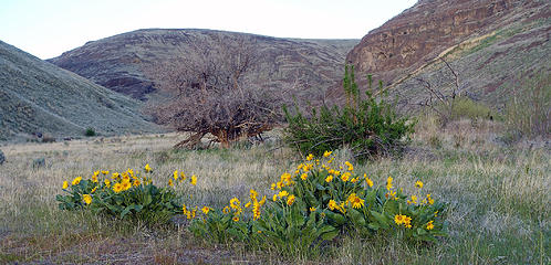 Balsam Root up the Quilomene Creek drainage. 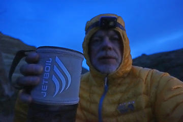 My body hurts but Morning Joe helps ! 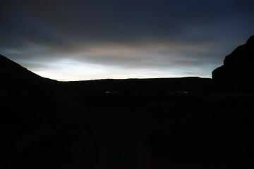 Another year on sunrise watch. 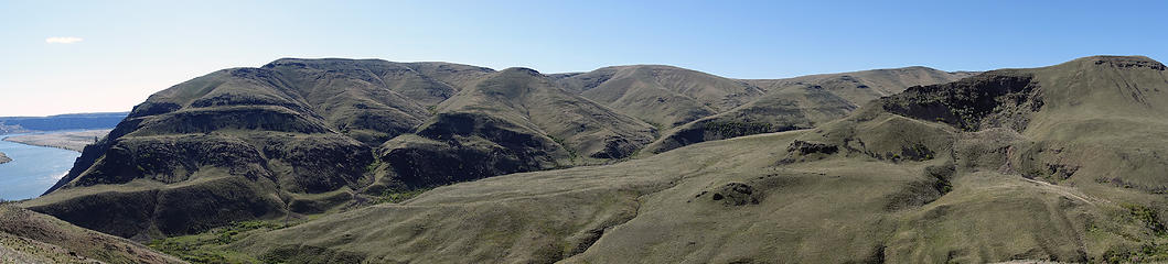 With over 40 miles in over 3 days of sunshine and 70's we sat on a ridge above North Tarpiscan Creek and ate lunch enjoying one last grand view before we turned North and closed the loop.
Living in the Anthropocene
Living in the Anthropocene
|
| Back to top |
  
|
|
RichP
Member

Joined: 13 Jul 2006
Posts: 5634 | TRs | Pics
Location: here |
|
RichP
Member
|
 Sun Apr 22, 2018 7:05 pm |
|
|
That looks like an awesome ramble through that area. 
|
| Back to top |
|
|
Get Out and Go
Member

Joined: 13 Nov 2004
Posts: 2128 | TRs | Pics
Location: Leavenworth |
"These are the places you will find me hiding'...These are the places I will always go."
(Down in the Valley by The Head and The Heart)
"Sometimes you're happy. Sometimes you cry.
Half of me is ocean. Half of me is sky."
(Thanks, Tom Petty)
|
| Back to top |
|
|
puzzlr
Mid Fork Rocks

Joined: 13 Feb 2007
Posts: 7220 | TRs | Pics
Location: Stuck in the middle |
|
puzzlr
Mid Fork Rocks
|
Sun Apr 22, 2018 8:42 pm |
|
|
Very interesting. I followed along on Google Earth using your photos. About a month ago I was looking for east side destinations and this huge undeveloped area caught my attention. I enjoyed your TR and many photos of it. I'm not sure I'll ever spend three days there, but I'd like to get a sample of it somehow.
When doing that I ran across this 2017 map. Do you know of those "Green Dot" roads are actually drive-able? Maybe it's different in the northern part where you were.
|
| Back to top |
|
|
DigitalJanitor
Dirt hippie

Joined: 20 May 2012
Posts: 792 | TRs | Pics
|
Right on. We have friends that do a lot of bikepacking put there.
|
| Back to top |
|
|
wildernessed
viewbagger
Joined: 31 Oct 2004
Posts: 9275 | TRs | Pics
Location: Wenatchee |
| puzzlr wrote: | | Green Dot" roads are actually drive-able? |
The green dot roads may be drivable but their condition is highly variable many are in poor condition even for high clearance 4wd so they get used by ATVs I would call the area wildlife office and get specific information on conditions since the large wildfire. Not seeing any snakes in that area was very uncommon. I have the Naneum East / West Map I bought from the Colockum Wildlife HQ.
Living in the Anthropocene
Living in the Anthropocene
|
| Back to top |
|
|
wildernessed
viewbagger
Joined: 31 Oct 2004
Posts: 9275 | TRs | Pics
Location: Wenatchee |
Living in the Anthropocene
|
| Back to top |
|
|
HitTheTrail
Member

Joined: 30 Oct 2007
Posts: 5455 | TRs | Pics
Location: 509 |
Wow! And here I had been sitting at home feeling sorry for myself for having too many domestic duties to join you guys. But now my feet (and bod in general) are feeling much better about it. Great trip guys!
|
| Back to top |
|
|
wildernessed
viewbagger
Joined: 31 Oct 2004
Posts: 9275 | TRs | Pics
Location: Wenatchee |
| RichP wrote: | | That looks like an awesome ramble through that area. |
I put links to both wildlife area websites as well as Green Dot Maps.
Living in the Anthropocene
Living in the Anthropocene
|
| Back to top |
|
|
wildernessed
viewbagger
Joined: 31 Oct 2004
Posts: 9275 | TRs | Pics
Location: Wenatchee |
The short photo collage version...
Living in the Anthropocene
Living in the Anthropocene
|
| Back to top |
|
|
wildernessed
viewbagger
Joined: 31 Oct 2004
Posts: 9275 | TRs | Pics
Location: Wenatchee |
| puzzlr wrote: | | I'm not sure I'll ever spend three days there, but I'd like to get a sample of it somehow. |
I talked with a person in charge of the South unit there is a new updated map we were looking at coming in that way but the temps are way to hot coming up. To get to Wanapum Lake drive Park Creek Rd. to Quilomene Ridge Rd. also known as Army to Quilomene Creek which has to be forded on foot you can then hike out to the miles long sand bar beside the Columbia River which is treed. There will be snakes by now.
Living in the Anthropocene
Living in the Anthropocene
|
| Back to top |
|
|
Brushbuffalo
Member

Joined: 17 Sep 2015
Posts: 1887 | TRs | Pics
Location: there earlier, here now, somewhere later... Bellingham in between |
Beautiful! You had the flowers that weren't out yet up on Umtanum Ridge last weekend.
Passing rocks and trees like they were standing still
Passing rocks and trees like they were standing still
|
| Back to top |
|
|
|
|


 Hard men, you guys. And no snakes, either.
  I might easily keep up with you....for coffee.


