| Previous :: Next Topic |
| Author |
Message |
RichP
Member


Joined: 13 Jul 2006
Posts: 5634 | TRs | Pics
Location: here |
|
RichP
Member
|
 Wed May 30, 2018 9:19 am |
|
|
Last week we tried to reach this summit from the low end of the ridge off of US 97.
https://www.nwhikers.net/forums/viewtopic.php?t=8027146
Trying a different route proposed by Ragman, we parked on the Old Blewett Pass Highway about 2/3 of a mile south of the former bridge crossing of Etienne Ck.
We walked the crumbling road to the location of the long gone bridge and found a short, steep trail down to a log crossing.
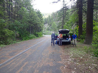 Parking along a section of The Old Blewett Pass Highway about 2/3 of a mile south of Etienne Ck. 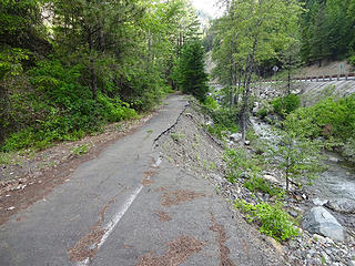 The road soon narrows. 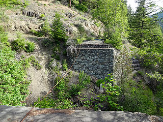 Site of Etienne Ck bridge. 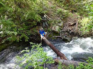 A spry 77 year-old shimmying across Etienne Ck. 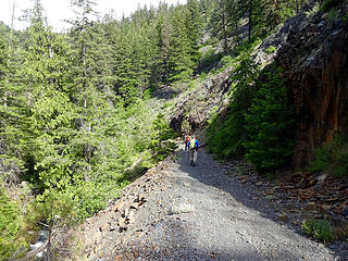 Walking the road up Etienne Ck. 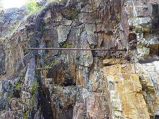 A giant drill bit. 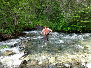 Our only ford of Etienne Ck. 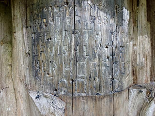 Carving on tree at Ceder Grove Campground site. 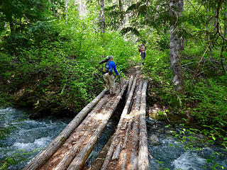 Bridge over Etienne Ck. 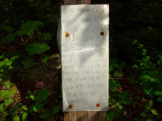 Claim staked in Aug '27. 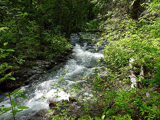 Etienne Ck. 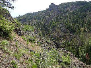 We climbed up a couple hundred feet to bypass a cliff and avoid two creek crossings. 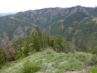 The ridge up to Point 5170. An old road comes up from Etienne Ck below and climbs about 1000.' 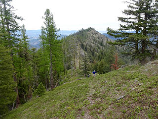 We were surprised to find a trail past Point 5170.  Some nice larch stands on the ridge to Three Brothers, East. 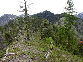 Summit in view right of center. 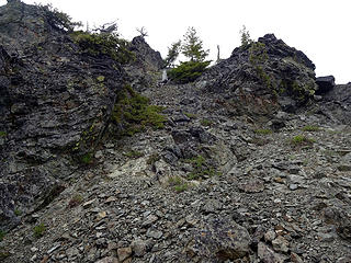 The open gully I chose up. 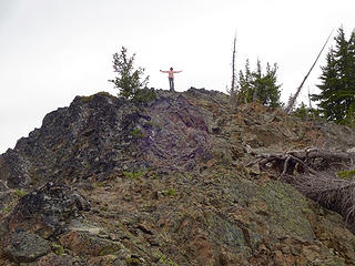 BarbE on Three Brothers, East. 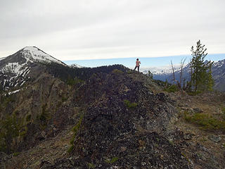 Three Brothers Middle Peak from Three Brothers, East. 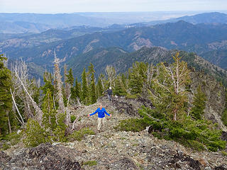 Rodman and Ragman arriving to the summit. 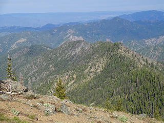 The lower part of the ridge that we hiked up the week before. We were stopped by the rocky section in the center.
|
| Back to top |
  
|
|
ragman and rodman
Member

Joined: 28 Apr 2005
Posts: 1219 | TRs | Pics
Location: http://rgervin.com/ |
Mama's don't let your babies grow up to do the east summit of Three Brothers via Etienne Creek.
A very long day... 14 hours car-to-car... 7.5 hrs to the summit, a 30 minute summit visit and 6 hours back to the car... 14.4 miles roundtrip, gaining 5221 feet of elevation.
This peak has been on my radar since August, 2015 when BarbE and I had stood on top of Point 7169 (the old lookout site) thinking that we had done all three of the brothers... however, Tim Hagan suggested that we had only done the west peak (7303'), a sub-summit (7232' per my GPS) of the west peak and the middle peak (the old lookout site)... pointing out that the USGS map for the area clearly shows the word "Three Brothers" underneath Point 6427... making the old lookout site the middle peak and 6427 the east peak.
I suggested parking at the end of Ingalls Creek Road and then hike FS-7312 to where it ends and becomes a trail that follows along Etienne Creek... however, RichP had done a lot of research on this hike and mentioned that there had been a fairly recent landslide that wiped out a large section of FS-7312 near the gate at the end of Ingalls Creek Road... perhaps making it impassable even for hikers... so RichP suggested that we start from a very subtle parking area that is located 10.8 miles east of Blewett Pass on Hwy 97.
The first 4 miles of the hike stayed near the floor of the valley... including two stream crossings (one by log and the other by foot) and a couple of detours that each took us more than 120 feet above the valley floor to get around trail that had been eroded by Etienne Creek.
The last 3 miles of the hike were cross-country... using an overgrown and abandoned miner's road that got us half-way up to Point 5170... where we hiked west along a ridge that took us to the east summit (6427') of Three Brothers.
Photos, trailhead directions and downloadable GPS track for our visit to the east summit of Three Brothers.
--
|
| Back to top |
|
|
raising3hikers
Member

Joined: 21 Sep 2007
Posts: 2344 | TRs | Pics
Location: Edmonds, Wa |
way to go back and get it 
|
| Back to top |
|
|
BarbE
Member

Joined: 28 Jul 2006
Posts: 1153 | TRs | Pics
|
|
BarbE
Member
|
Wed May 30, 2018 6:57 pm |
|
|
A long, hard and memorable trip. Finally got this one off our radar!
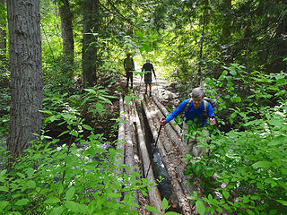 Yeah, a bridge! 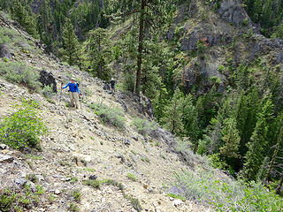 Ridge climb 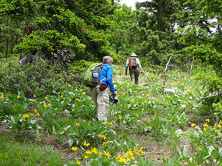 Ridge walk 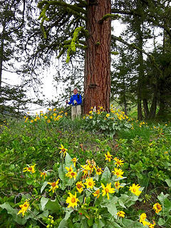 Huge Ponderosa 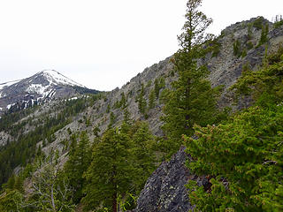 brother #3 in sight on the right 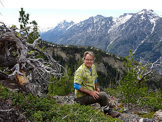 Richard on the summit 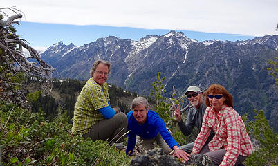 summit selfie 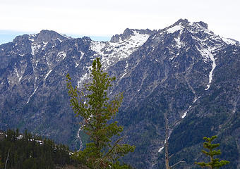 summit views 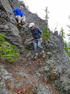 Leaving false summit 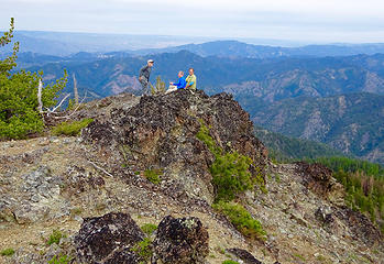 Ragman indicates what he thinks of this hike  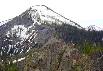 Richard checks out route to Big Brother #2 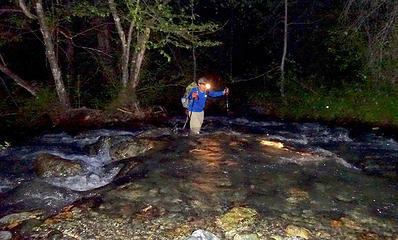 Headlamp creek crossing 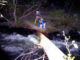 Etienne Creek crossing 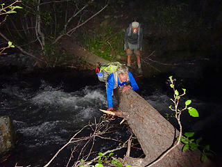 Are we having fun yet?
|
| Back to top |
|
|
Get Out and Go
Member

Joined: 13 Nov 2004
Posts: 2128 | TRs | Pics
Location: Leavenworth |
Great you found a way to make it up there! Looks like a fun group. Whenever I drive past the mouth of the creek, I think about exploring in there a bit. Didn't hear any banjo music, huh?  I've heard that a few people get a bit touchy about their "claims." Most are just friendly hobby miner enthusiasts. I've heard that a few people get a bit touchy about their "claims." Most are just friendly hobby miner enthusiasts.
"These are the places you will find me hiding'...These are the places I will always go."
(Down in the Valley by The Head and The Heart)
"Sometimes you're happy. Sometimes you cry.
Half of me is ocean. Half of me is sky."
(Thanks, Tom Petty)
"These are the places you will find me hiding'...These are the places I will always go."
(Down in the Valley by The Head and The Heart)
"Sometimes you're happy. Sometimes you cry.
Half of me is ocean. Half of me is sky."
(Thanks, Tom Petty)
|
| Back to top |
|
|
puzzlr
Mid Fork Rocks

Joined: 13 Feb 2007
Posts: 7220 | TRs | Pics
Location: Stuck in the middle |
|
puzzlr
Mid Fork Rocks
|
Wed May 30, 2018 8:08 pm |
|
|
Wow, I'm so impressed you tackled this route and even more so that you stuck it out all the way to the summit. That's a good one to check off your list. I might need to get it by camping by Navajo and coming in that way.
I've learned there was a reason I was feeling worn out -- I'm catching a cold. That 14 hours would have done me in!
|
| Back to top |
|
|
RichP
Member
Joined: 13 Jul 2006
Posts: 5634 | TRs | Pics
Location: here |
|
RichP
Member
|
Wed May 30, 2018 8:24 pm |
|
|
| puzzlr wrote: | | That's a good one to check off your list. I might need to get it by camping by Navajo and coming in that way. |
I'll join you. I still have the Middle Peak to tag. I was somewhat disappointed to not be able to go over there on this hike but that would have made it an 18 hour day. 
|
| Back to top |
|
|
wildernessed
viewbagger

Joined: 31 Oct 2004
Posts: 9275 | TRs | Pics
Location: Wenatchee |
Living in the Anthropocene
Living in the Anthropocene
|
| Back to top |
|
|
some names
Member

Joined: 08 Jan 2012
Posts: 244 | TRs | Pics
|
Thank you for the route description and all the information from the other route attempted. The pictures are great too. We are weighing camping at Navaho vs your route. East Brother has been on the list for years.
somesignaturehere and somesignaturethere
somesignaturehere and somesignaturethere
|
| Back to top |
|
|
RichP
Member
Joined: 13 Jul 2006
Posts: 5634 | TRs | Pics
Location: here |
|
RichP
Member
|
Fri Jun 01, 2018 7:15 am |
|
|
| some names wrote: | | We are weighing camping at Navaho vs your route. East Brother has been on the list for years. |
With a camp this is a very interesting route. Walking up that valley feels very remote though there are signs of relatively recent human activity in many places. It is a kind of "Blvd of Broken Dreams" if you like, with collapsed cabins and old equipment that may never move again. The old access road having been taken out by a landslide on the north and lack of a bridge from the south likely means that it will remain pretty quiet up there.
The trail on the ridge top beyond Point 5170 might have been an access for the lookout on the Middle summit. There were a couple of old fire rings up there and we did see some recent trash left behind. The trail eventually disappears into forest down toward the basin just east of the summit, maybe to a hunter's camp or more mining sites? I'd be curious to know.
|
| Back to top |
|
|
ragman and rodman
Member
Joined: 28 Apr 2005
Posts: 1219 | TRs | Pics
Location: http://rgervin.com/ |
Here is a little more beta on accessing the Etienne Creek area.
A couple days ago I did Serpentine Hill. After finishing the hike I drove a little further down Hwy 97 and parked at the end of Ingalls Creek Road... where I crossed the creek to do some recon on the condition of FS-7312 to see if it would give a person access to the Etienne Creek drainage.
While the road has been trashed by two landslides (one of them more than 500 feet wide), a hiker or miner can still easily use the road to reach the Etienne Creek drainage.
The downside to using this route to reach the east summit of Three Brothers is that the round trip would be 17 miles and 6000 feet of elevation gain as opposed to the 14.4 miles and 5200 feet of elevation gain that we did on May 29... and that would be a hard pill to swallow just to avoid a log crossing of Etienne Creek.
Photos, trailhead directions and downloadable GPS track for my recon mission on Forest Service Road 7312.
..
|
| Back to top |
|
|
RichP
Member
Joined: 13 Jul 2006
Posts: 5634 | TRs | Pics
Location: here |
|
RichP
Member
|
Sat Jun 09, 2018 8:39 am |
|
|
Very interesting, Ragman. Thanks for checking that out. The slide doesn't look nearly as bad as it does while driving by from the highway.
|
| Back to top |
|
|
puzzlr
Mid Fork Rocks
Joined: 13 Feb 2007
Posts: 7220 | TRs | Pics
Location: Stuck in the middle |
|
puzzlr
Mid Fork Rocks
|
Sat Jun 09, 2018 7:07 pm |
|
|
Thanks for the clear photos and explanation. It's good to see it from the ground instead of via Google Earth
|
| Back to top |
|
|
|
|


