| Previous :: Next Topic |
| Author |
Message |
mbravenboer
Member


Joined: 20 Oct 2013
Posts: 1422 | TRs | Pics
Location: Seattle |
Not being a fan of overly popular areas with permit complications, I had never been to the Enchantments. But even hikers who have seen everything in the Cascades say it's really pretty, so with a cloudy forecast for the west-side and clear on the east-side I decided to finally day hike it. Not wanting to be judged by Harvey Manning, I did the Snow Lakes approach in & out.
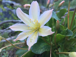 Tweedy's Lewisia - There are a few beautiful spots with Lewisia along the trail 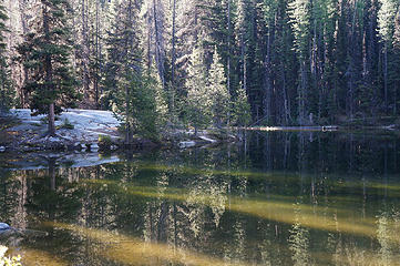 Nada Lake 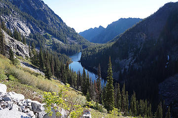 Nada Lake from the climb to Snow Lakes 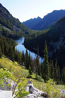 Nada Lake 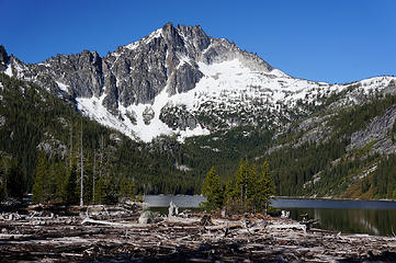 Log jam at Upper Snow Lake with McClellan in the background 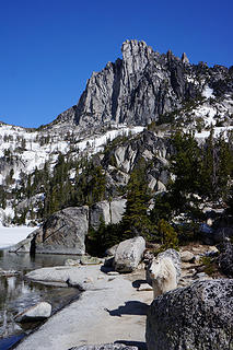 Mountain Goat at Lake Viviane with Prusik Peak in the background 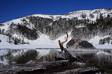 Lake Viviane 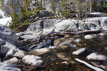 Outlet of Lake Viviane 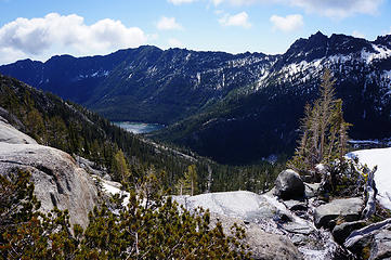 Looking back at Upper Snow Lake 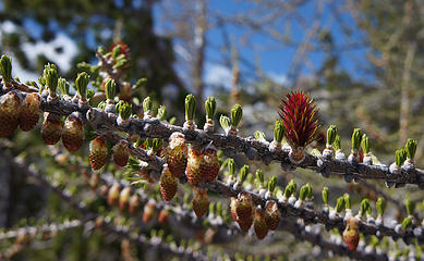 Larch needles starting a new season 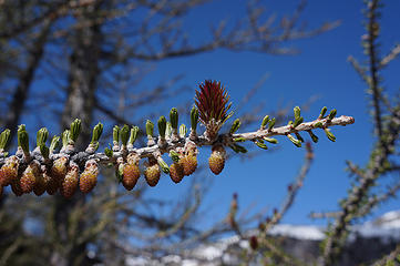 Larch needles starting a new season 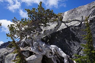 This tree at Lake Viviane has seen a lot 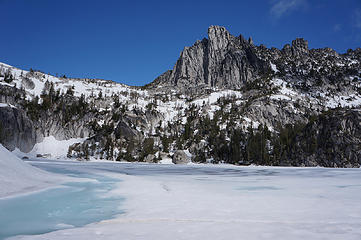 Lake Viviane starting to meld 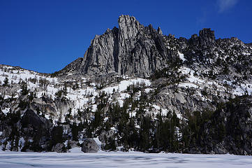 Prusik Peak 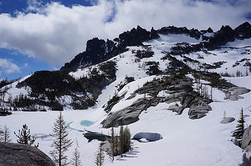 Leprechaun Lake 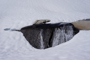 Water slowly breaking through the snowpack 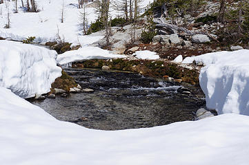 Creek in the Enchantment Bain 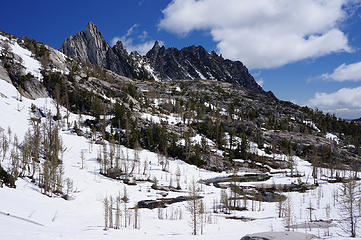 Tarns, Prusik and The Temple 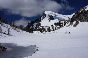 Little Annapurna rising about 1500ft above Perfection Lake 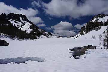 Perfection Lake 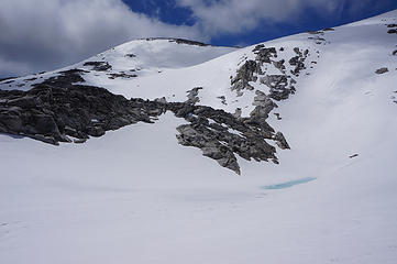 Little Annapurna 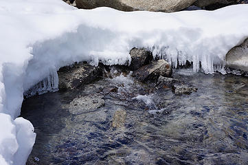 It had been fairly cold the last night, with some fresh snow and icicles forming 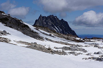 Prusik Peak and the Temple for Enchantment Basin 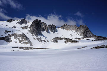 Dragontail Peak from Isolation Lake 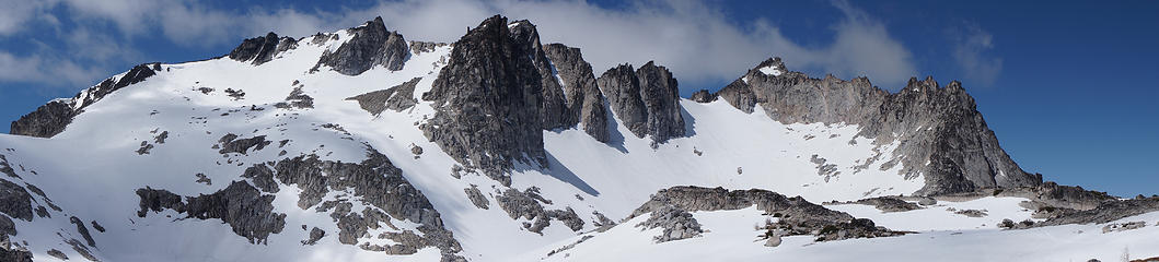 Witches Tower and Dragontail Peak 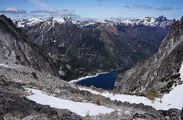 Lake Colchuck from the top of the Aasgard Pass with Cashmere to the right 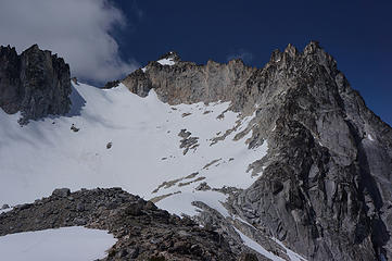 Dragontail Peak from the top of the Aasgard Pass 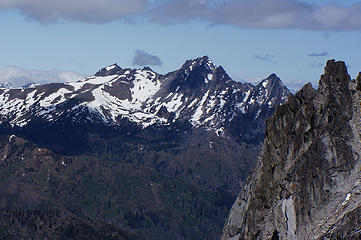 Cashmere from Aasgard 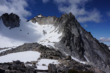 Dragontail Peak from the top of the Aasgard Pass 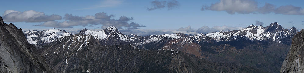 NW panorama from top of Aasgard Pass 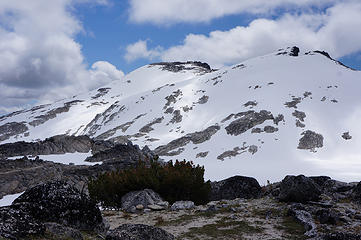 Little Annapurna and West Annapurna from top of Aasgard 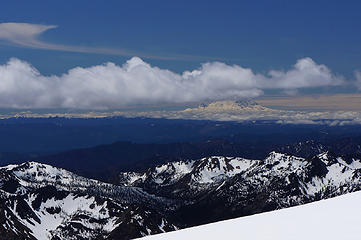 Mt Rainier from the gap between Little and West Annapurna (Teanaway in the foreground) 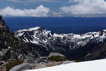 Mt Adams (Earl in the foreground) 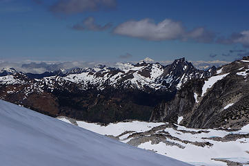 Glacier Peak from Little Annapurna 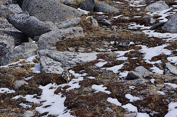 How many Ptarmigans can you find? 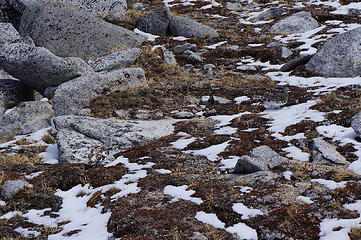 How many Ptarmigans can you find? 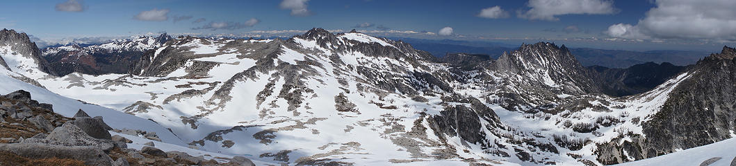 Enchantment Basin panorama from Little Annapurna 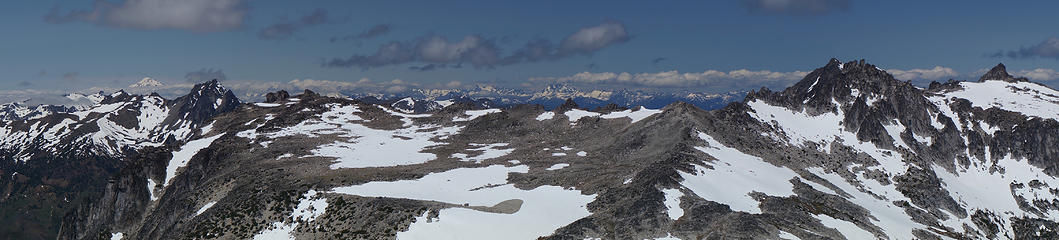 Little Annapurna panorama from Glacier Peak to Cannon. Bonanza in the distance. 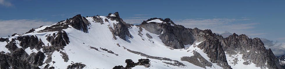 Dragontail ridge 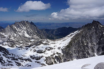 From Little Annapurna, looking down to Upper Snow Lake between The Temple (left) and McClellan (right) 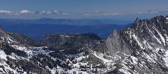 Edward Mesa from Little Annapurna, looking over Prusik Pass 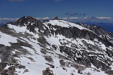 Enchantment Peaks and Cannon 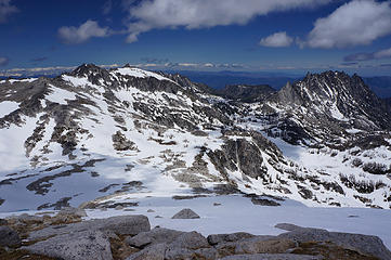 From Little Annapurna: Enchantment Peaks, Cannon, Edward Mesa, Prusik Peak, The Temple 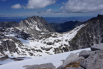 From Little Annapurna, looking down to Upper Snow Lake between The Temple (left) and McClellan (right) 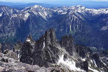 Nightmare Needles from Little Annapurna 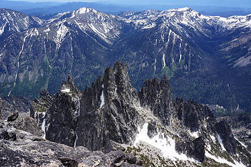 Nightmare Needles from Little Annapurna 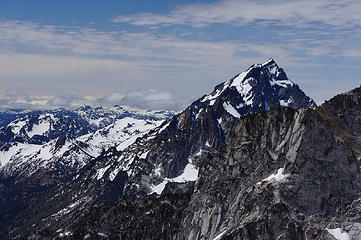 Mt Stuart from Little Annapurna 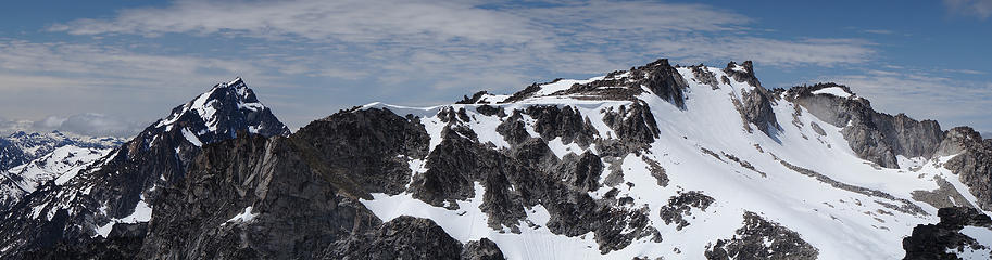 From Little Annapurna: Mt Stuart and the ridge to Dragontail Peak 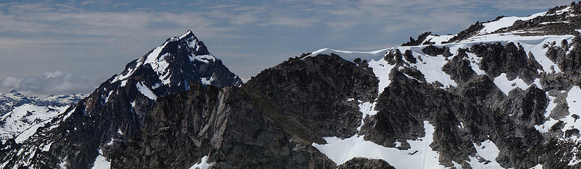 Mt Stuart from Little Annapurna 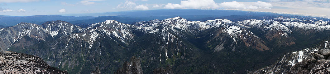 Teanaway pano from Little Annapurna 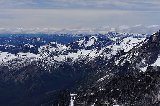 HiBox/Chikamin area over Hawkins 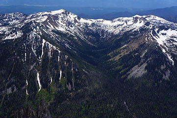 Earl, Bean and the Hardscrabble Creek drainage 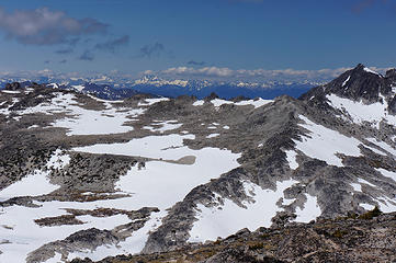 Bonanza peak in the far distance from Little Annapurna 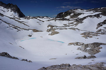 Unnamed lake north of Little Annapurna 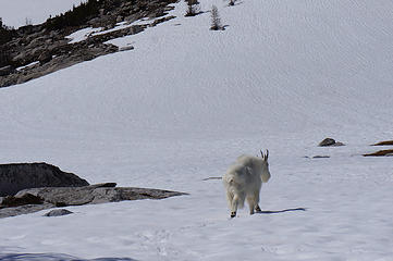 Mountain Goat  Enchantment Basin panorama 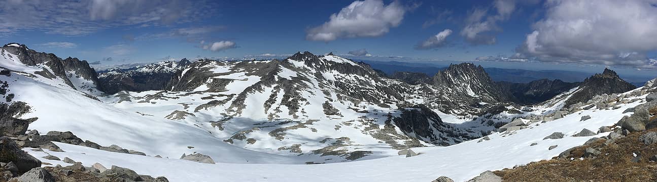 Enchantment Basin panorama from Little Annapurna 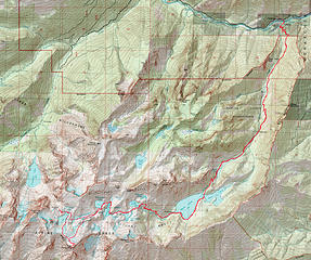 Snow Lakes, Enchantment Basin, Little Annapurna GPS track (24 miles, 7800ft gain)
|
| Back to top |
  
|
|
General ****
Member
Joined: 26 May 2014
Posts: 167 | TRs | Pics
Location: Clark County, SW WA |
Really appreciate your trip report, and your photos are spectacular!
The General primarily backpacks solo.
The General primarily backpacks solo.
|
| Back to top |
|
|
puzzlr
Mid Fork Rocks

Joined: 13 Feb 2007
Posts: 7220 | TRs | Pics
Location: Stuck in the middle |
|
puzzlr
Mid Fork Rocks
|
 Sat Jun 02, 2018 5:47 pm |
|
|
You sure got a clear day. I enjoyed the Teanaway pano.
|
| Back to top |
|
|
Brushbuffalo
Member

Joined: 17 Sep 2015
Posts: 1887 | TRs | Pics
Location: there earlier, here now, somewhere later... Bellingham in between |
Nice detail, as you are inclined to always give. Your report will be useful for folks who haven't been up there. For those of us who have been there, it is fun to vicariously experience it again without the sweat.
| mbravenboer wrote: | | It's not suitable for small kids, if anybody can drag them this far into the mountains. |
Your little hiker will do it in just a few more years, I betcha! 
Mt Rainier from the gap between Little and West Annapurna (Teanaway in the foreground)
Passing rocks and trees like they were standing still
Passing rocks and trees like they were standing still
|
| Back to top |
|
|
wildernessed
viewbagger

Joined: 31 Oct 2004
Posts: 9275 | TRs | Pics
Location: Wenatchee |

Living in the Anthropocene
Living in the Anthropocene
|
| Back to top |
|
|
olderthanIusedtobe
Member
Joined: 05 Sep 2011
Posts: 7708 | TRs | Pics
Location: Shoreline |
I saw 2 ptarmigan in each picture, am I missing some?
|
| Back to top |
|
|
olderthanIusedtobe
Member
Joined: 05 Sep 2011
Posts: 7708 | TRs | Pics
Location: Shoreline |
| mbravenboer wrote: | Earl, Bean and the Hardscrabble Creek drainage |
On Monday I climbed Earl from Bean Creek trail, then followed the ridge to the base of Bean Pk (didn't climb it though). It's shocking how melted out everything south facing is compared to the north slope in your pic here.
|
| Back to top |
|
|
christensent
Member

Joined: 05 Nov 2011
Posts: 658 | TRs | Pics
|
| mbravenboer wrote: | | Between Nada lake and Snow Lakes there are some boulder fields to cross where to trail is covered by presumably new boulders. |
That was like that last summer too, but has not always been that way. I think there was a massive rock fall event in either 2016 or 2017.
Learning mountaineering: 10% technical knowledge, 90% learning how to eat
Learning mountaineering: 10% technical knowledge, 90% learning how to eat
|
| Back to top |
|
|
RichP
Member

Joined: 13 Jul 2006
Posts: 5633 | TRs | Pics
Location: here |
|
RichP
Member
|
Sat Jun 02, 2018 9:07 pm |
|
|
Most people do this from the higher approach. That's a heck of a day all the way up from the lower end and then walk out that way too.
|
| Back to top |
|
|
mbravenboer
Member
Joined: 20 Oct 2013
Posts: 1422 | TRs | Pics
Location: Seattle |
Thanks all for the nice comments!
| Brushbuffalo wrote: | | Your little hiker will do it in just a few more years, I betcha! |
I do hope so . Now I have a little hiker I find myself making notes on the exposure and general obstacles for kids all the time. It's not super well documented in guide books, probably the general assumption is that kids don't get very far anyway (kid-friendly often simply means short).
| RichP wrote: | | Most people do this from the higher approach. |
Yeah, that's what the Manning reference was about  . One of the paragraphs from the book (and the less offensive paragraph!) . One of the paragraphs from the book (and the less offensive paragraph!)
| Manning wrote: | | A wilderness-mature adult ascends ritually and respectfully from the picturesque lower basin to the austere upper basin and at last to the cold snows and stern stones of Aasgard. To start with the ice cream and work through the meatballs and potatoes to the soup is not esthetic. Coming to the Enchantments by way of Aasgard is in very bad taste. |
I wouldn't put it like that, but the 'ritually' and 'respectfully' was definitely a little bit my motivation for going via Snow Lakes. Just reading about all the Aasgard madness doesn't make me want to go there. Having done the Snow Lakes approach now though, I'm not sure if I would do it again if I would be aiming for peaks on the west-side (I'd like to do Cannon one day). For visiting the basin, I think it's quite nice.
| olderthanIusedtobe wrote: | | It's shocking how melted out everything south facing is compared to the north slope in your pic here. |
Yeah, I was thinking the same thing judging from Teanaway reports!
| olderthanIusedtobe wrote: | | I saw 2 ptarmigan in each picture, am I missing some? |
Not that I'm aware off . I guess it was a little too easy, at least knowing there are Ptarmigans in it.
| christensent wrote: | | That was like that last summer too, but has not always been that way. I think there was a massive rock fall event in either 2016 or 2017. |
Ah thanks!
|
| Back to top |
|
|
Brushbuffalo
Member
Joined: 17 Sep 2015
Posts: 1887 | TRs | Pics
Location: there earlier, here now, somewhere later... Bellingham in between |
| mbravenboer wrote: | | RichP wrote: | | Most people do this from the higher approach. |
Yeah, that's what the Manning reference was about . One of the paragraphs from the book (and the less offensive paragraph!)
| Manning wrote: | | A wilderness-mature adult ascends ritually and respectfully from the picturesque lower basin to the austere upper basin and at last to the cold snows and stern stones of Aasgard. To start with the ice cream and work through the meatballs and potatoes to the soup is not esthetic. Coming to the Enchantments by way of Aasgard is in very bad taste. |
|
Harvey would really have ratcheted up his disdain for us "wilderness-immature" trail runners. 
Passing rocks and trees like they were standing still
Passing rocks and trees like they were standing still
|
| Back to top |
|
|
silence
Member

Joined: 25 Apr 2005
Posts: 4420 | TRs | Pics
|
|
silence
Member
|
Sun Jun 03, 2018 6:55 am |
|
|
PHOTOS
FILMS
Keep a good head and always carry a light bulb. Bob Dylan
|
| Back to top |
|
|
neek
Member

Joined: 12 Sep 2011
Posts: 2337 | TRs | Pics
Location: Seattle, WA |
|
neek
Member
|
Sun Jun 03, 2018 11:48 am |
|
|
I like the larch needle shots. In 3 short months they'll be starting to turn...
That Manning quote is hilarious. For those doing the loop, the right answer to which way is "both", since each offers a unique experience.
|
| Back to top |
|
|
Midnight Slogger
'Schwack Job

Joined: 04 Aug 2017
Posts: 96 | TRs | Pics
Location: Greater Cascadia |
Spectacular report, many thanks!
|
| Back to top |
|
|
Timbertoes
Member
Joined: 31 Jul 2003
Posts: 5 | TRs | Pics
Location: Shoreline, WA |
My father took me and two older siblings into the upper Enchantments in 1963 when I was 7 years old. Twenty years ago I repeated that trip with my own 7 year old son. All it took was patience and trail mix. Lots of trail mix.
|
| Back to top |
|
|
|
|
You cannot post new topics in this forum
You cannot reply to topics in this forum
You cannot edit your posts in this forum
You cannot delete your posts in this forum
You cannot vote in polls in this forum
|
Disclosure: As an Amazon Associate NWHikers.net earns from qualifying purchases when you use our link(s). |


