| Previous :: Next Topic |
| Author |
Message |
rubywrangler
Member


Joined: 04 Aug 2015
Posts: 511 | TRs | Pics
|
A few folks TR'd on a similar loop last year and Martin posted a recent report on conditions, so this will mainly be a photo dump. I lucked out and happened to be perusing recreation.gov soon after somebody cancelled their core permit reservation a couple weeks ago, so I snatched it up and recruited Julia to come along. She had never been to the enchantments at all and I had only been to the core once before, years ago, and on that trip I ended up in a whiteout and didn't see much. The plan was:
- hike in Thursday night and camp at Colchuck Lake
- spend the next 2 nights in the core and climb some stuff
- go back down Aasgard on Sunday; Julia would head home and I would camp at the lake and climb Colchuck peak Monday morning.
The first 2 days went according to plan. We hiked up Dragontail and Little A on Friday. On Saturday we meandered a bit too long on Enchantment peak (NE) and lost momentum for Cannon, so we did a little core tour instead and then hung out at camp with two goats that adopted us for the weekend. We decided to hike over to Cannon on Sunday morning and then take the NE/N ridge route back to the trailhead. I had cell service from the tops of all the peaks and was able to download some info. Unfortunately none of the reports I looked at emphasized the unpleasantness of this route. Hiking through the Rat Creek burn SUCKED. An obstacle course of downed logs and a jungle of new growth, with just enough rain to make everything slick. I lost count of the number of times I fell, but it was enough that I spent the past 2 days sitting on an ice pack!
Aside from the last 4 miserable hours, it was an awesome weekend! We only saw a handful of people on Friday, maybe 20 on Saturday (mostly in the distance) and zero on Sunday. Although we were prepared to camp on snow, there were plenty of melted out spots so we didn't need to. The only other campers we saw were clustered around the outlet of Lake Viviane so it felt like we had the whole place to ourselves, which I imagine is pretty rare on a weekend in permit season!
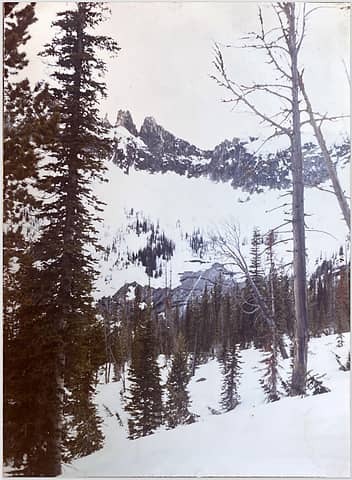
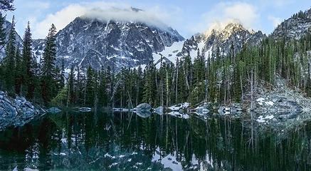 morning at colchuck 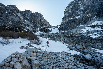 bottom of aasgard 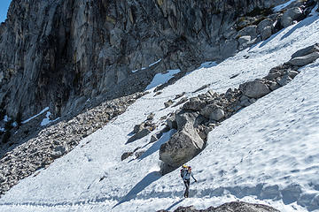 top of aasgard 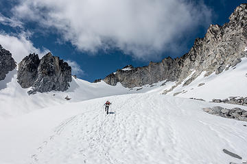 kicking steps up to dragontail 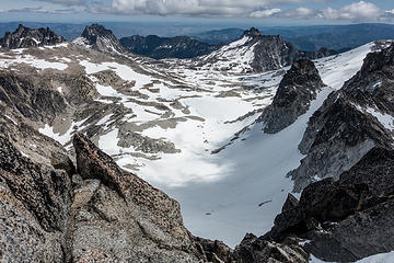 core from dragontail 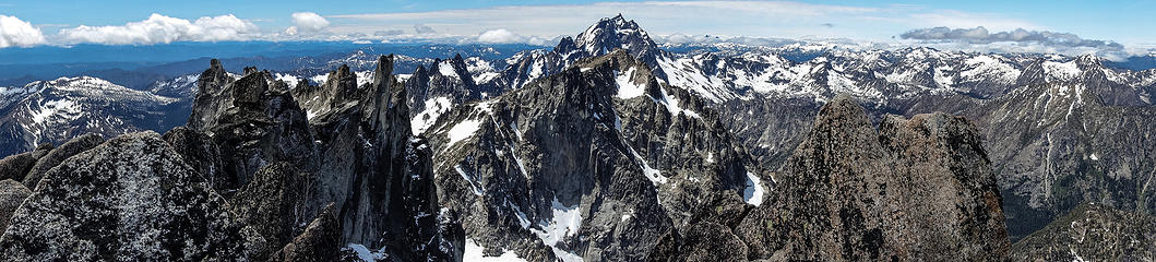 dragontail summit pano 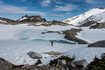 heading into the core 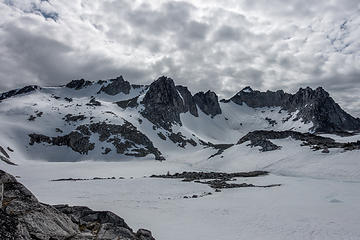 clouds over witches tower + dragontail 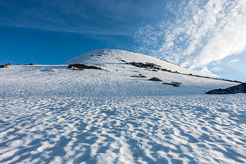 going up little annapurna for sunset 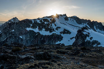 sun setting 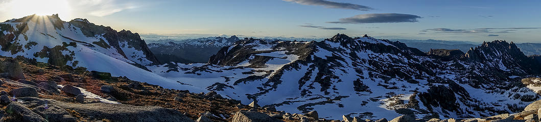 sunset pano 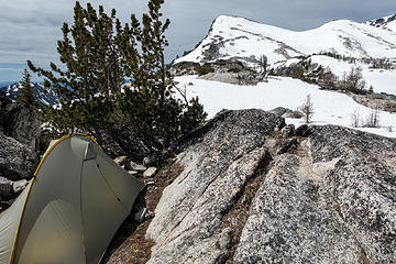 morning camp views 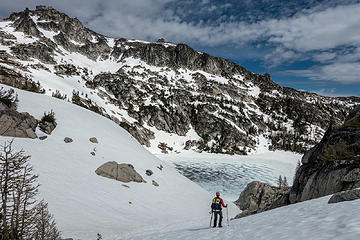 talisman/isolation lake + enchantment peak 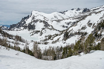 looking back from prusik pass, camp is somewhere on the rocks in the center 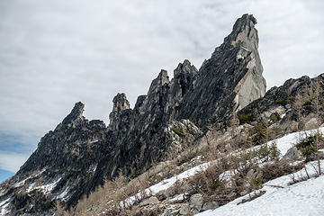 prusik 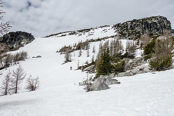 up to enchantment peak 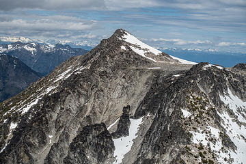 cannon and druid plateau 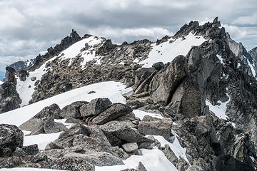 SW enchantment from NE 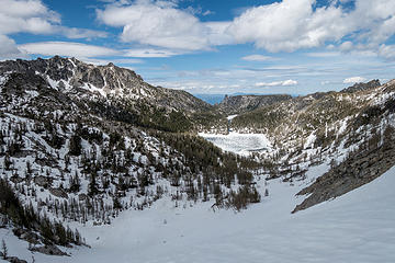 back at prusik pass, lost world plateau + shield lake 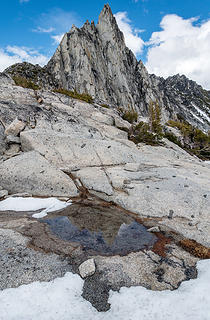 prusik + puddle 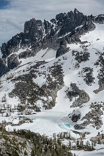 mcclellan + sprite  we followed the rocky ridge down to perfection/rune 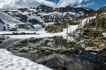 perfection/rune lake 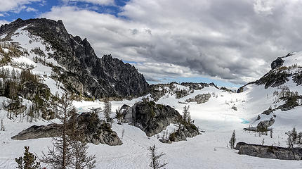 next stop crystal lake 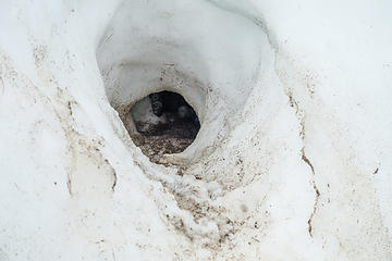 where i noticed this den, due to it's terrible smell 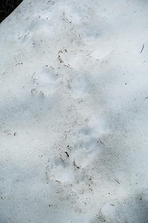 and these prints. who made them? 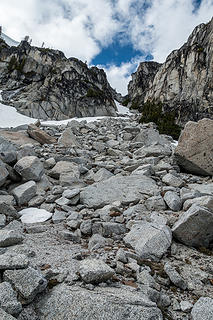 we climbed this gully back to camp 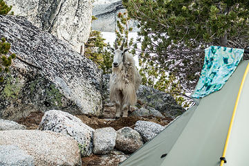 where we had visitors 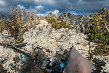 our visitors did a lot of posing 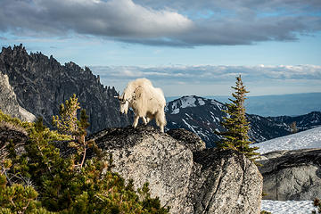 posers cont'd 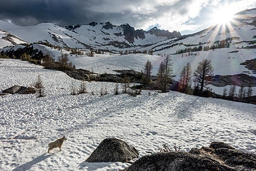 and more posing 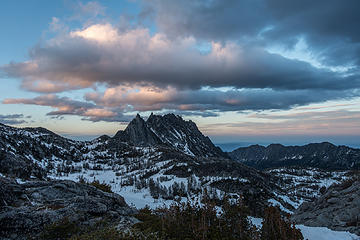 sunset clouds, a little LOTRish 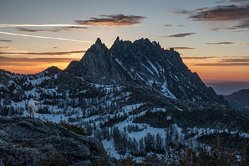 sunrise 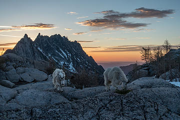 posers chasing me back to camp 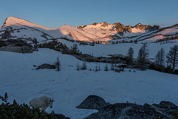 sunrise on little a + dragontail 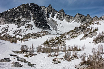 NE face of NE enchantment peak 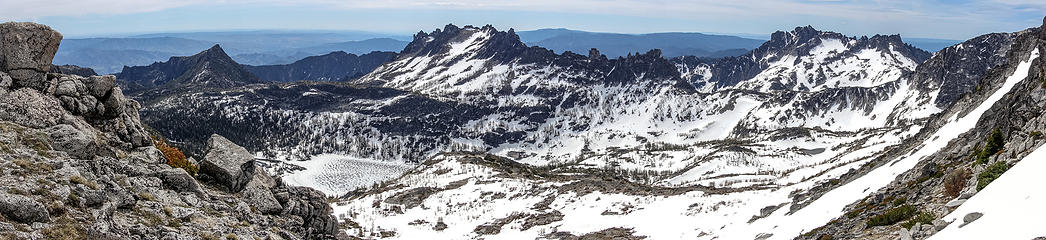 lost world pano 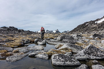 boulder-hopping to the edge of the druid plateau. we were surprised to see a large bear up here. 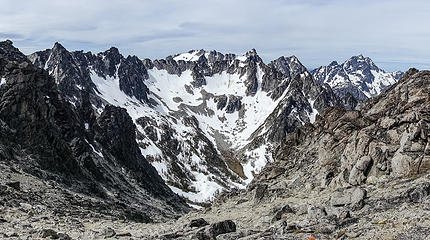 view from the edge 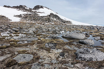 heading back to cannon 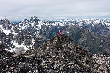 julia found a seat just west of cannon summit 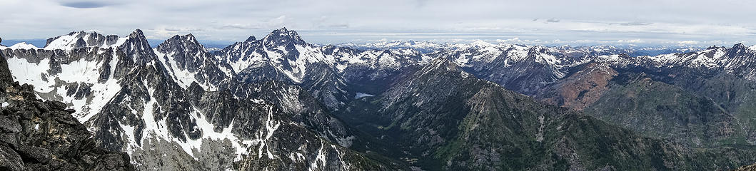 cannon pano 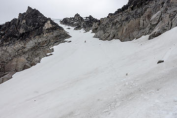 julia working her way down from cannon 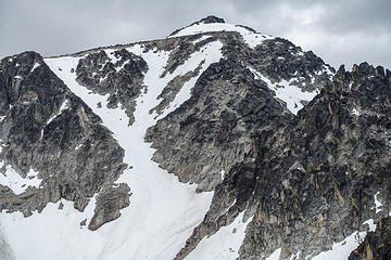 we came down the steep gully in the center 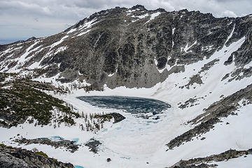 coney lake  things you notice when looking at your feet to try to stay upright in a burn 
|
| Back to top |
  
|
|
silence
Member

Joined: 25 Apr 2005
Posts: 4420 | TRs | Pics
|
|
silence
Member
|
 Thu Jun 07, 2018 6:31 am |
|
|
PHOTOS
FILMS
Keep a good head and always carry a light bulb. Bob Dylan
|
| Back to top |
|
|
geyer
Member

Joined: 23 May 2017
Posts: 463 | TRs | Pics
Location: Seattle |
|
geyer
Member
|
Thu Jun 07, 2018 7:53 am |
|
|
|
| Back to top |
|
|
fffej50
Member

Joined: 13 Oct 2007
Posts: 65 | TRs | Pics
Location: poulsbo |
|
fffej50
Member
|
Thu Jun 07, 2018 9:08 am |
|
|
having gone into the enchantments via Hook creek and exited via Rat creek I can empathize with the misery....I remember tripping and somersaulting several times in the dark while descending what we thought was going to be a clever shortcut.
|
| Back to top |
|
|
Bootpathguy
Member
Joined: 18 Jun 2015
Posts: 1791 | TRs | Pics
Location: United States |
| rubywrangler wrote: | where i noticed this den, due to it's terrible smell and these prints. who made them? |
Marmot
I scanned through your additional Flickr photos. No image of the bear?
The Rat Creek burn. It's no joke! I've been up and down that in a day hike. Down is two times as miserable as up.
Thanks for sharing.
Experience is what'cha get, when you get what'cha don't want
Experience is what'cha get, when you get what'cha don't want
|
| Back to top |
|
|
rubywrangler
Member
Joined: 04 Aug 2015
Posts: 511 | TRs | Pics
|
| Bootpathguy wrote: | | No image of the bear? |
No, I didn't even try - my camera has a terrible zoom. We noticed it on the NE corner of the druid plateau as we were descending Cannon. It noticed us too and immediately took off running to the SE. We also saw some large bear tracks on the ridge, before we hit the burn.
Thanks for id-ing the tracks!
|
| Back to top |
|
|
DadFly
Member
Joined: 02 Jul 2012
Posts: 402 | TRs | Pics
Location: Redmond |
|
DadFly
Member
|
Fri Jun 08, 2018 9:40 pm |
|
|
I figured out the "right way" to go up and down Rat Creek. Still not easy but very little blow down. I can't find a pic of Rat Creek or I would draw the route on a photo.
"May you live in interesting times"
"May you live in interesting times"
|
| Back to top |
|
|
mbravenboer
Member
Joined: 20 Oct 2013
Posts: 1422 | TRs | Pics
Location: Seattle |
I very much enjoyed your photos. Great trip!
Thanks for the warning on the Cannon approach  . Hope to visit that area some time, so that's good to know. . Hope to visit that area some time, so that's good to know.
|
| Back to top |
|
|
Jake Robinson
Member
Joined: 02 Aug 2016
Posts: 521 | TRs | Pics
|
This is the approximate route we took last year through the Rat Creek burn, from the TH to the ridge above Coney Lake. Just hike the old road to the big washout then head more or less directly uphill. I don't remember any particularly bad brush or blowdown, it's just steep. Having said that, we only went up that way and I'm sure it would be much worse going down.
|
| Back to top |
|
|
|
|


