| Previous :: Next Topic |
| Author |
Message |
RichP
Member


Joined: 13 Jul 2006
Posts: 5634 | TRs | Pics
Location: here |
|
RichP
Member
|
 Sat Jun 23, 2018 10:27 pm |
|
|
I celebrated the start of summer with a hike in the William O Douglas Wilderness Area to Bismarck Peak (spelled Bismark on WTA). Looking at Peakbagger I could see a couple of other summits in the area so I added them as bonus peaks.
Starting on the Pear Butte trail I walked about 5 miles to where I thought the junction with the Bismarck Peak Trail was. This trail may or may not appear on your map, but it's really there. It starts several hundred yards south of where Green Trails shows a short spur with dotted lines.
At any rate, I dropped my pack and made the quick hike over to Pear Butte. I left the trail at the 5800' saddle on the north side of the peak where it begins to drop and ascended the somewhat brushy slope easily to the summit.
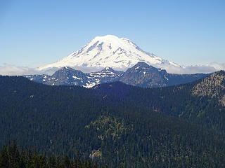 Crowd pleaser shot of Rainier. 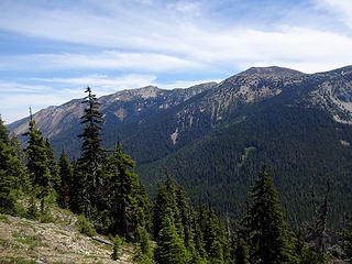 Nelson Ridge from Pear Butte Trail. 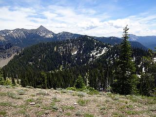 Bismarck Peak in the distance. 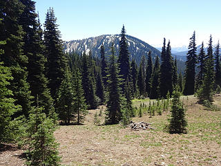 Pear Butte ahead. 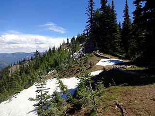 Approaching Pear Butte summit. 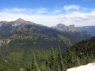 Bismarck and Rattlesnake Peaks. 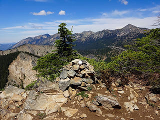 Pear Butte summit.  Pear Lake. 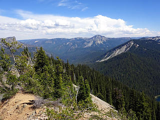 View southeast. 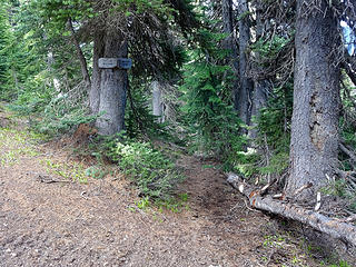 The Bismarck Peak Trail branches off of the Pear Butte Trail. I spent some time sprucing up this intersection since I walked right past it without seeing it. 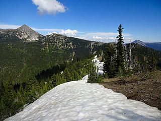 On the Bismarck Peak Trail. Snow still covers the trail where it crosses to the north side of the ridge. 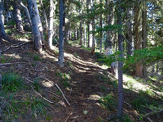 Still in good shape and easy to follow. 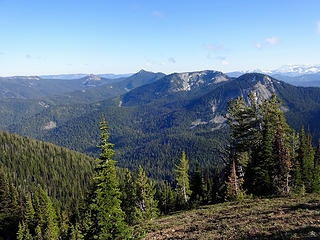 View south. 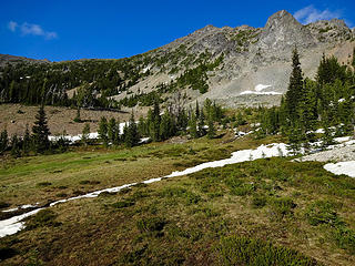 In the basin below the southwest side of Bismarck Peak. 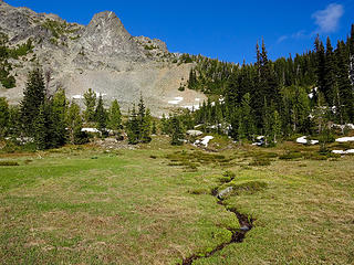 The summit route starts at the forested saddle between Bismarck and Point 6818. 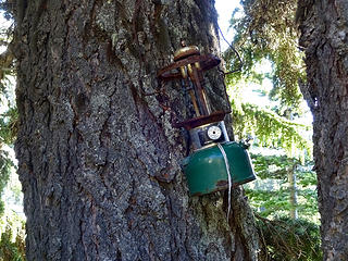 A green lantern at camp. 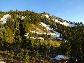 Basin and Point 6816 at the end of the longest day of the year. 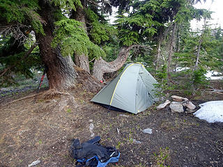 The green lantern camp in the morning. 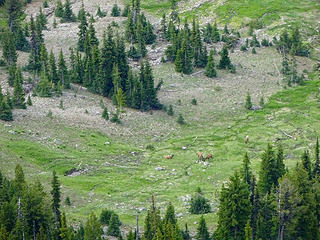 Elk grazing below. 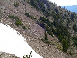 Goats on the route up. 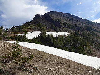 Upward. 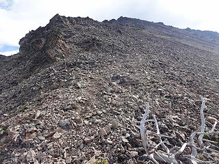 Steep and loose. 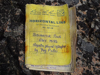 Wet and full with no pencil. 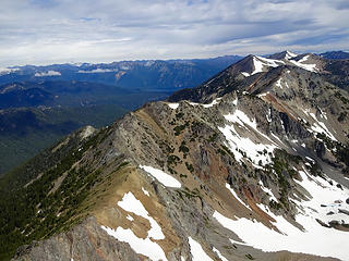 Nelson Ridge north. 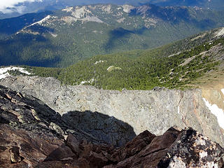 The steep part before the summit for those contemplating the Aix to Bismarck traverse. 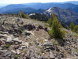 Bivy site on the summit and Rattlesnake Peaks below. 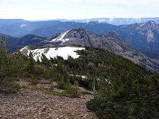 Heading down to Rattlesnake Peaks. 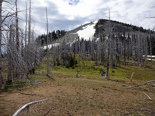 A 570' foot climb to the top. 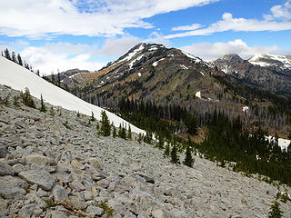 Bismarck while ascending Rattlesnake Peaks. 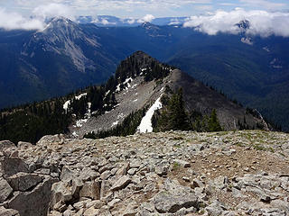 South Peak below. 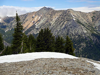 Mt Aix. 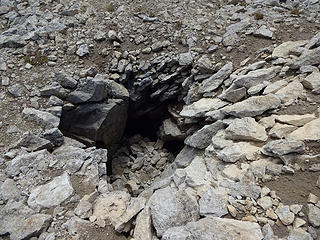 There are several of these curious holes on the summit. 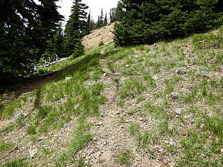 I followed what looked like a trail from the 6200' saddle between Bismarck and Rattlesnake Peaks. I had to climb back up to the ridge to Bismarck when I lost it. 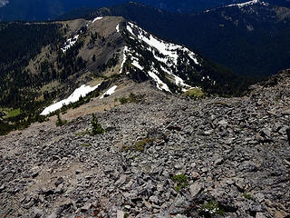 Looking down the route on Bismarck from near the summit. Point 6816 below. 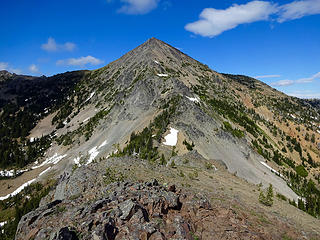 Bismarck from Point 6816 on the way out.
|
| Back to top |
  
|
|
ozzy
The hard way

Joined: 30 Jul 2015
Posts: 476 | TRs | Pics
Location: University place, wa |
|
ozzy
The hard way
|
Sat Jun 23, 2018 11:53 pm |
|
|
 Sweet ass trip man! Love that area, did Bismarck a few years back. That basin below Bismarck is so cool! I also saw the biggest lion tracks I've ever seen up there too, rather fresh ones! Sweet ass trip man! Love that area, did Bismarck a few years back. That basin below Bismarck is so cool! I also saw the biggest lion tracks I've ever seen up there too, rather fresh ones!  Thanks for the memories. Thanks for the memories.
I dont know whats gonna happen, but I wanna have my kicks before the whole shithouse goes up in flames-Mr Mojo Risin
I dont know whats gonna happen, but I wanna have my kicks before the whole shithouse goes up in flames-Mr Mojo Risin
|
| Back to top |
|
|
JimK
Member

Joined: 07 Feb 2002
Posts: 5606 | TRs | Pics
Location: Ballard |
|
JimK
Member
|
Sun Jun 24, 2018 7:08 am |
|
|
Very similar to the overnight trip I did in 2008 except we turned around after Bismarck. I don't think many folks get back there. A fun trip with a lot of solitude.
|
| Back to top |
|
|
RichP
Member
Joined: 13 Jul 2006
Posts: 5634 | TRs | Pics
Location: here |
|
RichP
Member
|
Sun Jun 24, 2018 7:12 am |
|
|
| JimK wrote: | | Very similar to the overnight trip I did in 2008 except we turned around after Bismarck. I don't think many folks get back there. A fun trip with a lot of solitude. |
Thanks Jim. Your trip report was very helpful when planning this hike.  It is a lonesome area but a pretty good trail makes it accessible.
Coincidentally, a Mountaineers group was up there a day before me. I read their report and they had to hunker down in a thunderstorm near the summit.
https://www.mountaineers.org/activities/trip-reports/alpine-scramble-bismarck-peak
It is a lonesome area but a pretty good trail makes it accessible.
Coincidentally, a Mountaineers group was up there a day before me. I read their report and they had to hunker down in a thunderstorm near the summit.
https://www.mountaineers.org/activities/trip-reports/alpine-scramble-bismarck-peak
|
| Back to top |
|
|
raising3hikers
Member

Joined: 21 Sep 2007
Posts: 2344 | TRs | Pics
Location: Edmonds, Wa |
Nice adding the rattlesnake peaks to the trip. I wish I had done that when I was in the area a few years ago.
|
| Back to top |
|
|
RichP
Member
Joined: 13 Jul 2006
Posts: 5634 | TRs | Pics
Location: here |
|
RichP
Member
|
Sun Jun 24, 2018 10:43 am |
|
|
| raising3hikers wrote: | | Nice adding the rattlesnake peaks to the trip. I wish I had done that when I was in the area a few years ago. |
It's definitely one of the more isolated peaks in that area. Since I'll probably never get that close to it again I'm glad I made the side trip.
|
| Back to top |
|
|
gb
Member
Joined: 01 Jul 2010
Posts: 6310 | TRs | Pics
|
|
gb
Member
|
Mon Jun 25, 2018 7:43 am |
|
|
Rich, how deep was the summit snow ridge on Rattlesnake? That area looks pretty melted out for this time of year.
|
| Back to top |
|
|
RichP
Member
Joined: 13 Jul 2006
Posts: 5634 | TRs | Pics
Location: here |
|
RichP
Member
|
Mon Jun 25, 2018 7:48 am |
|
|
| gb wrote: | | Rich, how deep was the summit snow ridge on Rattlesnake? That area looks pretty melted out for this time of year. |
There is not much left. The patch seen on the north in the photo might be a few feet deep at most.
|
| Back to top |
|
|
gb
Member
Joined: 01 Jul 2010
Posts: 6310 | TRs | Pics
|
|
gb
Member
|
Mon Jun 25, 2018 1:12 pm |
|
|
| RichP wrote: | | gb wrote: | | Rich, how deep was the summit snow ridge on Rattlesnake? That area looks pretty melted out for this time of year. |
There is not much left. The patch seen on the north in the photo might be a few feet deep at most. |
I was there July 4th, 2016. At that time the snowbank was around 6' deep, maybe deeper. The more images I see of east side, and low elevation sites, especially south, the snowpack looks rather pathetic.
|
| Back to top |
|
|
John Morrow
Member

Joined: 03 Apr 2007
Posts: 1526 | TRs | Pics
Location: Roslyn |
| RichP wrote: | The steep part before the summit for those contemplating the Aix to Bismarck traverse. |
I thought this little NW ridge was a fine scramble that complements the great ridge walk from Aix Trail. I recommend it!
How is the road 18 to 395 to Pear Butte TH (Road#s are from 1990 GT 271 Map)? Passenger car if driven carefully?
Thanks,
John
Tell me, what is it you plan to do with your one wild and precious life?-Mary Oliver
A nation that continues year after year to spend more money on military defense than on programs of social uplift is approaching spiritual doom.
― MLK Jr.
Tell me, what is it you plan to do with your one wild and precious life?-Mary Oliver
A nation that continues year after year to spend more money on military defense than on programs of social uplift is approaching spiritual doom.
― MLK Jr.
|
| Back to top |
|
|
RichP
Member
Joined: 13 Jul 2006
Posts: 5634 | TRs | Pics
Location: here |
|
RichP
Member
|
Wed Jul 18, 2018 8:19 am |
|
|
All roads are in decent shape, John. Just the normal imbedded rock obstacle course but fine for any car with careful driving.
|
| Back to top |
|
|
John Morrow
Member
Joined: 03 Apr 2007
Posts: 1526 | TRs | Pics
Location: Roslyn |
| RichP wrote: | | All roads are in decent shape, John. Just the normal imbedded rock obstacle course but fine for any car with careful driving. |
Thank you Rich! You've become the ambassador to the Southern Cascade East side like wildernessed is the northern region!
John
Tell me, what is it you plan to do with your one wild and precious life?-Mary Oliver
A nation that continues year after year to spend more money on military defense than on programs of social uplift is approaching spiritual doom.
― MLK Jr.
Tell me, what is it you plan to do with your one wild and precious life?-Mary Oliver
A nation that continues year after year to spend more money on military defense than on programs of social uplift is approaching spiritual doom.
― MLK Jr.
|
| Back to top |
|
|
RichP
Member
Joined: 13 Jul 2006
Posts: 5634 | TRs | Pics
Location: here |
|
RichP
Member
|
Wed Jul 18, 2018 8:28 am |
|
|
Just starting to scratch the surface of the area, but thanks! Packing up for another trip right now. 
|
| Back to top |
|
|
John Morrow
Member
Joined: 03 Apr 2007
Posts: 1526 | TRs | Pics
Location: Roslyn |
| RichP wrote: | | Just starting to scratch the surface of the area, but thanks! Packing up for another trip right now. |
I love the area after the subalpine larches up north have lost their needles. About then the western larches of the Naches Ranger district are really taking off. Lesser travelled hikes on American Ridge. Thunder Creek to Buffalo Hump, Fifes Ridge, Round Mtn near White Pass area are all good ones for larches.
Tell me, what is it you plan to do with your one wild and precious life?-Mary Oliver
A nation that continues year after year to spend more money on military defense than on programs of social uplift is approaching spiritual doom.
― MLK Jr.
Tell me, what is it you plan to do with your one wild and precious life?-Mary Oliver
A nation that continues year after year to spend more money on military defense than on programs of social uplift is approaching spiritual doom.
― MLK Jr.
|
| Back to top |
|
|
cascadetraverser
Member

Joined: 16 Sep 2007
Posts: 1407 | TRs | Pics
|
I rarely travel south but reports like this make me wanna go. Thanks Rich...
|
| Back to top |
|
|
|
|


